Tarn Hows Circular Walk in Lake District National Park

#8 of 265 trails in Lake District

Lake District National Park, EN

Tarn Hows Circular Walk

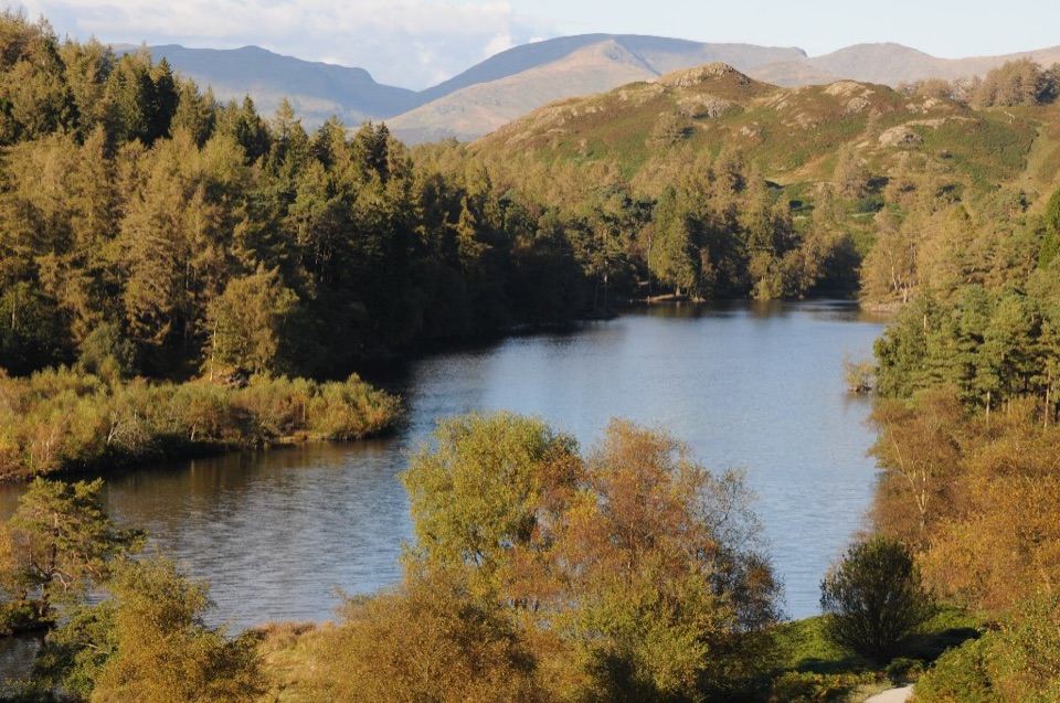
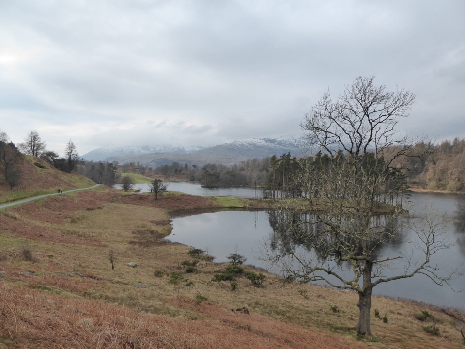
Wide gravel loop around a landscaped tarn beneath grazed fells

Photo: Wikimedia Commons
Length
3.2km
Time
1hr
Elev. change
34m
Difficulty
Easy
  • Loop
  • Dogs allowed
  • High point 229 m

Hear the audio tour

Tarn Hows: Lakeside or Fell Walk

Overview

About Tarn Hows Circular Walk

A circular loop with a short access spur from the car park, walked clockwise and finishing where it started. The official distance is 2 miles / 3.2 km total, with a typical time of about 1 hour. The mapped line measures a little under 1.8 miles because digital route data simplifies and rounds curves, so plan around the official figure.

Why go

  • Easy gravel circuit with excellent water-and-fell views
  • Main lakeside path suits wheelchairs and prams

Heads up

  • Limited parking and busy at popular times
  • Field return can be muddy after wet weather

Map & elevation

The route

Loading the Lake District map
Full map
Elevation195–229 m
TrailheadTarn Hows Car Park54.38726, -3.03834
Keep this map with you offline in the Parkwolf app

Plan your hike

Before you go

Parking

Use Tarn Hows Car Park, signed from the B5285 between Coniston and Hawkshead Hill, then cross the road from the car park to the access track. The approach road is unsuitable for large coaches; toilets, including an accessible toilet, are at the car park.


Best time to go

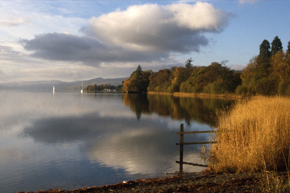
Quiet conditions and easier parking are more likely outside peak weekends, school holidays and fine summer days. Early morning tends to give the stillest water and the cleanest reflections. Autumn brings strong colour from the planted trees, while winter offers barer views and long shadows, with the trade-offs of shorter daylight and a wetter field crossing.

Safety

Short steep ascents and descents, plus occasional roots and larger stones. The field return can be muddy in wet weather, with the road as an alternative. Dogs must stay on short leads around the grazing livestock. The optional upper section is less level. No overnight camping.

8 active Lake District alerts

  • ClosureChapel Stile footpath closed for retaining-wall riskPart of Footpath 543030 between Chapel Stile and Baysbrown campsite is closed because a retaining wall beside the path could collapse and material it supports could fall across the footpath.Official details
  • ClosureStanley Ghyll Lower Falls footpath closed for rockfallThe section of Footpath 408037 leading towards Stanley Ghyll Lower Falls is closed because severe rockfall damage has made the path unstable and further rockfall remains a danger.Official details
See all 8 alerts
A park ranger sits on a dash-mounted phone, talking, as Parkwolf’s Tour Guide plays “Army Cutworm Moths: A Grizzly Bear Buffet” on Grand Loop Road below Dunraven Pass in Yellowstone
Parkwolf Tour GuideThe highest, rockiest slopes around here are a summer buffet for grizzly bears.

Lake District Tour Guide

Your drive to Tarn Hows Circular Walk, narrated.

Parkwolf is a GPS audio tour guide for Lake District National Park. As you drive, it chimes in with what’s ahead: hidden gems, upcoming stops, history, geology, and wildlife, right through your car’s speakers.

Recorded for this trailhead

Tarn Hows: Lakeside or Fell Walk
0:00 / 1:18
“You're coming up on Tarn Hows, a good choice for a gentle walk with water, woodland and fell views close together. Wooded islands break up the tarn, with the Coniston hills rising beyond the trees.”

Plays as you drive up to this trailhead in the Parkwolf Lake District Tour Guide.

More stories near here in the app

  • Tom Gill: Waterfalls from Glen Mary Bridge
  • Monk Coniston: A Gentle Lakeside Walk
  • Tilberthwaite: Cathedral Cavern or Slater’s Bridge
  • Elterwater: Slippers for the Horses
  • 298 audio storiesacross Lake District’s roads, triggered by GPS as you drive
  • Wildlife heatmapsfor Red Deer, Eurasian Otter, Osprey, and 13 more
  • Works offlinemaps, 265 trails, 89 places, and audio download before you lose signal
  • CarPlay readysimple controls built for the drive
★★★★★
“Fantastic app with many points of information… It’s great to just turn on while you’re driving and it gives you an audio tour of the national Park. We love it!!!!”
JMJamesApp Store review
Download Parkwolf on the App StoreGet Parkwolf on Google Play

4.7 from 8,600+ ratings

Trail guide

Hiking Tarn Hows Circular Walk

Sequence and payoffFrom the car park you cross the road onto a track and follow the tarn clockwise.

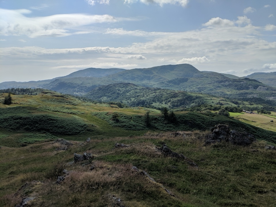
From the car park you cross the road onto a track and follow the tarn clockwise. At a junction you can either stay on the level surfaced path or take the gate on the left, which climbs to an upper track and a short-stay viewing car park with a wider outlook over the water. The route then crosses a road through a gate and follows a field with the tarn on your right before descending to the main car park. The reward is spread through the walk rather than saved for the end: open water on one side, planted conifers and broadleaves framing the views, and rising fell ground beyond.

Footing and difficultyMostly wide, firm, well-maintained gravel, easy underfoot.
  • Mostly wide, firm, well-maintained gravel, easy underfoot.
  • Gradual inclines and declines with a few short steeper ascents and descents.
  • Occasional tree roots and larger stones, so watch your feet on the rougher stretches.
  • Heights along the way sit roughly between 195 and 230 m, so nothing is sustained, though the circuit is not flat throughout.
  • The field section can be muddy in bad weather, and the road is the alternative if it is churned up.
Access, dogs and facilitiesA National Trust walk, signposted from the B5285 between Coniston and Hawkshead Hill.
  • A National Trust walk, signposted from the B5285 between Coniston and Hawkshead Hill. The approach road is unsuitable for large coaches.
  • The main lakeside path is suitable for wheelchairs, and Tramper mobility vehicles can be arranged in advance.
  • Toilets at the car park, including an accessible toilet and baby changing.
  • Dogs are welcome on short leads. Livestock graze year-round, especially sheep, so keep dogs close and use the gates properly.
  • No overnight camping.
Landscape, flora and grazingWhat looks natural here is a designed landscape, shaped in 1865 from three separate tarns into…

What looks natural here is a designed landscape, shaped in 1865 from three separate tarns into one sheet of water, with trees planted around it. The site has been a Site of Special Scientific Interest since 1965. Its nutrient-poor water supports a diverse aquatic flora and the margins hold rare mire habitats, which is a good reason to keep to the made paths. Belted Galloway cattle and Herdwick sheep graze nearby ground, so expect gates and stock along the way.

Drawbacks and a nearby alternativeEasy footing and a well-known view mean this circuit is busy at popular times, and parking…

Easy footing and a well-known view mean this circuit is busy at popular times, and parking pressure is the main practical constraint. The field crossing is the weak link after rain. If you want more effort, tree cover and moving water, the Tom Gill approach is a more challenging woodland and waterfall route to the same tarn.

Wildlife

Wildlife in Lake District

All Lake District wildlife maps

Sighting maps show where each species has been reported across Lake District. Wildlife moves, so no sighting is guaranteed.

Keep exploring

Near Tarn Hows Circular Walk

See it all on the map

Trails that start nearby

Places near the trailhead

Parkwolf’s Lake District ranking

Top-rated trails in Lake District

All 265 trails
  1. 1Scafell Pike via Hollow Stones from WasdaleChallenging · 9 km
  2. 2Helvellyn via Striding Edge and Swirral EdgeChallenging · 12.4 km
  3. 3CatbellsModerate · 6.6 km
  4. 4The Old Man of ConistonChallenging · 9 km
  5. 5Buttermere CircularEasy · 7.6 km
  6. 6The Fairfield HorseshoeChallenging · 17.2 km

Take Parkwolf to Lake District.

The audio tour guide for the drive, plus offline maps, trails, and wildlife heatmaps for when the signal drops.

4.7 from 8,600+ ratings

Download Parkwolf on the App StoreGet Parkwolf on Google Play