Warren County Bikeway in Lake George NY

Lake George NY, NY

Warren County Bikeway

A paved rail route with a bridge, rolling grades, and local history.

Photo: Wikimedia Commons
Length
9.4mi
Time
3.2hr
Elev. change
269ft
Difficulty
Moderate
  • No dogs
  • High point 584 ft

Hear the audio tour

Lake George Steamboat Company

Overview

About Warren County Bikeway

Why go

  • A long, paved corridor with several access points and interpretive history.
  • The rail bridge over Quaker Road is a memorable route landmark.

Heads up

  • A full one-way outing needs a pickup or nearly 19 miles of return walking.
  • Some sections use local roads and shoulders alongside traffic.

Map & elevation

The route

Loading the Lake George map
Full map
Elevation315–584 ft
TrailheadFort George Road Bikeway Access43.41917, -73.70833
Keep this map with you offline in the Parkwolf app

Plan your hike

Before you go

Parking

Use the Lake George access near Fort George Road; nearby parking is identified at that end. Public lots are also listed at Leonard Street in Glens Falls and Country Club Road in Queensbury. The route finishes at Platt Street, so arrange a pickup for a one-way trip. Lot capacity and current fees are not confirmed.

Safety

Dogs are prohibited. From December through March, snowmobiles share the section north of Bloody Pond Road to Fort George Road. Parts of the route use local roads and shoulders, with street crossings and traffic.

2 active Lake George alerts

  • ClosureFishbrook Pond North Lean-to site closedThe entire Fishbrook Pond North Lean-to site is closed because the lean-to burned down. - No camping or campfires are allowed at the site until further notice.Official details
  • CautionNo Parking Zones enforced along River RoadDo not park in the No Parking Zones along River Road in the Hudson River Special Management Area in the Towns of Lake Luzerne and Warrensburg; DEC is enforcing the restriction.Official details
Lake George alerts
A park ranger sits on a dash-mounted phone, talking, as Parkwolf’s Tour Guide plays “Army Cutworm Moths: A Grizzly Bear Buffet” on Grand Loop Road below Dunraven Pass in Yellowstone
Parkwolf Tour GuideThe highest, rockiest slopes around here are a summer buffet for grizzly bears.

Lake George Tour Guide

Your drive to Warren County Bikeway, narrated.

Parkwolf is a GPS audio tour guide for Lake George NY. As you drive, it chimes in with what’s ahead: hidden gems, upcoming stops, history, geology, and wildlife, right through your car’s speakers.

See the Lake George audio tour

Recorded for this area

Lake George Steamboat Company
0:00 / 0:35
“You're coming up on the Lake George Steamboat Company's waterfront at Steel Pier. A narrated cruise is a good way to see the wooded shoreline and islands beyond the village.”

Plays on the road 0.1 mi from the trailhead in the Parkwolf Lake George Tour Guide.

More stories near here in the app

  • Lake George Battlefield Park
  • Charles R. Wood Park
  • Fort William Henry Museum
  • Million Dollar Beach
  • 113 audio storiesacross Lake George’s roads, triggered by GPS as you drive
  • Wildlife heatmapsfor White-tailed Deer, Timber Rattlesnake, Osprey, and 13 more
  • Works offlinemaps, 67 trails, 64 places, and audio download before you lose signal
  • CarPlay readysimple controls built for the drive
★★★★★
“Fantastic app with many points of information… It’s great to just turn on while you’re driving and it gives you an audio tour of the national Park. We love it!!!!”
JMJamesApp Store review
Download Parkwolf on the App StoreGet Parkwolf on Google Play

4.7 from 8,600+ ratings

Trail guide

Hiking Warren County Bikeway

A long route between the lake and the cityWarren County Bikeway is a paved point-to-point route from Fort George Road at the Lake George…

Warren County Bikeway is a paved point-to-point route from Fort George Road at the Lake George end to Platt Street in Glens Falls. Warren County lists 9.4 miles one way; other route traces put it near 10 miles. It follows an old rail corridor through Queensbury and into Glens Falls, mixing separated path with local roads and shoulders. Give yourself about three hours on foot one way, then arrange a pickup or plan on nearly 19 miles to walk back.

From the Lake George endHeading south from Lake George, the route climbs toward Bloody Pond Road, then rolls and trends…

Heading south from Lake George, the route climbs toward Bloody Pond Road, then rolls and trends downhill toward Glens Falls. The high point is near Bloody Pond Road; going north from Glens Falls reverses that effort, with a long gradual climb before the final descent into Lake George. The route has a paved surface and several road crossings. It is a long walk or ride, not a wilderness hike, and the many public access points make it possible to do a shorter section.

Where the path meets trafficThe trail is paved and shared by people walking, running and cycling.

The trail is paved and shared by people walking, running and cycling. Parts use local roads and shoulders where a separated path was not possible, including a marked stretch on Country Club Road. Expect intersections and stop-and-go through Glens Falls; the road-shared stretches are the main drawback for a walk. The long pedestrian and bicycle bridge over Quaker Road carries you over a busy crossing without joining the highway traffic.

A railroad line with a local storyThe route follows a Delaware & Hudson branch built in 1882 between Fort Edward and Lake George.

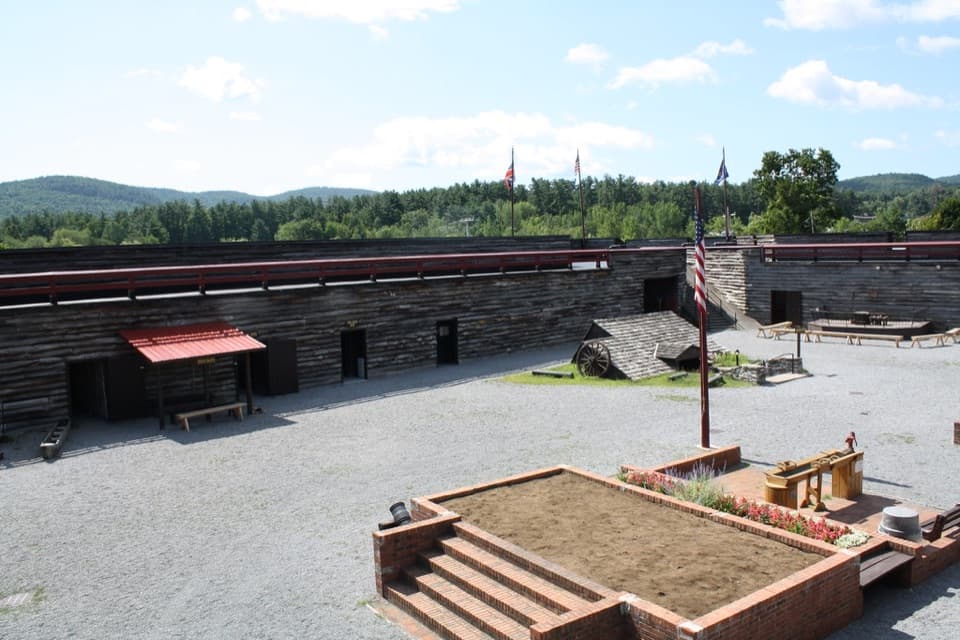
The route follows a Delaware & Hudson branch built in 1882 between Fort Edward and Lake George. Trains once brought visitors from New York City and Albany to the Lake George station beside Battlefield Park, where five daily departures were timed to meet steamboats on the lake. The bikeway was built in four stages from 1978 to 2000. Its 242-foot bridge over Quaker Road was dedicated in 2000 to Gerald B. Solomon, and kiosks and historic signs add context about the railroad and the region.

Winter use and getting backDogs are not allowed on the bikeway.

Dogs are not allowed on the bikeway. From December through March, snowmobiles share the section from Bloody Pond Road north to Fort George Road, so the Lake George end has seasonal motorized use. Public parking is noted near Fort George Road, with additional lots at Leonard Street in Glens Falls and Country Club Road in Queensbury. If you take the full route one way, set up transportation at Platt Street; lot capacity and current fees are not confirmed.

Wildlife

Wildlife in Lake George

All Lake George wildlife maps

Sighting maps show where each species has been reported across Lake George. Wildlife moves, so no sighting is guaranteed.

Keep exploring

Near Warren County Bikeway

See it all on the map

Trails that start nearby

Places near the trailhead

Parkwolf’s Lake George ranking

Top-rated trails in Lake George

All 67 trails
  1. 1Sleeping Beauty Mountain LoopModerate · 4 mi
  2. 2Buck Mountain Trail from Pilot KnobChallenging · 6.6 mi
  3. 3Black Mountain Summit TrailModerate · 5 mi
  4. 4Cat Mountain Trail from Valley Woods RoadModerate · 6.8 mi
  5. 5Prospect Mountain TrailChallenging · 3 mi
  6. 6Red Trail to The PinnacleModerate · 2.2 mi

Take Parkwolf to Lake George.

The audio tour guide for the drive, plus offline maps, trails, and wildlife heatmaps for when the signal drops.

4.7 from 8,600+ ratings

Download Parkwolf on the App StoreGet Parkwolf on Google Play