Mill Creek Falls in Lassen Volcanic National Park

Sight · Lassen Volcanic National Park

Mill Creek Falls

A 75-foot waterfall worth the hot, hilly hike to reach it.

Photo: Public Domain
Type
Sight
Nearest trail
1.1 mi
Audio stories
8 nearby
  • Scenic viewpoint
  • #16 of 37 sights

Hear the audio tour

Kohm Yah-mah-nee Visitor Center and Café

Overview

About Mill Creek Falls

Why stop

  • The park's highest waterfall
  • Wildflowers and mountain views along the route

Heads up

  • A steep, rocky, sun-exposed 3.8-mile round trip
Mill Creek Falls is a 75-foot waterfall where East Sulphur and Bumpass creeks meet. It is the highest waterfall in Lassen Volcanic, but the falls sit well beyond the road: this is a real hike, not a pullout. I'd choose it when you want a walk with a clear payoff, and skip it if you only have time for a quick stop. The out-and-back is about 3.8 miles and takes roughly 2½ to 3 hours.
Parkwolf’s verdictIs it worth the walk?

Map

Where it is

Loading the Lassen Volcanic map
Full map
SightMill Creek Falls40.44079, -121.51347
Keep this map with you offline in the Parkwolf app

Plan your stop

Before you go

1 active Lassen Volcanic alert

  • ClosureJuniper Lake campground and day-use area closedJuniper Lake Campground and day-use area are closed for maintenance and campground-improvement projects. - Potable water is unavailable in the campground.Official details

Lassen Volcanic alerts
A park ranger sits on a dash-mounted phone, talking, as Parkwolf’s Tour Guide plays “Army Cutworm Moths: A Grizzly Bear Buffet” on Grand Loop Road below Dunraven Pass in Yellowstone
Parkwolf Tour GuideThe highest, rockiest slopes around here are a summer buffet for grizzly bears.

Lassen Volcanic Tour Guide

Your drive to Mill Creek Falls, narrated.

Parkwolf is a GPS audio tour guide for Lassen Volcanic National Park. As you drive, it chimes in with what’s ahead: hidden gems, upcoming stops, history, geology, and wildlife, right through your car’s speakers.

See the Lassen Volcanic audio tour

Recorded for this place

Kohm Yah-mah-nee Visitor Center and Café
0:00 / 0:34
“You're nearing Kohm Yah-mah-nee Visitor Center, a useful stop for choosing hikes and getting a handle on the landscape. Start with the three-dimensional geology map, then ask the staff about trail and snow conditions.”

Plays as you drive up to Mill Creek Falls in the Parkwolf Lassen Volcanic Tour Guide.

More stories near here in the app

  • Diamond Peak Scenic Vista: Valley Views and Eagles
  • Sulphur Works: Boiling Mud Beside the Road
  • Brokeoff Mountain: A Full-Day Climb
  • Little Hot Springs Valley: Vents and Spring Grass
  • 45 audio storiesacross Lassen Volcanic’s roads, triggered by GPS as you drive
  • Wildlife heatmapsfor Black Bear, Bald Eagle, Mule Deer, and 13 more
  • Works offlinemaps, 59 trails, 56 places, and audio download before you lose signal
  • CarPlay readysimple controls built for the drive
★★★★★
“Fantastic app with many points of information… It’s great to just turn on while you’re driving and it gives you an audio tour of the national Park. We love it!!!!”
JMJamesApp Store review
Download Parkwolf on the App StoreGet Parkwolf on Google Play

4.7 from 8,600+ ratings

Guide

More about Mill Creek Falls

The approach takes workStart behind the amphitheater by the southwest parking area.

Start behind the amphitheater by the southwest parking area. The trail drops about 925 feet to the falls, a climb you get back on the return. It winds in and out of gullies along East Sulphur Creek, with rocky, narrow stretches and creek crossings. NPS rates it moderately strenuous. The route is sun-exposed, so avoid the hottest part of the day and bring drinking water.

A landscape changed by fireThe 2021 Dixie Fire burned most of the forest along this drainage and opened the viewshed.

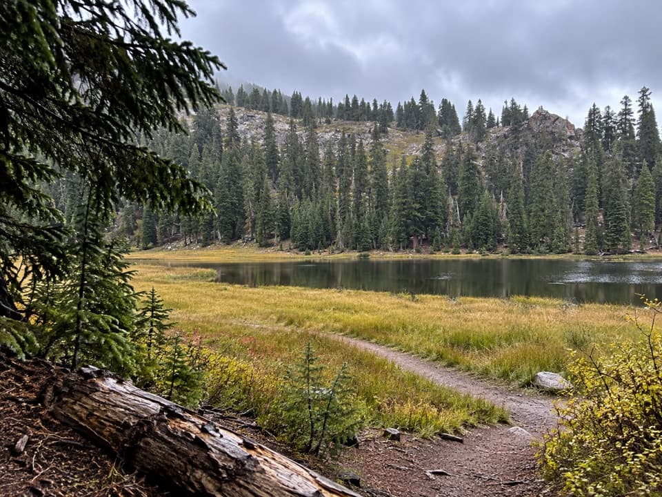
The 2021 Dixie Fire burned most of the forest along this drainage and opened the viewshed. The route crosses open hillside before threading through forested patches closer to the falls. From the hillside, look for Brokeoff Mountain and Mount Diller. Mule ears cover much of the open slope and are usually in full bloom by July; blue and white stickseed grow there too. Deer and birds are also likely along the trail.

Look down the gorgeAt the viewpoint, the water drops into a steep, rocky gorge.

At the viewpoint, the water drops into a steep, rocky gorge. For a photo, aim down over the fall and keep the creek below in frame; that shows how the water cuts through the rocks instead of leaving you with only a close crop of the chute.

Wildlife

Wildlife in Lassen Volcanic

All Lassen Volcanic wildlife maps

Sighting maps show where each species has been reported across Lassen Volcanic. Wildlife moves, so no sighting is guaranteed.

Keep exploring

Near Mill Creek Falls

See it all on the map

Trails nearby

More stops nearby

Parkwolf’s Lassen Volcanic ranking

Top sights in Lassen Volcanic

All 56 places
  1. 1Bumpass HellSight
  2. 2Lassen PeakSight
  3. 3Sulphur WorksSight
  4. 4Cinder ConeSight
  5. 5Lake HelenSight
  6. 6Manzanita LakeSight

Take Parkwolf to Lassen Volcanic.

The audio tour guide for the drive, plus offline maps, trails, and wildlife heatmaps for when the signal drops.

4.7 from 8,600+ ratings

Download Parkwolf on the App StoreGet Parkwolf on Google Play