Crags Lake Trail in Lassen Volcanic National Park

Lassen Volcanic National Park, CA

Crags Lake Trail

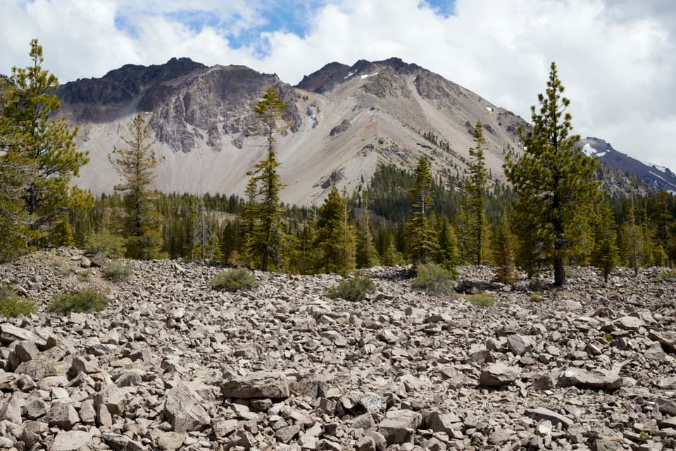
Rocky Chaos Jumbles give way to a high view of Crags Lake.

Photo: National Park Service
Length
4mi
Time
2.5hr
Elev. change
771ft
Difficulty
Moderate
  • No dogs
  • High point 6,699 ft
  • #11 of 59 in Lassen Volcanic

Hear the audio tour

Crags Lake: Cliffs Above a Seasonal Lake

Overview

About Crags Lake Trail

Why go

  • Close views of the Chaos Crags above the lake basin
  • Forest, manzanita and open volcanic terrain on one hike

Heads up

  • Much of the climb is sun exposed
  • Crags Lake can shrink or dry out by late summer

Map & elevation

The route

Loading the Lassen Volcanic map
Full map
Elevation5,928–6,699 ft
TrailheadChaos Crags Trailhead40.53592, -121.55930
Keep this map with you offline in the Parkwolf app

Plan your hike

Before you go

Parking

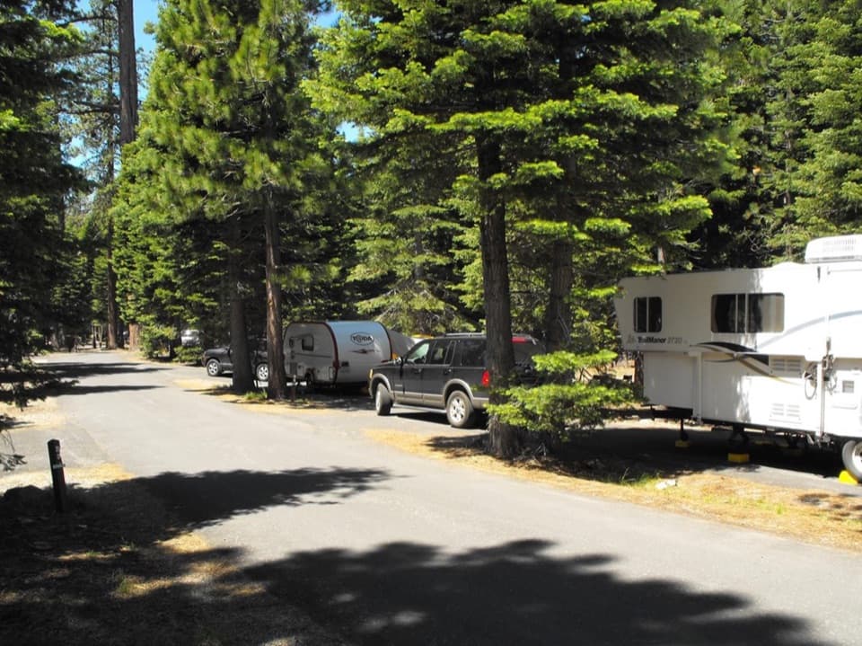
Use the signed Chaos Crags Trailhead parking area on the Manzanita Lake Campground road, about 150 yards after turning in. The sign can be easy to miss. Loomis Plaza is about a mile away and is a different winter approach, not the start for this 4-mile summer route.

Safety

Most of the route is sun exposed, with rough rock near the rim and lake. No drinking water was confirmed along the trail. Pets are prohibited on all park hiking trails.

1 active Lassen Volcanic alert

  • ClosureJuniper Lake campground and day-use area closedJuniper Lake Campground and day-use area are closed for maintenance and campground-improvement projects. - Potable water is unavailable in the campground.Official details
Lassen Volcanic alerts
A park ranger sits on a dash-mounted phone, talking, as Parkwolf’s Tour Guide plays “Army Cutworm Moths: A Grizzly Bear Buffet” on Grand Loop Road below Dunraven Pass in Yellowstone
Parkwolf Tour GuideThe highest, rockiest slopes around here are a summer buffet for grizzly bears.

Lassen Volcanic Tour Guide

Your drive to Crags Lake Trail, narrated.

Parkwolf is a GPS audio tour guide for Lassen Volcanic National Park. As you drive, it chimes in with what’s ahead: hidden gems, upcoming stops, history, geology, and wildlife, right through your car’s speakers.

See the Lassen Volcanic audio tour

Recorded for this trailhead

Crags Lake: Cliffs Above a Seasonal Lake
0:00 / 0:25
“Crags Lake trailhead is coming up, for a hike beneath the pale cliffs of Chaos Crags. Allow two and a half to three hours for the four-mile round trip, with a steady climb and rough, exposed ground near the top.”

Plays as you drive up to this trailhead in the Parkwolf Lassen Volcanic Tour Guide.

More stories near here in the app

  • Loomis Museum and Reflection Lake
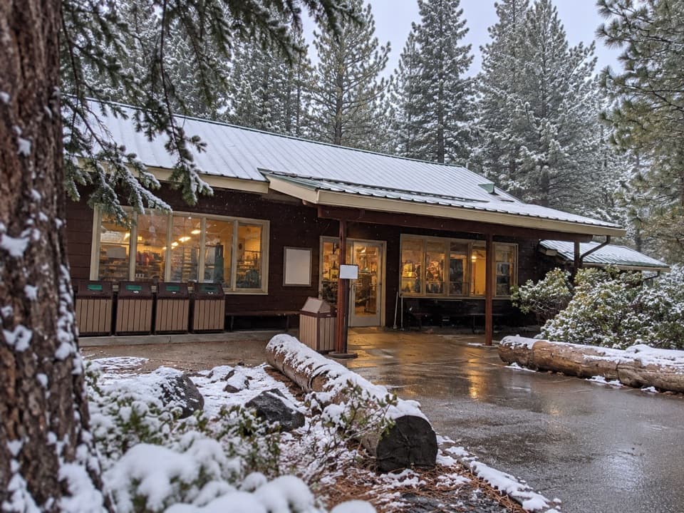
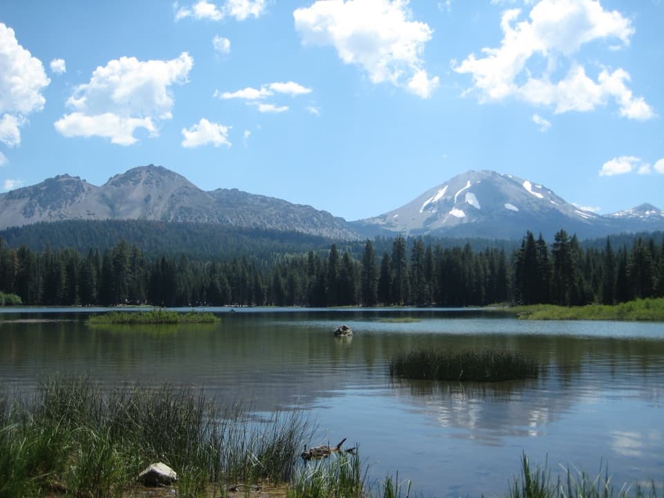
  • Manzanita Lake and the Camper Store
  • Manzanita Creek: Forest and a Flowering Meadow
  • Chaos Crags Viewpoint and the Rock Avalanches
  • 45 audio storiesacross Lassen Volcanic’s roads, triggered by GPS as you drive
  • Wildlife heatmapsfor Black Bear, Bald Eagle, Mule Deer, and 13 more
  • Works offlinemaps, 59 trails, 56 places, and audio download before you lose signal
  • CarPlay readysimple controls built for the drive
★★★★★
“Fantastic app with many points of information… It’s great to just turn on while you’re driving and it gives you an audio tour of the national Park. We love it!!!!”
JMJamesApp Store review
Download Parkwolf on the App StoreGet Parkwolf on Google Play

4.7 from 8,600+ ratings

Trail guide

Hiking Crags Lake Trail

A 4-mile walk above the lakeCrags Lake is a 4-mile out-and-back from Chaos Crags Trailhead: forest along Manzanita Creek, a…

Crags Lake is a 4-mile out-and-back from Chaos Crags Trailhead: forest along Manzanita Creek, a sustained climb through open manzanita and volcanic rock, then the crater rim and a short rocky drop to the lake. Allow about 2½ to 3 hours for roughly 800 to 1,000 feet of climbing. Most of the route is sun exposed, and the footing gets rougher as the trees thin. It is a worthwhile half-day hike for the Chaos Crags scenery, but this is a steady climb rather than a lakeside stroll.

From creekside forest to open slopeThe lower trail stays among firs above Manzanita Creek; the stream lies down a steep bank, so…

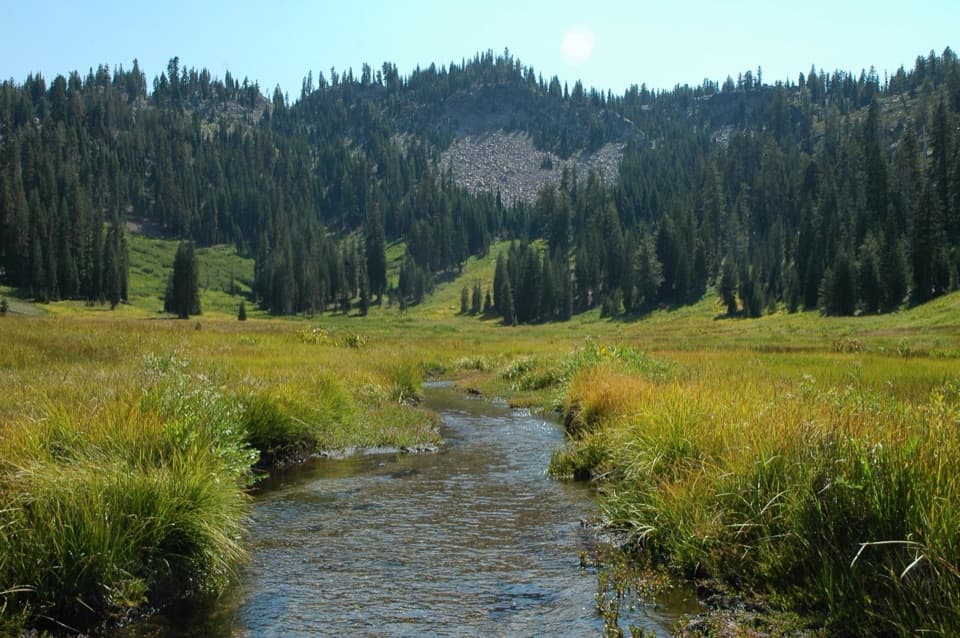
The lower trail stays among firs above Manzanita Creek; the stream lies down a steep bank, so you hear or glimpse a creek corridor rather than walking beside the water. Farther up, the forest thins into western white pine, pinemat manzanita and volcanic rubble. The route climbs in stages, with a brief easier stretch before the steeper upper slope. Expect the tread to change from dirt under the trees to rough, broken rock in the open.

The rim and Crags LakeAt roughly two miles, the rocky rim above the basin is the main viewpoint.

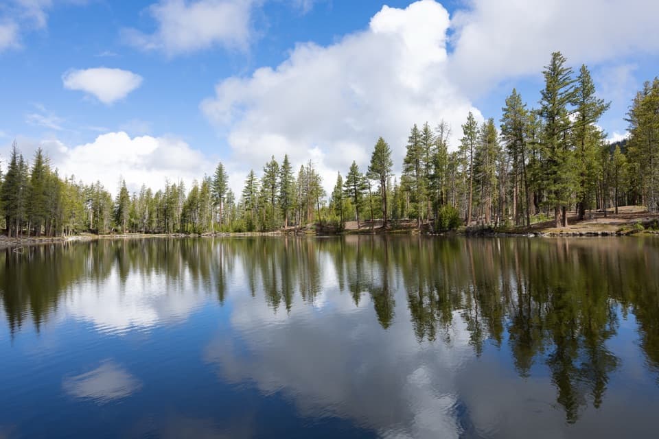
At roughly two miles, the rocky rim above the basin is the main viewpoint. Chaos Crags rise over the lake, while the view opens across Chaos Jumbles and toward Hat Creek Valley and the northern ranges. From the rim, a short rocky descent reaches the shore; leave time to look around before retracing the same trail. The lake can shrink substantially or dry by late summer, so the payoff may be the basin and pale cliffs rather than open water. For photos, include both the lake and the broad scree slope; a tight frame of water loses the scale of the crater setting.

A landscape made by avalanchesChaos Crags are young volcanic domes that rose about 1,100 years ago.

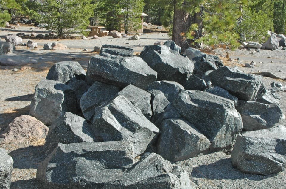
Chaos Crags are young volcanic domes that rose about 1,100 years ago. At least 300 years ago, fast rock avalanches from their north side spread across the slopes below, forming Chaos Jumbles and damming Manzanita Creek to create Manzanita Lake. From the upper trail, the pale debris field and sparse trees make that history visible: the forest gives way to broken rock where the avalanche swept through.

Start at the summer trailheadUse the signed Chaos Crags Trailhead parking area on the Manzanita Lake Campground road, about…

Use the signed Chaos Crags Trailhead parking area on the Manzanita Lake Campground road, about 150 yards after turning in; the trailhead sign can be easy to miss. The 4-mile figure starts here. Loomis Plaza is about a mile away and belongs to a different winter approach, so starting there changes the outing. No drinking water was confirmed along the trail; bring what you need. Most of the climb is exposed, and the final approach is rocky. Pets are prohibited on all park hiking trails. Check NPS road and trail conditions before setting out, especially when snow can affect access.

Wildlife

Wildlife in Lassen Volcanic

All Lassen Volcanic wildlife maps

Sighting maps show where each species has been reported across Lassen Volcanic. Wildlife moves, so no sighting is guaranteed.

Keep exploring

Near Crags Lake Trail

See it all on the map

Trails that start nearby

Places near the trailhead

Parkwolf’s Lassen Volcanic ranking

Top-rated trails in Lassen Volcanic

All 59 trails
  1. 1Lassen Peak TrailChallenging · 5 mi
  2. 2Cinder Cone TrailChallenging · 4 mi
  3. 3Bumpass Hell TrailModerate · 3 mi
  4. 4Brokeoff Mountain TrailChallenging · 7.4 mi
  5. 5Kings Creek Falls TrailModerate · 2.8 mi
  6. 6Manzanita Lake LoopEasy · 1.8 mi

Take Parkwolf to Lassen Volcanic.

The audio tour guide for the drive, plus offline maps, trails, and wildlife heatmaps for when the signal drops.

4.7 from 8,600+ ratings

Download Parkwolf on the App StoreGet Parkwolf on Google Play