Parking
Top Forks Hut is the trailhead, not a road car park. Walking in from Kerin Forks Hut is 15 km and 6–8 hours; plan access to the upper Wilkin and book the hut ahead.

Mount Aspiring National Park, OT · WC
A rugged 10-mile return to an alpine lake with several unbridged fords.
Overview
Map & elevation
Plan your hike

The highest, rockiest slopes around here are a summer buffet for grizzly bears.
Mount Aspiring Tour Guide
Parkwolf is a GPS audio tour guide for Mount Aspiring National Park. As you drive, it chimes in with what’s ahead: hidden gems, upcoming stops, history, geology, and wildlife, right through your car’s speakers.
See the Mount Aspiring audio tour“Fantastic app with many points of information… It’s great to just turn on while you’re driving and it gives you an audio tour of the national Park. We love it!!!!”


Trail guide
This is an unformed 16 km (10 mi) out-and-back from Top Forks Hut to Lake Castalia. DOC lists 8 km and 3–4 hours each way; allow about 7–8 hours for the return, before counting the separate journey to the hut. The lake is the reason to go, but this is a serious backcountry route, not a casual extension of the easier lakes nearby.
The route starts by crossing the South Branch in front of the hut. The shared North Branch approach involves boulder hopping that gets slippery when wet, plus a small side stream that can be awkward to ford. It climbs through forest to Disappearing Tarn, then passes Lake Diana and crosses open grassland toward Lake Lucidus, where part of the way is boardwalked. Diana and Lucidus are shorter turnarounds on this same approach; neither reaches Castalia.
Around the Lucidus boardwalk, the route leaves the easier track, crosses the outlet stream and the North Branch, climbs through alpine vegetation, then crosses the river again. It reaches a snow-grass terrace at the lake outlet. The last 200 m are loose rock. Beyond the formed approach this is unmade route terrain, so expect to choose your line carefully rather than follow a continuous built track.
Castalia sits beneath a steep glaciated cirque, with a rocky shore and ice above the basin. There is no constructed viewpoint; the outlet is where the route arrives. The surrounding peak group includes Castor, Pollux, Mercury, Vesta, Juno and Apollo, names attributed to explorer Charles Douglas.
This day walk starts at remote Top Forks Hut, a serviced 16-bunk hut that must be booked. Its tap water is untreated, so boil it before use. Reaching the hut is a separate trip: the walk from Kerin Forks Hut is 15 km and 6–8 hours, and access to the upper Wilkin needs planning in advance. There is no drive-up car park at this trailhead.
The North Branch and its side streams can become impassable after rain; do not cross high water. The route enters complex avalanche terrain beyond Lake Diana, with avalanche danger most common from May to November; DOC does not recommend the overall track in winter and spring. High-level backcountry and river-crossing skills are needed, and dogs are not allowed in the park.
Wildlife
 60 sightingsKeaMost seen around 5 PMSighting map
 112 sightingsRockwrenMost seen around 8 AMSighting map
 26 sightingsYellowheadMost seen around 8 AMSighting map
 13 sightingsTūīMost seen around 7 AMSighting map
 27 sightingsBellbirdMost seen around 7 AMSighting map
 35 sightingsRiflemanMost seen around 8 AMSighting map
Sighting maps show where each species has been reported across Mount Aspiring. Wildlife moves, so no sighting is guaranteed.
Keep exploring
 ChallengingNorth Branch Wilkin Track to Lakes Diana and Lucidus7 km · 4 hr · At the trailheadBoulder hopping leads through alpine grassland to a moraine lake
 ChallengingWilkin Valley–East Matukituki Traverse38 km · 17 hr · At the trailheadExpert alpine crossing over Rabbit Pass into the East Matukituki.
 ChallengingWilkin Valley Track: Kerin Forks Hut to Top Forks Hut15 km · 8 hr · 12.2 km awayA 15 km hut tramp ends with a river-level route choice.
 ChallengingCrucible Lake Track14 km · 7 hr · 15.7 km awayAn alpine lake under Mount Alba, reached after a serious valley climb.
 ModerateSiberia Valley Track7 km · 2.5 hr · 15.7 km awayFollow open valley flats through beech forest to the Wilkin.
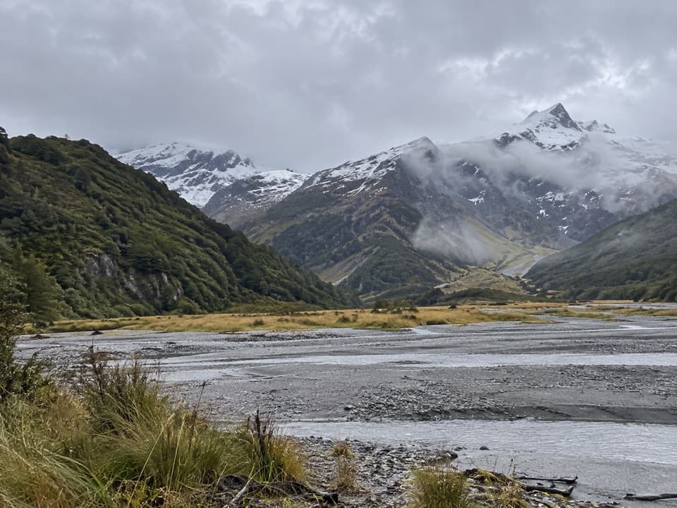 ChallengingRuth Flat Track31 km · 17 hr · 23.6 km awayRemote backcountry tramp to a view across the river to Ruth Flat.
 Lodging · At the trailheadTop Forks HutA remote base for upper Wilkin lakes and alpine routes.
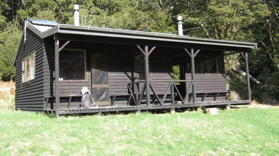 Lodging · 12.2 km awayKerin Forks HutA 10-bunk riverside stop for experienced Wilkin Valley trampers.Sight · 14.5 km awayCrucible LakeA serious climb to a lake that can hold ice into summer.
 Lodging · 15.7 km awaySiberia HutA heated 20-bunk stop deep in Siberia Valley
Parkwolf’s Mount Aspiring ranking

The audio tour guide for the drive, plus offline maps, trails, and wildlife heatmaps for when the signal drops.




