Wilkin Valley Track: Kerin Forks Hut to Top Forks Hut in Mount Aspiring National Park

Mount Aspiring National Park, OT · WC

Wilkin Valley Track: Kerin Forks Hut to Top Forks Hut

A 15 km hut tramp ends with a river-level route choice.

Length
15km
Time
8hr
Elev. change
289m
Difficulty
Challenging
  • No dogs
  • High point 610 m
Parkwolf audio tour80 stories across Mount Aspiring’s roads

Overview

About Wilkin Valley Track: Kerin Forks Hut to Top Forks Hut

Why go

  • Two open river flats break up the long forest and river-side sections.
  • Top Forks Hut opens onto separate North Branch lake walks.

Heads up

  • The final section is unmarked and depends on river level.
  • Access, river crossings and onward transport make this a serious all-day commitment.

Map & elevation

The route

Loading the Mount Aspiring map
Full map
Elevation321–610 m
TrailheadKerin Forks Hut-44.23933, 169.03577
Keep this map with you offline in the Parkwolf app

Plan your hike

Before you go

Parking

The recorded start is Kerin Forks Hut, not a roadhead. From SH6/Haast Highway, the Wilkin Road approach adds a separate 15 km and 4–5 hours, with Makarora and Wilkin River crossings. A boat pickup point is marked beside the hut; confirm transport and road-end parking before setting out.

Safety

Advanced tramping over slips and steep ravines, with an unmarked finish. The low-water option requires several unbridged fords; river levels can make crossings impassable after rain. Cross only when safe, otherwise wait or turn back. Rapid weather changes and hypothermia remain risks in summer; avalanche terrain can affect the track, usually May–November.

1 active Mount Aspiring alert

  • CautionRob Roy Track: stop at lower lookout during avalanche seasonFrom May through November, end your Rob Roy Track hike at the lower lookout; DOC strongly recommends against continuing to the upper lookout because the track crosses active avalanche paths.Official details
Mount Aspiring alerts
A park ranger sits on a dash-mounted phone, talking, as Parkwolf’s Tour Guide plays “Army Cutworm Moths: A Grizzly Bear Buffet” on Grand Loop Road below Dunraven Pass in Yellowstone
Parkwolf Tour GuideThe highest, rockiest slopes around here are a summer buffet for grizzly bears.

Mount Aspiring Tour Guide

Your drive to Wilkin Valley Track: Kerin Forks Hut to Top Forks Hut, narrated.

Parkwolf is a GPS audio tour guide for Mount Aspiring National Park. As you drive, it chimes in with what’s ahead: hidden gems, upcoming stops, history, geology, and wildlife, right through your car’s speakers.

See the Mount Aspiring audio tour
  • 80 audio storiesacross Mount Aspiring’s roads, triggered by GPS as you drive
  • Wildlife heatmapsfor Kea, Rockwren, Yellowhead, and 8 more
  • Works offlinemaps, 50 trails, 52 places, and audio download before you lose signal
  • CarPlay readysimple controls built for the drive
★★★★★
“Fantastic app with many points of information… It’s great to just turn on while you’re driving and it gives you an audio tour of the national Park. We love it!!!!”
JMJamesApp Store review
Download Parkwolf on the App StoreGet Parkwolf on Google Play

4.7 from 8,600+ ratings

Trail guide

Hiking Wilkin Valley Track: Kerin Forks Hut to Top Forks Hut

The hut-to-hut lineWilkin Valley Track: Kerin Forks Hut to Top Forks Hut is a 15 km (9.

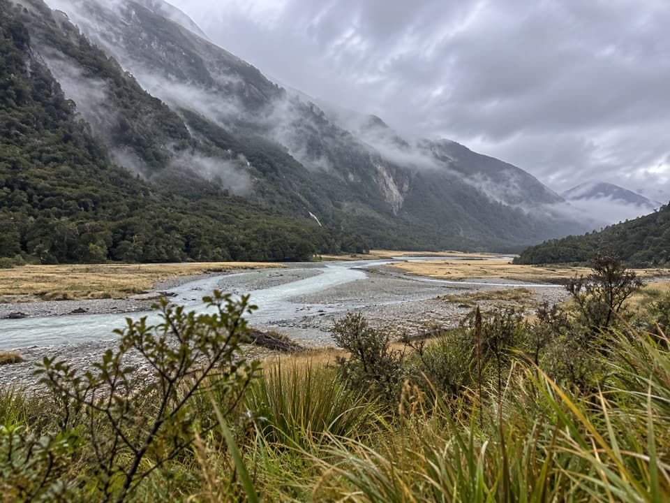
Wilkin Valley Track: Kerin Forks Hut to Top Forks Hut is a 15 km (9.3 mi) one-way point-to-point tramp through the upper Wilkin Valley. It follows beech/tawhai forest beside the Wilkin River, opens onto Wonderland flats, climbs and sidles above the river, then drops to Jumboland and ends at Top Forks Hut above the North and South Branch junction. This is an advanced backcountry trip for people comfortable with rough tracks, route-finding and unbridged crossings. Plan for a full day: route guidance ranges from 6–8 to 7–10 hours, so allow extra time for river decisions and slower going.

Get to the right startThe 15 km recorded here begins at Kerin Forks Hut, not at a road car park.

The 15 km recorded here begins at Kerin Forks Hut, not at a road car park. Reaching Kerin Forks from SH6 by the Wilkin Road access adds a separate 15 km and 4–5 hours, including crossings of the Makarora and Wilkin rivers. A boat pickup point is marked beside the hut, but confirm transport and road-end parking before setting out. This upper section can be done on its own or as part of a longer Wilkin Valley trip; the lower approach and the North Branch lake walks are separate routes, not part of this distance.

Forest, slips and open flatsThe track starts behind Kerin Forks Hut in beech/tawhai forest beside the river.

The track starts behind Kerin Forks Hut in beech/tawhai forest beside the river. Several slips and steep-sided ravines need care, and this is not a smooth, built path. Wonderland flats make a natural lunch break about halfway. Beyond them the track returns to forest, climbs and sidles above the river, then descends to Jumboland flats. The alternation between sheltered bush and wide river country gives the long valley walk some welcome variety.

The unmarked finishBeyond Jumboland the route is unmarked across the river flats to the branch junction.

Beyond Jumboland the route is unmarked across the river flats to the branch junction. In low water, the described line follows the true right and fords the river several times before reaching flats near Top Forks Hut. If the river is high, track markers lead over a hill instead. Don't commit to the river option in advance: decide on the ground, and wait or turn back if a crossing is unsafe. The rivers can become impassable after rain, so check current river and weather information before leaving.

What Top Forks offersTop Forks Hut sits above the junction on the true right of the South Branch, at about 600 m.

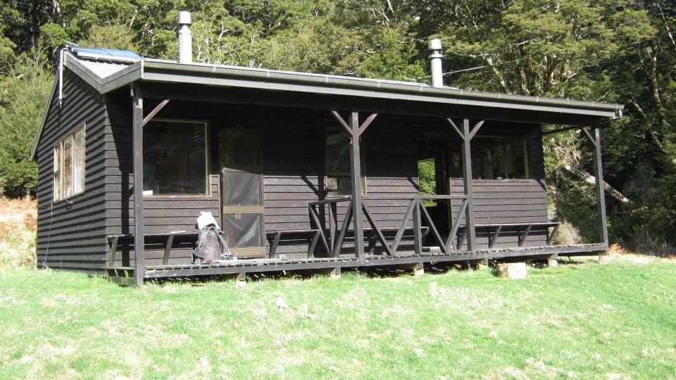
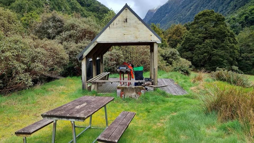
Top Forks Hut sits above the junction on the true right of the South Branch, at about 600 m. Kerin Forks is a serviced 10-bunk hut; Top Forks has 16 bunks. Both have heating, basic toilets and untreated water that must be boiled. Bring a sleeping bag, stove and fuel, utensils, toilet paper, food and a rubbish bag; these are backcountry huts, not resupply stops. Top Forks also starts separate North Branch walks to Lake Diana and other lakes, which are extra trips. If you stay at either hut, book it during the main summer season. Dogs are not allowed.

Conditions and commitmentWeather can change quickly and hypothermia is possible even in summer.

Weather can change quickly and hypothermia is possible even in summer. Avalanche terrain can affect this track, most often from May into November, so check the hazard outlook before leaving. This is a point-to-point route: arrange your onward travel or continue on a longer tramp rather than expecting to walk back to Kerin Forks in the same day. The payoff is a full crossing of the upper valley, but the unmarked, river-dependent finish and remote access make this one for experienced parties.

Wildlife

Wildlife in Mount Aspiring

All Mount Aspiring wildlife maps

Sighting maps show where each species has been reported across Mount Aspiring. Wildlife moves, so no sighting is guaranteed.

Keep exploring

Near Wilkin Valley Track: Kerin Forks Hut to Top Forks Hut

See it all on the map

Trails that start nearby

Places near the trailhead

Parkwolf’s Mount Aspiring ranking

Top-rated trails in Mount Aspiring

All 50 trails
  1. 1Routeburn TrackChallenging · 33.1 km
  2. 2Rob Roy TrackModerate · 10 km
  3. 3Gillespie Pass CircuitChallenging · 56 km
  4. 4Rees-Dart TrackChallenging · 63 km
  5. 5Brewster TrackChallenging · 5.6 km
  6. 6Blue Pools TrackEasy · 3.2 km

Take Parkwolf to Mount Aspiring.

The audio tour guide for the drive, plus offline maps, trails, and wildlife heatmaps for when the signal drops.

4.7 from 8,600+ ratings

Download Parkwolf on the App StoreGet Parkwolf on Google Play