Rob Roy Track in Mount Aspiring National Park

#2 of 50 trails in Mount Aspiring

Mount Aspiring National Park, OT · WC

Rob Roy Track

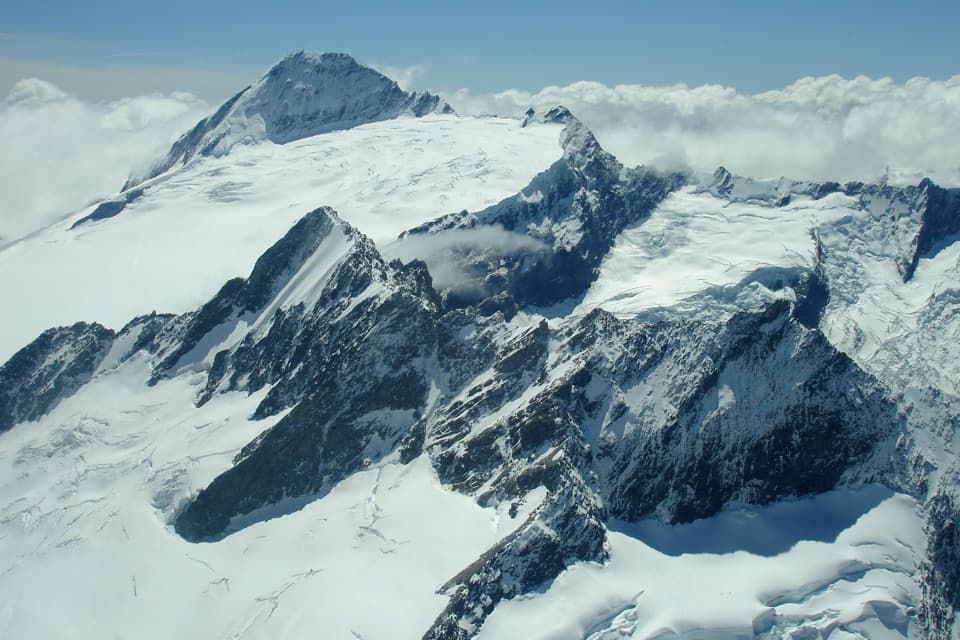
A swingbridge, beech forest and glacier views reward the climb.

Photo: Wikimedia Commons
Length
10km
Time
4.5hr
Elev. change
389m
Difficulty
Moderate
  • No dogs
  • High point 753 m

Hear the audio tour

Raspberry Creek and Rob Roy Glacier

Overview

About Rob Roy Track

Why go

  • A memorable glacier and waterfall panorama from the upper lookout
  • River swingbridge, gorge and beech forest break up the steady climb

Heads up

  • A sustained, rocky climb with steep drop-offs on sections
  • High fords can complicate the access drive after rain

Map & elevation

The route

Loading the Mount Aspiring map
Full map
Elevation364–753 m
TrailheadRaspberry Creek car park-44.51031, 168.74344
Keep this map with you offline in the Parkwolf app

Plan your hike

Before you go

Parking

Use Raspberry Creek car park, also called Raspberry Flat car park in some listings. It is about 54 km west of Wānaka, roughly 1 hour 20 minutes by road. The last 30 km are gravel, and several fords cross the final 10 km. After heavy rain, high water can stop 2WDs and sometimes 4WDs; check road conditions before leaving Wānaka.

Safety

From May through November, avalanche paths cross the upper section and DOC strongly recommends turning back at the lower lookout. Going higher requires current avalanche and weather checks, avalanche-terrain knowledge and suitable rescue gear. The track has steep drop-offs; do not continue beyond the signed upper lookout because of canyons, unstable ground and fast-flowing water. Shaded sections can be icy in winter and early spring. Dogs are prohibited.

1 active Mount Aspiring alert

  • CautionRob Roy Track: stop at lower lookout during avalanche seasonMentions this trailFrom May through November, end your Rob Roy Track hike at the lower lookout; DOC strongly recommends against continuing to the upper lookout because the track crosses active avalanche paths.Official details
Mount Aspiring alerts
A park ranger sits on a dash-mounted phone, talking, as Parkwolf’s Tour Guide plays “Army Cutworm Moths: A Grizzly Bear Buffet” on Grand Loop Road below Dunraven Pass in Yellowstone
Parkwolf Tour GuideThe highest, rockiest slopes around here are a summer buffet for grizzly bears.

Mount Aspiring Tour Guide

Your drive to Rob Roy Track, narrated.

Parkwolf is a GPS audio tour guide for Mount Aspiring National Park. As you drive, it chimes in with what’s ahead: hidden gems, upcoming stops, history, geology, and wildlife, right through your car’s speakers.

See the Mount Aspiring audio tour

Recorded for this trailhead

Raspberry Creek and Rob Roy Glacier
0:00 / 0:30
“You're approaching Raspberry Creek car park, the start of the Rob Roy Glacier walk. For hanging glacier ice and waterfalls dropping from high cliffs, this is a walk I'd choose.”

Plays as you drive up to this trailhead in the Parkwolf Mount Aspiring Tour Guide.

More stories near here in the app

  • Wishbone Falls from the Valley Road
  • Otago Boys’ High Bridge and Kitchener Track
  • Mountains Still in the Making
  • Aspiring Hut's Original Walls
  • 80 audio storiesacross Mount Aspiring’s roads, triggered by GPS as you drive
  • Wildlife heatmapsfor Kea, Rockwren, Yellowhead, and 8 more
  • Works offlinemaps, 50 trails, 52 places, and audio download before you lose signal
  • CarPlay readysimple controls built for the drive
★★★★★
“Fantastic app with many points of information… It’s great to just turn on while you’re driving and it gives you an audio tour of the national Park. We love it!!!!”
JMJamesApp Store review
Download Parkwolf on the App StoreGet Parkwolf on Google Play

4.7 from 8,600+ ratings

Trail guide

Hiking Rob Roy Track

Why take this trackRob Roy Track is a 10 km (6.

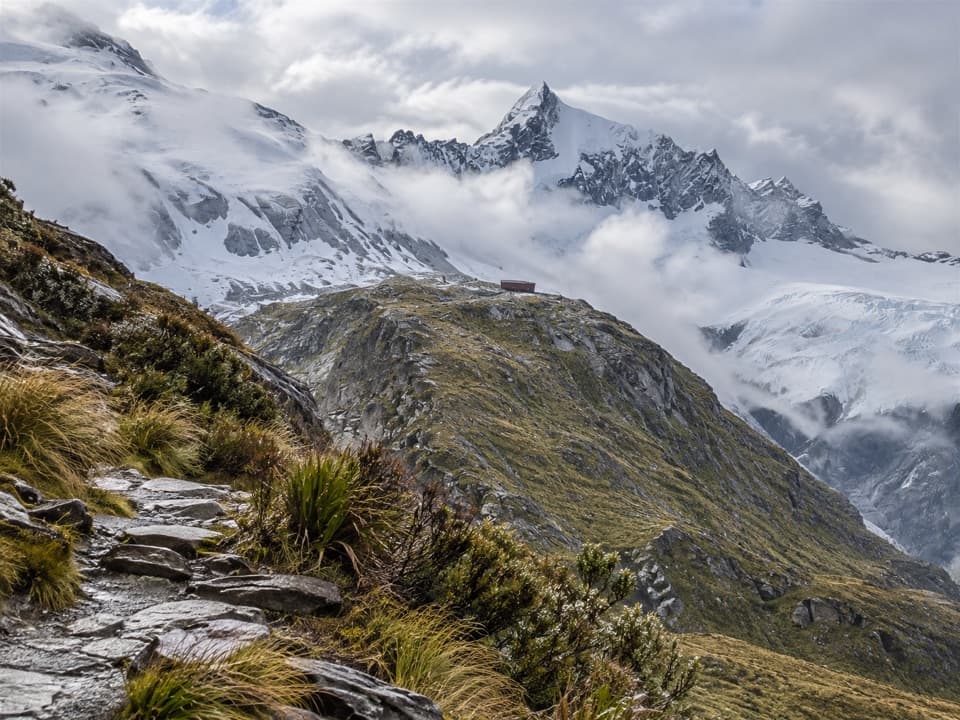
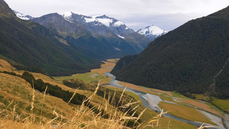
Rob Roy Track is a 10 km (6.2-mile) out-and-back from Raspberry Creek car park to the upper glacier lookout. The route crosses the West Matukituki valley, swings over the river, climbs through a small gorge and beech forest, then opens into alpine vegetation below Rob Roy Glacier. If you want a full day walk with a close glacier-and-waterfall view, this is a strong pick. The marked time is 3–4 hours; allow 4–5 for a steady pace and time at the viewpoints. The climb is a real part of the day, but the changing scenery keeps it from feeling like one long uphill slog.

From the car park into the gorgeThe first stretch crosses private farmland.

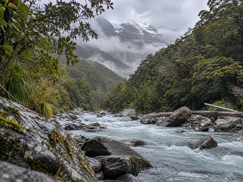
The first stretch crosses private farmland. Stay on the marked track and respect gates, stock and the land. After about 15 minutes, a swingbridge crosses the West Matukituki River; it has a user limit, so wait for a clear turn rather than bunching up. Past the bridge, the track enters a small gorge and climbs through shaded beech forest. The path is uneven and rocky in places, with steep drop-offs along sections, so expect to watch your footing on the way down as well as up.

The two lookouts are different choicesThe lower lookout gives you the first view of the glacier.

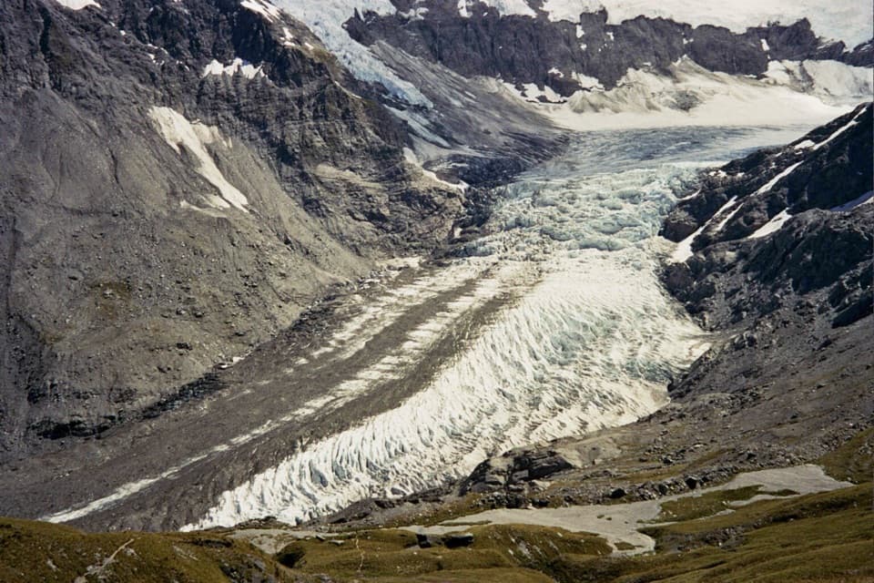
The lower lookout gives you the first view of the glacier. Beyond it, the track climbs into alpine vegetation and the upper lookout faces the glacier, its cliffs and waterfalls across the head of the valley. From May through November, avalanche paths cross the upper section and DOC strongly recommends turning back at the lower lookout. The hazard can exist when the track looks snow-free. Going higher outside that period still calls for checking current avalanche and weather conditions and having the skills and equipment for avalanche terrain. The lower lookout makes a worthwhile shorter return when you don't continue.

Plan the drive as wellUse Raspberry Creek car park, also called Raspberry Flat car park in some listings.

Use Raspberry Creek car park, also called Raspberry Flat car park in some listings. It is about 54 km west of Wānaka, roughly an hour and twenty minutes by road. The last 30 km are gravel, and several fords cross the final 10 km. After heavy rain, high water can make them impassable to 2WDs and sometimes even 4WDs, so check road conditions before leaving Wānaka. The track crosses private land on the approach; keep to the route throughout.

Kea, waterfalls and the signed endKea are often seen or heard in the valley; don't feed them, and dogs aren't allowed on this…

Kea are often seen or heard in the valley; don't feed them, and dogs aren't allowed on this track. At the upper lookout, take time to pick out the hanging glacier ice and waterfalls below the cliffs. For a photo, include some of the gorge or valley in the foreground so the glacier's scale comes through. Stop at the signed end: beyond it, steep drop-offs, canyons, unstable ground and fast-flowing water make the terrain dangerous. Shaded parts of the track can also be icy in winter and early spring.

Wildlife

Wildlife in Mount Aspiring

All Mount Aspiring wildlife maps

Sighting maps show where each species has been reported across Mount Aspiring. Wildlife moves, so no sighting is guaranteed.

Keep exploring

Near Rob Roy Track

See it all on the map

Trails that start nearby

Places near the trailhead

Parkwolf’s Mount Aspiring ranking

Top-rated trails in Mount Aspiring

All 50 trails
  1. 1Routeburn TrackChallenging · 33.1 km
  2. 3Gillespie Pass CircuitChallenging · 56 km
  3. 4Rees-Dart TrackChallenging · 63 km
  4. 5Brewster TrackChallenging · 5.6 km
  5. 6Blue Pools TrackEasy · 3.2 km
  6. 7Liverpool TrackChallenging · 30 km

Take Parkwolf to Mount Aspiring.

The audio tour guide for the drive, plus offline maps, trails, and wildlife heatmaps for when the signal drops.

4.7 from 8,600+ ratings

Download Parkwolf on the App StoreGet Parkwolf on Google Play