Parking
Start at the shared gravel car park for Fantail Falls on SH 6. Waterfall visitors use the same access, so parking can be busy in high season.

#5 of 50 trails in Mount Aspiring
Mount Aspiring National Park, OT · WC
A steep alpine climb to a hut above the Haast River
Overview
Map & elevation
Plan your hike

The highest, rockiest slopes around here are a summer buffet for grizzly bears.
Mount Aspiring Tour Guide
Parkwolf is a GPS audio tour guide for Mount Aspiring National Park. As you drive, it chimes in with what’s ahead: hidden gems, upcoming stops, history, geology, and wildlife, right through your car’s speakers.
See the Mount Aspiring audio tourRecorded for this trailhead
Fantail Falls and the Road Builders“You're nearing the Fantail Falls car park, for a five-minute return walk to a fan-shaped cascade across the Haast River.”
Plays as you drive up to this trailhead in the Parkwolf Mount Aspiring Tour Guide.
More stories near here in the app
“Fantastic app with many points of information… It’s great to just turn on while you’re driving and it gives you an audio tour of the national Park. We love it!!!!”


Trail guide
Brewster Track is a 3.5-mile (5.6 km) out-and-back from the Fantail Falls car park on SH 6 to Brewster Hut, with roughly 950 m of climbing packed into a short route. Allow 6 to 8 hours for the return. This is a full-day alpine tramp despite the modest mileage: you cross an unbridged river, climb hard through forest, then finish above the bush line on an exposed face and ridge. It suits fit hikers who are steady on rough ground and want the hut and its big mountain setting.
The first serious decision comes before the climb. You cross the Haast River on foot; there’s no bridge, and rain or snowmelt can raise the water while you’re out. The Department of Conservation warns against starting when rain is forecast. At the crossing, fast flow, discoloured water or debris are reasons to stay out. Think about the return crossing before you go in, and turn back if you’re unsure it’ll be safe both ways.
After the river, the track climbs steeply through beech forest on rough, unformed ground. Expect slippery mud, roots, loose rock and fallen timber, with good balance and fitness needed throughout. There’s little to see under the trees, so this stretch is mostly a sustained push for height. The route is only about 2.8 km one way, but it gains close to a kilometre before reaching the hut.
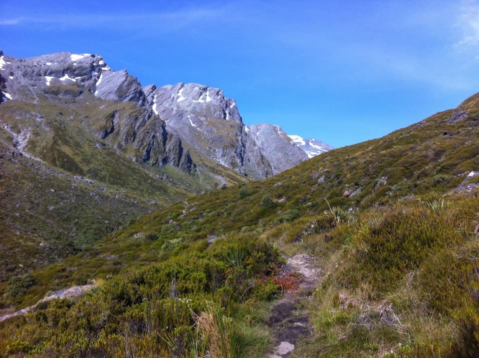
The forest gives way to a snow-grass face and a narrow ridge leading to Brewster Hut. It’s more exposed up here, and mountain weather can turn cold and wet even in summer. The views open as you leave the trees; look back down the Haast River valley as well as toward the surrounding Southern Alps. Winter travel needs mountaineering skills and avalanche knowledge, so this isn’t a year-round walking track for casual hikers.
Brewster Hut sits on the ridge above the valley, with Mount Brewster, Mount Armstrong and the distant glacier in view from the area. A sign marks the end of the maintained track. Don’t treat the hut as a launch point for the glacier, lakes or Mount Armstrong: there’s no track beyond it, and the continuation is steep, exposed alpine terrain. For a photo, include the red hut with the valley and peaks behind it; that setting tells the story better than a close-up of the building.
Start and finish at the shared gravel Fantail Falls car park on SH 6; the waterfall uses the same access, so parking can be busy in high season. No pets are allowed in the national park. Brewster Hut has 12 bunks, mattresses and a non-flush toilet. If you stay overnight, book for the summer season. Its tap water is untreated and must be boiled, and the tank can run dry in summer, especially from December to February, so carry enough water rather than relying on it.
Wildlife
 60 sightingsKeaMost seen around 5 PMSighting map
 112 sightingsRockwrenMost seen around 8 AMSighting map
 26 sightingsYellowheadMost seen around 8 AMSighting map
 13 sightingsTūīMost seen around 7 AMSighting map
 27 sightingsBellbirdMost seen around 7 AMSighting map
 35 sightingsRiflemanMost seen around 8 AMSighting map
Sighting maps show where each species has been reported across Mount Aspiring. Wildlife moves, so no sighting is guaranteed.
Keep exploring
 EasyFantail Falls Walk0.2 km · 5 min · At the trailheadA five-minute return walk to a fan-shaped waterfall.
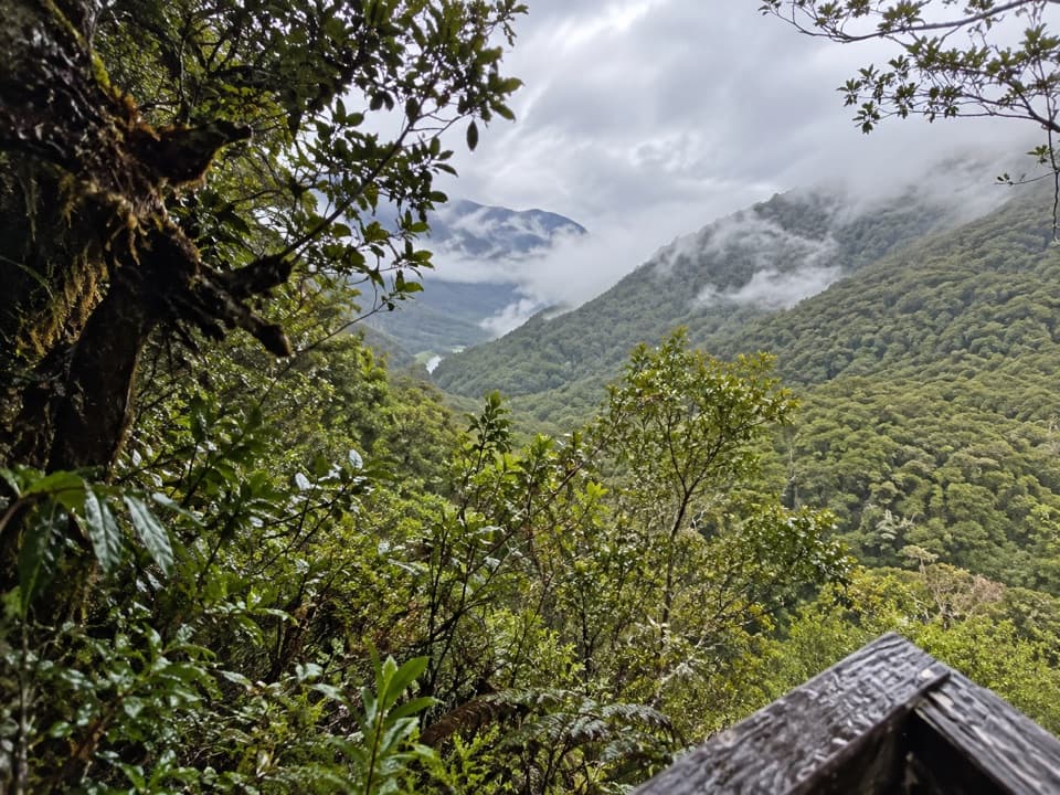 EasyBridle Track3.5 km · 1.5 hr · 4.2 km awayWalk a graded stretch of the old Otago to Westland route
 ModerateHaast Pass Lookout Track1.5 km · 1 hr · 4.2 km awayA short climb to a timber-railed Southern Alps lookout.
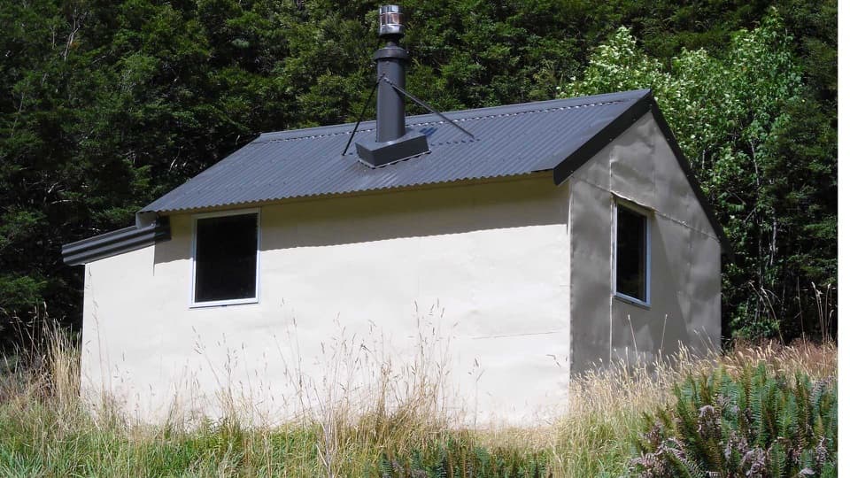 ChallengingWills Valley Track15 km · 11 hr · 4.2 km awayAn unstable gorge approach leads to a remote four-bunk hut.
 EasyThunder Creek Falls Walk0.2 km · 9 min · 4.7 km awayA sealed path ends above Haast River, facing a 28 m waterfall.
 EasyPleasant Flat Walk0.2 km · 5 min · 7.3 km awayA quick forest walk beside a mountain stream
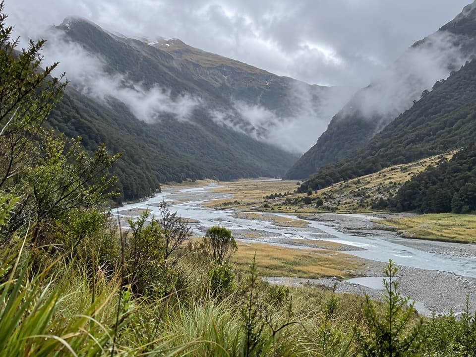 ChallengingMakarora Track to Makarora Hut21 km · 14 hr · 8.4 km awayA rough valley tramp to a four-bunk hut beneath Mount Brewster.
 EasyCameron Lookout Walk1 km · 20 min · 11 km awayShort climb through silver beech to a Cameron Creek lookout.
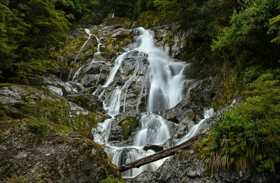 Sight · 0.1 km awayFantail FallsA five-minute walk to a 23 m fan-shaped waterfall.
 Lodging · 2.4 km awayBrewster HutA 12-bunk alpine hut at the end of a steep climb.
 Sight · 4.2 km awayGates of HaastBlue-green rapids under a narrow truss bridge make a quick stop.Sight · 4.2 km awayHaast Pass LookoutA steep climb buys a higher view over Haast Pass.
 Sight · 4.7 km awayThunder Creek FallsA five-minute forest walk to a 28 m waterfall.Lodging · 7.1 km awayWills HutFour bunks at the end of a demanding valley tramp
 Lodging · 7.2 km awayMakarora HutA small four-bunk hut at the end of a challenging valley tramp.
 Campground · 7.3 km awayPleasant Flat CampsiteOpen camping, a short stream walk, and Mount Hooker on the skyline.
Parkwolf’s Mount Aspiring ranking

The audio tour guide for the drive, plus offline maps, trails, and wildlife heatmaps for when the signal drops.