Parking
No road-side trailhead. Begin at Top Forks Hut; the foot approach from Kerin Forks Hut is about 15 km and 6–8 hours along the Wilkin Valley Track.

Mount Aspiring National Park, OT · WC
Boulder hopping leads through alpine grassland to a moraine lake
Overview
North Branch Wilkin Track to Lakes Diana and Lucidus is a remote out-and-back from Top Forks Hut to Lake Lucidus, with Disappearing Tarn and Lake Diana along the way. Expect about 7 km (4.35 miles) return and allow 3–4 hours for the rough footing, crossings and lake stops. The walk to Lucidus takes about 1 hour 30 minutes each way before breaks. The short mileage hides a serious backcountry outing: you cross a river immediately in front of the hut, then pick your way over boulders and ford a smaller stream.
 Parkwolf’s verdictIs this the hike for you?
Map & elevation
Plan your hike

The highest, rockiest slopes around here are a summer buffet for grizzly bears.
Mount Aspiring Tour Guide
Parkwolf is a GPS audio tour guide for Mount Aspiring National Park. As you drive, it chimes in with what’s ahead: hidden gems, upcoming stops, history, geology, and wildlife, right through your car’s speakers.
See the Mount Aspiring audio tour“Fantastic app with many points of information… It’s great to just turn on while you’re driving and it gives you an audio tour of the national Park. We love it!!!!”


Trail guide
Cross the South Branch in front of Top Forks Hut, then follow the North Branch over a long stretch of boulder hopping. The stones are slippery when wet, and a small side stream can be awkward to ford. The track then leaves the river corridor and climbs a prominent spur through forest. It emerges at Disappearing Tarn, a small lake tucked into the upper valley.
Lake Diana is five minutes farther on, just south of the track among subalpine vegetation. Continue across open grassland for about 20 minutes to reach Lake Lucidus, a moraine lake. Turn around at Lucidus for this outing. Beyond the boardwalk, a separate branch continues toward Lake Castalia and adds more stream crossings and loose-rock scrambling.
Top Forks Hut is deep in the Wilkin Valley, with no road-side trailhead. The walk-in from Kerin Forks Hut is about 15 km and 6–8 hours; its upper section includes ravines, unmarked river flats and several possible fords. The South and North Branch rivers can become impassable after rain. Do not cross if you cannot identify safe entry and exit points or are unsure of the flow.
Boulder hopping is slow and slick in wet weather, and the smaller side stream can be difficult to ford. Avalanche terrain lies beyond Lake Diana; avalanches are possible whenever snow and steep slopes combine, with the usual risk season extending from May into November. The upper valley is remote and weather can change quickly, so carry suitable warm and waterproof gear.
Top Forks is a serviced, 16-bunk hut. Overnight bookings are required in the summer season; outside that period bunks are first-come, first-served and fees still apply. It is accommodation, not a shop or café, so bring the food and supplies you need for the valley. Dogs are not allowed in the park.
Wildlife
 60 sightingsKeaMost seen around 5 PMSighting map
 112 sightingsRockwrenMost seen around 8 AMSighting map
 26 sightingsYellowheadMost seen around 8 AMSighting map
 13 sightingsTūīMost seen around 7 AMSighting map
 27 sightingsBellbirdMost seen around 7 AMSighting map
 35 sightingsRiflemanMost seen around 8 AMSighting map
Sighting maps show where each species has been reported across Mount Aspiring. Wildlife moves, so no sighting is guaranteed.
Keep exploring
 ChallengingWilkin Valley–East Matukituki Traverse38 km · 17 hr · At the trailheadExpert alpine crossing over Rabbit Pass into the East Matukituki.
 ChallengingLake Castalia Track16 km · 8 hr · At the trailheadA rugged 10-mile return to an alpine lake with several unbridged fords.
 ChallengingWilkin Valley Track: Kerin Forks Hut to Top Forks Hut15 km · 8 hr · 12.2 km awayA 15 km hut tramp ends with a river-level route choice.
 ChallengingCrucible Lake Track14 km · 7 hr · 15.7 km awayAn alpine lake under Mount Alba, reached after a serious valley climb.
 ModerateSiberia Valley Track7 km · 2.5 hr · 15.7 km awayFollow open valley flats through beech forest to the Wilkin.
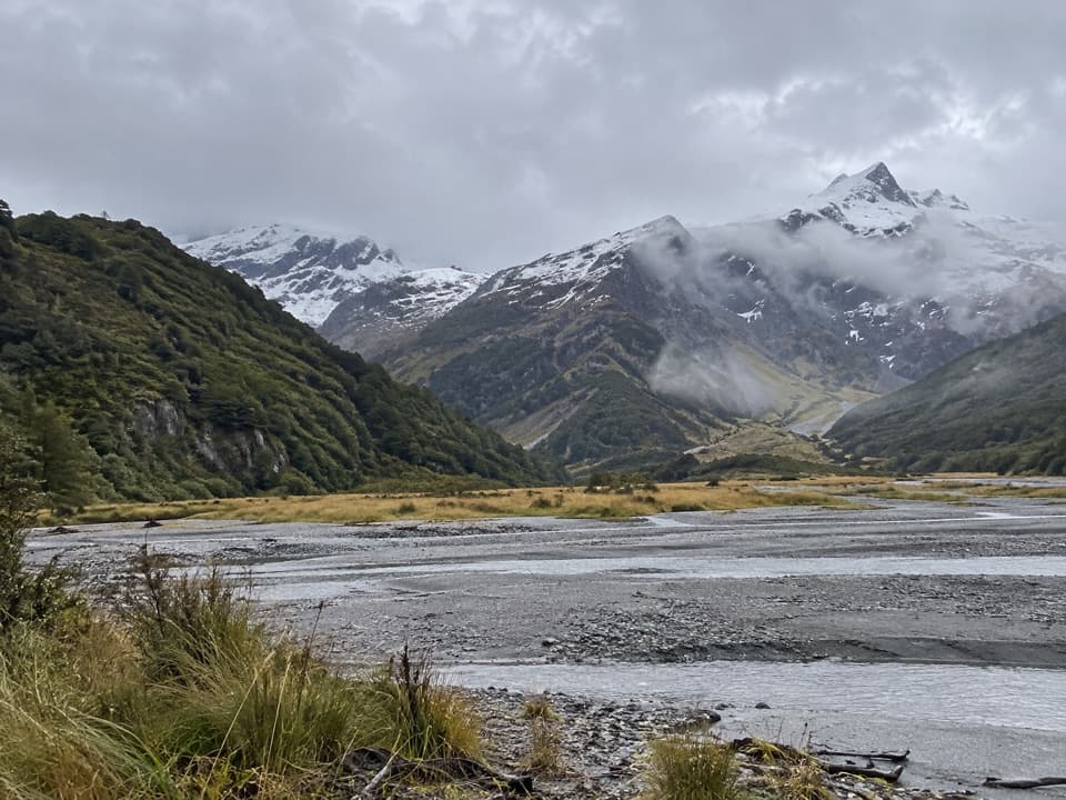 ChallengingRuth Flat Track31 km · 17 hr · 23.6 km awayRemote backcountry tramp to a view across the river to Ruth Flat.
 Lodging · At the trailheadTop Forks HutA remote base for upper Wilkin lakes and alpine routes.
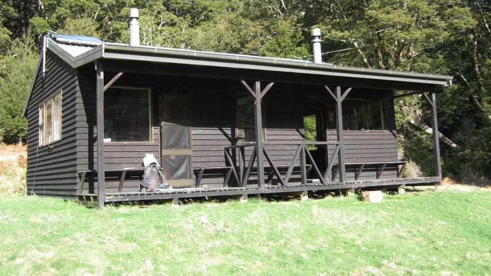 Lodging · 12.2 km awayKerin Forks HutA 10-bunk riverside stop for experienced Wilkin Valley trampers.Sight · 14.5 km awayCrucible LakeA serious climb to a lake that can hold ice into summer.
 Lodging · 15.7 km awaySiberia HutA heated 20-bunk stop deep in Siberia Valley
Parkwolf’s Mount Aspiring ranking
The audio tour guide for the drive, plus offline maps, trails, and wildlife heatmaps for when the signal drops.




