Makarora Track to Makarora Hut in Mount Aspiring National Park

Mount Aspiring National Park, OT · WC

Makarora Track to Makarora Hut

A rough valley tramp to a four-bunk hut beneath Mount Brewster.

Length
21km
Time
14hr
Elev. change
332m
Difficulty
Challenging
  • No dogs
  • High point 694 m

Hear the audio tour

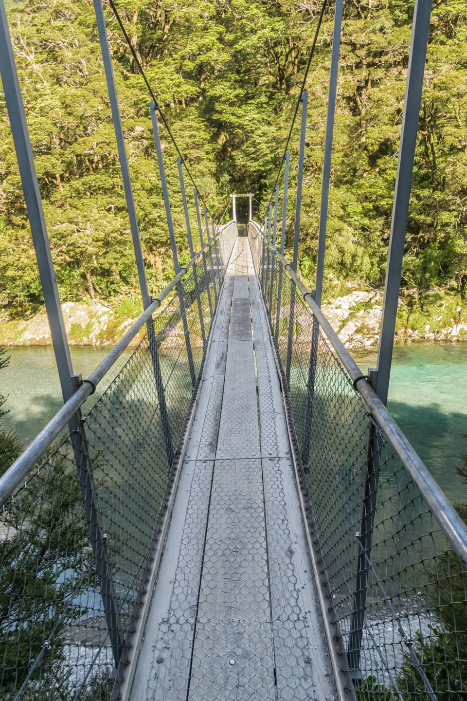
Makarora River Bridge and the Hut Track

Overview

About Makarora Track to Makarora Hut

Why go

  • Stewart Falls and open river flats reward the demanding approach.
  • A four-bunk hut makes an overnight trip into the upper valley possible.

Heads up

  • The unmarked river-flat finish and high water can stop progress.
  • Unstable slips, scrambling and seasonal avalanche terrain make this a serious backcountry trip.

Map & elevation

The route

Loading the Mount Aspiring map
Full map
Elevation362–694 m
TrailheadSH6 Makarora River Bridge layby, true left-44.14027, 169.32903
Keep this map with you offline in the Parkwolf app

Plan your hike

Before you go

Parking

Use the small layby on the true left of the SH6 road bridge between Kiwi Flat and Davis Flat. If it is full, do not park on the highway. Davis Flat car park is an alternative in dry conditions, but the river must be low enough for a safe crossing and the car park can flood after heavy rain.

Safety

The gorge sidle is slippery when wet, and a large unstable slip is marked only with tape. Unbridged river and side-stream crossings, plus about 50 minutes of unmarked route to the hut, require confident route-finding; do not cross flooded or unsafe water. Avalanche terrain can affect the track, usually May–November, and weather can cause hypothermia even in summer.

1 active Mount Aspiring alert

  • CautionRob Roy Track: stop at lower lookout during avalanche seasonFrom May through November, end your Rob Roy Track hike at the lower lookout; DOC strongly recommends against continuing to the upper lookout because the track crosses active avalanche paths.Official details
Mount Aspiring alerts
A park ranger sits on a dash-mounted phone, talking, as Parkwolf’s Tour Guide plays “Army Cutworm Moths: A Grizzly Bear Buffet” on Grand Loop Road below Dunraven Pass in Yellowstone
Parkwolf Tour GuideThe highest, rockiest slopes around here are a summer buffet for grizzly bears.

Mount Aspiring Tour Guide

Your drive to Makarora Track to Makarora Hut, narrated.

Parkwolf is a GPS audio tour guide for Mount Aspiring National Park. As you drive, it chimes in with what’s ahead: hidden gems, upcoming stops, history, geology, and wildlife, right through your car’s speakers.

See the Mount Aspiring audio tour

Recorded for this trailhead

Makarora River Bridge and the Hut Track
0:00 / 0:29
“The Makarora River bridge is ahead, with access to the track to Makarora Hut. For experienced trampers, it leads through a steep forested gorge to open grassy flats beneath Mount Brewster.”

Plays as you drive up to this trailhead in the Parkwolf Mount Aspiring Tour Guide.

More stories near here in the app

  • How Mountains Make a Rain Shadow
  • Cameron Lookout: Turn Around at the Platform
  • Blue Pools: Beyond the First Bridge
  • Haast Pass Lookout at Tioripatea
  • 80 audio storiesacross Mount Aspiring’s roads, triggered by GPS as you drive
  • Wildlife heatmapsfor Kea, Rockwren, Yellowhead, and 8 more
  • Works offlinemaps, 50 trails, 52 places, and audio download before you lose signal
  • CarPlay readysimple controls built for the drive
★★★★★
“Fantastic app with many points of information… It’s great to just turn on while you’re driving and it gives you an audio tour of the national Park. We love it!!!!”
JMJamesApp Store review
Download Parkwolf on the App StoreGet Parkwolf on Google Play

4.7 from 8,600+ ratings

Trail guide

Hiking Makarora Track to Makarora Hut

A long out-and-back to a hutMakarora Track to Makarora Hut is an advanced backcountry out-and-back from the true left of…

Makarora Track to Makarora Hut is an advanced backcountry out-and-back from the true left of the SH6 road bridge between Kiwi Flat and Davis Flat. Allow about 10.5 km each way (21 km return) and seven hours each way; this is best treated as an overnight trip, not a long day walk. The track is steep and rough, with scrambling, unstable slips, unbridged water and sections that need route-finding. The upper river-flat approach has no marked line, so the exact distance can vary with the route across it. This is for experienced trampers who can judge crossings and navigate through changing terrain. The short Stewart Falls walk is a separate, much easier outing.

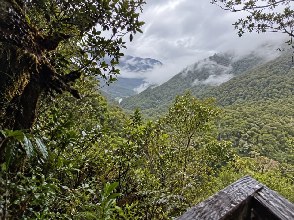
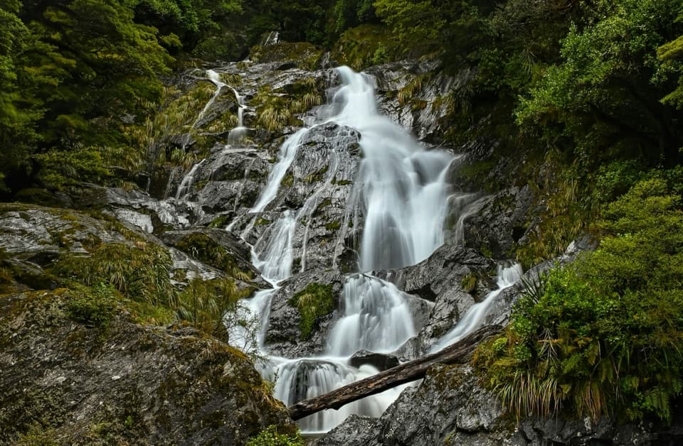
Beside Stewart Falls and above the gorgeThe track follows the Makarora River before climbing steeply beside Stewart Falls.

The track follows the Makarora River before climbing steeply beside Stewart Falls. Beyond the falls it sidles high above the gorge; that traverse is slippery when wet, and the descent across a large unstable slip is marked only with tape. Expect to navigate through small open flats, beech forest, more slips and fallen branches before reaching the main valley flat. A large side stream on the way cannot be crossed safely during or after heavy rain.

The final approach and Makarora HutThe marked track ends at the main valley flat.

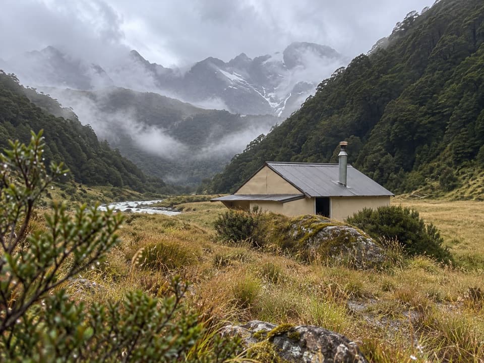
The marked track ends at the main valley flat. From there, the hut is about 50 minutes away on an unmarked route, and the easiest line may cross the river several times. Go only when the water is low and the crossings have safe entry and exit points; wait or turn back if they do not. The four-bunk hut sits at the northern end of the flat beside the bush on the true left. It has mattresses, heating, a non-flush toilet and stream water that is untreated; bookings are not needed, but hut tickets or a pass are required. Bring food for the trip. Dogs are not allowed in the national park.

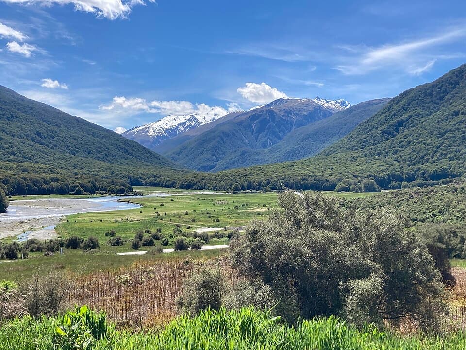
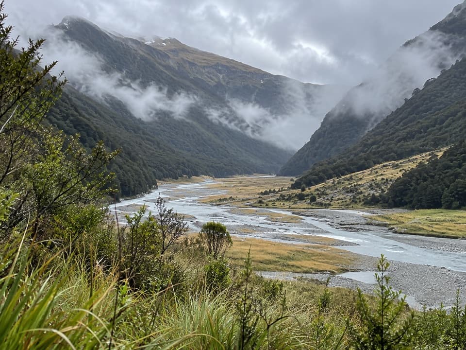
An open valley beneath Mount BrewsterThe forested gorge opens onto long grassy flats below the basin of Mount Brewster.

The forested gorge opens onto long grassy flats below the basin of Mount Brewster. From the open ground, the braided river makes a strong foreground for a view up the valley. The steep surrounding ranges are shaped by glacial carving, and the forest is mainly tawhai, or silver beech. Rifleman and yellow-crowned kākāriki are among the birds recorded in the wider region, though sightings are never guaranteed.

A route through Makarora's historyMāori travelling inland from coastal Otago and Southland used camps in the Makarora valley,…

Māori travelling inland from coastal Otago and Southland used camps in the Makarora valley, known as Kaika Paekai, or “the place of abundant food.” Haast Pass was also a route to the West Coast for pounamu. A pack track crossed the valley and pass by 1876; the road linking Wānaka and the West Coast was completed in 1965.

Wildlife

Wildlife in Mount Aspiring

All Mount Aspiring wildlife maps

Sighting maps show where each species has been reported across Mount Aspiring. Wildlife moves, so no sighting is guaranteed.

Keep exploring

Near Makarora Track to Makarora Hut

See it all on the map

Trails that start nearby

Places near the trailhead

Parkwolf’s Mount Aspiring ranking

Top-rated trails in Mount Aspiring

All 50 trails
  1. 1Routeburn TrackChallenging · 33.1 km
  2. 2Rob Roy TrackModerate · 10 km
  3. 3Gillespie Pass CircuitChallenging · 56 km
  4. 4Rees-Dart TrackChallenging · 63 km
  5. 5Brewster TrackChallenging · 5.6 km
  6. 6Blue Pools TrackEasy · 3.2 km

Take Parkwolf to Mount Aspiring.

The audio tour guide for the drive, plus offline maps, trails, and wildlife heatmaps for when the signal drops.

4.7 from 8,600+ ratings

Download Parkwolf on the App StoreGet Parkwolf on Google Play