Pros & cons
PROS
- Highest point most hikers can reach without technical climbing
- Historic high camp with a public shelter and ranger presence
- Front‑row glacier scenery and true alpine atmosphere
CONS
- Strenuous, sustained snow travel with altitude and rapid weather shifts
- No services or running water; you’ll melt and treat snow for water
- Crowded in good weather and the snowfield is unmarked in whiteouts
Overview
Perched around 10,000 feet above Paradise, Camp Muir is Rainier’s famed high camp—where ambitious day‑hikers meet roped climbers staging for the summit. It’s the informal boundary between hiking and mountaineering, and the payoff is a bona fide alpine experience most visitors never see.
What You’ll See
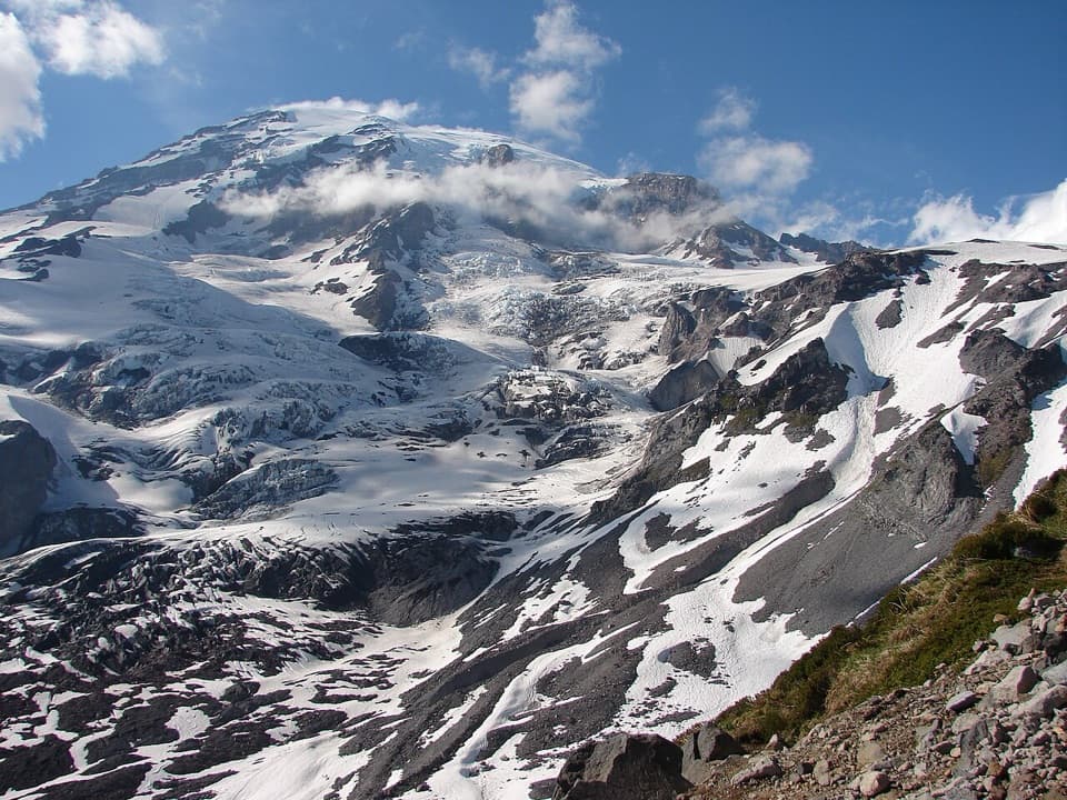
Below Pebble Creek, summer meadows and wildflowers give way to stark, high‑snowfield travel. At camp you’ll stare straight into hanging glaciers, seracs, and yawning crevasses above. On clear days the horizon stretches across the Cascades, with the Nisqually and Cowlitz Glaciers dominating the foreground.
Getting There
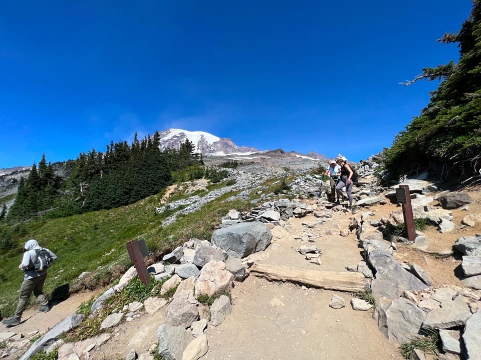
Most hikers ascend from Paradise via the Skyline Trail, then leave marked trail above Pebble Creek to cross the Muir Snowfield. Expect steep grades, firm morning snow softening to slush by afternoon, and a long descent that demands fresh legs.
Difficulty & Safety
This is a demanding, high‑elevation outing with roughly 4,600 feet of gain and snow travel much of the year. Weather can flip from sunny to whiteout in minutes, and the route above Pebble Creek is unmarked—strong navigation is essential. Altitude hits harder than you think here: pace yourself, hydrate, and be willing to turn around.
Wildlife
Marmots and deer are common in the lower meadows; sightings thin out quickly as you climb. Above treeline, wildlife is scarce on the snowfield itself.
On‑Site Facilities
Camp Muir has a simple public shelter (first‑come, first‑served), a ranger station, and a solar toilet—no running water. Overnight camping requires a wilderness permit, and anyone going higher onto glaciers needs a climbing pass and appropriate skills. Plan to melt and treat snow for water.
Best Time to Visit
Clear summer windows offer the best combination of stability and daylight, with late summer typically seeing less new snow on the surface. Start early for firmer morning snow, safer travel, and thinner crowds; weekdays are generally quieter than weekends. Midday sun on the snowfield is harsh for both eyes and skin, and late‑day weather build‑ups are common.
Is It Worth It?
If you’re fit, prepared for snow travel, and hungry for big‑mountain scenery, Camp Muir is one of the park’s most rewarding day objectives. If you want an easy stroll, this isn’t it.
Where it is
46.8355, -121.7324Tips for Camp Muir
- 01Start before sunrise for firmer snow, safer navigation, and fewer crowds.
- 02Carry traction (microspikes or crampons) and trekking poles; conditions vary by season and day.
- 03Bring at least 3 liters of water and note Pebble Creek as the last reliable source to treat.
- 04Study the park’s Camp Muir “Get Your Bearings” route and carry GPS, map, and compass.
- 05High UV on snow is brutal—wear glacier‑grade sunglasses, sunscreen, and lip balm; no dogs allowed.
Amenities
Near Camp Muir
All places →All trails →
0.5 mi awayAnvil RockDistinctive volcanic outcrop overlooking the Muir Snowfield
0.6 mi awayMuir SnowfieldHigh‑alpine snow route to Camp Muir with year‑round turns
0.7 mi awayNisqually GlacierThe park’s most storied glacier, best seen from the Nisqually Vista LoopParking · Scenic Viewpoint
1.4 mi awayLittle TahomaRainier's jagged 11,138 ft satellite for serious glacier climbs
3.1 mi awayParadise Glacier TrailA quieter Paradise climb to stark glacier country and big views.Moderate · 5.6 mi · 3 hr
3.4 mi awaySkyline TrailParadise’s crown‑jewel loop of meadows, glaciers, and big viewsChallenging · 5.5 mi · 4 hr
3.4 mi awayUpper Skyline TrailRainier’s classic high route: wildflowers, glaciers, and big viewsChallenging · 5.5 mi · 4 hr
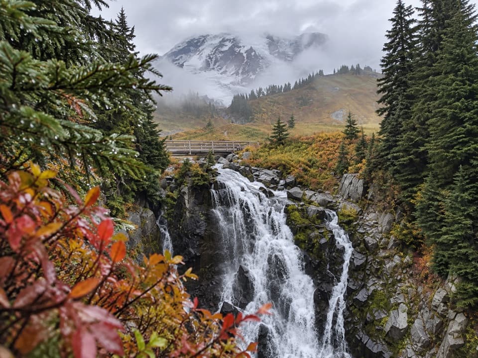
3.4 mi awaySkyline Trail to Myrtle FallsPaved stroll to Rainier’s classic Myrtle Falls postcard viewEasy · 0.8 mi · 36 min