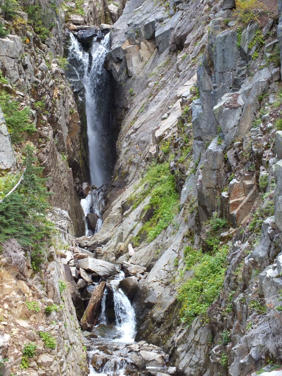
Golden Gate Loop Trail in Mount Rainier National Park

Mount Rainier National Park, WA

Golden Gate Loop Trail

Wildflower meadows, Myrtle Falls and a high notch above Paradise.

Photo: National Park Service
Length
4mi
Time
3hr
Elev. change
935ft
Difficulty
Moderate
  • Loop
  • No dogs
  • High point 6,388 ft
  • #41 of 99 in Mount Rainier

Hear the audio tour

Paradise: Meadows, Myrtle Falls and the Inn

Overview

About Golden Gate Loop Trail

Why go

  • Combines Myrtle Falls, open wildflower meadows and high Paradise views.
  • A shorter Paradise circuit than the full Skyline Loop.

Heads up

  • About 1,160 feet of climbing to 6,400 feet in mostly exposed terrain.
  • Two Paradise River crossings need care when water is high.
Golden Gate Loop is a 4-mile Paradise circuit from the Jackson Visitor Center. The paved approach reaches Myrtle Falls and the Edith Creek bridge, then Golden Gate Trail climbs through open subalpine meadows to a 6,400-foot notch. The return drops by Skyline into Paradise River valley and back to the visitor center. Plan on about three hours and 1,160 feet of climbing. It is a good middle ground if you want a proper high-country walk but do not need the longer Skyline Loop.
Parkwolf’s verdictIs this the loop for you?

Map & elevation

The route

Loading the Mount Rainier map
Full map
Elevation5,453–6,388 ft
TrailheadJackson Visitor Center / Paradise Meadows stone steps46.78630, -121.73620
Keep this map with you offline in the Parkwolf app

Plan your hike

Before you go

Parking

Use the upper Paradise parking lot beside the Jackson Visitor Center; the trail starts at the stone steps. The lots serve the wider Paradise trail network. Park entrance admission or a valid pass applies. Paradise is day-use only; the Longmire gate closes nightly in winter, so check road status before driving up.

Safety

The route reaches 6,400 feet through open terrain and crosses Paradise River twice. Early-season snow can make the Skyline-area route hazardous; check NPS trail conditions. Do not attempt a river crossing when the flow makes footing unsafe. Stay on constructed trail to protect fragile meadows.

7 active Mount Rainier alerts

  • ClosureWildfire closures in the northern parkGrand Park 2 and Wonderland Complex fire closures affect trails, backcountry camps, and Sunrise access; stay out of closed areas.Official details
  • ClosureSR 165 bridge closed: no public access to Carbon River or Mowich LakeThe SR 165 Carbon River/Fairfax Bridge is closed to vehicles, bicycles, and pedestrians; there is no public access or alternate route to Carbon River or Mowich Lake.Official details
See all 7 alerts
A park ranger sits on a dash-mounted phone, talking, as Parkwolf’s Tour Guide plays “Army Cutworm Moths: A Grizzly Bear Buffet” on Grand Loop Road below Dunraven Pass in Yellowstone
Parkwolf Tour GuideThe highest, rockiest slopes around here are a summer buffet for grizzly bears.

Mount Rainier Tour Guide

Your drive to Golden Gate Loop Trail, narrated.

Parkwolf is a GPS audio tour guide for Mount Rainier National Park. As you drive, it chimes in with what’s ahead: hidden gems, upcoming stops, history, geology, and wildlife, right through your car’s speakers.

See the Mount Rainier audio tour

Recorded for this trailhead

Paradise: Meadows, Myrtle Falls and the Inn
0:00 / 0:40
“You're coming up on Paradise, where meadow walks start beside the visitor center and historic inn.”

Plays as you drive up to this trailhead in the Parkwolf Mount Rainier Tour Guide.

More stories near here in the app

  • Paradise Picnic Area: A Lunch Stop Among the Trees
  • Nisqually Vista: A Short Glacier Walk
  • Edith Gorge Falls: A Quick Bridge View
  • Ruby Falls: Beneath the Bridge
  • 77 audio storiesacross Mount Rainier’s roads, triggered by GPS as you drive
  • Wildlife heatmapsfor Mountain Goat, Black Bear, Wolverine, and 13 more
  • Works offlinemaps, 99 trails, 87 places, and audio download before you lose signal
  • CarPlay readysimple controls built for the drive
★★★★★
“Fantastic app with many points of information… It’s great to just turn on while you’re driving and it gives you an audio tour of the national Park. We love it!!!!”
JMJamesApp Store review
Download Parkwolf on the App StoreGet Parkwolf on Google Play

4.7 from 8,600+ ratings

Trail guide

Hiking Golden Gate Loop Trail

Start with Myrtle FallsBegin at the stone steps beside the visitor center and follow signs toward Myrtle Falls.

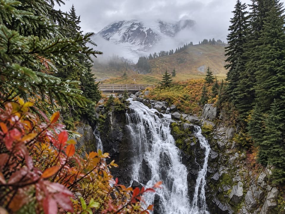
Begin at the stone steps beside the visitor center and follow signs toward Myrtle Falls. The Edith Creek bridge comes around 0.45 mile in; a short side path reaches the waterfall viewpoint. At about 0.55 mile, cross the bridge and turn left onto Golden Gate Trail. The bridge is the best place to frame Myrtle Falls with Rainier behind it; stay on the built path instead of cutting through the flower meadow.

Climb to Golden GateThe next mile climbs about 780 feet on a wide, stepped trail through open meadows.

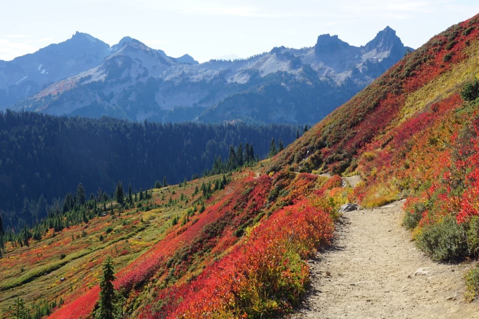
The next mile climbs about 780 feet on a wide, stepped trail through open meadows. Lupine is common, snowmelt streams cross the slopes, and marmots are often out on sunny days. There is little tree cover, so this is a bright, exposed stretch. At 6,400 feet you reach the Golden Gate notch and its Skyline junction. A brief step onto Skyline gives the view; return to the junction before taking the descending trail into the valley.

The notch is the top of this loop. The older park map also lists a separate Panorama Point route that reaches 6,800 feet and has more climbing. Do not assume this Golden Gate Loop reaches Panorama Point or combine that higher route into this circuit.

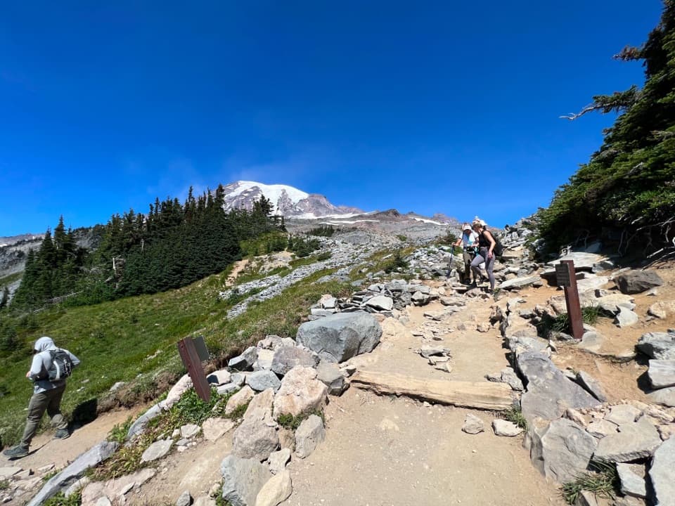
Take the Paradise River returnOn the descent, the view opens into Paradise River valley.

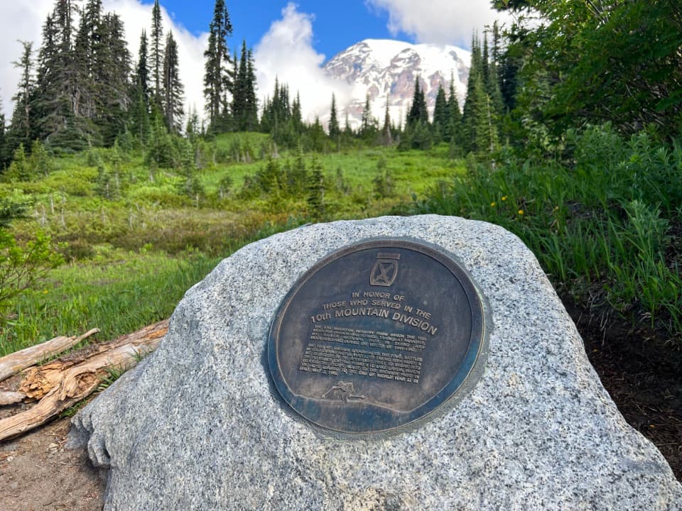
On the descent, the view opens into Paradise River valley. You cross the river twice; the first is a rock hop. Pass the Paradise Glacier Trail junction and stay on the Paradise-bound loop: the old Paradise Ice Caves collapsed, so that side trail no longer leads to a cave. A stone monument about 40 yards beyond the junction marks the site where the first climbers waited for their guide. Sluiskin Falls is close, but trees and the narrow canyon hide it from the trail.

After the second river crossing, follow signs for Paradise, bypassing the Lakes and 4th Crossing trail junctions. A gentle climb returns to about 5,600 feet and completes the valley circuit; retrace the first half mile to the visitor center.

A story from the 1870 climbThe monument remembers the August 1870 climb by Hazard Stevens and P. B.

The monument remembers the August 1870 climb by Hazard Stevens and P. B. Van Trump, guided by Sluiskin. They named the nearby falls for him and were credited with the first ascent, though later accounts say they probably did not reach Rainier’s true summit. One oral tradition holds that Sluiskin’s grandfather warned that Takhoma’s summit held an evil spirit in a fiery lake; Sluiskin declined to climb higher than 9,200 feet. It is a story about the climb and its cultural setting, not a geological explanation.

Make the Paradise approach workUse the upper Paradise parking lot beside the Jackson Visitor Center.

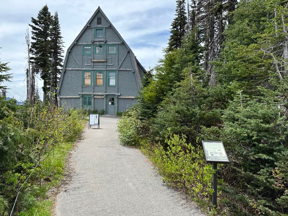
Use the upper Paradise parking lot beside the Jackson Visitor Center. Restrooms, food, and water are at the start; no on-route food or water source was found. Park entrance admission or a valid pass applies, and Paradise is day-use only. Pets are not allowed on park trails. NPS warns that early-season snow can make Skyline-area hiking hazardous; check current conditions and stay on constructed tread to protect the fragile meadows. Paradise Road also closes nightly at the Longmire gate in winter, so check the road status before driving up.

Wildlife

Wildlife in Mount Rainier

All Mount Rainier wildlife maps

Sighting maps show where each species has been reported across Mount Rainier. Wildlife moves, so no sighting is guaranteed.

Keep exploring

Near Golden Gate Loop Trail

See it all on the map

Trails that start nearby

Places near the trailhead

Parkwolf’s Mount Rainier ranking

Top-rated trails in Mount Rainier

All 99 trails
  1. 1Wonderland TrailChallenging · 93 mi
  2. 2Skyline Trail LoopChallenging · 5.5 mi
  3. 3Mount Fremont Lookout TrailModerate · 5.6 mi
  4. 4Burroughs Mountain TrailModerate · 6.2 mi
  5. 5Summerland TrailModerate · 8.4 mi
  6. 6Naches Peak Loop TrailModerate · 3.5 mi

Take Parkwolf to Mount Rainier.

The audio tour guide for the drive, plus offline maps, trails, and wildlife heatmaps for when the signal drops.

4.7 from 8,600+ ratings

Download Parkwolf on the App StoreGet Parkwolf on Google Play