Silver Falls in Mount Rainier National Park

#7 of 61 sights in Mount Rainier

Sight · Mount Rainier National Park

Silver Falls

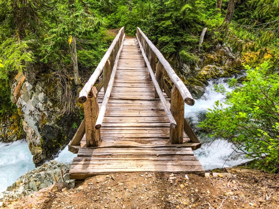
A 60-foot drop and a footbridge in an old-growth gorge.

Photo: Wikimedia Commons
Type
Sight
Nearest trail
0.1 mi
Audio stories
5 nearby
  • Trailhead
  • Parking
  • Scenic viewpoint

Hear the audio tour

Ohanapecosh: Old Forest and Silver Falls

Overview

About Silver Falls

Why stop

  • The footbridge puts you beside the waterfall and gorge.

Heads up

  • Rocks near the fast, cold water can be slippery.

Map

Where it is

Loading the Mount Rainier map
Full map
SightSilver Falls46.75233, -121.55949
Keep this map with you offline in the Parkwolf app

Plan your stop

Before you go

7 active Mount Rainier alerts

  • ClosureOhanapecosh Developed Area closed for constructionMentions this placeThe entire Ohanapecosh Developed Area is closed through the construction project, expected to continue through February 2027; visitors may not enter or recreate there.Official details
  • ClosureGrove of the Patriarchs closed; parking reopenedMentions this placeThe Grove of the Patriarchs remains closed to all recreation because severe flooding in November 2021 caused major structural failure of its 1961 suspension bridge, which was removed for safety.Official details

See all 7 alerts
A park ranger sits on a dash-mounted phone, talking, as Parkwolf’s Tour Guide plays “Army Cutworm Moths: A Grizzly Bear Buffet” on Grand Loop Road below Dunraven Pass in Yellowstone
Parkwolf Tour GuideThe highest, rockiest slopes around here are a summer buffet for grizzly bears.

Mount Rainier Tour Guide

Your drive to Silver Falls, narrated.

Parkwolf is a GPS audio tour guide for Mount Rainier National Park. As you drive, it chimes in with what’s ahead: hidden gems, upcoming stops, history, geology, and wildlife, right through your car’s speakers.

See the Mount Rainier audio tour

Recorded for this place

Ohanapecosh: Old Forest and Silver Falls
0:00 / 0:33
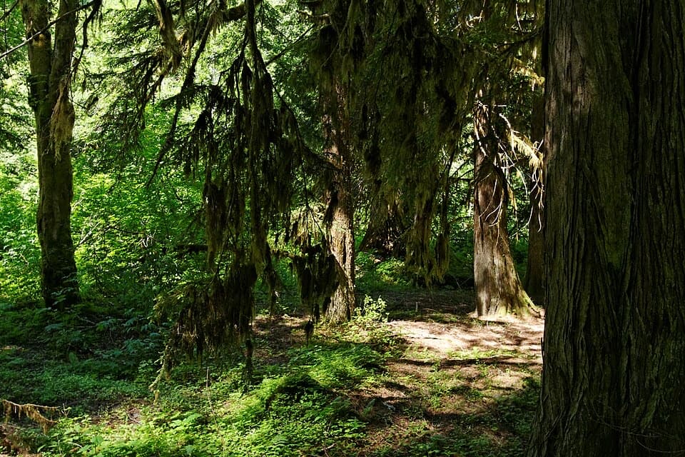
“Up ahead is Ohanapecosh, where huge firs, cedars and hemlocks shade the river. I'd stop here for the old forest and Silver Falls, where a footbridge brings you beside white water pouring through a rocky gorge.”

Plays as you drive up to Silver Falls in the Parkwolf Mount Rainier Tour Guide.

More stories near here in the app

  • Laughingwater Creek: A Full Day to Three Lakes
  • A Woodpecker's Rectangular Clue
  • A Douglas-fir’s Thick Skin
  • A Banana Slug's Slime
  • 77 audio storiesacross Mount Rainier’s roads, triggered by GPS as you drive
  • Wildlife heatmapsfor Mountain Goat, Black Bear, Wolverine, and 13 more
  • Works offlinemaps, 99 trails, 87 places, and audio download before you lose signal
  • CarPlay readysimple controls built for the drive
★★★★★
“Fantastic app with many points of information… It’s great to just turn on while you’re driving and it gives you an audio tour of the national Park. We love it!!!!”
JMJamesApp Store review
Download Parkwolf on the App StoreGet Parkwolf on Google Play

4.7 from 8,600+ ratings

Guide

More about Silver Falls

Why make time for itSilver Falls is a waterfall on the Ohanapecosh River in the old-growth forest on Mount…

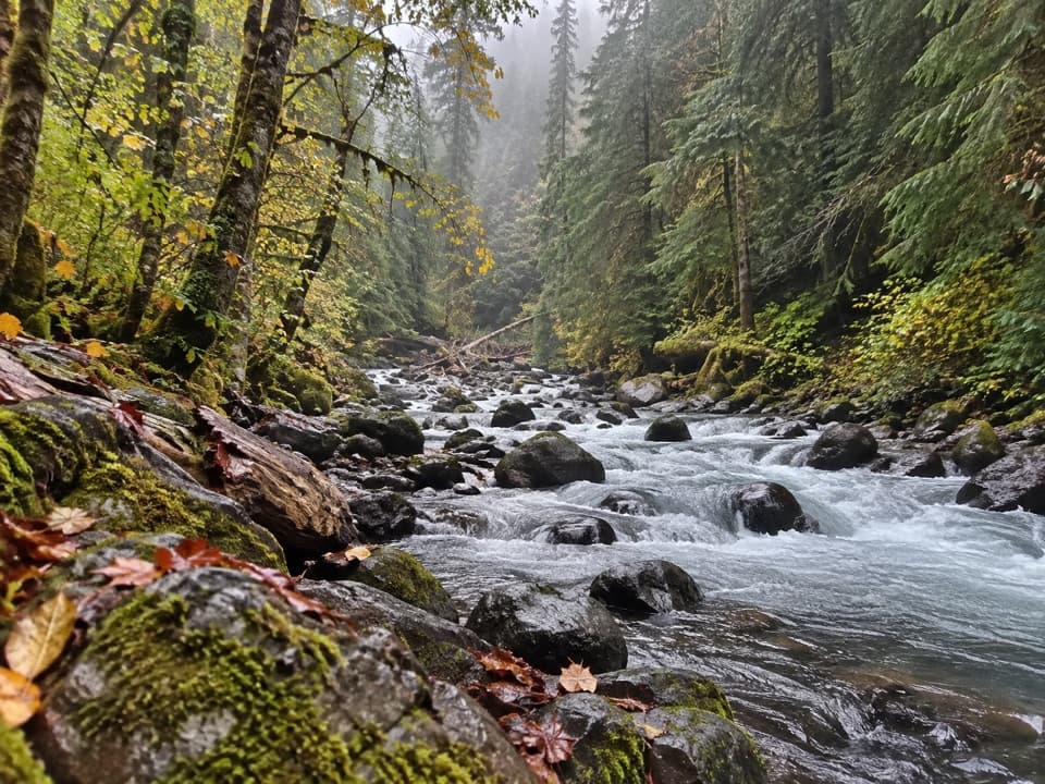
Silver Falls is a waterfall on the Ohanapecosh River in the old-growth forest on Mount Rainier’s southeast side. The river tumbles over smaller cascades before its main drop, about 60 feet, into a rocky amphitheater. The footbridge and nearby viewpoints bring you close to the falls and the river channel. If you’re exploring Ohanapecosh, this is the walk to keep on your list.

The usual routeThe standard loop follows one riverbank upstream, crosses the footbridge by the falls, then…

The standard loop follows one riverbank upstream, crosses the footbridge by the falls, then returns along the other bank. Published estimates vary a little, so plan for about 3 miles round trip, roughly 500 to 600 feet of climbing, and around 1.5 to 2 hours. It’s a real walk with some uphill and uneven footing near the river, even though many families do it. The trail is typically hikeable from May through October; Ohanapecosh isn’t accessible by car in winter, and pets aren’t allowed on trails.

Find the best viewFor the fullest look into the gorge, stop just east of the footbridge.

For the fullest look into the gorge, stop just east of the footbridge. There’s another viewpoint on the west side of the amphitheater. For a photo, keep some of the river channel below the drop in frame; it shows the falls and the fast, blue-green water together.

A cold, fast riverThe Ohanapecosh River carries water from glaciers and snowfields at its headwaters.

The Ohanapecosh River carries water from glaciers and snowfields at its headwaters. At Silver Falls it runs clear, cold and swift, and the water can roar and throw spray when flow is high. Rocks beside the falls are slippery, and the river is turbulent and dangerously cold, so stay back from its edge.

Forest along the walkThe trail passes through old growth with Douglas-fir, western red cedar and western hemlock.

The trail passes through old growth with Douglas-fir, western red cedar and western hemlock. Listen for woodpeckers in the trees and keep an eye out for deer along the river.

The name and the hot springsOhanapecosh is named for a Taidnapam (Upper Cowlitz) habitation site along the river.

Ohanapecosh is named for a Taidnapam (Upper Cowlitz) habitation site along the river. The name is thought to mean “standing at the edge.” The area also had an early hot-springs resort that drew visitors to warm water believed to have healing properties; the springs are no longer available for soaking.

Wildlife

Wildlife in Mount Rainier

All Mount Rainier wildlife maps

Sighting maps show where each species has been reported across Mount Rainier. Wildlife moves, so no sighting is guaranteed.

Keep exploring

Near Silver Falls

See it all on the map

Trails nearby

More stops nearby

Parkwolf’s Mount Rainier ranking

Top sights in Mount Rainier

All 87 places
  1. 1Reflection LakesSight
  2. 2Myrtle FallsSight
  3. 3Panorama PointSight
  4. 4Narada FallsSight
  5. 5Tipsoo LakeSight
  6. 6Sunrise Point OverlookSight

Take Parkwolf to Mount Rainier.

The audio tour guide for the drive, plus offline maps, trails, and wildlife heatmaps for when the signal drops.

4.7 from 8,600+ ratings

Download Parkwolf on the App StoreGet Parkwolf on Google Play