Indian Bar Trail in Mount Rainier National Park

Mount Rainier National Park, WA

Indian Bar Trail

A hard ridge crossing opens into a waterfall-filled alpine basin.

Photo: Unsplash License
Length
14.5mi
Time
11hr
Elev. change
2,723ft
Difficulty
Challenging
  • No dogs
  • High point 5,774 ft
  • #16 of 99 in Mount Rainier

Hear the audio tour

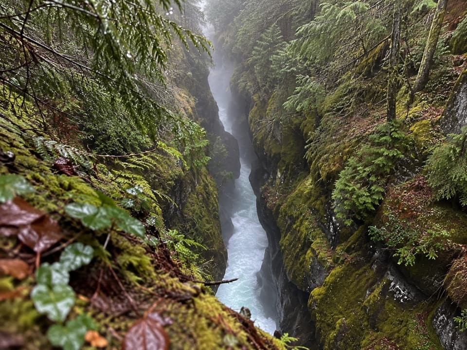
Box Canyon: A River in a Narrow Crack

Overview

About Indian Bar Trail

Why go

  • Rainier opens above rolling meadows on Cowlitz Divide.
  • Indian Bar combines river, waterfalls, a stone shelter and glacial remnants.

Heads up

  • The 14.5-mile return repeats the divide and regains the steep descent.
  • Nickel Creek is the last reliable water until Indian Bar.

Map & elevation

The route

Loading the Mount Rainier map
Full map
Elevation3,051–5,774 ft
TrailheadBox Canyon / Wonderland Trail trailhead46.76556, -121.63444
Keep this map with you offline in the Parkwolf app

Plan your hike

Before you go

Parking

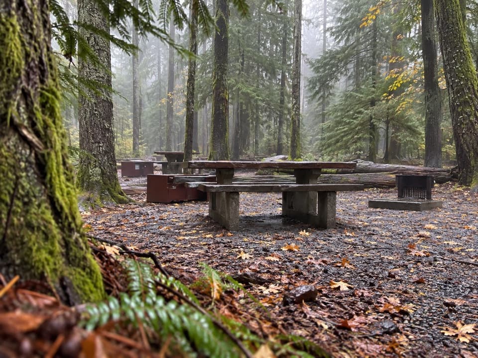
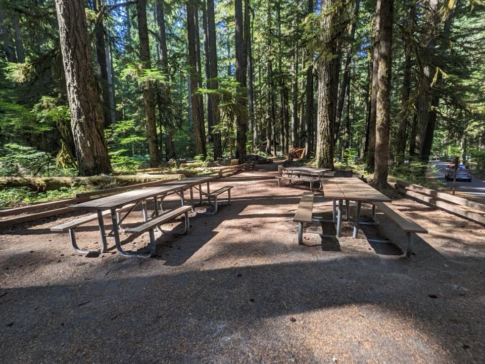
Start at the Box Canyon parking area on Stevens Canyon Road, then cross the road to the signed gravel Wonderland Trail. The paved path from the lot is the separate Box Canyon Nature Trail. A seasonal comfort station and picnic area are at Box Canyon; there is no potable water.

Safety

This is a strenuous all-day hike with repeated climbing and a steep descent that must be climbed again. Nickel Creek is the last reliable water before Indian Bar; smaller streams can be seasonal, and all water must be treated. No pets are allowed on park trails. Overnight camping requires a wilderness permit.

7 active Mount Rainier alerts

  • ClosureWildfire closures in the northern parkGrand Park 2 and Wonderland Complex fire closures affect trails, backcountry camps, and Sunrise access; stay out of closed areas.Official details
  • ClosureSR 165 bridge closed: no public access to Carbon River or Mowich LakeThe SR 165 Carbon River/Fairfax Bridge is closed to vehicles, bicycles, and pedestrians; there is no public access or alternate route to Carbon River or Mowich Lake.Official details
See all 7 alerts
A park ranger sits on a dash-mounted phone, talking, as Parkwolf’s Tour Guide plays “Army Cutworm Moths: A Grizzly Bear Buffet” on Grand Loop Road below Dunraven Pass in Yellowstone
Parkwolf Tour GuideThe highest, rockiest slopes around here are a summer buffet for grizzly bears.

Mount Rainier Tour Guide

Your drive to Indian Bar Trail, narrated.

Parkwolf is a GPS audio tour guide for Mount Rainier National Park. As you drive, it chimes in with what’s ahead: hidden gems, upcoming stops, history, geology, and wildlife, right through your car’s speakers.

See the Mount Rainier audio tour

Recorded for this trailhead

Box Canyon: A River in a Narrow Crack
0:00 / 0:34
“Box Canyon is coming up beside Stevens Canyon Road. Make this stop for a look straight down into a remarkably narrow gorge: the river squeezes through a slot just thirteen feet wide at its tightest point.”

Plays as you drive up to this trailhead in the Parkwolf Mount Rainier Tour Guide.

More stories near here in the app

  • The Songbird Under the Water
  • Lilies at the Snow Line
  • A Night Beside the Steam Vents
  • Ohanapecosh's Long Human History
  • 77 audio storiesacross Mount Rainier’s roads, triggered by GPS as you drive
  • Wildlife heatmapsfor Mountain Goat, Black Bear, Wolverine, and 13 more
  • Works offlinemaps, 99 trails, 87 places, and audio download before you lose signal
  • CarPlay readysimple controls built for the drive
★★★★★
“Fantastic app with many points of information… It’s great to just turn on while you’re driving and it gives you an audio tour of the national Park. We love it!!!!”
JMJamesApp Store review
Download Parkwolf on the App StoreGet Parkwolf on Google Play

4.7 from 8,600+ ratings

Trail guide

Hiking Indian Bar Trail

The full day to Indian BarIndian Bar Trail is a strenuous 14.

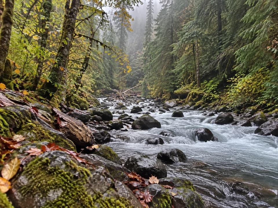
Indian Bar Trail is a strenuous 14.5-mile out-and-back from Box Canyon, following the Wonderland Trail over Cowlitz Divide and down to a subalpine basin beside the Ohanapecosh River. The destination earns the long approach: a wide green meadow, waterfalls, a stone shelter and open views back toward Mount Rainier. Allow about 10–12 hours for the whole walk if you do it in a day; some hikers split it into an overnight. This is a serious hike, with repeated climbs on the divide and a steep drop to Indian Bar that you have to climb back out of. The reported total climbing varies from 3,700 to 5,074 feet; a coarse elevation profile along the mapped corridor suggests roughly 4,000 feet for the return trip, so treat any single number as an estimate.

Start at Box CanyonPark at Box Canyon on Stevens Canyon Road and cross the road to the signed gravel Wonderland…

Park at Box Canyon on Stevens Canyon Road and cross the road to the signed gravel Wonderland Trail. The paved path from the lot is the short Box Canyon Nature Trail, a different walk. The first mile is a fairly gentle warm-up through forest to Nickel Creek. There's a smaller creek about half a mile farther along, but Nickel Creek is the last reliable water before Indian Bar; the smaller one can be seasonal. Fill up there and treat water before drinking it.

Climb across Cowlitz DivideFrom Nickel Creek the trail climbs steadily through shaded forest, gaining about 1,800 feet on…

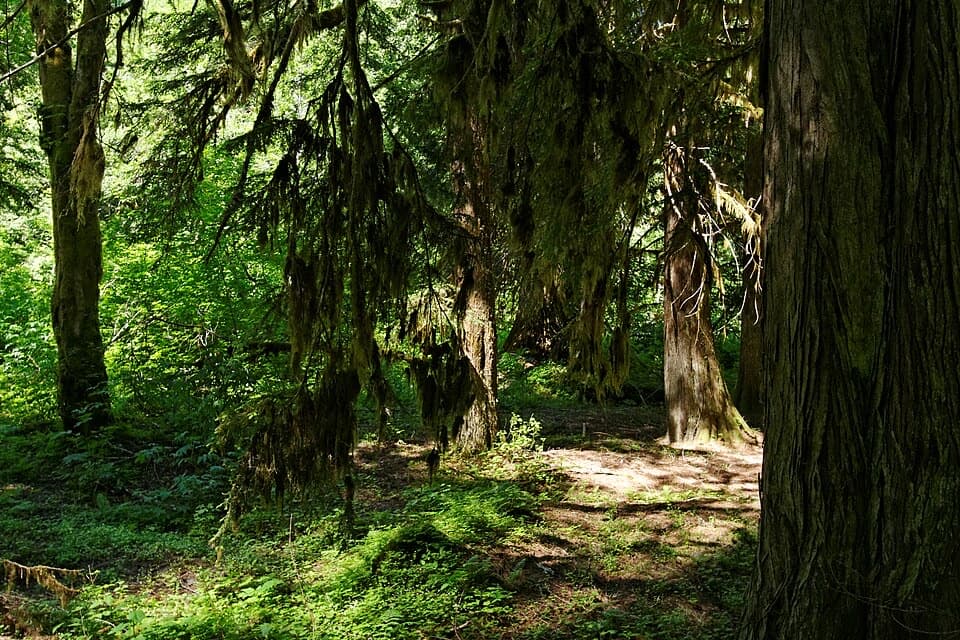
From Nickel Creek the trail climbs steadily through shaded forest, gaining about 1,800 feet on the way to the divide. The grade steepens toward the junction: stay on the Wonderland Trail for Indian Bar, because the Cowlitz Divide Trail branches east toward Olallie Creek. Above the junction, the route rolls over several bumps, alternating between forest and open meadow. Mount Adams and Goat Rocks appear through the openings; the full southeast face of Rainier arrives from the 5,914-foot knoll. That high point is a good place to pause before the descent, and the outward-and-back return makes you cross the same rolling ground again.

Drop to the basinFrom the knoll, the trail loses about 800 feet to Indian Bar.

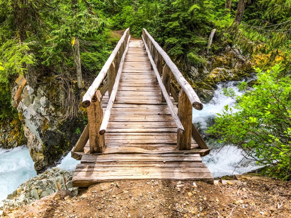
From the knoll, the trail loses about 800 feet to Indian Bar. One steep section uses stairs, then the route turns and the whole basin opens below. The last stretch winds through meadow and berry plants to the Ohanapecosh River and the group shelter on its west bank. A bridge crosses above Wauhaukaupauken Falls just below the shelter; established campsites and a toilet are also in the basin. For a photo that shows the place rather than just the shelter, stop at the bend before the drop and include the meadow, river and falls together.

Meadows, lava cliffs and a CCC shelterIndian Bar is a broad subalpine meadow divided by the Ohanapecosh River, with small remnants of…

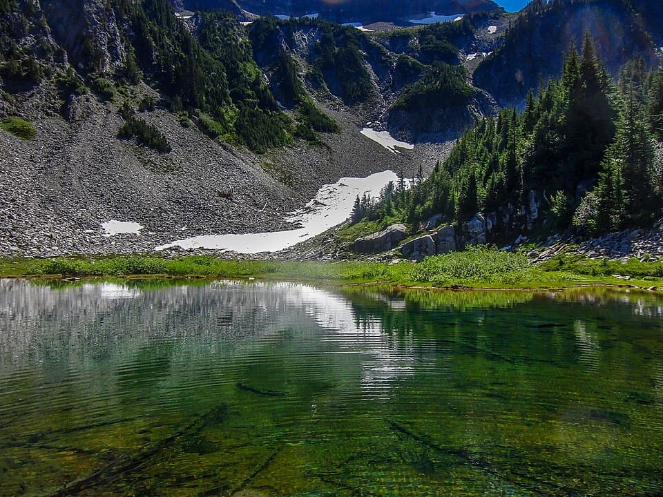
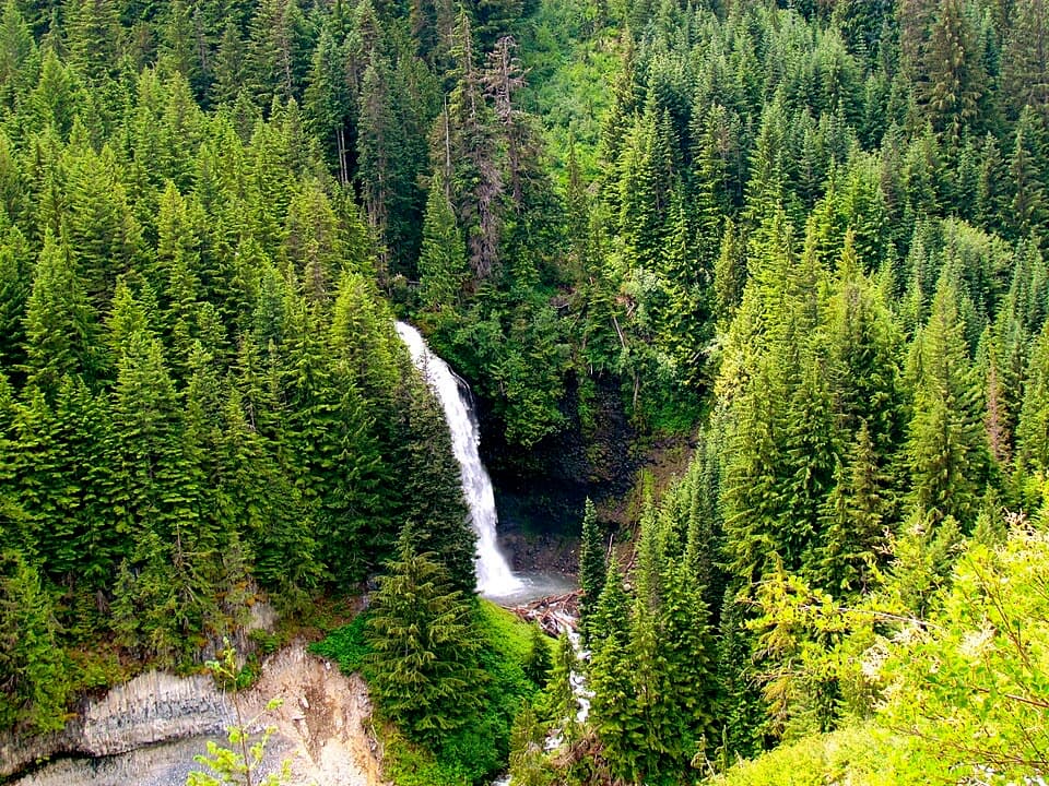
Indian Bar is a broad subalpine meadow divided by the Ohanapecosh River, with small remnants of the Ohanapecosh Glacier at the head of the valley. In early summer, waterfalls spill over the lava cliffs; the flow is most dramatic when snow is melting. On the divide, lupine, paintbrush, bistort, alpine daisies and corn lilies flower around late July and early August, with berries coming later. Stay on the trail through the fragile meadow. Late August nights can bring bull elk bugling in the basin.

The stone Indian Bar shelter was built in 1940 by the Civilian Conservation Corps under NPS architect Edwin A. Nickel. It still gives this high basin a useful place to stop, and Nickel Creek takes its name from the same builder.

Rules and planningPark entry fees apply, pets aren't allowed on park trails, and all natural water needs…

Park entry fees apply, pets aren't allowed on park trails, and all natural water needs treatment. Camping overnight at Indian Bar or Nickel Creek requires a wilderness permit; the shelter is a backcountry facility, not a food stop. Box Canyon has a seasonal comfort station and picnic area, but no potable water. Check current trail and water conditions before setting out, especially early or late in the hiking season.

Wildlife

Wildlife in Mount Rainier

All Mount Rainier wildlife maps

Sighting maps show where each species has been reported across Mount Rainier. Wildlife moves, so no sighting is guaranteed.

Keep exploring

Near Indian Bar Trail

See it all on the map

Trails that start nearby

Places near the trailhead

Parkwolf’s Mount Rainier ranking

Top-rated trails in Mount Rainier

All 99 trails
  1. 1Wonderland TrailChallenging · 93 mi
  2. 2Skyline Trail LoopChallenging · 5.5 mi
  3. 3Mount Fremont Lookout TrailModerate · 5.6 mi
  4. 4Burroughs Mountain TrailModerate · 6.2 mi
  5. 5Summerland TrailModerate · 8.4 mi
  6. 6Naches Peak Loop TrailModerate · 3.5 mi

Take Parkwolf to Mount Rainier.

The audio tour guide for the drive, plus offline maps, trails, and wildlife heatmaps for when the signal drops.

4.7 from 8,600+ ratings

Download Parkwolf on the App StoreGet Parkwolf on Google Play