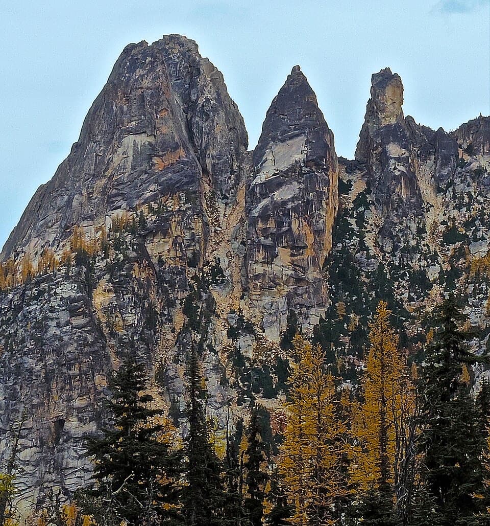
Blue Lake Trail in North Cascades National Park

North Cascades National Park, WA

Blue Lake Trail

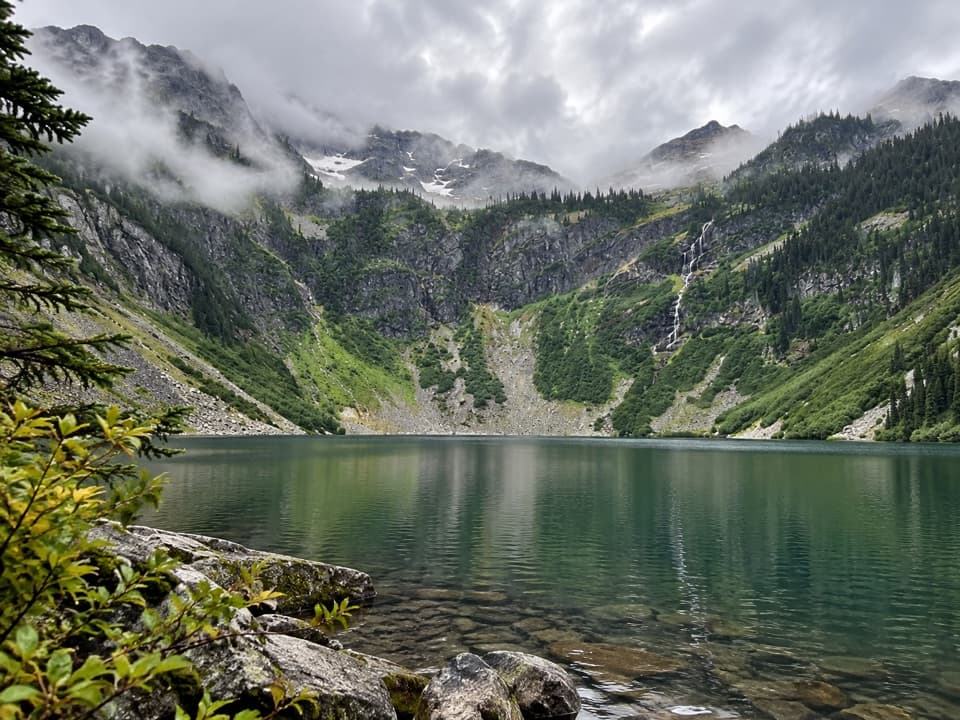
A shaded climb ends at a turquoise lake beneath granite towers.

Photo: Wikimedia Commons
Length
4.4mi
Time
3hr
Elev. change
906ft
Difficulty
Moderate
  • Dogs allowed
  • High point 6,286 ft
  • #11 of 88 in North Cascades

Hear the audio tour

Blue Lake: A Half-Day Mountain Hike

Overview

About Blue Lake Trail

Why go

  • Turquoise lake, granite walls and golden larches reward the climb.
  • Boardwalks, a wildflower meadow and open peak views break up the forest.

Heads up

  • Rocky, rooted footing makes the climb slower than the distance suggests.
  • The small trailhead lot often fills, and there is no potable water.
Blue Lake Trail is a 4.4-mile out-and-back from Blue Lake Trailhead to a turquoise alpine lake beneath granite walls. Expect about 1,050 feet of climbing and roughly three hours for the round trip, with a long stretch of rocky, rooted tread. It is a rewarding half-day hike if you want a mountain-lake destination without spending the whole day on trail. The small parking lot often fills; if it is full, choose another hike instead of improvising along the highway.
Parkwolf’s verdictThe lake makes this climb worth it

Map & elevation

The route

Loading the North Cascades map
Full map
Elevation5,381–6,286 ft
TrailheadBlue Lake Trailhead48.51910, -120.67420
Keep this map with you offline in the Parkwolf app

Plan your hike

Before you go

Parking

Use the paved Blue Lake Trailhead on the south side of Highway 20 near milepost 162. It has about 20 designated spaces, including one accessible space, and often fills. If full, choose another hike; do not block the roadway or emergency access. A vault toilet and picnic tables are available, but there is no potable water.

Safety

Expect rocky, rooted footing through much of the climb. At the lake outlet, the rocks or makeshift log bridge can be unstable or flex. No potable water is available at the trailhead. A day-use fee or accepted recreation pass applies, and winter closure of Highway 20 prevents access.

7 active North Cascades alerts

  • ClosureWildfire closures and Stehekin fire advisoryWildfire-related closures remain in effect; stay out of all closed trails, camps, and areas.Official details
  • CautionCampfires banned across the park complexCampfires and other ash-producing fires are banned throughout the North Cascades National Park Service Complex.Official details
See all 7 alerts
A park ranger sits on a dash-mounted phone, talking, as Parkwolf’s Tour Guide plays “Army Cutworm Moths: A Grizzly Bear Buffet” on Grand Loop Road below Dunraven Pass in Yellowstone
Parkwolf Tour GuideThe highest, rockiest slopes around here are a summer buffet for grizzly bears.

North Cascades Tour Guide

Your drive to Blue Lake Trail, narrated.

Parkwolf is a GPS audio tour guide for North Cascades National Park. As you drive, it chimes in with what’s ahead: hidden gems, upcoming stops, history, geology, and wildlife, right through your car’s speakers.

See the North Cascades audio tour

Recorded for this trailhead

Blue Lake: A Half-Day Mountain Hike
0:00 / 0:23
“You're nearing the Blue Lake trailhead, a good choice for a half-day hike to turquoise water beneath granite walls.”

Plays as you drive up to this trailhead in the Parkwolf North Cascades Tour Guide.

More stories near here in the app

  • Washington Pass Overlook
  • The Cone with Little Pitchforks
  • Bridge Creek and the Pacific Crest Trail
  • Rainy Pass: Lake Walk or Ridge Hike
  • 83 audio storiesacross North Cascades’s roads, triggered by GPS as you drive
  • Wildlife heatmapsfor Mountain Goat, Black Bear, Mule Deer, and 10 more
  • Works offlinemaps, 88 trails, 76 places, and audio download before you lose signal
  • CarPlay readysimple controls built for the drive
★★★★★
“Fantastic app with many points of information… It’s great to just turn on while you’re driving and it gives you an audio tour of the national Park. We love it!!!!”
JMJamesApp Store review
Download Parkwolf on the App StoreGet Parkwolf on Google Play

4.7 from 8,600+ ratings

Trail guide

Hiking Blue Lake Trail

Stay on the lake trailAbout 1.7 miles from the trailhead, a fork leads left toward climbing routes on Liberty Bell.

About 1.7 miles from the trailhead, a fork leads left toward climbing routes on Liberty Bell. Stay on the main Blue Lake Trail to keep this hike focused on the lake. At the destination, the path crosses the outlet on rocks or a makeshift log bridge, then passes an old log cabin to shore boulders. The logs can flex, so take the crossing carefully. The 4.4-mile distance ends at Blue Lake and does not include the separately named Tarn Loop.

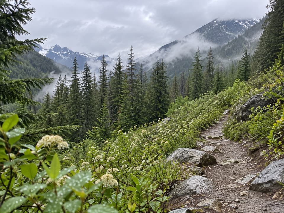
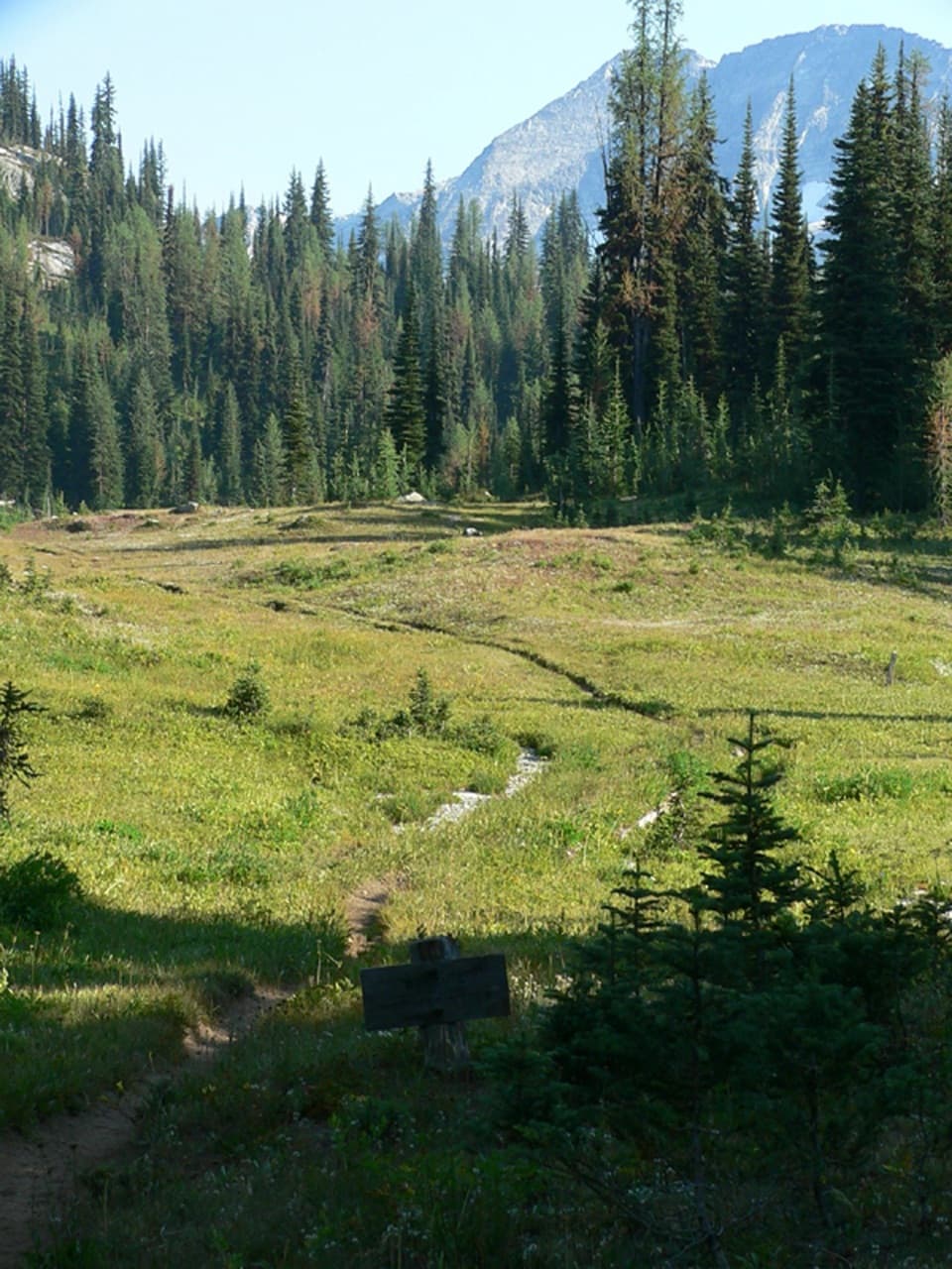
Forest, meadow, then open peaksThe trail starts with a short dip and several boardwalks; the highway is the last thing you see…

The trail starts with a short dip and several boardwalks; the highway is the last thing you see around the first quarter mile. Then comes a steady climb through shady, rocky forest. The tread can be dusty in summer and has enough roots and rocks to watch your footing. A meadow just under halfway brings Cascade azalea and lupine, with Early Winters Spire above it. After a small creek crossing, the route returns to forest before opening to views of Cutthroat Peak and Whistler Mountain in the last half mile.

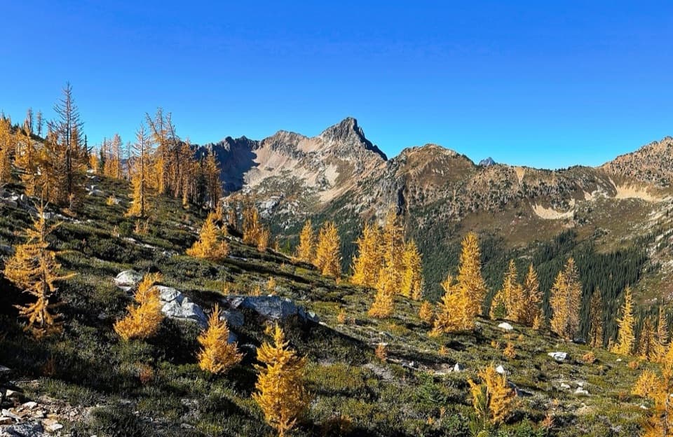
Blue water and fall colorBlue Lake sits at about 6,254 feet, ringed by granite and scattered larches.

Blue Lake sits at about 6,254 feet, ringed by granite and scattered larches. Late September into early October is the classic red-and-gold season. Mountain goats are sometimes seen near the lake, though a sighting is never guaranteed. From the shore, frame the turquoise water with a boulder or larch in the foreground and the rock walls behind it; that gives the view a sense of scale.

Plan the accessThis is a Forest Service-managed hike in the North Cascades Highway corridor.

This is a Forest Service-managed hike in the North Cascades Highway corridor. A day-use fee or accepted recreation pass is required. The paved lot has about 20 spaces, including one accessible space; it often fills. There is a vault toilet and picnic tables, but no potable water. Dogs are allowed on leash. Highway 20 closes seasonally in winter, which cuts off access to the trailhead. Washington Pass Overlook is a separate short paved stop about 0.8 mile east; do not count it as part of this hike.

Wildlife

Wildlife in North Cascades

All North Cascades wildlife maps

Sighting maps show where each species has been reported across North Cascades. Wildlife moves, so no sighting is guaranteed.

Parkwolf’s North Cascades ranking

Top-rated trails in North Cascades

All 88 trails
  1. 1Sahale Arm TrailChallenging · 11.8 mi
  2. 2Cascade Pass TrailModerate · 7.4 mi
  3. 3Heather–Maple Pass LoopChallenging · 7.2 mi
  4. 4Hidden Lake TrailChallenging · 9 mi
  5. 5Copper Ridge / Chilliwack River LoopChallenging · 33.5 mi
  6. 6Thunder Knob TrailModerate · 3.8 mi

Take Parkwolf to North Cascades.

The audio tour guide for the drive, plus offline maps, trails, and wildlife heatmaps for when the signal drops.

4.7 from 8,600+ ratings

Download Parkwolf on the App StoreGet Parkwolf on Google Play