Cutthroat Pass via Pacific Crest Trail in North Cascades National Park

North Cascades National Park, WA

Cutthroat Pass via Pacific Crest Trail

An alpine PCT climb to Cutthroat Pass and lake views.

Photo: Wikimedia Commons
Length
10.1mi
Time
5.5hr
Elev. change
1,949ft
Difficulty
Challenging
  • Dogs allowed
  • High point 6,844 ft
  • #27 of 88 in North Cascades

Hear the audio tour

Rainy Pass: Lake Walk or Ridge Hike

Overview

About Cutthroat Pass via Pacific Crest Trail

Why go

  • Broad pass views with Cutthroat Lake below
  • Golden larches on the open upper slopes in autumn

Heads up

  • A long uphill is followed by the same long descent
  • Porcupine Creek can run high late in the season
Cutthroat Pass via the Pacific Crest Trail is a 10.1-mile out-and-back from Rainy Pass North to an open pass at 6,831 feet, with about 1,984 feet of climbing. It makes a good half-day if you’re happy with a long uphill and the same trail back; allow around five to five and a half hours. The standard route ends at Cutthroat Pass. Continuing north on the PCT toward Granite Pass is an optional extension, not part of this distance.
Parkwolf’s verdictIs this the hike for you?

Map & elevation

The route

Loading the North Cascades map
Full map
Elevation4,895–6,844 ft
TrailheadRainy Pass North Trailhead48.51810, -120.73310
Keep this map with you offline in the Parkwolf app

Plan your hike

Before you go

Parking

Use Rainy Pass North Trailhead, reached by a short gravel road on the north side of SR 20. The PCT crosses the large lot; a day-use fee or accepted recreation pass is required, and a restroom is available. The lot can fill. The picnic area across the highway is a separate Maple Pass access.

Safety

Several creek crossings lead to Porcupine Creek, which can run high late in the season. The route crosses avalanche paths; snow-season travel requires current avalanche and access information.

7 active North Cascades alerts

  • ClosureWildfire closures and Stehekin fire advisoryWildfire-related closures remain in effect; stay out of all closed trails, camps, and areas.Official details
  • CautionCampfires banned across the park complexCampfires and other ash-producing fires are banned throughout the North Cascades National Park Service Complex.Official details
See all 7 alerts
A park ranger sits on a dash-mounted phone, talking, as Parkwolf’s Tour Guide plays “Army Cutworm Moths: A Grizzly Bear Buffet” on Grand Loop Road below Dunraven Pass in Yellowstone
Parkwolf Tour GuideThe highest, rockiest slopes around here are a summer buffet for grizzly bears.

North Cascades Tour Guide

Your drive to Cutthroat Pass via Pacific Crest Trail, narrated.

Parkwolf is a GPS audio tour guide for North Cascades National Park. As you drive, it chimes in with what’s ahead: hidden gems, upcoming stops, history, geology, and wildlife, right through your car’s speakers.

See the North Cascades audio tour

Recorded for this trailhead

Rainy Pass: Lake Walk or Ridge Hike
0:00 / 0:31
“Up ahead is Rainy Pass, where you can choose a short lake walk or a much bigger ridge hike. For about an hour out of the car, I'd choose Rainy Lake: two miles round trip on pavement, ending below cliffs and waterfalls.”

Plays as you drive up to this trailhead in the Parkwolf North Cascades Tour Guide.

More stories near here in the app

  • Bridge Creek and the Pacific Crest Trail
  • A Mountain Goat’s Grip
  • The Cone with Little Pitchforks
  • Blue Lake: A Half-Day Mountain Hike
  • 83 audio storiesacross North Cascades’s roads, triggered by GPS as you drive
  • Wildlife heatmapsfor Mountain Goat, Black Bear, Mule Deer, and 10 more
  • Works offlinemaps, 88 trails, 76 places, and audio download before you lose signal
  • CarPlay readysimple controls built for the drive
★★★★★
“Fantastic app with many points of information… It’s great to just turn on while you’re driving and it gives you an audio tour of the national Park. We love it!!!!”
JMJamesApp Store review
Download Parkwolf on the App StoreGet Parkwolf on Google Play

4.7 from 8,600+ ratings

Trail guide

Hiking Cutthroat Pass via Pacific Crest Trail

The climb from Rainy PassHead north from the parking lot into the Porcupine Creek drainage.

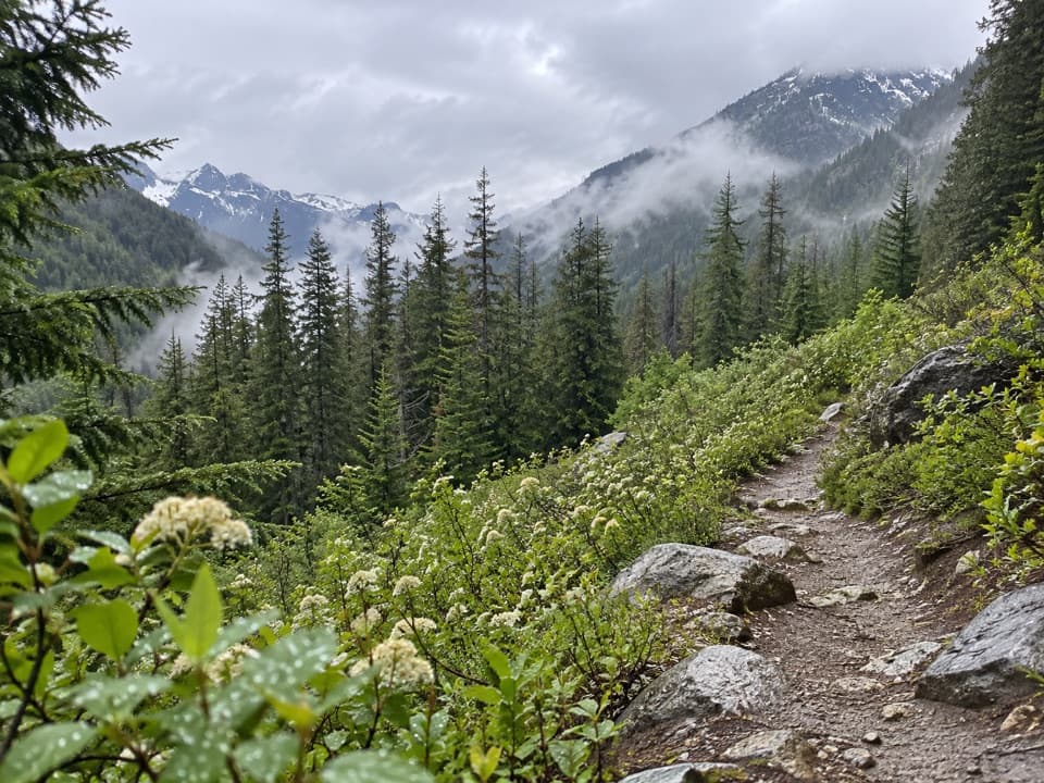
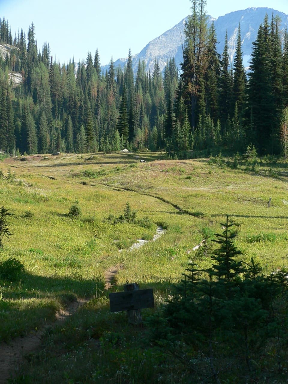
Head north from the parking lot into the Porcupine Creek drainage. The PCT climbs through dark forest and crosses several small creeks; Porcupine Creek is the largest, roughly 1.5 to 1.8 miles in. It can run high late in the season. Beyond the crossing, the route traverses the valley and climbs through open avalanche paths. As the forest thins, views open toward Black and Fisher peaks across Highway 20; cascades appear along the final switchbacks.

Cutthroat PassThe upper trail alternates traverses and switchbacks before reaching a broad, rocky saddle.

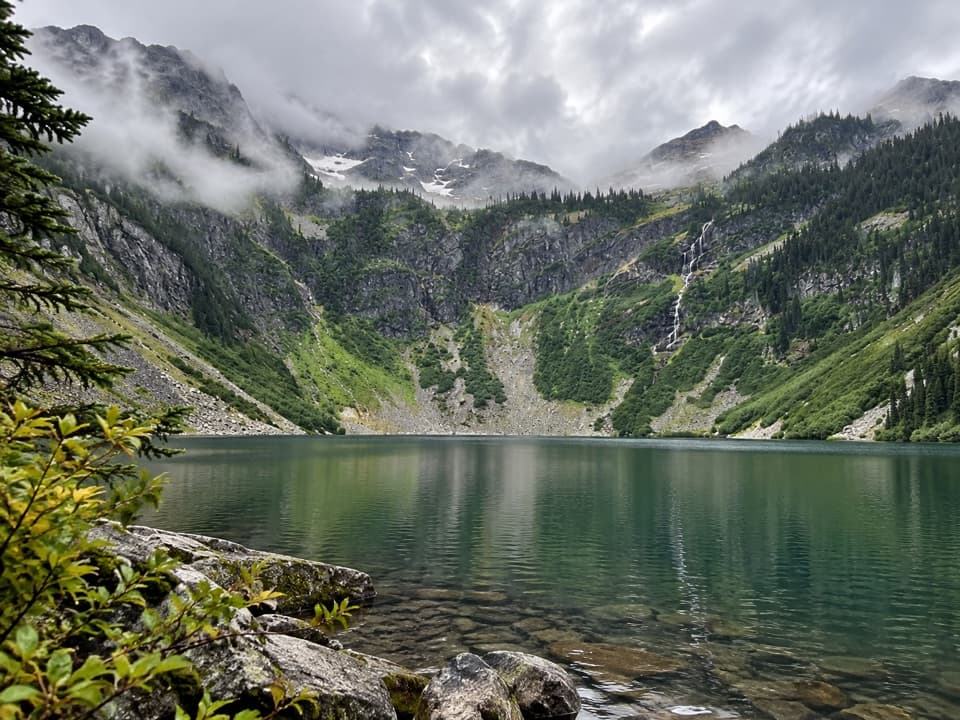
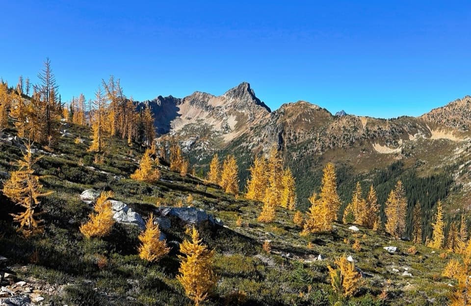
The upper trail alternates traverses and switchbacks before reaching a broad, rocky saddle. Granite slabs make good places to stop, with Cutthroat Lake below and Vasiliki Ridge and Silver Star Mountain to the east. At 6,831 feet, the pass is one of the highest points on Washington’s PCT. Huckleberry, heather, alpine meadow and golden larches fill the open slopes; autumn color shifts with elevation and year. For a photo, include the lake and a bit of the rocky, larch-covered slope so the view reads as a pass rather than a generic mountain panorama.

Access and conditionsThe PCT crosses the large dirt-and-gravel lot at Rainy Pass North, on the north side of Highway…

The PCT crosses the large dirt-and-gravel lot at Rainy Pass North, on the north side of Highway 20. The lot is paid, with recreation passes accepted, and has a restroom. The picnic area across the highway is a separate access for Maple Pass. Dogs are allowed on leash. Highway 20 closes seasonally in winter, and this route crosses avalanche paths; snow-season travel needs current access and avalanche information.

Wildlife

Wildlife in North Cascades

All North Cascades wildlife maps

Sighting maps show where each species has been reported across North Cascades. Wildlife moves, so no sighting is guaranteed.

Parkwolf’s North Cascades ranking

Top-rated trails in North Cascades

All 88 trails
  1. 1Sahale Arm TrailChallenging · 11.8 mi
  2. 2Cascade Pass TrailModerate · 7.4 mi
  3. 3Heather–Maple Pass LoopChallenging · 7.2 mi
  4. 4Hidden Lake TrailChallenging · 9 mi
  5. 5Copper Ridge / Chilliwack River LoopChallenging · 33.5 mi
  6. 6Thunder Knob TrailModerate · 3.8 mi

Take Parkwolf to North Cascades.

The audio tour guide for the drive, plus offline maps, trails, and wildlife heatmaps for when the signal drops.

4.7 from 8,600+ ratings

Download Parkwolf on the App StoreGet Parkwolf on Google Play