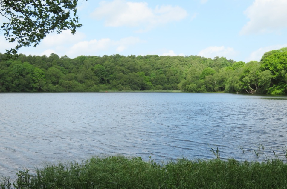
Gormire Lake in North York Moors National Park

Sight · North York Moors National Park

Gormire Lake

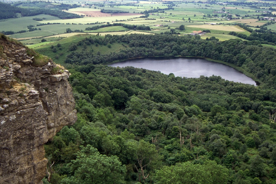
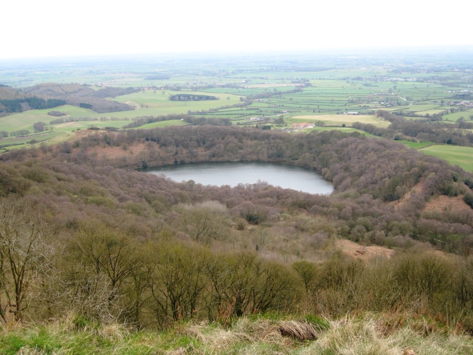
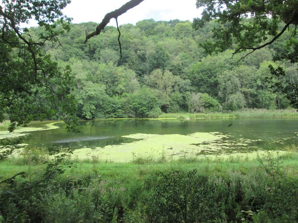
Glacial lake below Whitestone Cliff, reached by a steep woodland descent

Photo: Wikimedia Commons
Type
Sight
Nearest trail
1.3 km
Audio stories
5 nearby
  • #24 of 55 sights

Hear the audio tour

Sutton Bank

Overview

About Gormire Lake

Why stop

  • Unusual natural lake beneath Whitestone Cliff
  • Woodland and wetland wildlife

Heads up

  • Steep, muddy approach after rain
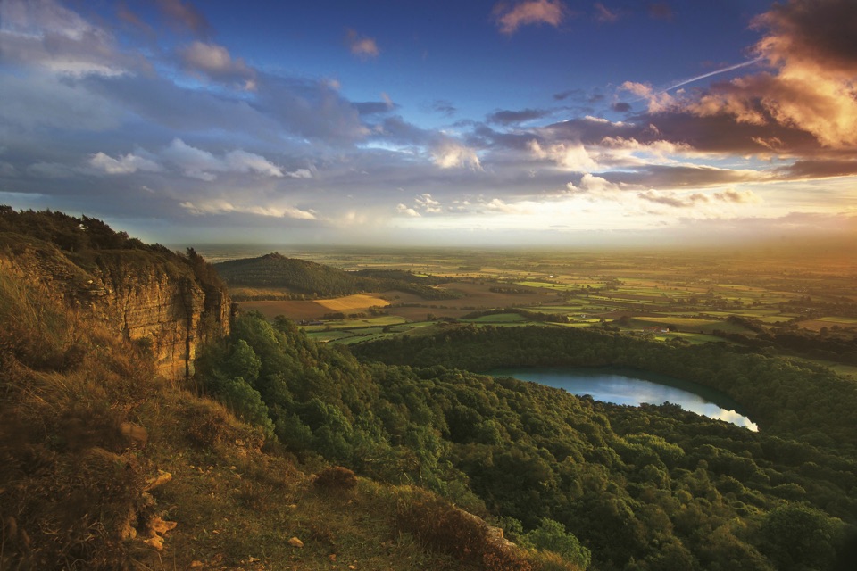
A still, tree-ringed lake sitting in a hollow beneath the Sutton Bank escarpment, with the sheer face of Whitestone Cliff rising above the far shore. It is one of the very few natural lakes in the area, and the setting is unusual: no major stream flows in or out, and the water is thought to have collected after glacial deposits blocked the old drainage below the bank. The appeal is quiet water, birdsong and reflected woodland rather than facilities or viewpoints.
Parkwolf’s verdictWhy stop here

Map

Where it is

Loading the North York Moors map
Full map
SightGormire Lake54.24229, -1.22921
Keep this map with you offline in the Parkwolf app

Plan your stop

Before you go

Best time to go

Spring to late summer is the richest stretch, with woodland flowers earlier on and wet-edge plants later. Early morning brings the calmest water and the best light on the cliff. Autumn colour in the birches is worth the trip, though the paths are at their muddiest after rain and through winter.


Getting there

You cannot drive to the shore. Start at Sutton Bank National Park Centre, where there is car parking, follow the clifftop path north, then take the signed footpath dropping steeply through Garbutt Wood to the water. Allow a good chunk of time for the return climb, which is the hard part. You can walk down, loop the lake and come back the same way, or link the descent into a longer circular route through the surrounding countryside.

8 active North York Moors alerts

  • ClosureHawnby Bridleway 110 closurePublic Bridleway 25.122/110/1 in Hawnby is closed to pedestrians, cyclists and equestrians because its bridge is unsafe. - The closure is between grid references SE 5309 9073 and SE 5335 9097.Official details
  • ClosureWest Ayton Footpath 1 closurePublic Footpath 1 in West Ayton (Forge Valley) is temporarily closed because its boardwalk is unsafe. - The closure is between SE 9860 8494 and SE 9839 8712.Official details
See all 8 alerts
A park ranger sits on a dash-mounted phone, talking, as Parkwolf’s Tour Guide plays “Army Cutworm Moths: A Grizzly Bear Buffet” on Grand Loop Road below Dunraven Pass in Yellowstone
Parkwolf Tour GuideThe highest, rockiest slopes around here are a summer buffet for grizzly bears.

North York Moors Tour Guide

Your drive to Gormire Lake, narrated.

Parkwolf is a GPS audio tour guide for North York Moors National Park. As you drive, it chimes in with what’s ahead: hidden gems, upcoming stops, history, geology, and wildlife, right through your car’s speakers.

Recorded for this place

Sutton Bank
0:00 / 0:36
“Sutton Bank is coming up, where the moorland plateau ends abruptly above the Vale of York.”

Plays as you drive up to Gormire Lake in the Parkwolf North York Moors Tour Guide.

More stories near here in the app

  • The Fort Beneath the Gliders
  • A Thousand Pellets Under the Eaves
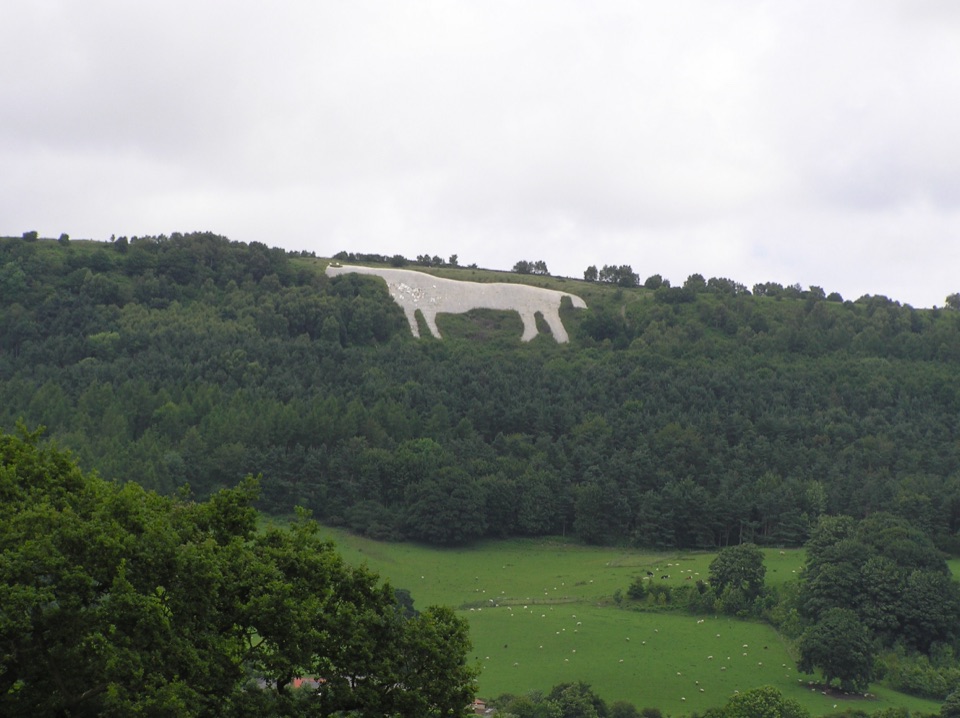
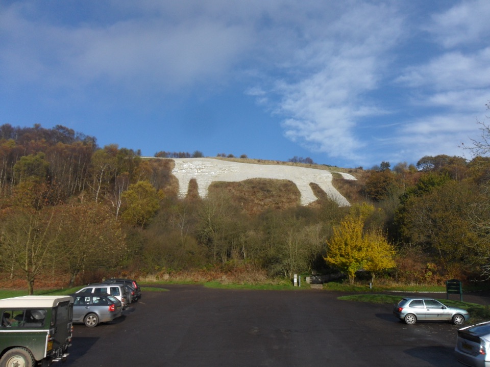
  • Kilburn White Horse
  • Why the White Horse Needs Whitening
  • 298 audio storiesacross North York Moors’s roads, triggered by GPS as you drive
  • Wildlife heatmapsfor Eurasian Otter, Red Deer, Grey Seal, and 13 more
  • Works offlinemaps, 126 trails, 65 places, and audio download before you lose signal
  • CarPlay readysimple controls built for the drive
★★★★★
“Fantastic app with many points of information… It’s great to just turn on while you’re driving and it gives you an audio tour of the national Park. We love it!!!!”
JMJamesApp Store review
Download Parkwolf on the App StoreGet Parkwolf on Google Play

4.7 from 8,600+ ratings

Guide

More about Gormire Lake

What you see and doA path threads around the lake shore, giving changing views of open water, reedy margins and…
  • A path threads around the lake shore, giving changing views of open water, reedy margins and the cliff face.
  • The descent passes through Garbutt Wood, a birch, oak and holly woodland spilling down the scree, with mosses, ferns and lichens on the rocks.
  • Damp ground supports flowering plants in season, and the woods hold breeding birds through spring and early summer. Sightings are never guaranteed, so treat them as a bonus.
  • Fungi appear in the leaf litter later in the year.
What to bringSturdy boots with grip.
  • Sturdy boots with grip. The path is steep, uneven and slippery when wet, with flights of steps and boardwalk sections.
  • Water and food. There is nothing at the lake itself, so use the cafe, shop, toilets, picnic area and water refill point at the National Park Centre before setting off. There are cycle facilities there too.
  • A lead for your dog through the woodland.
Honest drawbacksPay attention at path junctions on the descent.

Pay attention at path junctions on the descent. The route is not suitable for wheelchairs or buggies; the only easy going is the level clifftop path out from the National Park Centre to the escarpment edge. The lake has a wild swimming reputation, but visitors report no-swimming signage and leeches in the water, so treat it as a place to look at rather than get into.

Wildlife

Wildlife in North York Moors

All North York Moors wildlife maps

Sighting maps show where each species has been reported across North York Moors. Wildlife moves, so no sighting is guaranteed.

Keep exploring

Near Gormire Lake

See it all on the map

Trails nearby

More stops nearby

Parkwolf’s North York Moors ranking

Top sights in North York Moors

All 65 places
  1. 1North Yorkshire Moors RailwaySight
  2. 2Roseberry ToppingSight
  3. 3Rievaulx AbbeySight
  4. 4Robin Hood's Bay and BeachSight
  5. 5Hole of HorcumSight
  6. 6Goathland StationSight

Take Parkwolf to North York Moors.

The audio tour guide for the drive, plus offline maps, trails, and wildlife heatmaps for when the signal drops.

4.7 from 8,600+ ratings

Download Parkwolf on the App StoreGet Parkwolf on Google Play