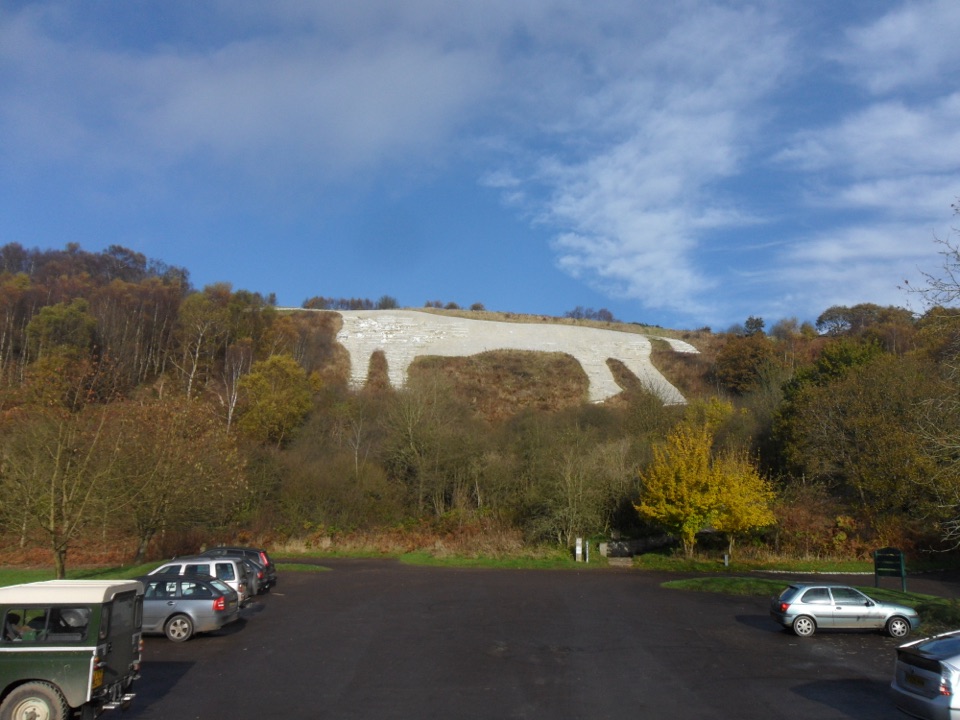
White Horse of Kilburn in North York Moors National Park

#8 of 55 sights in North York Moors

Sight · North York Moors National Park

White Horse of Kilburn

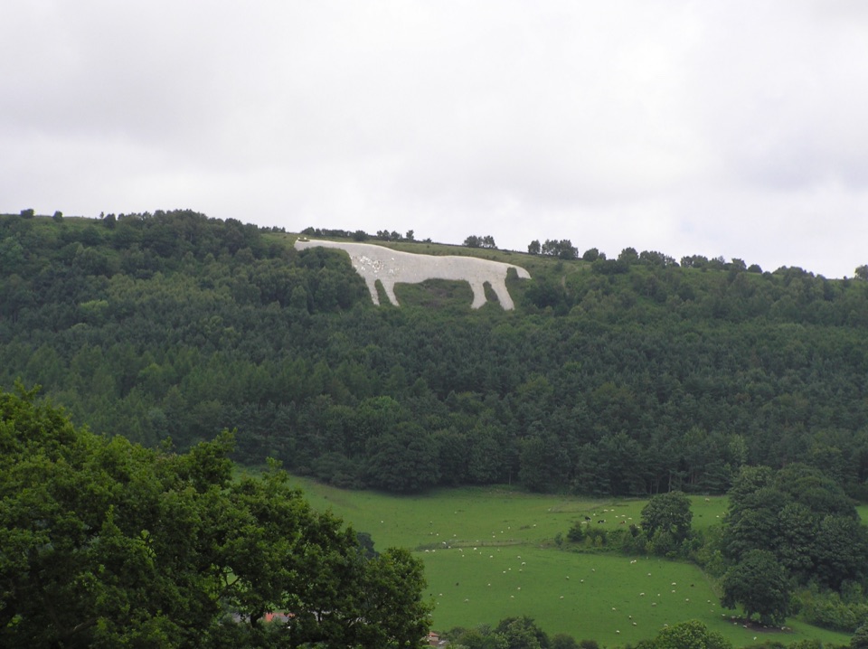
Britain's most northerly turf-cut hill figure, visible for over 20 miles

Photo: Wikimedia Commons
Type
Sight
Nearest trail
1.8 km
Audio stories
4 nearby
  • Parking
  • Scenic viewpoint

Hear the audio tour

Kilburn White Horse

Overview

About White Horse of Kilburn

Why stop

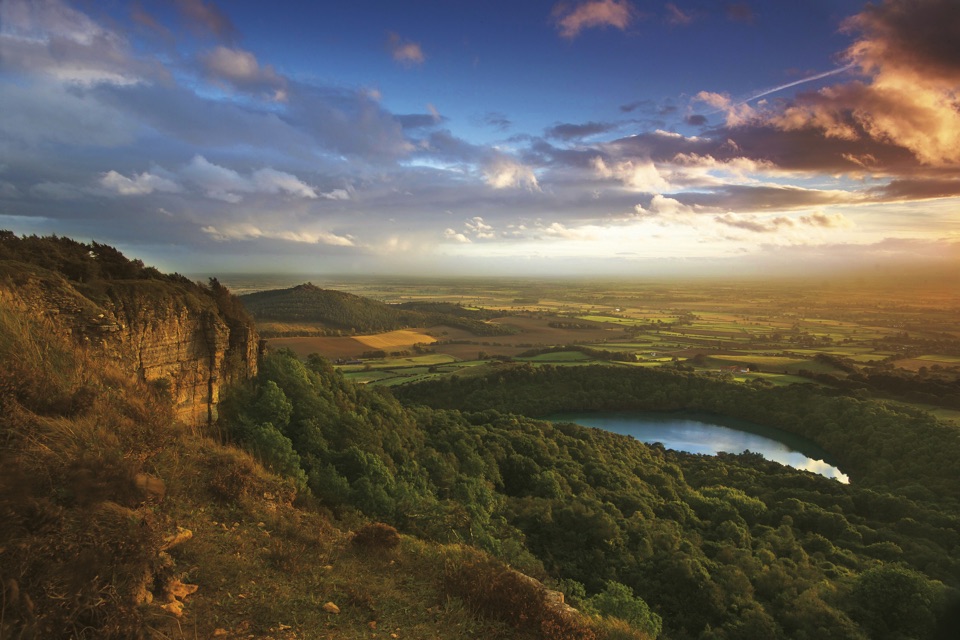
  • Wide escarpment and Vale views from the circular walk
  • A distinctive Victorian landmark with real local history

Heads up

  • The horse is difficult to read from close range
  • Steep steps make the direct approach physically demanding
This is the historic hill figure itself, cut high on the escarpment below the top of Sutton Bank. It dates from 1857, when a local businessman, Thomas Taylor, set the idea going and the village schoolmaster, John Hodgson, marked out the outline with his pupils before it was cut into the limestone bedrock beneath. It was made as a folly inspired by ancient hill figures, and it is now reputedly the largest and most northerly turf-cut figure in Britain, covering a little over an acre at roughly 314 ft long by 228 ft high and visible from more than 20 miles away.
Parkwolf’s verdictWhy stop here

Map

Where it is

Loading the North York Moors map
Full map
SightWhite Horse of Kilburn54.22481, -1.21282
Keep this map with you offline in the Parkwolf app

Plan your stop

Before you go

Best time to visit

Go on a clear day, since haze or low cloud removes both the long view and much of the point of a landmark designed to be seen from miles away. Weekday mornings tend to feel quieter and calmer than sunny weekends and holidays, when the car park and clifftop path attract more walkers. Any season works, though the exposed clifftop is windy and the stepped sections are easier in dry conditions.


8 active North York Moors alerts

  • ClosureHawnby Bridleway 110 closurePublic Bridleway 25.122/110/1 in Hawnby is closed to pedestrians, cyclists and equestrians because its bridge is unsafe. - The closure is between grid references SE 5309 9073 and SE 5335 9097.Official details
  • ClosureWest Ayton Footpath 1 closurePublic Footpath 1 in West Ayton (Forge Valley) is temporarily closed because its boardwalk is unsafe. - The closure is between SE 9860 8494 and SE 9839 8712.Official details
See all 8 alerts
A park ranger sits on a dash-mounted phone, talking, as Parkwolf’s Tour Guide plays “Army Cutworm Moths: A Grizzly Bear Buffet” on Grand Loop Road below Dunraven Pass in Yellowstone
Parkwolf Tour GuideThe highest, rockiest slopes around here are a summer buffet for grizzly bears.

North York Moors Tour Guide

Your drive to White Horse of Kilburn, narrated.

Parkwolf is a GPS audio tour guide for North York Moors National Park. As you drive, it chimes in with what’s ahead: hidden gems, upcoming stops, history, geology, and wildlife, right through your car’s speakers.

Recorded for this place

Kilburn White Horse
0:00 / 0:32
“You're nearing the Kilburn White Horse, a Victorian creation rather than an ancient hill figure.”

Plays as you drive up to White Horse of Kilburn in the Parkwolf North York Moors Tour Guide.

More stories near here in the app

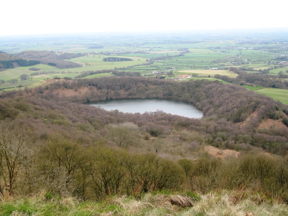
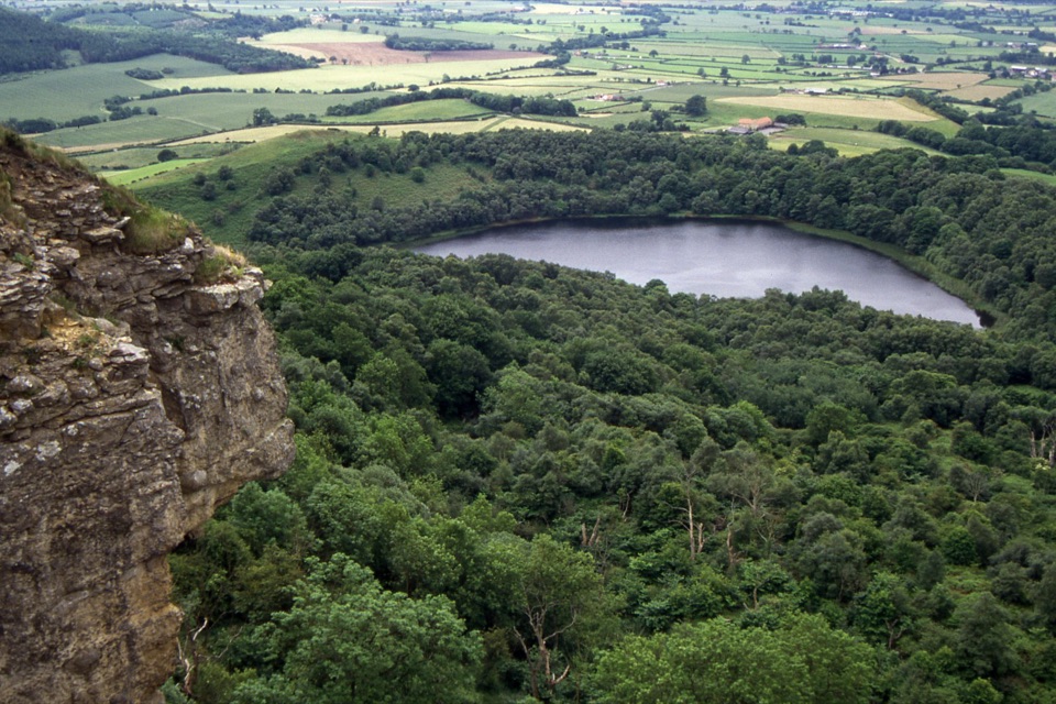
  • Why Gormire Lake Sits Below the Cliff
  • Sutton Bank
  • The Fort Beneath the Gliders
  • The Battle on Sutton Bank
  • 298 audio storiesacross North York Moors’s roads, triggered by GPS as you drive
  • Wildlife heatmapsfor Eurasian Otter, Red Deer, Grey Seal, and 13 more
  • Works offlinemaps, 126 trails, 65 places, and audio download before you lose signal
  • CarPlay readysimple controls built for the drive
★★★★★
“Fantastic app with many points of information… It’s great to just turn on while you’re driving and it gives you an audio tour of the national Park. We love it!!!!”
JMJamesApp Store review
Download Parkwolf on the App StoreGet Parkwolf on Google Play

4.7 from 8,600+ ratings

Guide

More about White Horse of Kilburn

What you actually seeThe horse is whitewashed and topped up with chalk chippings at intervals, which is what keeps…
  • The horse is whitewashed and topped up with chalk chippings at intervals, which is what keeps it readable from a distance.
  • From directly beneath, the angle foreshortens the shape and vegetation can break up the outline, so the figure often looks less impressive up close than it does from far off.
  • Steps down the side of the escarpment bring you nearer the figure and give a better sense of its scale than standing on the path along the cliff edge.
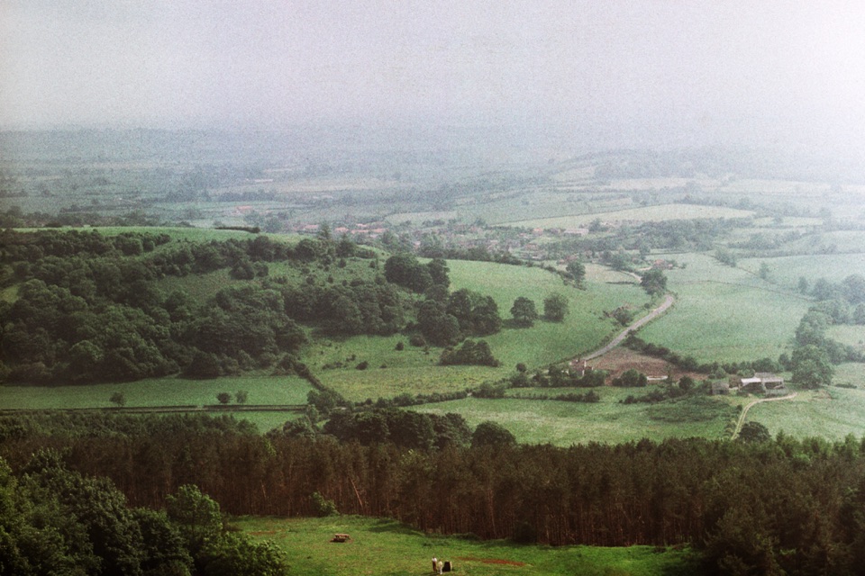
  • The compensation is the view south and west across the Vale of Mowbray, which is the real reward on a clear day.
The circular walkFrom the car park below the horse there is a 2.5 km / 1.5 mile circular route.

From the car park below the horse there is a 2.5 km / 1.5 mile circular route. It climbs steps past the figure, joins the Cleveland Way along the top of Sutton Bank for panoramic views, then drops back down through woodland to the parking area. Expect varied gradients and some steeper sections, and note that the stepped climb makes this route unsuitable for wheelchairs or anyone with limited mobility. Many people find the walk and the clifftop views more rewarding than the moment spent immediately below the horse, and that is a fair way to plan your time.

Photographing and reading the figureIf you want a photograph of the whole horse, take it from farther south, from the lanes and…

If you want a photograph of the whole horse, take it from farther south, from the lanes and open ground around Kilburn village and the approach roads, where the full outline reads properly. Close up, aim for detail, the scale of the cut surface, and the drop of the escarpment instead.

Practical accessReached from Low Town Bank Road, Kilburn, near Thirsk (YO61 4AN), either through Kilburn…
  • Reached from Low Town Bank Road, Kilburn, near Thirsk (YO61 4AN), either through Kilburn village or from the A170 via the Yorkshire Gliding Club turn.
  • There is a surface car park just below the figure, and the site is open air with no staffed facilities at the horse itself.
  • For toilets, food and staffed information, head to the separate Sutton Bank National Park Centre, roughly 1.7 km north along the escarpment.
  • Gliders operate from Roulston Scar above, which many visitors enjoy watching, though the club is a separate operation and not part of the landmark.
Honest drawbacksSome visitors come expecting a dramatic close-up monument and leave a little flat.

Some visitors come expecting a dramatic close-up monument and leave a little flat. Treat it as a historic landscape landmark: a Victorian community project maintained for over a century and a half, best appreciated as part of the walk, the escarpment and the wide Yorkshire view rather than as a single photogenic object at your feet.

Wildlife

Wildlife in North York Moors

All North York Moors wildlife maps

Sighting maps show where each species has been reported across North York Moors. Wildlife moves, so no sighting is guaranteed.

Keep exploring

Near White Horse of Kilburn

See it all on the map

Trails nearby

More stops nearby

Parkwolf’s North York Moors ranking

Top sights in North York Moors

All 65 places
  1. 1North Yorkshire Moors RailwaySight
  2. 2Roseberry ToppingSight
  3. 3Rievaulx AbbeySight
  4. 4Robin Hood's Bay and BeachSight
  5. 5Hole of HorcumSight
  6. 6Goathland StationSight

Take Parkwolf to North York Moors.

The audio tour guide for the drive, plus offline maps, trails, and wildlife heatmaps for when the signal drops.

4.7 from 8,600+ ratings

Download Parkwolf on the App StoreGet Parkwolf on Google Play