Wheeldale Roman Road in North York Moors National Park

Sight · North York Moors National Park

Wheeldale Roman Road

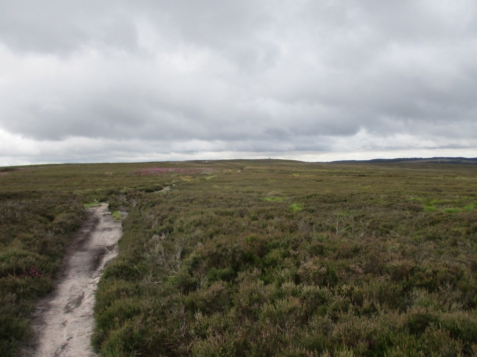
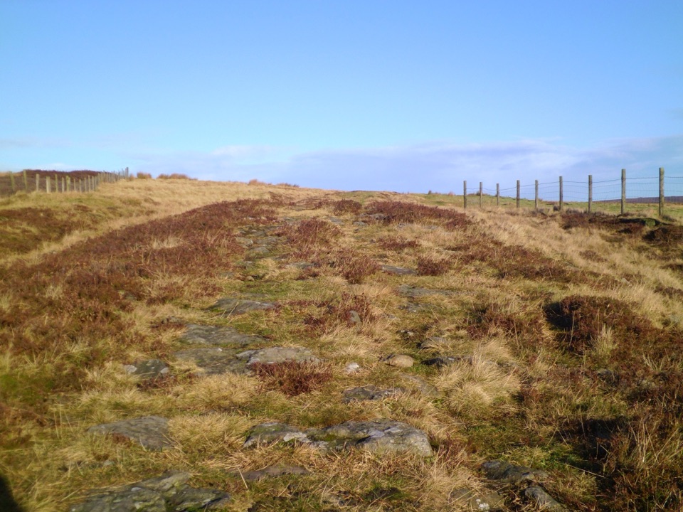
Ancient stone causeway over heather moor, its builders still debated

Photo: Wikimedia Commons
Type
Sight
Nearest trail
1.1 km
Audio stories
4 nearby
  • Exhibit
  • Parking

Hear the audio tour

Wheeldale Roman Road

Overview

About Wheeldale Roman Road

Why stop

  • Readable stonework, camber and drainage ditches
  • Heather moorland setting with a quiet feel

Heads up

  • Uneven, slippery stones and a stile
  • Modest remains may underwhelm without an interest in archaeology
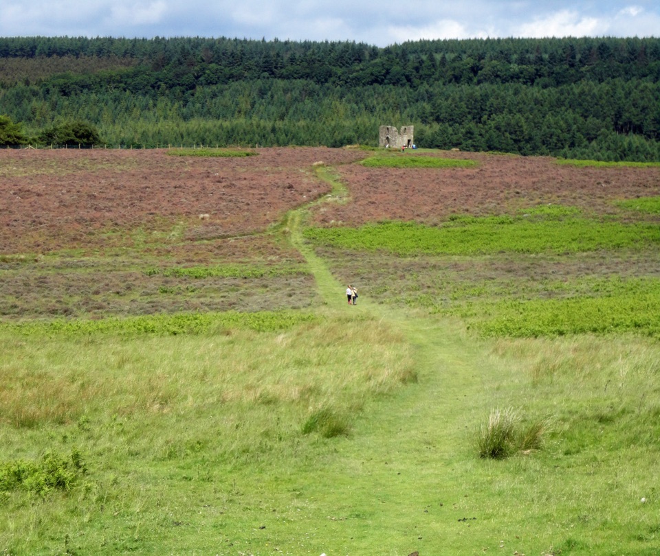
A band of stone paving runs out across open moorland, with the hard core and drainage ditches still readable on the ground. It is a short, strange, memorable stop between Goathland and the higher moor, and it rewards anyone who likes standing on something old and unresolved rather than something explained.
Parkwolf’s verdictWhy stop here

Map

Where it is

Loading the North York Moors map
Full map
SightWheeldale Roman Road54.36910, -0.76067
Keep this map with you offline in the Parkwolf app

Plan your stop

Before you go

Best time to go

Visit in daylight, since this is unlit open moor with no formal paths beyond the worn track. Reviews commonly describe little or no waiting and a quiet feel, and weekday or early visits tend to suit people who want the place to themselves. August is the strongest month for heather colour across the surrounding moor. After rain and through winter the ground is wet, slippery and harder to navigate, and low cloud can flatten the views that make the setting worthwhile.


Arrival and parking

Access is from the minor moorland road near Wheeldale Beck. Roadside parking is limited and tight, on verges only, so leave any vehicle with care and keep the lane clear for farm and passing traffic. There is no dedicated car park at the monument itself.

8 active North York Moors alerts

  • ClosureHawnby Bridleway 110 closurePublic Bridleway 25.122/110/1 in Hawnby is closed to pedestrians, cyclists and equestrians because its bridge is unsafe. - The closure is between grid references SE 5309 9073 and SE 5335 9097.Official details
  • ClosureWest Ayton Footpath 1 closurePublic Footpath 1 in West Ayton (Forge Valley) is temporarily closed because its boardwalk is unsafe. - The closure is between SE 9860 8494 and SE 9839 8712.Official details
See all 8 alerts
A park ranger sits on a dash-mounted phone, talking, as Parkwolf’s Tour Guide plays “Army Cutworm Moths: A Grizzly Bear Buffet” on Grand Loop Road below Dunraven Pass in Yellowstone
Parkwolf Tour GuideThe highest, rockiest slopes around here are a summer buffet for grizzly bears.

North York Moors Tour Guide

Your drive to Wheeldale Roman Road, narrated.

Parkwolf is a GPS audio tour guide for North York Moors National Park. As you drive, it chimes in with what’s ahead: hidden gems, upcoming stops, history, geology, and wildlife, right through your car’s speakers.

Recorded for this place

Wheeldale Roman Road
0:00 / 0:34
“You're approaching the walking access to Wheeldale Roman Road, a long band of stonework crossing the heather.”

Plays as you drive up to Wheeldale Roman Road in the Parkwolf North York Moors Tour Guide.

More stories near here in the app

  • A Drum Made with Tail Feathers
  • White Tufts, Old Uses
  • When a Beck Turns Orange
  • The Hole Geologists Still Debate
  • 298 audio storiesacross North York Moors’s roads, triggered by GPS as you drive
  • Wildlife heatmapsfor Eurasian Otter, Red Deer, Grey Seal, and 13 more
  • Works offlinemaps, 126 trails, 65 places, and audio download before you lose signal
  • CarPlay readysimple controls built for the drive
★★★★★
“Fantastic app with many points of information… It’s great to just turn on while you’re driving and it gives you an audio tour of the national Park. We love it!!!!”
JMJamesApp Store review
Download Parkwolf on the App StoreGet Parkwolf on Google Play

4.7 from 8,600+ ratings

Guide

More about Wheeldale Roman Road

What you seeJust over a mile of surviving foundations lies exposed, with the outline, camber and side…

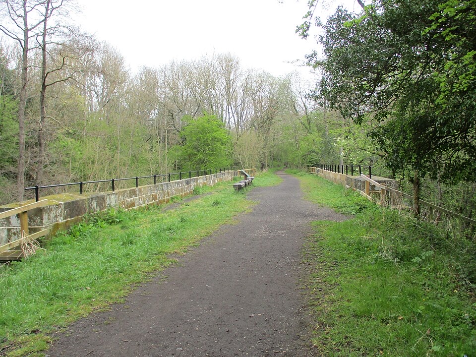
Just over a mile of surviving foundations lies exposed, with the outline, camber and side ditches visible in stretches and a worn path running alongside. The line follows the ground with slight changes of direction rather than running dead level. Around it there is heather, bracken and rough grazing, so the setting is as much of the visit as the stones.

An identity still argued overIt was first recorded as Wade's Causeway, a Roman Way, on a 1720 map, and antiquarian writers…

It was first recorded as Wade's Causeway, a Roman Way, on a 1720 map, and antiquarian writers traced routes of some 33 to 35 miles from near Malton toward the coast north of Whitby. Newer thinking suggests it may be medieval, or a reworked Neolithic or early Bronze Age boundary, and possibly not a road at all. Links to Cawthorn Camps, Malton, Lease Rigg and coastal signal stations remain theories rather than settled fact. The Wade name comes from a local giant of folklore. The site has been in state guardianship since 1912, and the visible section was uncovered between 1912 and 1920 after clearance work in the 1890s.

Access, ground and mobilityFree entry, open at reasonable times during daylight.
  • Free entry, open at reasonable times during daylight.
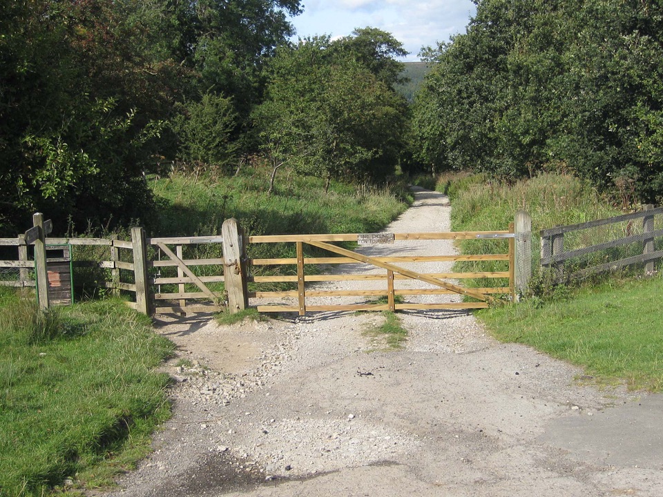
  • Reaching the stones involves a stile and uneven flagstones, and visitors consistently describe the surface as rough underfoot.
  • That combination makes access difficult for anyone who needs level or firm ground, and sturdy footwear helps everyone else.
  • Farm livestock, including sheep, are likely, so keep dogs under close control and close gates behind you.
  • Smoking, vaping, barbecues and naked flames are prohibited on the site.
The monument and the longer walksThe protected stretch itself is a short there-and-back look at the stones.

The protected stretch itself is a short there-and-back look at the stones. Longer circular routes in the area take in Wheeldale Gill, bracken and heather slopes and stepping stones, with further stiles along the way, and their distances belong to those walks rather than to the monument. Treat them as a separate decision, made with a map and a weather forecast.

Honest tradeoffsNo on-site toilets, cafe or other facilities are verified here.

No on-site toilets, cafe or other facilities are verified here. There is little interpretation on the ground, the parking is awkward, and someone expecting a dramatic Roman highway may find the reality modest. What you get instead is an unusually atmospheric piece of exposed archaeology whose age and purpose are genuinely open questions, in a landscape that carries the visit.

Wildlife

Wildlife in North York Moors

All North York Moors wildlife maps

Sighting maps show where each species has been reported across North York Moors. Wildlife moves, so no sighting is guaranteed.

Keep exploring

Near Wheeldale Roman Road

See it all on the map

Trails nearby

More stops nearby

Parkwolf’s North York Moors ranking

Top sights in North York Moors

All 65 places
  1. 1North Yorkshire Moors RailwaySight
  2. 2Roseberry ToppingSight
  3. 3Rievaulx AbbeySight
  4. 4Robin Hood's Bay and BeachSight
  5. 5Hole of HorcumSight
  6. 6Goathland StationSight

Take Parkwolf to North York Moors.

The audio tour guide for the drive, plus offline maps, trails, and wildlife heatmaps for when the signal drops.

4.7 from 8,600+ ratings

Download Parkwolf on the App StoreGet Parkwolf on Google Play