Morse Creek Overlook in Olympic National Park

Sight · Olympic National Park

Morse Creek Overlook

A quick roadside geology stop with an ice-age lake and pillow basalt.

Type
Sight
Nearest trail
2 mi
Audio stories
4 nearby
  • Scenic viewpoint
  • Exhibit
  • Parking

Hear the audio tour

Morse Creek Overlook: The Vanished Lake

Overview

About Morse Creek Overlook

Why stop

  • One short stop pairs an ice-age lake story with a real basalt exposure.

Heads up

  • The overlook and basalt exposure are on opposite sides of the road.

Map

Where it is

Loading the Olympic map
Full map
SightMorse Creek Overlook47.99220, -123.40162
Keep this map with you offline in the Parkwolf app

Plan your stop

Before you go

Getting there

The overlook is on paved Hurricane Ridge Road. The road is weather dependent and has a limited winter schedule; winter visitors must carry tire chains. Check current road conditions before you set out, since access can change with weather.

6 active Olympic alerts

  • InfoNo potable water at Hurricane RidgeMentions Hurricane Ridge, referenced in this guideNo potable water is available at Hurricane Ridge; bring your own drinking water.Official details
  • CautionUS 101 Hoh River Bridge reduced to one laneUS 101 at the Hoh River Bridge is restricted to one lane of alternating traffic; obey the signals and 25 mph speed limit.Official details
See all 6 alerts
A park ranger sits on a dash-mounted phone, talking, as Parkwolf’s Tour Guide plays “Army Cutworm Moths: A Grizzly Bear Buffet” on Grand Loop Road below Dunraven Pass in Yellowstone
Parkwolf Tour GuideThe highest, rockiest slopes around here are a summer buffet for grizzly bears.

Olympic Tour Guide

Your drive to Morse Creek Overlook, narrated.

Parkwolf is a GPS audio tour guide for Olympic National Park. As you drive, it chimes in with what’s ahead: hidden gems, upcoming stops, history, geology, and wildlife, right through your car’s speakers.

See the Olympic audio tour

Recorded for this place

Morse Creek Overlook: The Vanished Lake
0:00 / 0:20
“Morse Creek Overlook is ahead, a quick stop to picture an ice-age lake where there's now a forested gorge.”

Plays as you drive up to Morse Creek Overlook in the Parkwolf Olympic Tour Guide.

More stories near here in the app

  • The Goats That Flew Out
  • A Marmot’s Short Summer
  • North Peninsula Overlook: A Quick Valley View
  • The Motorcycle That Pulled Skiers
  • 204 audio storiesacross Olympic’s roads, triggered by GPS as you drive
  • Wildlife heatmapsfor Olympic Marmot, Humpback Whale, Grey Whale, and 13 more
  • Works offlinemaps, 148 trails, 94 places, and audio download before you lose signal
  • CarPlay readysimple controls built for the drive
★★★★★
“Fantastic app with many points of information… It’s great to just turn on while you’re driving and it gives you an audio tour of the national Park. We love it!!!!”
JMJamesApp Store review
Download Parkwolf on the App StoreGet Parkwolf on Google Play

4.7 from 8,600+ ratings

Guide

More about Morse Creek Overlook

A roadside stop with two geology storiesMorse Creek Overlook is a short scenic stop on Hurricane Ridge Road.

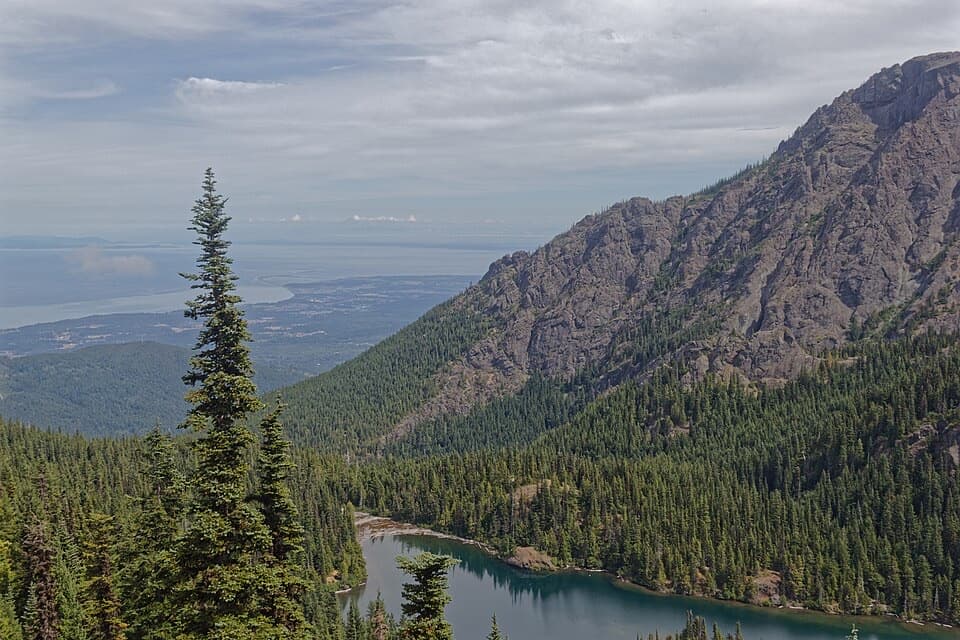
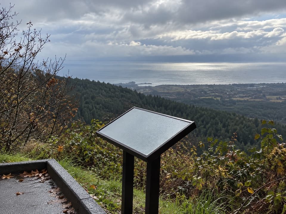
Morse Creek Overlook is a short scenic stop on Hurricane Ridge Road. Its wayside looks into a forested gorge, and a separate pillow-basalt exposure sits across the road. It’s worth a few minutes if you want a clear story of how ice and flowing water shaped this corner of Olympic. The viewpoint has a sidewalk, a low stone wall and an interpretive panel.

When a lake filled the valleyThe panel compares today’s forested gorge with Ancient Lake Morse, which once filled the valley…

The panel compares today’s forested gorge with Ancient Lake Morse, which once filled the valley between Round Mountain and Blue Mountain. A continental ice sheet and glaciers from the Olympics blocked drainage; meltwater pooled here until the ice retreated and the lake drained. The panel’s side-by-side past-and-present views make that change easier to picture than a map would.

How Morse Creek cut the gorgeBefore the glaciers redirected it, Morse Creek flowed over softer sediments between the…

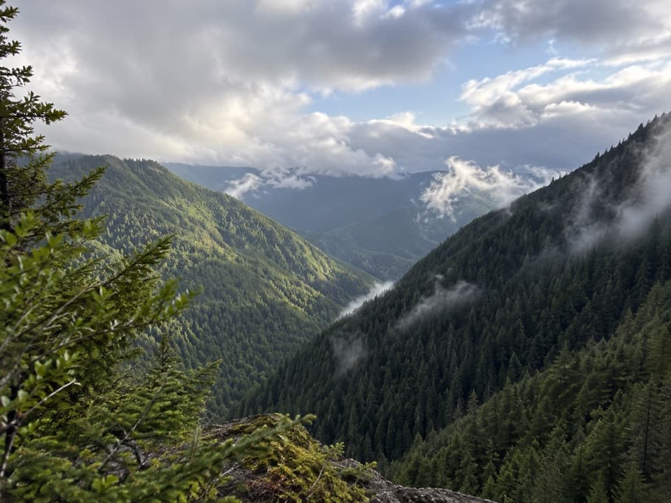
Before the glaciers redirected it, Morse Creek flowed over softer sediments between the mountains. The diverted creek cut a new path through harder volcanic rock, leaving the gorge visible from the overlook. Look from the panel to the forested valley and you’re seeing the result of that rerouted creek.

Pillow basalt across the roadThe rounded, cracked rocks at the adjoining exposure are pillow basalt, formed when lava cooled…

The rounded, cracked rocks at the adjoining exposure are pillow basalt, formed when lava cooled quickly underwater. The Olympic Mountains’ Crescent Formation basalts date to roughly 40–50 million years ago. NPS notes that the local rocks have few gas bubbles, consistent with lava cooling under deep-water pressure on the ocean floor.

Wildlife

Wildlife in Olympic

All Olympic wildlife maps

Sighting maps show where each species has been reported across Olympic. Wildlife moves, so no sighting is guaranteed.

Keep exploring

Near Morse Creek Overlook

See it all on the map

Trails nearby

More stops nearby

Parkwolf’s Olympic ranking

Top sights in Olympic

All 94 places
  1. 1Hurricane RidgeSight
  2. 2Ruby BeachBeach
  3. 3Rialto BeachBeach
  4. 4Sol Duc FallsSight
  5. 5Marymere FallsSight
  6. 6Second BeachBeach

Take Parkwolf to Olympic.

The audio tour guide for the drive, plus offline maps, trails, and wildlife heatmaps for when the signal drops.

4.7 from 8,600+ ratings

Download Parkwolf on the App StoreGet Parkwolf on Google Play