Win Hill in Peak District National Park

Sight · Peak District National Park

Win Hill

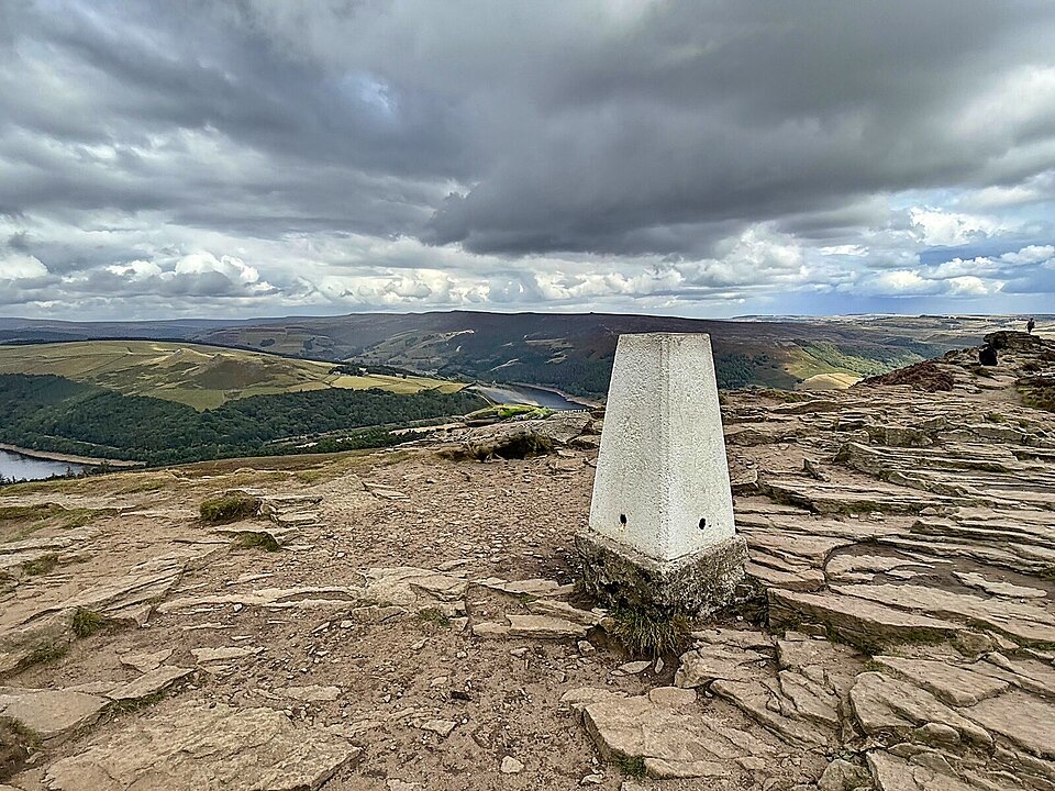
Steep, short climb to a rocky trig point above Ladybower

Photo: Wikimedia Commons
Type
Sight
Nearest trail
1.1 km
Audio stories
7 nearby

Hear the audio tour

Win Hill from Yorkshire Bridge

Overview

About Win Hill

Why stop

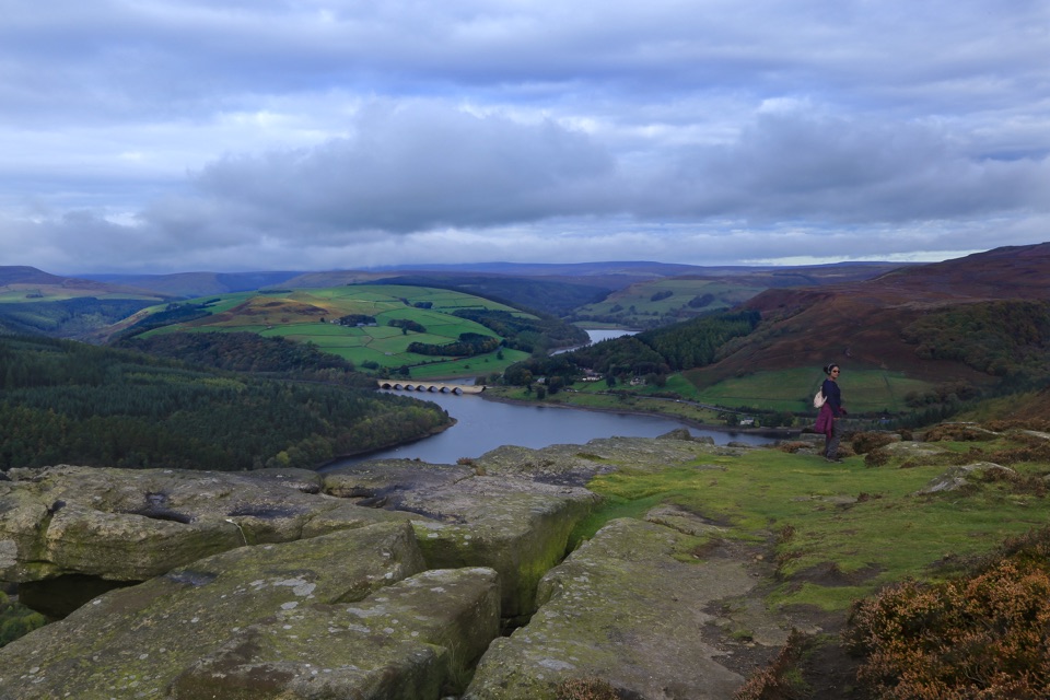
  • 360-degree views over Ladybower and the Hope Valley

Heads up

  • Steep, muddy ascent on direct routes

Map

Where it is

Loading the Peak District map
Full map
SightWin Hill53.36239, -1.72072
Keep this map with you offline in the Parkwolf app

Plan your stop

Before you go

Best time to go

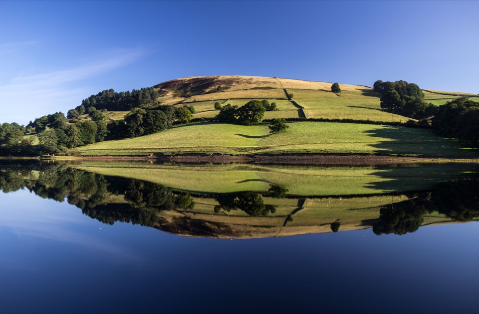
If photography is the point, aim for early morning or the hour before sunset: the low light works well on the reservoir and the ridge. The view is the whole reason to come, so if the tops are in cloud you'll climb hard for a white wall; check visibility before you commit and be prepared to swap plans.


5 active Peak District alerts

  • ClosureA54 Cat and Fiddle road closureThe A54 Macclesfield Main Road (Cat and Fiddle) is fully closed to all traffic from 27 July through 30 October 2026 during phase 1 improvement works.Official details
  • ClosureHooks Carr (Stanage Popular) car park closureHooks Carr (Stanage Popular) car park will be partially or fully closed from 6 October for four weeks.Official details
See all 5 alerts
A park ranger sits on a dash-mounted phone, talking, as Parkwolf’s Tour Guide plays “Army Cutworm Moths: A Grizzly Bear Buffet” on Grand Loop Road below Dunraven Pass in Yellowstone
Parkwolf Tour GuideThe highest, rockiest slopes around here are a summer buffet for grizzly bears.

Peak District Tour Guide

Your drive to Win Hill, narrated.

Parkwolf is a GPS audio tour guide for Peak District National Park. As you drive, it chimes in with what’s ahead: hidden gems, upcoming stops, history, geology, and wildlife, right through your car’s speakers.

Recorded for this place

Win Hill from Yorkshire Bridge
0:00 / 0:24
“You're approaching the Yorkshire Bridge start for Win Hill, a gritstone summit above Ladybower Reservoir. Parkin Clough climbs roughly three hundred metres in just over a kilometre, so this is a steep hill walk.”

Plays as you drive up to Win Hill in the Parkwolf Peak District Tour Guide.

More stories near here in the app

  • Bamford Edge Above Ladybower
  • The Community beside Navio
  • A Blackbird with a White Collar
  • Ladybower Reservoir and Heatherdene
  • 298 audio storiesacross Peak District’s roads, triggered by GPS as you drive
  • Wildlife heatmapsfor Red Deer, Red Fox, Eurasian Otter, and 13 more
  • Works offlinemaps, 88 trails, 76 places, and audio download before you lose signal
  • CarPlay readysimple controls built for the drive
★★★★★
“Fantastic app with many points of information… It’s great to just turn on while you’re driving and it gives you an audio tour of the national Park. We love it!!!!”
JMJamesApp Store review
Download Parkwolf on the App StoreGet Parkwolf on Google Play

4.7 from 8,600+ ratings

Guide

More about Win Hill

Why bother with this oneAt 464 m it isn't the tallest thing around, but Win Hill sits in a genuinely useful spot: a…

At 464 m it isn't the tallest thing around, but Win Hill sits in a genuinely useful spot: a narrow ridge wedged between the Upper Derwent and the Hope Valley, with broad views opening out in every direction. You get a big-mountain payoff for a fairly modest amount of walking, which is why it's a hill plenty of walkers come back to rather than tick off once.

The summit itselfThe top is a knuckle of gritstone with a trig point on it, open moor and rough grass all around.

The top is a knuckle of gritstone with a trig point on it, open moor and rough grass all around. It's fully exposed, so expect it to be breezy even when the valleys are still, and dress for more wind than you set off in.

What you can actually seeWhere visibility allows, it's a full 360-degree sweep:

Where visibility allows, it's a full 360-degree sweep:

  • Ladybower Reservoir below
  • The Upper Derwent Valley beyond
  • Kinder Scout and the Edale skyline to the west, with Mam Tor across the valley
  • Stanage Edge and Derwent Edge on the gritstone side, and the Hope Valley spread out below
Getting up there, honestlyHow hard this feels depends entirely on your line of approach.

How hard this feels depends entirely on your line of approach.

This is open countryside on the tops. Paths are unsurfaced and mud is a real factor after rain, especially in the woods and on the peatier sections near the ridge. Proper boots with grip, not trainers.

  • Parkin Clough from Yorkshire Bridge is the brutal one: roughly 300 m of ascent in about 1.2 km, steep and relentless through the woods. Short, sharp and genuinely rewarding, but not a gentle stroll.
  • From Hope or Bamford the gradients are much kinder. A traverse over the summit works out at around 5.3 to 5.6 miles, generally reckoned a moderate half-day, with stiles and squeeze stiles along the way.
What to bringSturdy, waterproof footwear and a windproof layer for the summit
  • Sturdy, waterproof footwear and a windproof layer for the summit
  • Water and food carried with you, and treat it as a self-sufficient hill walk
  • A map or offline route, as paths branch across the moor and the ridge line isn't always obvious
  • Walking poles if you're descending Parkin Clough, which is harder on the knees than the way up
The honest drawbacksThe direct route is steep enough to feel like a slog rather than a walk, the ground gets sloppy…

The direct route is steep enough to feel like a slog rather than a walk, the ground gets sloppy for much of the year, and the summit is fully exposed. There's also a well-worn story about the name coming from a battle fought between Win Hill and Lose Hill; it gets repeated a lot, but there's no solid evidence behind it, so treat it as folklore rather than history. Come for the view and the climb.

Reaching itApproaches from Yorkshire Bridge, Hope and Bamford all work, and both Hope and Bamford sit on…

Approaches from Yorkshire Bridge, Hope and Bamford all work, and both Hope and Bamford sit on the Hope Valley rail line, with local bus stops near the valley routes. Doing it as a linear walk between two stations is the tidiest way to take in the whole ridge without retracing your steps.

Wildlife

Wildlife in Peak District

All Peak District wildlife maps

Sighting maps show where each species has been reported across Peak District. Wildlife moves, so no sighting is guaranteed.

Keep exploring

Near Win Hill

See it all on the map

Trails nearby

More stops nearby

Parkwolf’s Peak District ranking

Top sights in Peak District

All 76 places
  1. 1Chatsworth HouseSight
  2. 2Mam TorSight
  3. 3Dovedale Stepping StonesSight
  4. 4Ladybower ReservoirSight
  5. 5Stanage EdgeSight
  6. 6Kinder ScoutSight

Take Parkwolf to Peak District.

The audio tour guide for the drive, plus offline maps, trails, and wildlife heatmaps for when the signal drops.

4.7 from 8,600+ ratings

Download Parkwolf on the App StoreGet Parkwolf on Google Play