Froggatt, Curbar and White Edge Red Deer Circular Walk in Peak District National Park

Peak District National Park, EN

Froggatt, Curbar and White Edge Red Deer Circular Walk

Three gritstone edges, a red deer moor and a pub halfway round.

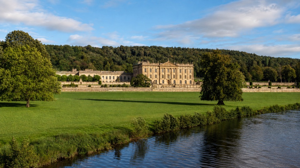
Photo: Wikimedia Commons
Length
9.6km
Time
3hr
Elev. change
111m
Difficulty
Moderate
  • Loop
  • Dogs allowed
  • High point 361 m
  • #11 of 88 in Peak District

Hear the audio tour

Curbar and Froggatt Edges

Overview

About Froggatt, Curbar and White Edge Red Deer Circular Walk

Why go

  • Three connected gritstone edges with wide valley views
  • White Edge trig point and a halfway pub stop

Heads up

  • Steep, stony sections and exposed edge walking
  • Road crossing and field detour break up the ridge

Map & elevation

The route

Loading the Peak District map
Full map
Elevation250–361 m
TrailheadCurbar Gap car park53.26898, -1.60808
Keep this map with you offline in the Parkwolf app

Plan your hike

Before you go

Parking

Curbar Gap car park on Clodhall Lane (SK262747 / S32 3YR), the route's start and finish. It is pay-and-display and small, so busy weekends can fill it. There are no public toilets at the lot; Longshaw's toilets, café and shop are a separate 10–15-minute drive.

Safety

The route goes beside exposed gritstone edges with steep drops; keep back from the rims. Expect a steep bank, narrow stony paths, uneven rocks and a road crossing near Haywood and the Grouse Inn. Paths and the brook/fields can be wet or muddy. Dogs must stay on leads around wildlife and livestock; barbecues and campfires are not permitted.

5 active Peak District alerts

  • ClosureA54 Cat and Fiddle road closureThe A54 Macclesfield Main Road (Cat and Fiddle) is fully closed to all traffic from 27 July through 30 October 2026 during phase 1 improvement works.Official details
  • ClosureHooks Carr (Stanage Popular) car park closureHooks Carr (Stanage Popular) car park will be partially or fully closed from 6 October for four weeks.Official details
See all 5 alerts
A park ranger sits on a dash-mounted phone, talking, as Parkwolf’s Tour Guide plays “Army Cutworm Moths: A Grizzly Bear Buffet” on Grand Loop Road below Dunraven Pass in Yellowstone
Parkwolf Tour GuideThe highest, rockiest slopes around here are a summer buffet for grizzly bears.

Peak District Tour Guide

Your drive to Froggatt, Curbar and White Edge Red Deer Circular Walk, narrated.

Parkwolf is a GPS audio tour guide for Peak District National Park. As you drive, it chimes in with what’s ahead: hidden gems, upcoming stops, history, geology, and wildlife, right through your car’s speakers.

Recorded for this trailhead

Curbar and Froggatt Edges
0:00 / 0:28
“You’re approaching Curbar Gap, where a short path reaches Curbar Edge above the Derwent Valley.”

Plays as you drive up to this trailhead in the Parkwolf Peak District Tour Guide.

More stories near here in the app

  • The Signpost Before Road Signs
  • Chatsworth's Surprise Soaking
  • The Mill That Played a Castle
  • Antlers Above the Heather
  • 298 audio storiesacross Peak District’s roads, triggered by GPS as you drive
  • Wildlife heatmapsfor Red Deer, Red Fox, Eurasian Otter, and 13 more
  • Works offlinemaps, 88 trails, 76 places, and audio download before you lose signal
  • CarPlay readysimple controls built for the drive
★★★★★
“Fantastic app with many points of information… It’s great to just turn on while you’re driving and it gives you an audio tour of the national Park. We love it!!!!”
JMJamesApp Store review
Download Parkwolf on the App StoreGet Parkwolf on Google Play

4.7 from 8,600+ ratings

Trail guide

Hiking Froggatt, Curbar and White Edge Red Deer Circular Walk

Three edges in one loopFroggatt, Curbar and White Edge Red Deer Circular Walk is a 6-mile (9.

Froggatt, Curbar and White Edge Red Deer Circular Walk is a 6-mile (9.6 km) loop from Curbar Gap, linking open White Edge, the gritstone ridges and a field-and-woodland return by Froggatt. Allow about three hours without rushing. It is mostly level once you are up on the edges, but this is not a smooth promenade: there is a steep bank, narrow stony paths, uneven rock and a road crossing. The payoff is variety: open moor, trig point, old stonework, three different edges and a pub roughly halfway round.

For only the famous view, take the short Curbar Edge walk from the car park. Choose this loop for a proper half-day walk.

Start with White EdgeLeave Curbar Gap on the vehicle track, take the fork towards Sandyford Brook and cross the…

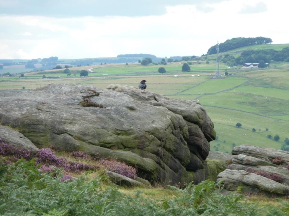
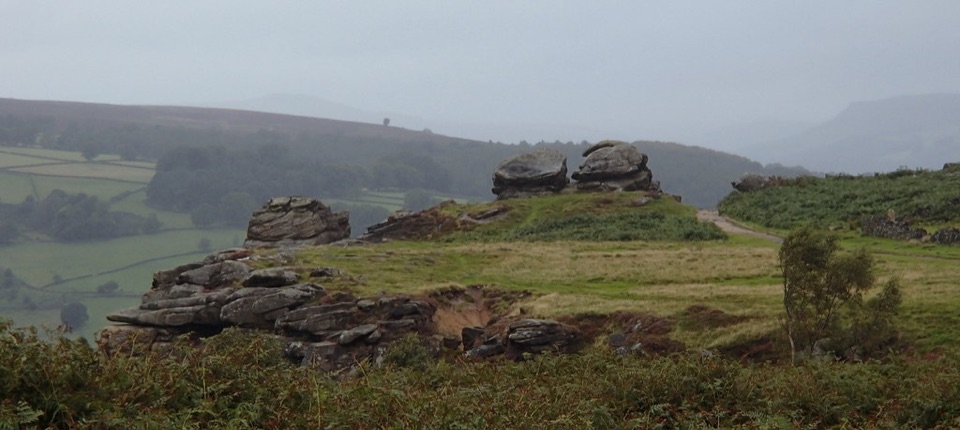
Leave Curbar Gap on the vehicle track, take the fork towards Sandyford Brook and cross the small bridge. The first real effort is a steep climb beside a dry-stone wall. At the top, the path settles into open moorland along White Edge. Take the short detour to the trig point. Big Moor spreads out below you, with Barbrook Reservoir in the distance. Red deer live on the moor, and you may see antlers above the heather, but keep your distance and do not turn a possible sighting into a chase.

The gritstone was quarried for local mills; discarded millstones still turn up here. Heather is most colourful in late summer.

A longer return with a few surprisesAt the gap in the wall, turn down through fields towards the Grouse Inn.

At the gap in the wall, turn down through fields towards the Grouse Inn. The pub is about halfway round and serves meals, so it is a useful break rather than a random detour. After Haywood, cross the main road and climb through woodland. Look for the small ancient stone circle just off the path before Froggatt Edge.

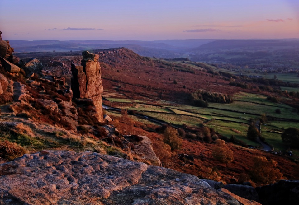
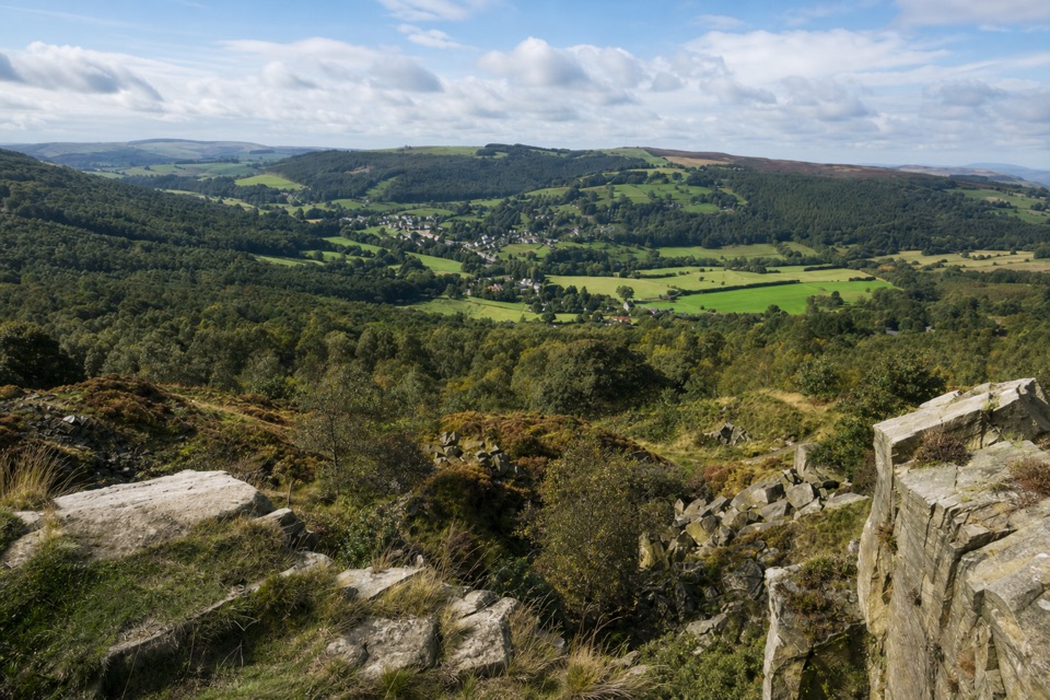
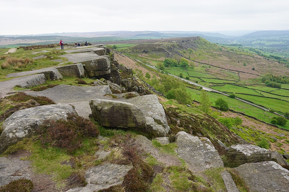
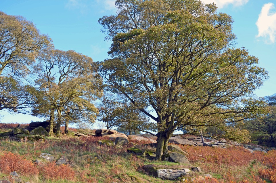
The final stretch follows Froggatt Edge into Curbar Edge, with weathered gritstone, boulders and wide views over the Derwent Valley. The path is generally obvious, but the edges are exposed and the rocks make you watch your feet. For a photo, include the path and a gritstone block in the foreground so the picture shows the route.

Making it workStart at Curbar Gap car park, which is pay-and-display and small enough to fill on busy…

Start at Curbar Gap car park, which is pay-and-display and small enough to fill on busy weekends. There are no public toilets at the lot; Longshaw's toilets, café and shop are a separate 10–15-minute drive. Dogs are welcome only on leads, especially around deer and livestock. Keep back from the exposed rims, take care crossing the road near Haywood and the pub, and expect wet or muddy footing after rain. Barbecues and campfires are not permitted on the moor.

Wildlife

Wildlife in Peak District

All Peak District wildlife maps

Sighting maps show where each species has been reported across Peak District. Wildlife moves, so no sighting is guaranteed.

Keep exploring

Near Froggatt, Curbar and White Edge Red Deer Circular Walk

See it all on the map

Trails that start nearby

Places near the trailhead

Parkwolf’s Peak District ranking

Top-rated trails in Peak District

All 88 trails
  1. 1The Roaches and Lud’s Church Circular from Hen CloudModerate · 12.2 km
  2. 2Mam Tor Circular WalkModerate · 4.8 km
  3. 3Castleton, Mam Tor & the Great Ridge WalkModerate · 10.5 km
  4. 4Stanage Edge from HathersageModerate · 10.6 km
  5. 5Kinder Scout Circular via Jacob’s LadderChallenging · 12.1 km
  6. 6Padley Gorge and Burbage Brook WalkEasy · 3.7 km

Take Parkwolf to Peak District.

The audio tour guide for the drive, plus offline maps, trails, and wildlife heatmaps for when the signal drops.

4.7 from 8,600+ ratings

Download Parkwolf on the App StoreGet Parkwolf on Google Play