Parking
Start at Bear Gulch Day Use Area on the east side of the park. Parking can be limited on busy spring and weekend days; arrive early. The nine-mile round trip includes the walk to Bear Gulch Reservoir.

#9 of 25 trails in Pinnacles
Pinnacles National Park, CA
An exposed climb to the park’s high point and a closed lookout.
Overview
Map & elevation
Plan your hike

The highest, rockiest slopes around here are a summer buffet for grizzly bears.
Pinnacles Tour Guide
Parkwolf is a GPS audio tour guide for Pinnacles National Park. As you drive, it chimes in with what’s ahead: hidden gems, upcoming stops, history, geology, and wildlife, right through your car’s speakers.
Recorded for this trailhead
North Chalone Peak via Bear Gulch“You're approaching the road into Bear Gulch, the starting area for a hike to North Chalone Peak. It's the park's highest summit, with wide valley views and a fire lookout built in nineteen fifty-two.”
Plays as you drive up to this trailhead in the Parkwolf Pinnacles Tour Guide.
More stories near here in the app
“Fantastic app with many points of information… It’s great to just turn on while you’re driving and it gives you an audio tour of the national Park. We love it!!!!”


Trail guide
Chalone Peak Trail is a strenuous out-and-back from Bear Gulch Day Use Area to North Chalone Peak and back. The full walk is about 9 miles round-trip, including the approach between the day-use area and Bear Gulch Reservoir, with about 2,040 feet of climbing. Allow around five hours; a long cave stop or an unhurried summit break can turn it into a six-hour outing. The payoff is Pinnacles’ highest point, wide views over the surrounding valleys, and an old fire lookout at the end. Treat this as a half-day hike, not a short summit spur.
From the day-use area, the route climbs through oak woodland into a narrow gorge of broken volcanic rock. The Bear Gulch Cave approach can lead through dark, boulder-filled passages and up stairs beside dryfalls to the reservoir. Bring a flashlight: the cave has low ceilings and uneven, sometimes slippery footing, and wading may be needed after winter rain. Cave access changes to protect bats and can also close for high water or other hazards. If the cave route is closed, use the Moses Spring bypass to reach the reservoir and check current access status before setting out.
At Bear Gulch Reservoir, turn left along the east shore and follow Chalone Peak Trail. The path passes a spur for the Sisters climbing area, leaves the water, then climbs through Little Pinnacles. Views north toward the High Peaks begin to open as you gain height. The route is easy to follow, but the shade of the lower gorge gives way to open, rocky slopes, so the reservoir is the last place to count on water.
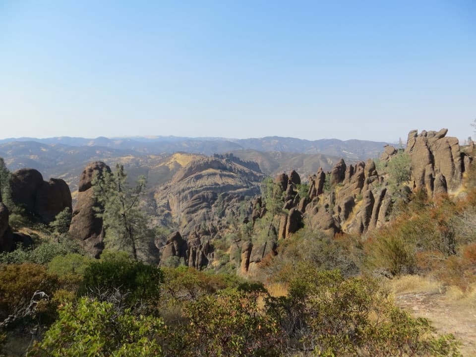
Above Frog Canyon saddle, switchbacks climb through scrubby chaparral and manzanita. A rocky outcrop partway up gives the clearest look back over Bear Gulch and the High Peaks; farther on, the route opens west across the Salinas Valley toward the Santa Lucia Range. This is a good place to pause and look around before the final climb. For a photo, use the outcrop rocks in the foreground with the High Peaks beyond them; from the summit, the old lookout helps show the scale of the ridge.
A wooden stile marks the change from narrow footpath to a broad dirt road. The final climb is sunny and exposed along the west flank. Near the high saddle, watch for the easy-to-miss South Chalone spur and stay on the North Peak route. The unmaintained South Chalone trail continues another 1.6 miles one way and is a separate extension, not part of this nine-mile outing.
North Chalone Peak is Pinnacles National Park’s highest point. The route reaches an abandoned fire lookout built in 1952 by the California Department of Forestry. The tower is closed to visitors, but the summit can be walked around for views across the valleys and the Gabilan Range. The approach and summit expose the region’s rough rhyolitic rock; the gorge’s broken breccia is especially clear on the lower walk.
Bear Gulch Day Use Area is the starting parking area, and spaces can be limited on busy spring and weekend days. Restrooms and picnic tables are at the trailhead; there is no drinking water along the route, so carry enough for the full outing and pack food as well. The upper hike has virtually no shade, and the peak can run about 10°F hotter than the parking area. Carry ample water, sun protection, and salty snacks, and plan strenuous hiking for cooler parts of the day. Dogs are not allowed on park trails; service animals are permitted. No separate hiking reservation or trail fee is required, though the park entrance fee applies.
Wildlife
 47 sightingsCalifornia CondorMost seen around 1 PMSighting map
 26 sightingsMule DeerMost seen around 6 PMSighting map
 19 sightingsChipmunkMost seen around 7 AMSighting map
 33 sightingsTurkey VultureMost seen around noonSighting map
 26 sightingsAcorn WoodpeckerMost seen around 8 AMSighting map
 16 sightingsSteller's JayMost seen around 8 AMSighting map
Sighting maps show where each species has been reported across Pinnacles. Wildlife moves, so no sighting is guaranteed.
Keep exploring
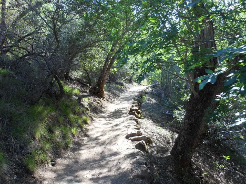 ModerateMoses Spring to Rim Trail Loop2.2 mi · 1.5 hr · 0.1 mi awayA short loop linking Bear Gulch’s cave, reservoir, and rim.
 ModerateCondor Gulch Trail to Overlook2 mi · 1.8 hr · 0.1 mi awayA steady mile leads to a rocky overlook into Condor Gulch.
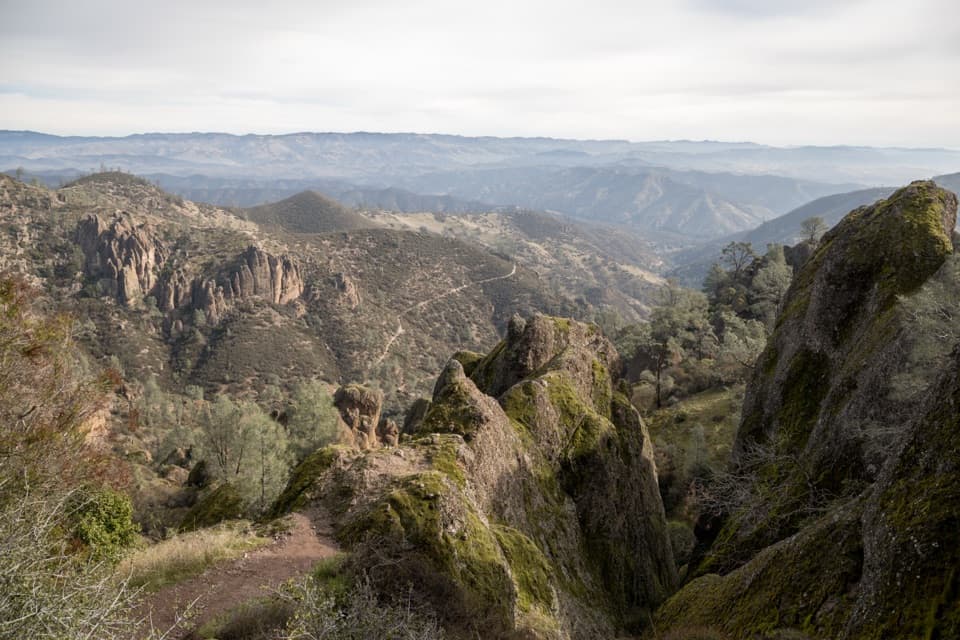 ChallengingCondor Gulch to High Peaks Loop5.3 mi · 4 hr · 0.3 mi awayA strenuous circuit through volcanic spires and an exposed, narrow ridge.
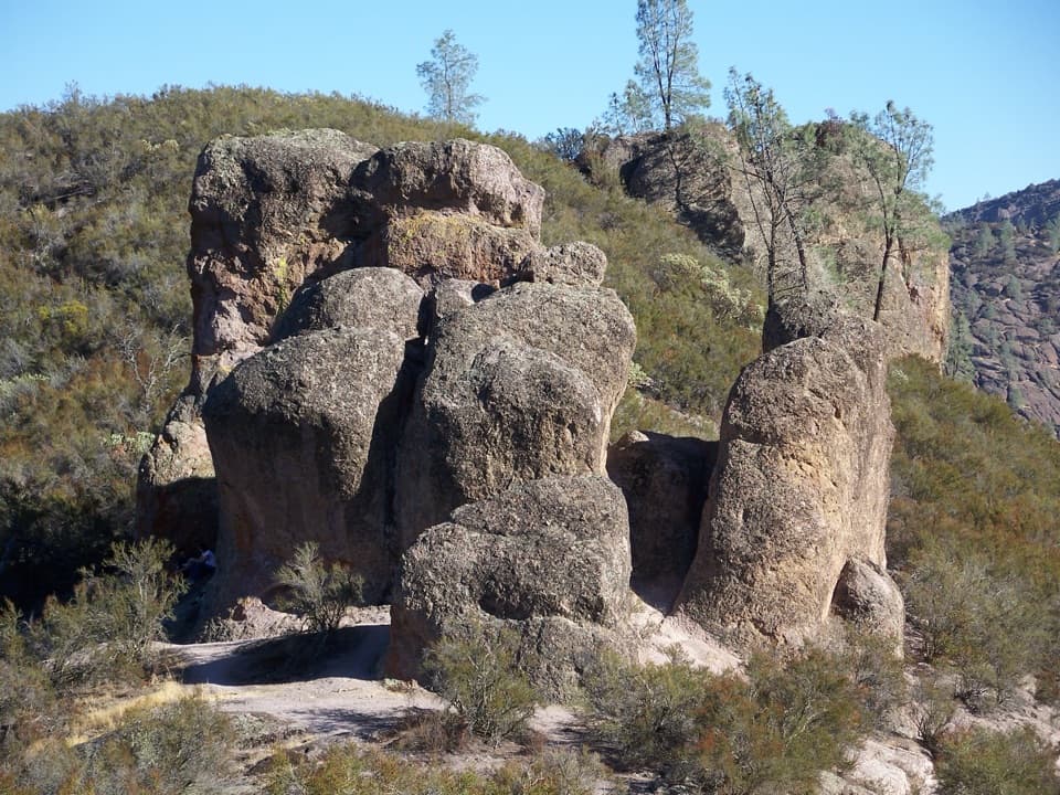 ChallengingHigh Peaks to Bear Gulch Loop6.7 mi · 4.5 hr · 0.3 mi awayA steep ridge climb, tight rock passages, and a shaded return.
 ModerateMoses Spring Trail to Bear Gulch Reservoir1 mi · 1.3 hr · 0.4 mi awayA short rocky climb to a ferny grotto and stone dam.ChallengingSouth Chalone Peak Trail9.8 mi · 6.5 hr · 0.7 mi awayA long, unmaintained branch to the southern ridge.
 ModerateSycamore Trail1 mi · 45 min · 0.8 mi awayA gentle creekside mile between Peaks View and Bear Gulch.
 ModerateBlue Oak Trail5.3 mi · 3.5 hr · 1 mi awayOak and tall grass give way to the High Peaks.
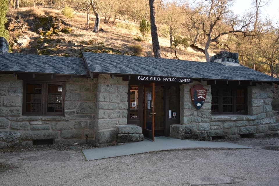 Visitor center · At the trailheadBear Gulch Nature CenterA compact ranger stop before Bear Gulch trails
 Sight · At the trailheadBear Gulch Day Use AreaPark once for east-side trails and a rocky-hills view.
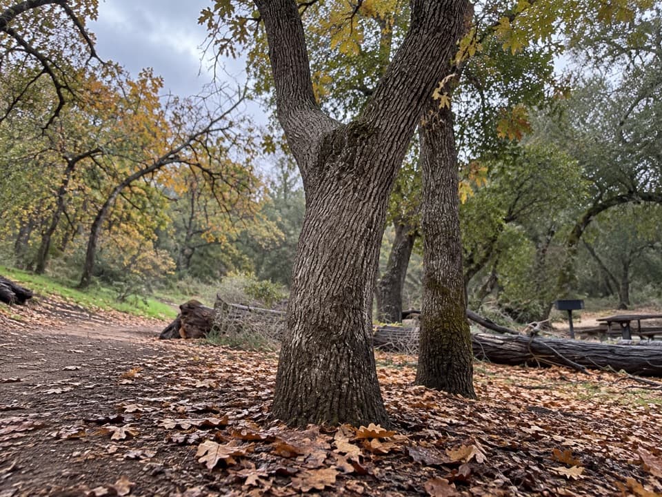 Picnic area · 0.2 mi awayBear Gulch Picnic AreaA small picnic grove between Moses Spring and Bear Gulch Day Use.
 Sight · 0.5 mi awayDiscovery WallA technical crag where weak volcanic rock demands care.
 Sight · 0.5 mi awayMoses SpringA rock-wall spring worth a pause; don’t drink the water.
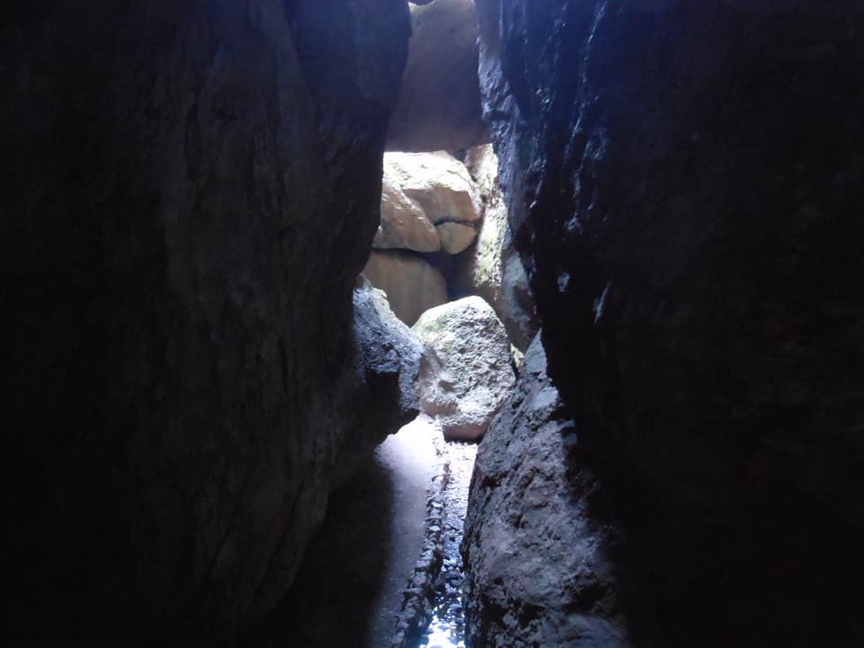 Sight · 0.6 mi awayBear Gulch CaveA boulder-built cave passage leads toward Bear Gulch Reservoir.
 Sight · 0.7 mi awayThe MonolithA steep volcanic face beside the reservoir, famous among climbers.
 Sight · 0.7 mi awayBear Gulch ReservoirStill water mirrors the spires above the rocky cave route.
Parkwolf’s Pinnacles ranking

The audio tour guide for the drive, plus offline maps, trails, and wildlife heatmaps for when the signal drops.