Moses Spring to Rim Trail Loop in Pinnacles National Park

#2 of 25 trails in Pinnacles

Pinnacles National Park, CA

Moses Spring to Rim Trail Loop

A short loop linking Bear Gulch’s cave, reservoir, and rim.

Photo: Wikimedia Commons
Length
2.2mi
Time
1.5hr
Elev. change
492ft
Difficulty
Moderate
  • Loop
  • No dogs
  • High point 1,801 ft

Hear the audio tour

Bear Gulch Cave and Reservoir

Overview

About Moses Spring to Rim Trail Loop

Why go

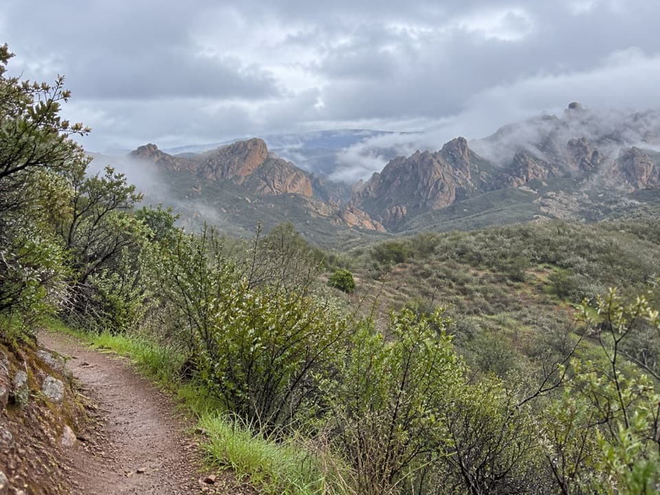
  • A compact loop with a cave passage, reservoir, and canyon views.
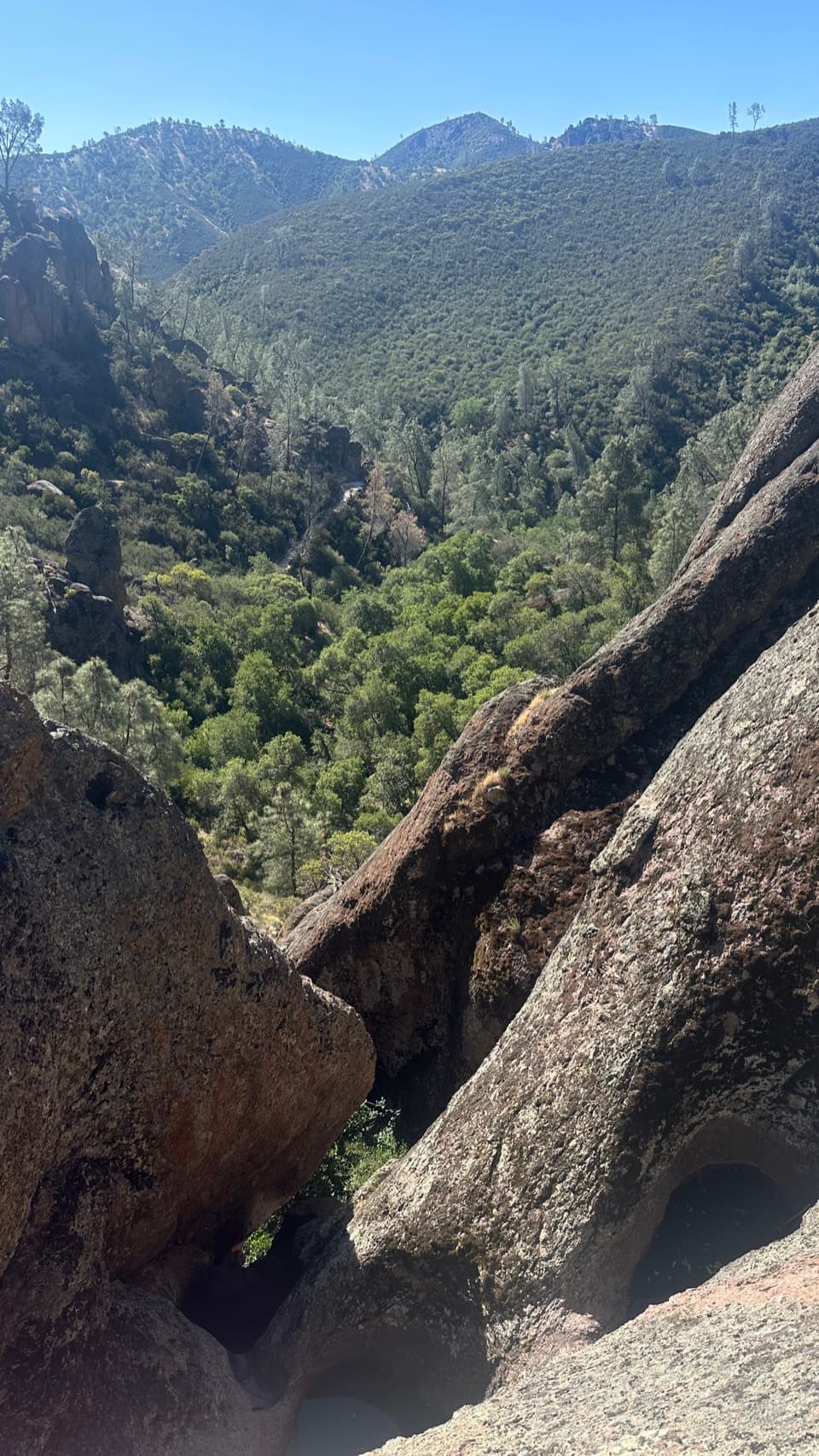
  • Moses Spring’s ledge looks into a jumble of house-size boulders.
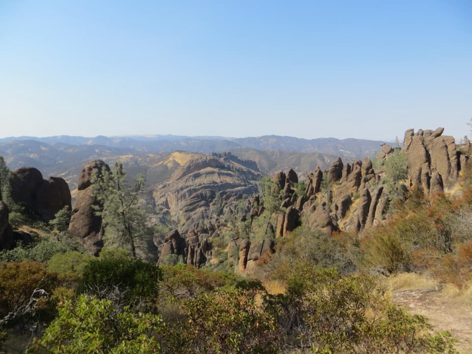
  • The Rim Trail adds a broad view above the shaded gorge.

Heads up

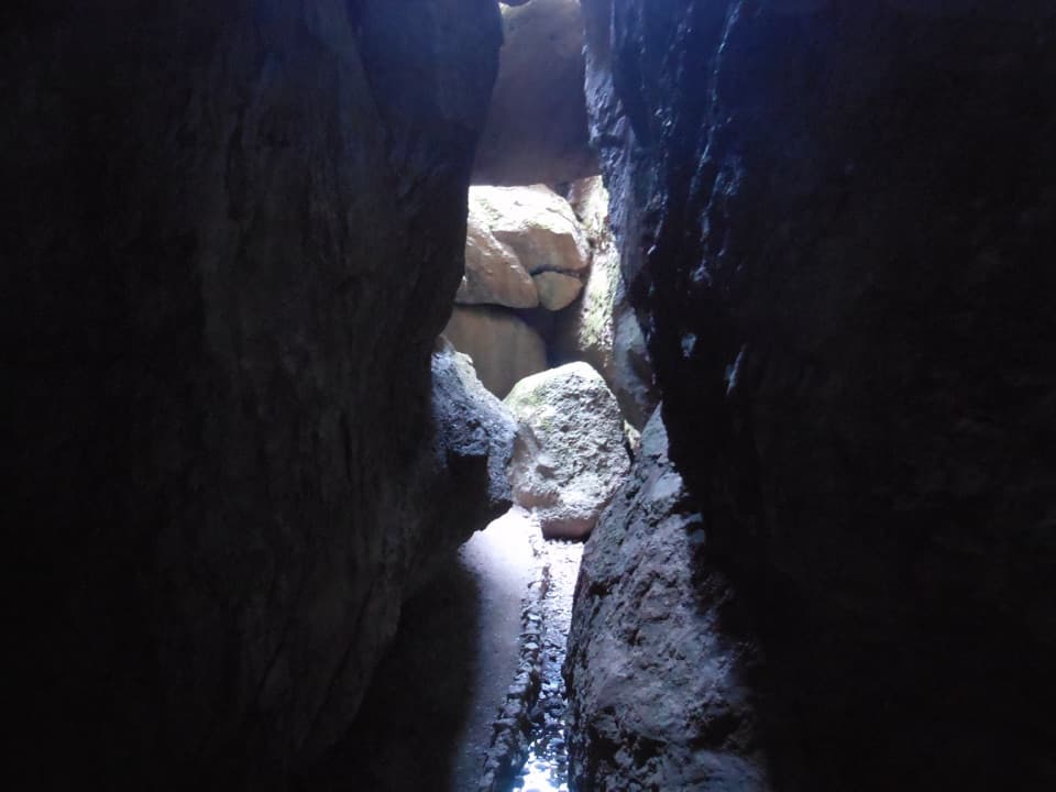
  • The cave passage is low, dark, uneven, and sometimes slippery.
  • The exposed Rim Trail has no shade or drinking water.

Map & elevation

The route

Loading the Pinnacles map
Full map
Elevation1,309–1,801 ft
TrailheadBear Gulch Nature Center36.48142, -121.18145
Keep this map with you offline in the Parkwolf app

Plan your hike

Before you go

Parking

Park at Moses Spring Parking Area in Bear Gulch Day Use Area, about four miles along East Entrance Road from the east entrance. A signed footpath connects the Nature Center with the parking area and is included in the mapped line. Do not park along the road.

Safety

A flashlight is required in the low-ceiling cave, where rocks and steps can be slippery. Seasonal cave closures and short flood closures can change the route; check current conditions and follow the bypass when directed. There is no water on the trail, and the Rim Trail is unshaded; carry water and avoid peak heat. Poison oak and rattlesnakes occur in the park.

2 active Pinnacles alerts

  • CautionVery high fire danger restrictionsVery high fire danger is active; follow Pinnacles’ fire restrictions. - Because fire danger is VERY HIGH, wood-burning fires and charcoal grills are prohibited.Official details
  • CautionHot conditions and heat alertHot conditions and a heat alert are active; limit strenuous hiking to early morning and late evening and prepare for temperatures above the forecast.Official details
Pinnacles alerts
A park ranger sits on a dash-mounted phone, talking, as Parkwolf’s Tour Guide plays “Army Cutworm Moths: A Grizzly Bear Buffet” on Grand Loop Road below Dunraven Pass in Yellowstone
Parkwolf Tour GuideThe highest, rockiest slopes around here are a summer buffet for grizzly bears.

Pinnacles Tour Guide

Your drive to Moses Spring to Rim Trail Loop, narrated.

Parkwolf is a GPS audio tour guide for Pinnacles National Park. As you drive, it chimes in with what’s ahead: hidden gems, upcoming stops, history, geology, and wildlife, right through your car’s speakers.

Recorded for this trailhead

Bear Gulch Cave and Reservoir
0:00 / 0:32
“You're coming up on the Bear Gulch walking area, the starting point for the cave and reservoir. The moderate Moses Spring and Rim Trail loop is about two point two miles; allow an hour and a half to two hours.”

Plays as you drive up to this trailhead in the Parkwolf Pinnacles Tour Guide.

More stories near here in the app

  • Bear Gulch to High Peaks
  • North Chalone Peak via Bear Gulch
  • Old Pinnacles and Machete Ridge
  • Peaks View Picnic Stop
  • 12 audio storiesacross Pinnacles’s roads, triggered by GPS as you drive
  • Wildlife heatmapsfor California Condor, Mule Deer, Chipmunk, and 13 more
  • Works offlinemaps, 25 trails, 23 places, and audio download before you lose signal
  • CarPlay readysimple controls built for the drive
★★★★★
“Fantastic app with many points of information… It’s great to just turn on while you’re driving and it gives you an audio tour of the national Park. We love it!!!!”
JMJamesApp Store review
Download Parkwolf on the App StoreGet Parkwolf on Google Play

4.7 from 8,600+ ratings

Trail guide

Hiking Moses Spring to Rim Trail Loop

The full loopThis is the Bear Gulch circuit for a dark passage beneath wedged boulders, a small reservoir,…

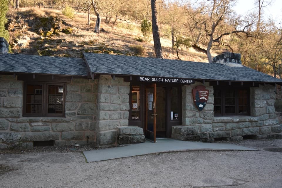
This is the Bear Gulch circuit for a dark passage beneath wedged boulders, a small reservoir, and a return above the canyon. Start near Bear Gulch Nature Center, follow the connecting path to the Moses Spring trailhead, continue through the cave corridor toward Bear Gulch Reservoir, then circle back on the Rim Trail and High Peaks connector. Plan for about 2.2 miles, moderate effort, roughly 500 feet of climbing, and 1.5 to 2 hours with stops. The shorter walk to the reservoir and back is a different itinerary. The route line follows mapped paths and closes at the Nature Center access, but it measures about 1.8 miles; use posted junctions and treat the mileage as approximate.

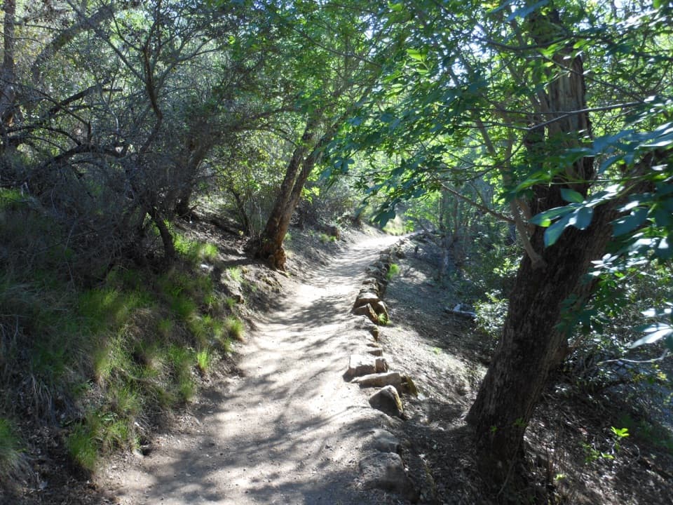
Through the talus caveThe cave is made by large volcanic boulders jammed together in the narrow canyon, rather than…

The cave is made by large volcanic boulders jammed together in the narrow canyon, rather than by water dissolving limestone. A flashlight is required. The passage has low ceilings, steps, uneven rock and slippery surfaces, so watch your head and footing; it can feel tight and is not a good fit for anyone uncomfortable in confined spaces. The cave trail was developed in the 1930s, and the dark spaces shelter Townsend’s big-eared bats. Access changes seasonally to protect them, and rain or flooding can also prompt short closures. When the cave is closed, follow the signed Moses Spring bypass and check the current cave notice before setting out.

Spring and reservoirMoses Spring is a seep beside the route, with a ledge looking into a jumble of house-size…

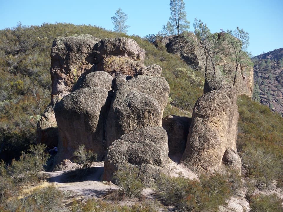
Moses Spring is a seep beside the route, with a ledge looking into a jumble of house-size boulders and up the canyon. The reservoir sits behind a dam in the same narrow gorge; pause for its still-water reflection, then stay on the designated path as the loop climbs away. These are small features in a rugged setting, so the short stops add texture without turning the hike into a long detour.

The rim returnThe Rim Trail gives the circuit its open view back across Bear Gulch and the surrounding…

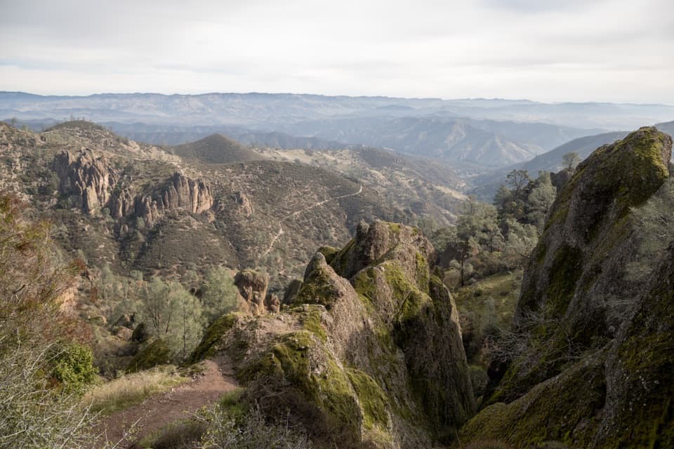
The Rim Trail gives the circuit its open view back across Bear Gulch and the surrounding pinnacles. It is exposed and has no shade, unlike portions of the creek-side approach. Expect rocky, uneven footing and stairs. There is no drinking water along the hiking trails; carry water for the full outing, and avoid the hottest part of a summer day. Poison oak and rattlesnakes occur in the park, so watch where you step and keep to the path.

Access and rulesThe Moses Spring Parking Area is in Bear Gulch Day Use Area on the east side of the park; the…

The Moses Spring Parking Area is in Bear Gulch Day Use Area on the east side of the park; the Nature Center is connected by a signed footpath included in the mapped line. Do not park along the road. Dogs are not allowed on this trail; service animals are permitted. A park entrance fee applies, with no additional hiking fee or reservation required.

Wildlife

Wildlife in Pinnacles

All Pinnacles wildlife maps

Sighting maps show where each species has been reported across Pinnacles. Wildlife moves, so no sighting is guaranteed.

Keep exploring

Near Moses Spring to Rim Trail Loop

See it all on the map

Trails that start nearby

Places near the trailhead

Parkwolf’s Pinnacles ranking

Top-rated trails in Pinnacles

All 25 trails
  1. 1Condor Gulch to High Peaks LoopChallenging · 5.3 mi
  2. 3Juniper Canyon Trail LoopChallenging · 4.3 mi
  3. 4Balconies Cliffs-Cave LoopModerate · 2.4 mi
  4. 5High Peaks to Balconies Cave LoopChallenging · 8.4 mi
  5. 6High Peaks to Bear Gulch LoopChallenging · 6.7 mi
  6. 7Prewett Point TrailEasy · 1 mi

Take Parkwolf to Pinnacles.

The audio tour guide for the drive, plus offline maps, trails, and wildlife heatmaps for when the signal drops.

4.7 from 8,600+ ratings

Download Parkwolf on the App StoreGet Parkwolf on Google Play