Pros & cons
PROS
- Short, steep walk from a roadside pullout to a sturdy viewing platform [alltrails.com](https://www.alltrails.com/trail/us/colorado/chasm-falls-hike)
- Car-free hike or bike option from the winter gate when the road is closed [alltrails.com](https://www.alltrails.com/trail/us/colorado/chasm-falls-hike)
CONS
- Parking is limited at the pullout and fills on summer days [alltrails.com](https://www.alltrails.com/trail/us/colorado/chasm-falls-hike)
- Access depends on the seasonal opening of one-way, unpaved Old Fall River Road [alltrails.com](https://www.alltrails.com/trail/us/colorado/chasm-falls-hike)
Overview
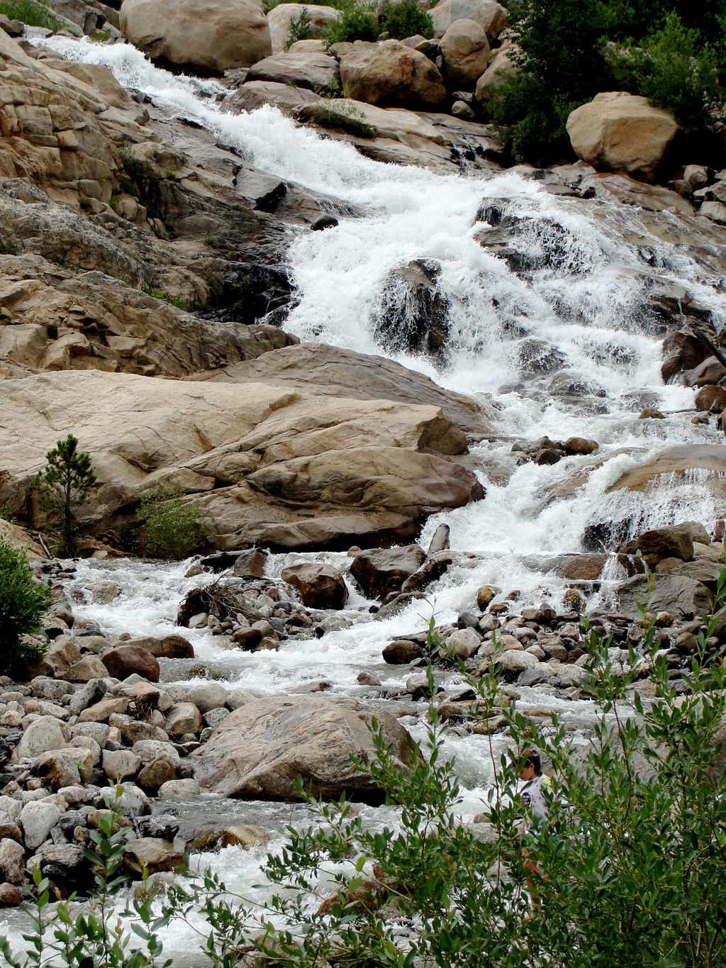
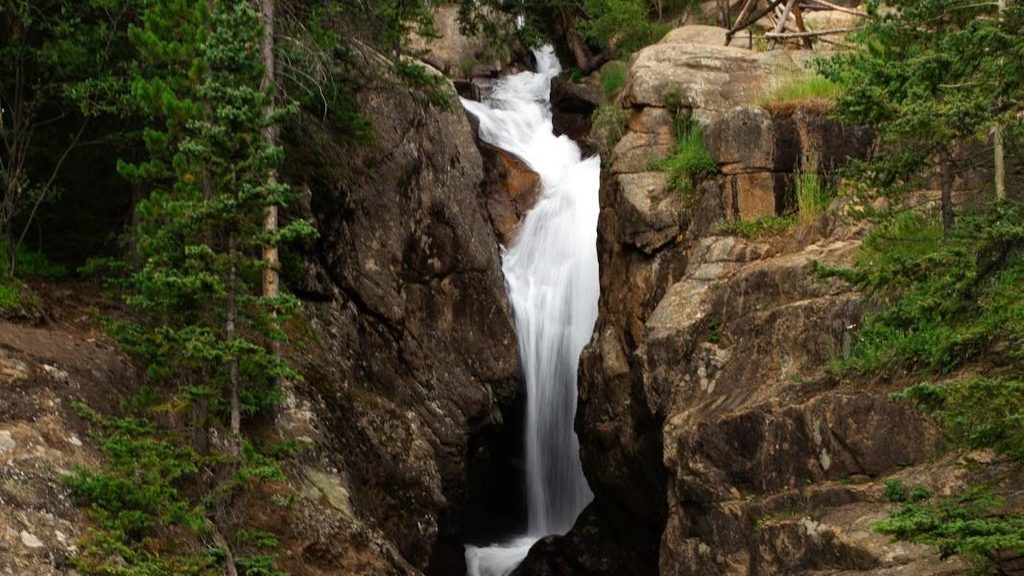
Chasm Falls is a tight, roaring waterfall squeezed into a rocky chasm along Old Fall River Road. It’s a quick stop with big payoff: a short set of steep stone steps drops to a rail‑protected viewpoint where the water thunders through bedrock.
What You’ll See
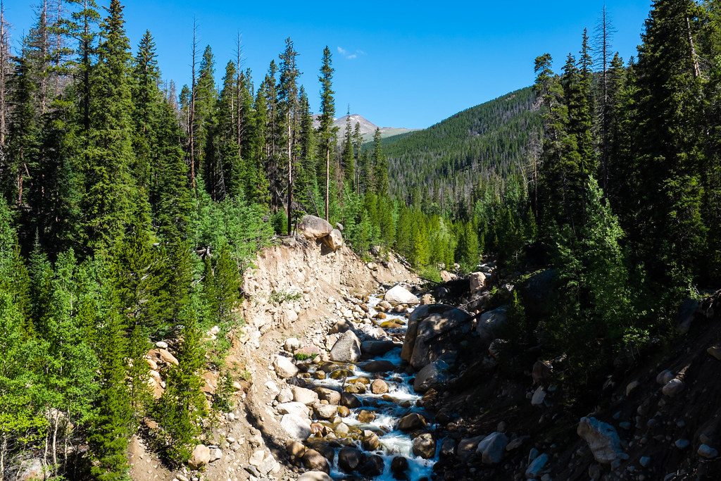
Expect a powerful cascade in a narrow gorge, with spray, cool air, and a front‑row angle from the lower platform. The Fall River corridor showcases classic glacial scenery; the river now cuts through resistant rock to form these stacked drops.
Getting There
When Old Fall River Road is open, look for the small pullout shortly after the road begins. From the pullout, it’s roughly 0.1 mile total with a brief, steep stair section to the viewpoint. If you’re approaching from the Fall River Entrance, it’s about 2.1 miles to the right turn onto Endovalley/Old Fall River Road, then roughly 0.8 miles to the falls pullout.
Road Status and Seasonal Access
Old Fall River Road is a one‑way, uphill, graded dirt/gravel road open in the warm months, then closed to vehicles in winter. In the off‑season, you can walk or bike from the winter gate for a quieter, car‑free visit (about 2.2 miles round trip to the falls). Summer brings more traffic; once you pass the pullout you’ll continue uphill—plan your stop.
Best Time to Visit
- Summer: Easiest access by car; go early to beat the pullout crunch.
- Spring: Snowmelt boosts flow, but the road is often still closed—hike or bike from the gate.
- Late fall: Catch it before ice sets in for a serene experience.
For photography, late‑day light helps avoid harsh shadows in the chasm.
Wildlife and Safety
Keep an eye out in the valley for marmots and bighorn sheep. The steps and rocks can be wet and slick—watch your footing and stay behind the railings. Weather shifts fast; bring a layer even for a short stop.
Practical Notes
There’s no toilet at the viewpoint; use facilities before starting up Old Fall River Road (Endovalley/Alluvial Fan are the usual go‑tos). Parking is a small pullout with quick turnover, but it can back up on busy summer weekends.
Bottom Line
It’s a textbook quick‑win stop: minimal effort, dramatic waterfall, and a classic taste of the Old Fall River Road vibe. If you’re already driving the road, don’t skip it.
Where it is
40.4169, -105.6725Tips for Chasm Falls
- 01If Old Fall River Road is closed, start at the winter gate near Endovalley and walk or bike about 2.2 miles round trip to the falls [alltrails.com](https://www.alltrails.com/trail/us/colorado/chasm-falls-hike).
- 02In summer, arrive early; the small pullout fills and the road is one-way uphill [alltrails.com](https://www.alltrails.com/trail/us/colorado/chasm-falls-hike).
- 03From the Fall River Entrance, go 2.1 miles, turn right onto Endovalley/Old Fall River Road; the falls pullout is roughly 0.8 miles from that turn [eptrail.com](https://www.eptrail.com/2024/11/21/hike-of-the-week-catch-a-view-of-chasm-falls-before-it-freezes/).
- 04Pair this stop with nearby Alluvial Fan along the same access road to maximize the drive [nps.gov](https://www.nps.gov/romo/planyourvisit/alluvial-fan-wedding-site.htm).
- 05For softer light and less glare in the chasm, aim for late afternoon.
Amenities
Near Chasm Falls
All places →All trails →
0.8 mi awayEndo ValleyRiverside picnic loop at the base of Old Fall River RoadPicnic Table · Restroom
1.2 mi awayRainbow Curve OverlookTreeline pullout with sweeping valley views and storm-made rainbowsPullout · Parking
1.8 mi awayHidden ValleyFamily sledding hill and year-round picnic spot with flush bathroomsRestroom · Parking
1.9 mi awayYpsilon LakeQuieter alpine lake with a waterfall and optional high-country scrambleScenic Viewpoint
2.2 mi awayAlluvial FanShort, mostly paved stroll to boulder field cascades and big viewsEasy · 0.6 mi · 14 min
2.5 mi awayYpsilon Lake TrailSteady, quieter climb to a pretty subalpine lake and waterfallsModerate · 9.4 mi · 4.8 hr
2.5 mi awayLawn Lake TrailLong, quiet climb to a storied alpine lake and 1982 flood scarsModerate · 12.5 mi · 7 hr
3.2 mi awayTundra Communities TrailShort, high-alpine stroll to mushroom rocks and 360-degree viewsEasy · 1.1 mi · 42 min