Parking
Crescent Meadow Picnic Area at the end of Moro Rock / Crescent Meadow Road. The small lot may fill; seasonal restrooms and picnic tables are at the trailhead.
#10 of 99 trails in Sequoia
Sequoia National Park, CA
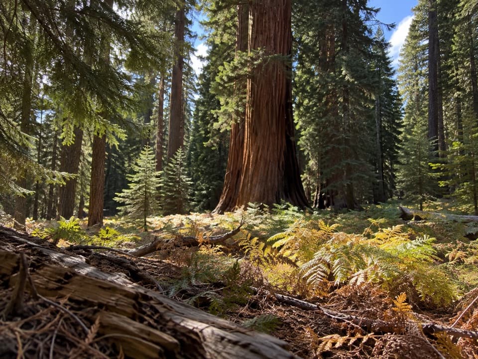
A short loop where giant sequoias frame Crescent Meadow.
Overview
Map & elevation
Plan your hike

The highest, rockiest slopes around here are a summer buffet for grizzly bears.
Sequoia Tour Guide
Parkwolf is a GPS audio tour guide for Sequoia National Park. As you drive, it chimes in with what’s ahead: hidden gems, upcoming stops, history, geology, and wildlife, right through your car’s speakers.
See the Sequoia audio tourRecorded for this trailhead
Crescent Meadow and Tharp’s Log“Crescent Meadow is coming up, an open wetland ringed by giant sequoias, with picnic tables near the trailhead. Stop here if you'd like a gentler outing with room to see the red trunks against the meadow grass.”
Plays as you drive up to this trailhead in the Parkwolf Sequoia Tour Guide.
More stories near here in the app
“…The kids and my husband and I all agree that the narration really added to our experience driving through the parks. We learned so much about the history and the flora & fauna.”


Trail guide
Crescent Meadow Loop is an easy, roughly 1.4-mile circuit from the picnic-area trailhead, skirting a meadow beneath giant sequoias. Plan about an hour so you can pause at the meadow edge and look for birds or seasonal flowers. The route sits high in the grove, around 6,700 feet, but it is short and mostly gentle.
From the Crescent Meadow access, the path briefly shares the High Sierra Trail before the loop turns toward the meadow. Follow the loop around its edge; several junctions lead toward longer hikes. The short route mixes packed dirt with partly paved stretches and a short wooden bridge. It is not a uniformly paved path. Some branches lead farther toward Log Meadow and Tharp’s Log; those are longer outings beyond this loop.
The main draw is the contrast between the open green meadow and the red trunks around it. Early light makes that color difference stand out. Wildflowers are seasonal, and birds are often heard around the meadow, but neither is guaranteed on a particular visit. If you photograph the scene, frame the meadow against the sequoia trunks rather than treating the forest alone as the whole view.
This entry follows the standalone loop: the mapped line measures about 1.32 miles, rounded here to 1.4. Independent loop descriptions range from about 1.3 to 1.5 miles. A roughly 1.8-mile round-trip figure is also used for an outing whose directions continue toward Log Meadow and Tharp’s Log; that may include the longer connection. The route here does not add that extension.
Bears are sometimes seen in meadows, particularly in spring and early summer. Keep well back and never approach or feed wildlife. Dogs are not allowed on the trail. The path is partly paved and may work for some visitors, but the dirt sections mean accessibility depends on individual ability.
The trail begins at Crescent Meadow Picnic Area at the end of Moro Rock / Crescent Meadow Road. The small parking area can fill; during summer weekends, private vehicles cannot use the road and visitors reach the meadow by shuttle. Snow closes the road in winter, when access is on foot, skis, or snowshoes. Picnic tables and seasonal restrooms are at the trailhead.
Wildlife
 691 sightingsBlack BearMost seen around 6 PMSighting map
 17 sightingsMountain LionMost seen around 6 AMSighting map
 18 sightingsBobcatMost seen around 7 PMSighting map
 24 sightingsCoyoteMost seen around 7 PMSighting map
 15 sightingsGolden EagleMost seen around 11 AMSighting map
 20 sightingsSpotted OwlMost seen around 7 PMSighting map
Sighting maps show where each species has been reported across Sequoia. Wildlife moves, so no sighting is guaranteed.
Keep exploring
 EasyEagle View Trail1.5 mi · 1.5 hr · At the trailheadA short climb from Crescent Meadow to a sweeping Sierra view.
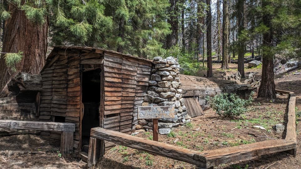 EasyLog Meadow Loop and Tharp’s Log1.8 mi · 1.5 hr · At the trailheadA cabin built inside a fallen sequoia is the unusual payoff.
 ModerateBobcat Point Loop1.3 mi · 1 hr · At the trailheadMorteros and a close Moro Rock view on a short loop.
 ChallengingHigh Sierra Trail48.9 mi · 1.7 days · At the trailheadA 49-mile wilderness crossing from Giant Forest to the John Muir Trail.
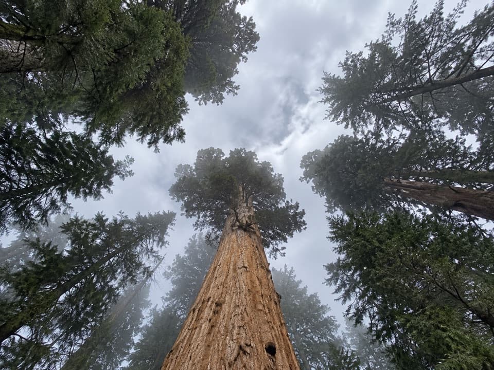 ModerateTrail of the Sequoias3.3 mi · 2.3 hr · At the trailheadQuiet sequoia traverse from Crescent Meadow to the Congress Trail.
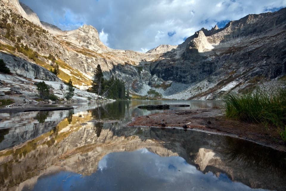 ChallengingHamilton Lakes Trail30.2 mi · 18 hr · At the trailheadA high granite lake, reached by an exposed Sierra traverse.
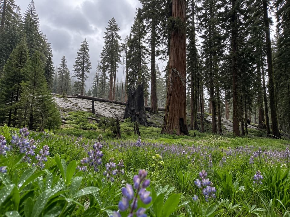 ModerateCircle Meadow Loop4.3 mi · 2.5 hr · At the trailheadA meadow circuit through Giant Forest's wildflowers and sequoias.
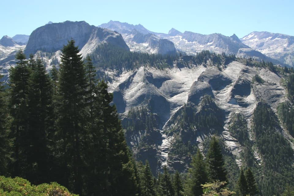 ChallengingBearpaw Meadow via High Sierra Trail22.8 mi · 16 hr · At the trailheadA long Sierra traverse opens to Kaweah canyon and Bearpaw Camp.
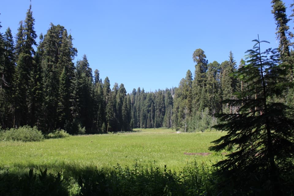 Sight · 0.1 mi awayCrescent MeadowAn open meadow framed by giant sequoias, with two memorable tree stops.
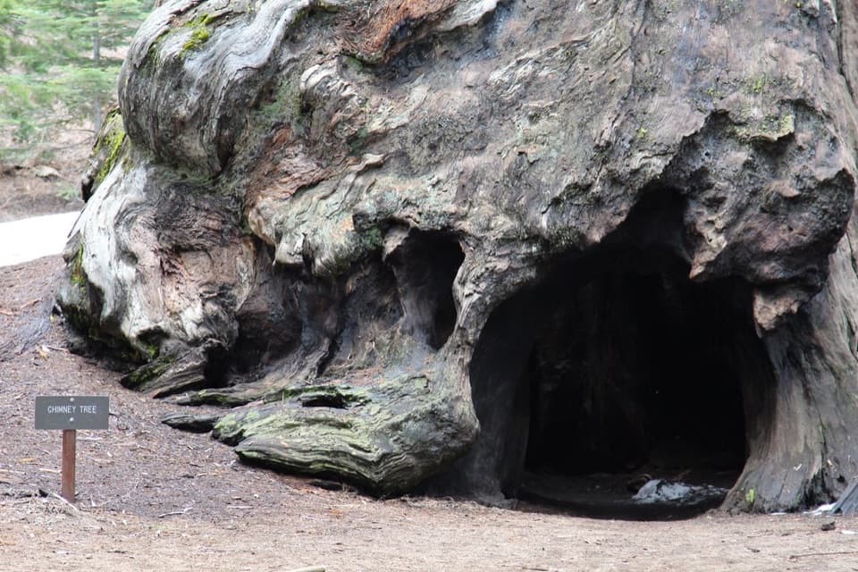 Sight · 0.4 mi awayChimney TreeStep inside the hollow left by a 1914 fire.
 Sight · 0.4 mi awaySquatters CabinA tiny log cabin anchors a larger Kaweah Colony story.Sight · 0.5 mi awayTharp's LogA 70-foot sequoia log became a summer cabin.
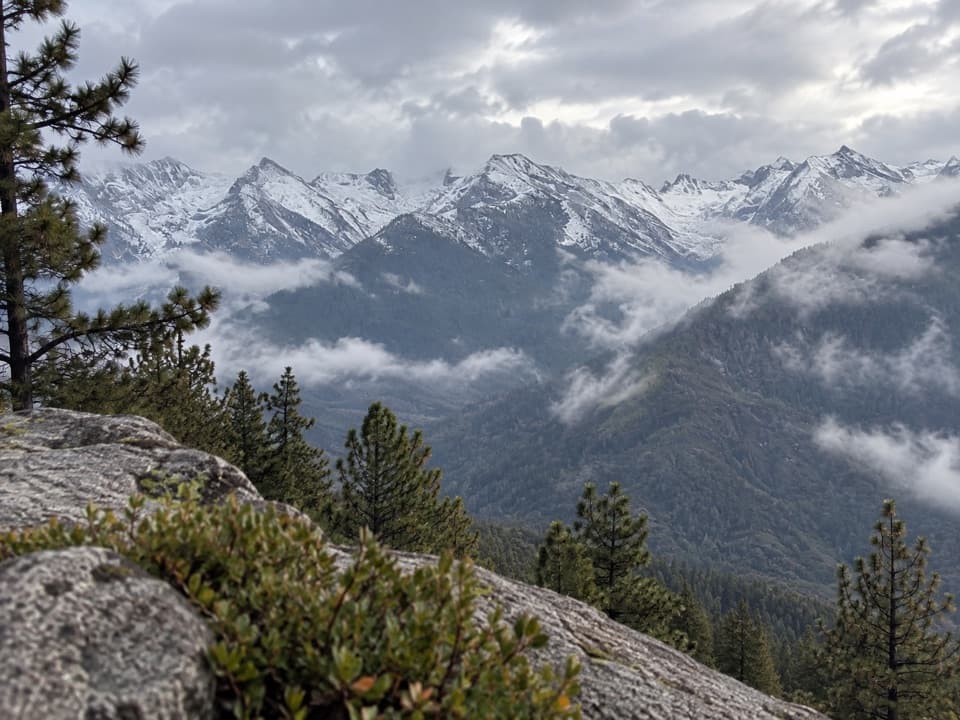 Sight · 0.6 mi awayEagle ViewA short climb to a long look across the high Sierra.
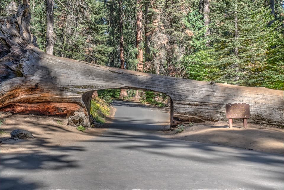 Sight · 0.7 mi awayTunnel LogDrive through a fallen giant sequoia on Crescent Meadow Road.
 Sight · 0.9 mi awayParker GroupEight sequoias, close enough to study their fire scars.
 Sight · 1 mi awayButtress TreeA fallen giant sequoia with an astonishingly broad root plate.
Parkwolf’s Sequoia ranking

The audio tour guide for the drive, plus offline maps, trails, and wildlife heatmaps for when the signal drops.




