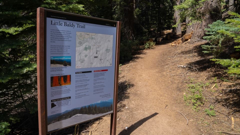
Little Baldy Trail in Sequoia National Park

Sequoia National Park, CA

Little Baldy Trail

Switchbacks climb to an open granite dome with High Sierra views.

Photo: National Park Service
Length
3.4mi
Time
2.5hr
Elev. change
705ft
Difficulty
Moderate
  • No dogs
  • High point 8,040 ft
  • #24 of 99 in Sequoia

Hear the audio tour

Little Baldy

Overview

About Little Baldy Trail

Why go

  • A short climb reaches a broad 360-degree granite-dome panorama.
  • A shaded conifer ascent gives way to an open, exposed summit.

Heads up

  • The final push is a steep scramble over exposed, uneven granite.
  • The roadside pullout is easy to miss and has no designated accessible parking.
Little Baldy Trail is a 3.4-mile out-and-back from Little Baldy Saddle to the summit dome. The National Park Service gives it 2–3 hours, with 790 feet of climbing on the 1.7-mile uphill leg. It is a good choice when you want a summit and a broad view without a long day of mileage. The climb is steady, then the finish crosses steep, open granite in a short scramble. That last bit asks for sure footing and comfort on rough rock.
Parkwolf’s verdictIs this the hike for you?

Map & elevation

The route

Loading the Sequoia map
Full map
Elevation7,335–8,040 ft
TrailheadLittle Baldy Trailhead at Little Baldy Saddle36.62048, -118.80918
Keep this map with you offline in the Parkwolf app

Plan your hike

Before you go

Parking

Paved roadside pullouts at Little Baldy Saddle on Generals Highway serve the trailhead, about six miles north of Lodgepole. The signed route starts on the east side; the pullout can be easy to miss, and there is no designated accessible parking.

Best time to go

The trail can be hiked year-round, though summer and fall are the recommended seasons. Ice and deep snow can appear in winter and early spring. The route has uneven, rocky ground and no smooth path over the final dome. Pets are not allowed on park trails. No reservation or activity fee is required for this hike, though park entrance fees may apply.

Safety

The summit approach is a short, steep scramble over exposed granite. Winter and early spring can bring ice and deep snow. Pets are prohibited on park trails.

8 active Sequoia alerts

  • InfoGenerals Highway weekday hazard-tree removal delaysMentions Generals Highway, referenced in this guideExpect weekday delays of up to 30 minutes total on Generals Highway between Highway 180 and Giant Forest, 8 a.m.–5 p.m., while crews remove hazard trees; the highway remains open.Official details
  • CautionStage 1 fire restrictionsStage 1 fire restrictions are in effect due to high fire danger and catastrophic-wildfire risk; the restrictions reduce the possibility of accidental human-caused fires that could threaten visitors…Official details
See all 8 alerts
A park ranger sits on a dash-mounted phone, talking, as Parkwolf’s Tour Guide plays “Army Cutworm Moths: A Grizzly Bear Buffet” on Grand Loop Road below Dunraven Pass in Yellowstone
Parkwolf Tour GuideThe highest, rockiest slopes around here are a summer buffet for grizzly bears.

Sequoia Tour Guide

Your drive to Little Baldy Trail, narrated.

Parkwolf is a GPS audio tour guide for Sequoia National Park. As you drive, it chimes in with what’s ahead: hidden gems, upcoming stops, history, geology, and wildlife, right through your car’s speakers.

See the Sequoia audio tour

Recorded for this trailhead

Little Baldy
0:00 / 0:24
“You're approaching the Little Baldy trailhead, for a forest climb to an open granite dome with Great Western Divide views. Allow two to three hours for about three and a half miles round trip.”

Plays as you drive up to this trailhead in the Parkwolf Sequoia Tour Guide.

More stories near here in the app

  • Dorst Creek Campground and Muir Grove
  • Scratches Left by Ice
  • Halstead Meadow Picnic Area
  • A Pika's Winter Harvest
  • 71 audio storiesacross Sequoia’s roads, triggered by GPS as you drive
  • Wildlife heatmapsfor Black Bear, Mountain Lion, Bobcat, and 13 more
  • Works offlinemaps, 99 trails, 68 places, and audio download before you lose signal
  • CarPlay readysimple controls built for the drive
★★★★★
“…The kids and my husband and I all agree that the narration really added to our experience driving through the parks. We learned so much about the history and the flora & fauna.”
JessestblondeApp Store review
Download Parkwolf on the App StoreGet Parkwolf on Google Play

4.7 from 8,600+ ratings

Trail guide

Hiking Little Baldy Trail

From the saddle into the forestLook for the signed trailhead on the east side of Generals Highway at Little Baldy Saddle,…

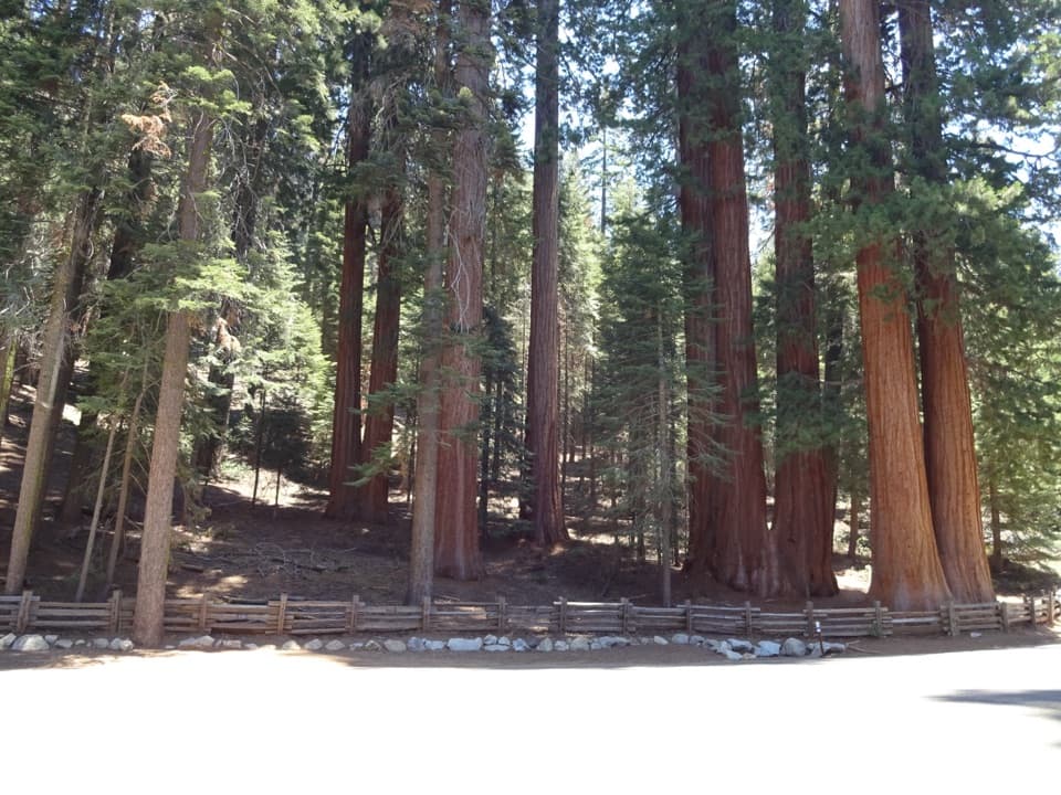
Look for the signed trailhead on the east side of Generals Highway at Little Baldy Saddle, about six miles north of Lodgepole. The paved roadside pullouts are easy to miss and have no designated accessible parking. The path starts climbing through mixed conifers, with steps and a couple of short turns before a longer, shaded ascent. Small openings begin early; by about four-tenths of a mile, the view west toward Big Baldy is clearer. Wildflowers add color in season. This is a forested climb toward a granite summit, not a walk through the park’s giant sequoia groves.

Three switchbacks, then the burnThree longer switchbacks between roughly half a mile and eight-tenths of a mile account for…

Three longer switchbacks between roughly half a mile and eight-tenths of a mile account for most of the climb. Beyond them, the trail levels and dips through a burned patch, with standing and fallen trunks among the trees. It turns south, and Little Baldy stays out of sight for a while. Around 1.3 miles in, you cross a small rise and a sunny open section before the final climb.

The dome and the viewThe last stretch climbs a rocky crag and crosses onto the smooth, exposed granite of Little…

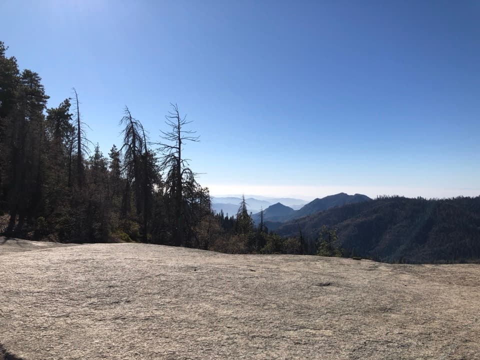
The last stretch climbs a rocky crag and crosses onto the smooth, exposed granite of Little Baldy Dome. It is a short but steep scramble; take your time on the descent and look for the trail where you left it. The top has room to sit, but little shelter. Views reach the Great Western Divide, Kaweah Peaks, Silliman Crest, and Alta Peak; on a clear day, you can see west across the Central Valley. Turn in place for the full panorama, or frame the eastern ridgeline above the bare granite foreground.

Wildlife

Wildlife in Sequoia

All Sequoia wildlife maps

Sighting maps show where each species has been reported across Sequoia. Wildlife moves, so no sighting is guaranteed.

Keep exploring

Near Little Baldy Trail

See it all on the map

Trails that start nearby

Places near the trailhead

Parkwolf’s Sequoia ranking

Top-rated trails in Sequoia

All 99 trails
  1. 1Congress TrailEasy · 2.7 mi
  2. 2General Sherman Tree TrailModerate · 1 mi
  3. 3Moro Rock TrailModerate · 0.5 mi
  4. 4High Sierra TrailChallenging · 48.9 mi
  5. 5Mount Whitney TrailChallenging · 22 mi
  6. 6Lakes Trail to Pear LakeChallenging · 12.8 mi

Take Parkwolf to Sequoia.

The audio tour guide for the drive, plus offline maps, trails, and wildlife heatmaps for when the signal drops.

4.7 from 8,600+ ratings

Download Parkwolf on the App StoreGet Parkwolf on Google Play