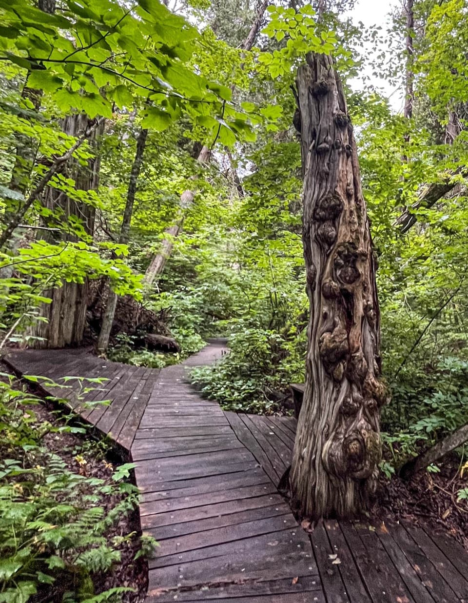
South Manitou Old-Growth Cedars in Sleeping Bear Dunes National Lakeshore

Sight · Sleeping Bear Dunes National Lakeshore

South Manitou Old-Growth Cedars

A quiet walk among cedars several centuries old.

Photo: National Park Service
Type
Sight
Nearest trail
2.6 mi
  • Trailhead
  • #16 of 72 sights
Parkwolf audio tour73 stories across Sleeping Bear Dunes’s roads

Overview

About South Manitou Old-Growth Cedars

Why stop

  • Boardwalks and benches bring you close to the trunks.

Heads up

  • The roughly seven-mile round trip takes a large share of an island visit.
Its isolation and proximity to the dunes are thought to have helped it escape logging. A local account places the stand against early-1900s logging activity on the island. Together, those details explain why this small pocket of forest is such an unusual stop.
Parkwolf’s verdictWhy this grove survived

Map

Where it is

Loading the Sleeping Bear Dunes map
Full map
SightSouth Manitou Old-Growth Cedars45.00350, -86.14757
Keep this map with you offline in the Parkwolf app

Plan your stop

Before you go

1 active Sleeping Bear Dunes alert

  • ClosureManitou Islands access closures during 2026 constructionNorth and South Manitou Islands have limited visitor access throughout the 2026 season: all facilities, docks, and utilities on both islands remain closed during major construction.Official details

Sleeping Bear Dunes alerts
A park ranger sits on a dash-mounted phone, talking, as Parkwolf’s Tour Guide plays “Army Cutworm Moths: A Grizzly Bear Buffet” on Grand Loop Road below Dunraven Pass in Yellowstone
Parkwolf Tour GuideThe highest, rockiest slopes around here are a summer buffet for grizzly bears.

Sleeping Bear Dunes Tour Guide

Your drive to South Manitou Old-Growth Cedars, narrated.

Parkwolf is a GPS audio tour guide for Sleeping Bear Dunes National Lakeshore. As you drive, it chimes in with what’s ahead: hidden gems, upcoming stops, history, geology, and wildlife, right through your car’s speakers.

  • 73 audio storiesacross Sleeping Bear Dunes’s roads, triggered by GPS as you drive
  • Wildlife heatmapsfor Piping Plover, Bald Eagle, White-tailed Deer, and 13 more
  • Works offlinemaps, 34 trails, 89 places, and audio download before you lose signal
  • CarPlay readysimple controls built for the drive
★★★★★
“Fantastic app with many points of information… It’s great to just turn on while you’re driving and it gives you an audio tour of the national Park. We love it!!!!”
JMJamesApp Store review
Download Parkwolf on the App StoreGet Parkwolf on Google Play

4.7 from 8,600+ ratings

Guide

More about South Manitou Old-Growth Cedars

A hike to the groveSouth Manitou Old-Growth Cedars is a small grove of northern white cedars in the southwest…

South Manitou Old-Growth Cedars is a small grove of northern white cedars in the southwest corner of South Manitou Island, also called the Valley of the Giants. The draw is walking among some of the region’s oldest and largest white cedars, with the trees close around you.

Make this the main hike of an island visit. It’s about seven miles round trip, so it takes a real chunk of the day. When ferry access is operating, reach South Manitou from Leland, then continue to the grove on foot.

Among the treesBoardwalks and benches carry the path through the grove and let you pause close to the trunks.

Boardwalks and benches carry the path through the grove and let you pause close to the trunks. There’s no broad overlook across a valley of trees; the reward is being inside the stand. For a photo, include a stretch of boardwalk beside a trunk so the planks give the tree a sense of scale.

Cedars measured in centuriesMany of the trees are estimated at 300 to 500 years old and can reach about 100 feet tall.

Many of the trees are estimated at 300 to 500 years old and can reach about 100 feet tall. A fallen cedar revealed 528 growth rings. The grove also includes a tree that was once the national champion white cedar.

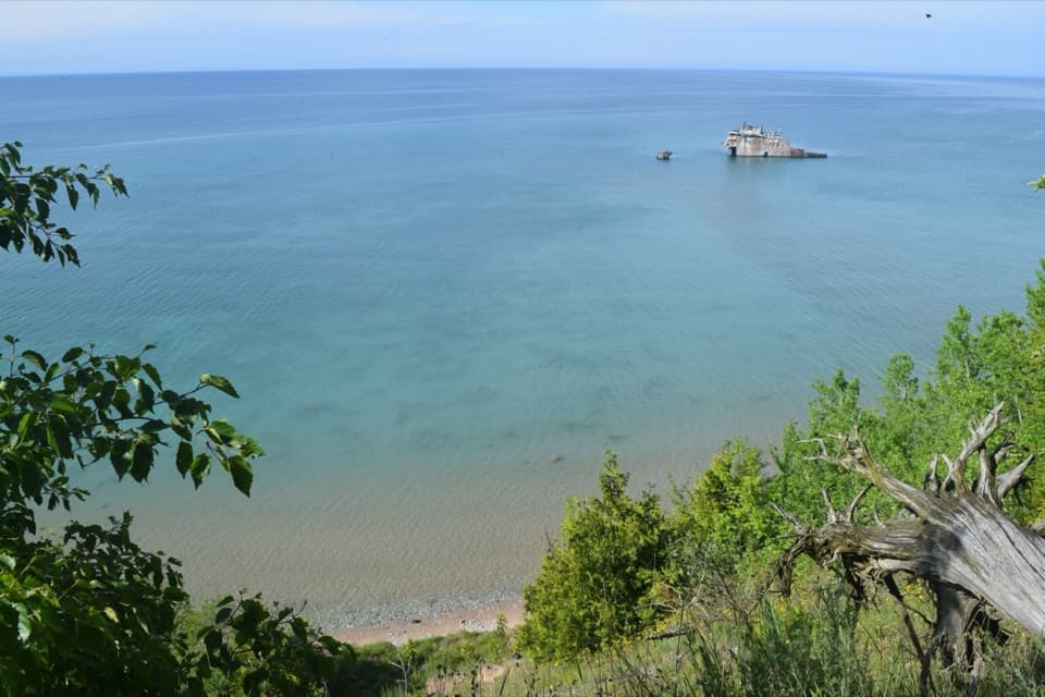
Add the shipwreck on the way backA beach route past the Francisco Morazan shipwreck is one option for the return, adding another…

A beach route past the Francisco Morazan shipwreck is one option for the return, adding another piece of the island’s story to the hike. Check the island route before setting out; current access can change.

Wildlife

Wildlife in Sleeping Bear Dunes

All Sleeping Bear Dunes wildlife maps

Sighting maps show where each species has been reported across Sleeping Bear Dunes. Wildlife moves, so no sighting is guaranteed.

Keep exploring

Near South Manitou Old-Growth Cedars

See it all on the map

Trails nearby

More stops nearby

Parkwolf’s Sleeping Bear Dunes ranking

Top sights in Sleeping Bear Dunes

All 89 places
  1. 1Dune ClimbSight
  2. 2Lake Michigan OverlookSight
  3. 3Pyramid Point OverlookSight
  4. 4Empire Bluff OverlookSight
  5. 5South Manitou Lighthouse ComplexSight
  6. 6North Bar BeachBeach

Take Parkwolf to Sleeping Bear Dunes.

The audio tour guide for the drive, plus offline maps, trails, and wildlife heatmaps for when the signal drops.

4.7 from 8,600+ ratings

Download Parkwolf on the App StoreGet Parkwolf on Google Play