Lago Sarmiento – Sendero de los Trombolitos in Torres del Paine National Park

Torres del Paine National Park, MA

Lago Sarmiento – Sendero de los Trombolitos

White thrombolites make this quiet Sarmiento shore unusual.

Length
4.9km
Time
2.5hr
Elev. change
67m
Difficulty
Easy
  • High point 146 m

Hear the audio tour

Lago Sarmiento: The Thrombolite Walk

Overview

About Lago Sarmiento – Sendero de los Trombolitos

Why go

  • Pale thrombolite formations right at the lake shore
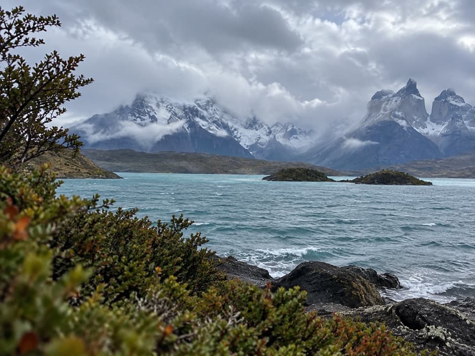
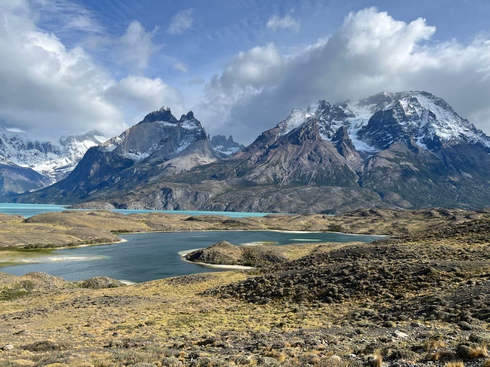
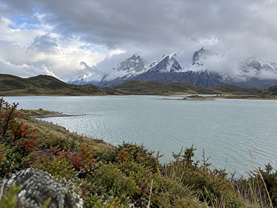
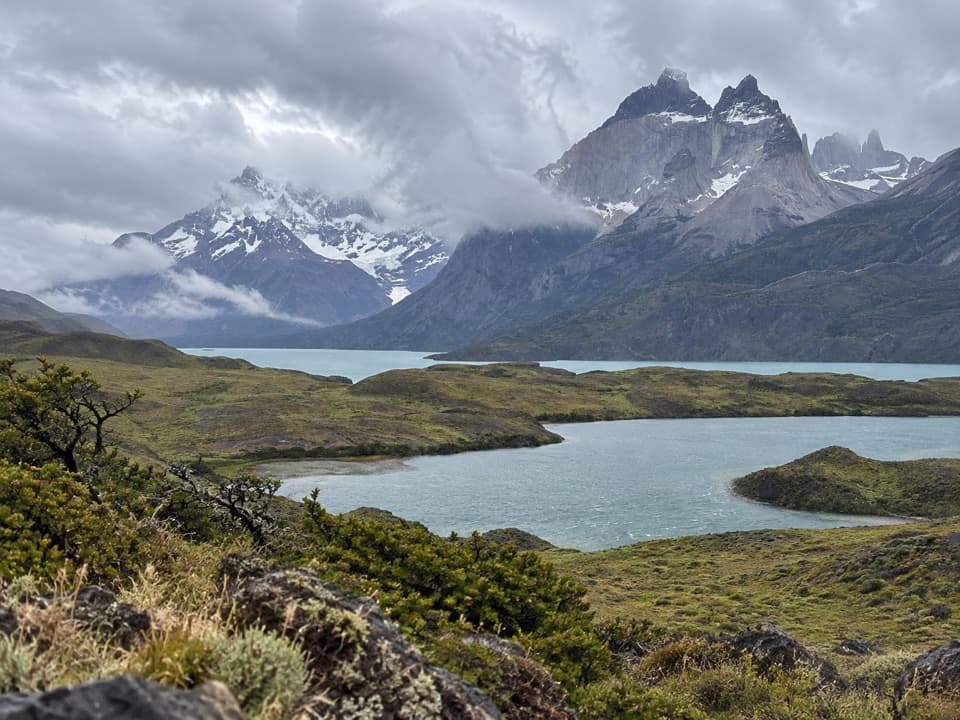
  • Views toward the Paine Horns and Almirante Nieto

Heads up

  • The exact shore access and public parking are poorly documented
  • Guided versions use different starts and distances

Map & elevation

The route

Loading the Torres del Paine map
Full map
Elevation79–146 m
TrailheadLago Sarmiento shore path (Ruta Y-150)-51.04625, -72.92244
Keep this map with you offline in the Parkwolf app

Plan your hike

Before you go

Parking

No named public parking area is verified for this access. The mapped footpath meets Ruta Y-150 at the north end of the route, but roadside parking and independent entry are unconfirmed; arrange access and a legal place to park with an operator or CONAF.

Safety

Public self-guided access to this shore path is unconfirmed. Confirm permission and the exact meeting point with CONAF or an operator before going; the Portería Sarmiento–Laguna Amarga walk is a different route.

2 active Torres del Paine alerts

  • ClosureInternal Y-150 road closedThe internal Y-150 road between Sarmiento and Laguna Los Cisnes is closed. - This is the internal road segment; CONAF lists the separate Y-150 access road to Sarmiento as open.Official details
  • CautionOne-way and guide-only trail restrictionsPlan around CONAF’s current one-way and guide-only trail restrictions.Official details
Torres del Paine alerts
A park ranger sits on a dash-mounted phone, talking, as Parkwolf’s Tour Guide plays “Army Cutworm Moths: A Grizzly Bear Buffet” on Grand Loop Road below Dunraven Pass in Yellowstone
Parkwolf Tour GuideThe highest, rockiest slopes around here are a summer buffet for grizzly bears.

Torres del Paine Tour Guide

Your drive to Lago Sarmiento – Sendero de los Trombolitos, narrated.

Parkwolf is a GPS audio tour guide for Torres del Paine National Park. As you drive, it chimes in with what’s ahead: hidden gems, upcoming stops, history, geology, and wildlife, right through your car’s speakers.

See the Torres del Paine audio tour

Recorded for this trailhead

Lago Sarmiento: The Thrombolite Walk
0:00 / 0:27
“You're coming up on the access path for Sendero de los Trombolitos, the Lago Sarmiento shore walk.”

Plays as you drive up to this trailhead in the Parkwolf Torres del Paine Tour Guide.

More stories near here in the app

  • Nordenskjöld: A View from the Road
  • The Rhea Dad on Duty
  • The Life in a Patch of Lichen
  • Los Cisnes Lagoon: Watch the Waterbirds
  • 81 audio storiesacross Torres del Paine’s roads, triggered by GPS as you drive
  • Wildlife heatmapsfor Puma, Andean Condor, Guanaco, and 13 more
  • Works offlinemaps, 35 trails, 56 places, and audio download before you lose signal
  • CarPlay readysimple controls built for the drive
★★★★★
“Fantastic app with many points of information… It’s great to just turn on while you’re driving and it gives you an audio tour of the national Park. We love it!!!!”
JMJamesApp Store review
Download Parkwolf on the App StoreGet Parkwolf on Google Play

4.7 from 8,600+ ratings

Trail guide

Hiking Lago Sarmiento – Sendero de los Trombolitos

The shoreline walkThis easy 4.95 km (3.

This easy 4.95 km (3.1 mi) out-and-back reaches the south shore of Lago Sarmiento, where pale thrombolite formations make the walk worth the effort. Allow about 2.5 hours with time to look around. One current guided itinerary lists a shorter 4 km version, so confirm your operator’s start and route before using this distance.

A short walk to the beachThe mapped route begins at a footpath beside Ruta Y-150, crosses open low vegetation, then…

The mapped route begins at a footpath beside Ruta Y-150, crosses open low vegetation, then descends to the lake shore and returns the same way. The Paine Horns and Almirante Nieto rise in the wider view. The recorded route is easy, with about 100 m of ascent and descent; the exact footing beyond the mapped path is not well described.

What the pale formations areThose knobbly carbonate structures are thrombolites, built as microbial communities help…

Those knobbly carbonate structures are thrombolites, built as microbial communities help deposit calcium carbonate. Living forms continue below the water, while older structures are exposed along the shore. Their microbial lineage is ancient, but the visible formations are not billions of years old; that age refers to early microbial life, not these deposits.

Check access before you goThis is the shore walk to the formations, not the separate route between Portería Sarmiento and…

This is the shore walk to the formations, not the separate route between Portería Sarmiento and Laguna Amarga. Public self-guided access and parking for this exact start are not confirmed. Arrange the outing with an operator or check with CONAF, and confirm the meeting point before driving out; the published guided versions do not all use the same distance.

Wildlife

Wildlife in Torres del Paine

All Torres del Paine wildlife maps

Sighting maps show where each species has been reported across Torres del Paine. Wildlife moves, so no sighting is guaranteed.

Keep exploring

Near Lago Sarmiento – Sendero de los Trombolitos

See it all on the map

Trails that start nearby

Places near the trailhead

Parkwolf’s Torres del Paine ranking

Top-rated trails in Torres del Paine

All 35 trails
  1. 1Base Las Torres TrailChallenging · 20.1 km
  2. 2W Trek (Circuito W)Challenging · 75.7 km
  3. 3O Circuit (Circuito Macizo Paine)Challenging · 93 km
  4. 4Mirador Británico TrailChallenging · 10.8 km
  5. 5Valle del FrancésChallenging · 20 km
  6. 6Paine Grande to Refugio Grey TrailModerate · 11 km

Take Parkwolf to Torres del Paine.

The audio tour guide for the drive, plus offline maps, trails, and wildlife heatmaps for when the signal drops.

4.7 from 8,600+ ratings

Download Parkwolf on the App StoreGet Parkwolf on Google Play