Mirador Cóndor Trail in Torres del Paine National Park

#8 of 35 trails in Torres del Paine

Torres del Paine National Park, MA

Mirador Cóndor Trail

A short, steep climb to a sweeping Pehoé and Paine panorama.

Photo: Wikimedia Commons
Length
2.4km
Time
1.5hr
Elev. change
206m
Difficulty
Moderate
  • No dogs
  • High point 249 m

Hear the audio tour

Mirador Cóndor from Pehoé

Overview

About Mirador Cóndor Trail

Why go

  • A huge Pehoé and Paine panorama for a short hike
  • Condors may ride the rising air above the cliffs

Heads up

  • A steep, loose-gravel climb
  • The open ridge can be hit by powerful gusts
Mirador Cóndor is a 1.5-mile out-and-back from the Camping Pehoé access to a broad, rocky lookout above Lago Pehoé. It packs a steady climb and a huge lake-and-mountain panorama into about 1.5 hours. It’s a good choice when you want a short hike with a real summit feel; the exposed top makes it more demanding than the mileage suggests.
Parkwolf’s verdictIs it worth the climb?

Map & elevation

The route

Loading the Torres del Paine map
Full map
Elevation43–249 m
TrailheadCamping Pehoé (Mirador Cóndor access)-51.10807, -72.98542
Keep this map with you offline in the Parkwolf app

Plan your hike

Before you go

Parking

Use the Camping Pehoé access as the trailhead area. The mapped hiking line begins a short walk from the campsite access; nearby Hostería and roadside approaches are separate options. Parking capacity, fees and day-use terms were not verified.

Safety

The upper ridge and narrow passage between cliffs are highly exposed; powerful gusts can affect balance. Loose gravel on the steep climb can slip. Turn back before the ridge if the wind is pushing you around.

2 active Torres del Paine alerts

  • ClosureInternal Y-150 road closedThe internal Y-150 road between Sarmiento and Laguna Los Cisnes is closed. - This is the internal road segment; CONAF lists the separate Y-150 access road to Sarmiento as open.Official details
  • CautionOne-way and guide-only trail restrictionsPlan around CONAF’s current one-way and guide-only trail restrictions.Official details
Torres del Paine alerts
A park ranger sits on a dash-mounted phone, talking, as Parkwolf’s Tour Guide plays “Army Cutworm Moths: A Grizzly Bear Buffet” on Grand Loop Road below Dunraven Pass in Yellowstone
Parkwolf Tour GuideThe highest, rockiest slopes around here are a summer buffet for grizzly bears.

Torres del Paine Tour Guide

Your drive to Mirador Cóndor Trail, narrated.

Parkwolf is a GPS audio tour guide for Torres del Paine National Park. As you drive, it chimes in with what’s ahead: hidden gems, upcoming stops, history, geology, and wildlife, right through your car’s speakers.

See the Torres del Paine audio tour

Recorded for this trailhead

Mirador Cóndor from Pehoé
0:00 / 0:26
“Up ahead is the Camping Pehoé area, one starting point for Mirador Cóndor.”

Plays as you drive up to this trailhead in the Parkwolf Torres del Paine Tour Guide.

More stories near here in the app

  • Salto Chico and the Explora Lodge
  • Lago Pehoé and the Island Hotel
  • Finding South with the Cross
  • Green Ground, Missing Forest
  • 81 audio storiesacross Torres del Paine’s roads, triggered by GPS as you drive
  • Wildlife heatmapsfor Puma, Andean Condor, Guanaco, and 13 more
  • Works offlinemaps, 35 trails, 56 places, and audio download before you lose signal
  • CarPlay readysimple controls built for the drive
★★★★★
“Fantastic app with many points of information… It’s great to just turn on while you’re driving and it gives you an audio tour of the national Park. We love it!!!!”
JMJamesApp Store review
Download Parkwolf on the App StoreGet Parkwolf on Google Play

4.7 from 8,600+ ratings

Trail guide

Hiking Mirador Cóndor Trail

How the route unfoldsThe marked path climbs along the slope, eases briefly across a flatter patch with dead lenga…

The marked path climbs along the slope, eases briefly across a flatter patch with dead lenga trees, then rises again. Expect loose gravel and dirt underfoot. Near the top the tread is briefly harder to pick out; stay with the established line until it becomes clear again. The final short rise leads onto a wide, fairly level rocky plateau.

Wind is the main catchThe upper ridge is open, and the narrow passage between cliffs can be difficult in strong gusts.

The upper ridge is open, and the narrow passage between cliffs can be difficult in strong gusts. Wind is the main reason this short hike can feel serious. Keep loose gear secured, and turn around before the ridge if gusts are affecting your balance.

The view from the topFrom the plateau you can look over Lago Pehoé and its small islands toward the Cuernos and the…

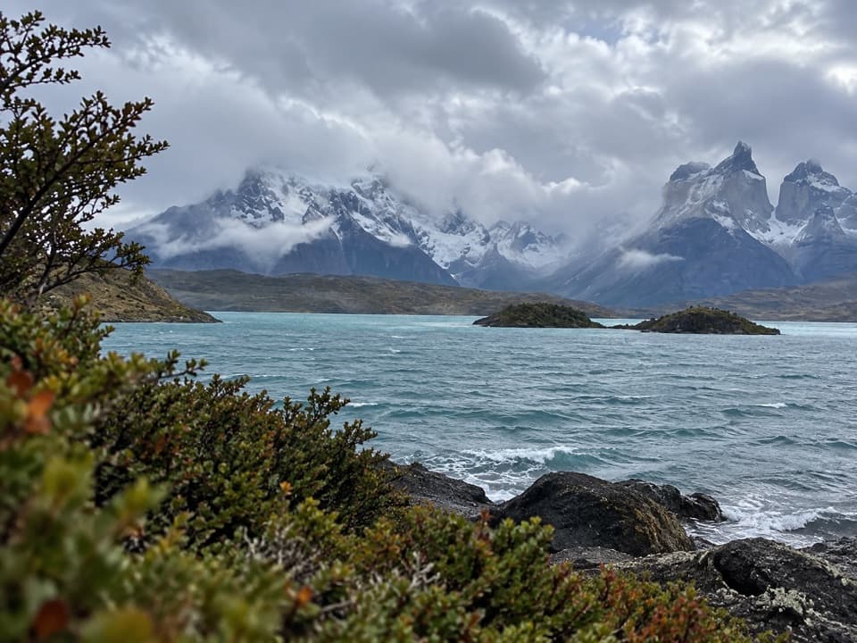
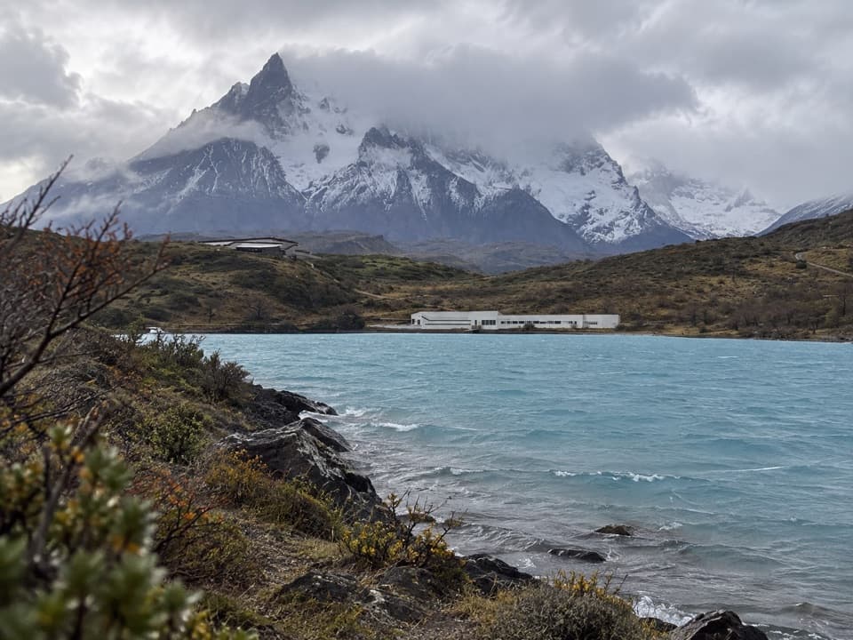
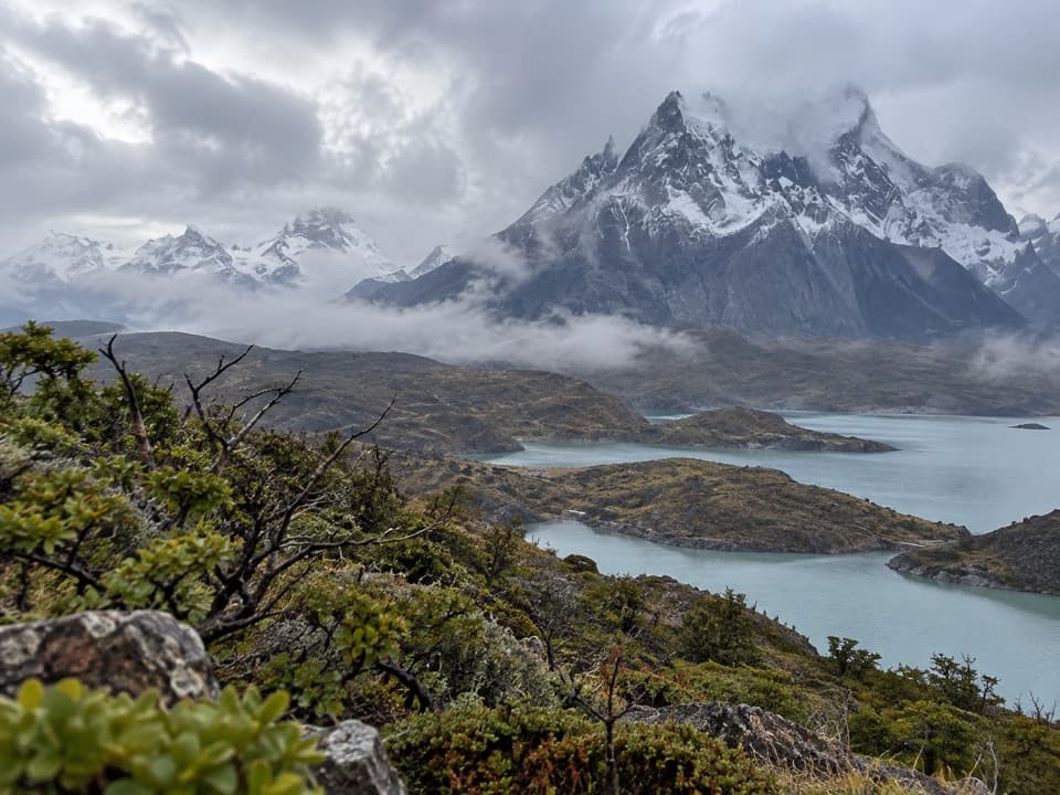
From the plateau you can look over Lago Pehoé and its small islands toward the Cuernos and the Paine massif; the wider panorama also takes in nearby lagoons, the Southern Patagonian Ice Field and Sierra Baguales. Andean condors sometimes glide on the air rising along the cliffs, but treat a sighting as a bonus. For a photo, keep the rocky ridge in the foreground so the lake and peaks have scale.

Start and park rulesThis record follows the Camping Pehoé approach; nearby Hostería and roadside starts describe…

This record follows the Camping Pehoé approach; nearby Hostería and roadside starts describe other ways to reach the same lookout and aren’t included in its mileage. Park admission is required. Pets aren’t allowed, and CONAF does not permit hiking after dark. The climb gains roughly 200 m; allow one to two hours with time at the top.

Wildlife

Wildlife in Torres del Paine

All Torres del Paine wildlife maps

Sighting maps show where each species has been reported across Torres del Paine. Wildlife moves, so no sighting is guaranteed.

Keep exploring

Near Mirador Cóndor Trail

See it all on the map

Trails that start nearby

Places near the trailhead

Parkwolf’s Torres del Paine ranking

Top-rated trails in Torres del Paine

All 35 trails
  1. 1Base Las Torres TrailChallenging · 20.1 km
  2. 2W Trek (Circuito W)Challenging · 75.7 km
  3. 3O Circuit (Circuito Macizo Paine)Challenging · 93 km
  4. 4Mirador Británico TrailChallenging · 10.8 km
  5. 5Valle del FrancésChallenging · 20 km
  6. 6Paine Grande to Refugio Grey TrailModerate · 11 km

Take Parkwolf to Torres del Paine.

The audio tour guide for the drive, plus offline maps, trails, and wildlife heatmaps for when the signal drops.

4.7 from 8,600+ ratings

Download Parkwolf on the App StoreGet Parkwolf on Google Play