Parking
Begin at Hotel Las Torres in the eastern park sector; this route finishes back at Paine Grande, where the catamaran crosses Lago Pehoé to Pudeto. Arrange transport for both ends before starting; this is point-to-point.

#2 of 35 trails in Torres del Paine
Torres del Paine National Park, MA
The Towers, French Valley and Grey Glacier, linked on foot.
Overview
Map & elevation
Plan your hike

The highest, rockiest slopes around here are a summer buffet for grizzly bears.
Torres del Paine Tour Guide
Parkwolf is a GPS audio tour guide for Torres del Paine National Park. As you drive, it chimes in with what’s ahead: hidden gems, upcoming stops, history, geology, and wildlife, right through your car’s speakers.
See the Torres del Paine audio tourRecorded for this trailhead
Las Torres: Before the Climb“You're approaching the Las Torres sector, the starting area for the walk to the lake beneath the three granite towers.”
Plays as you drive up to this trailhead in the Parkwolf Torres del Paine Tour Guide.
More stories near here in the app
“Fantastic app with many points of information… It’s great to just turn on while you’re driving and it gives you an audio tour of the national Park. We love it!!!!”


Trail guide
The Circuito W is a point-to-point, multi-day trek of about 47 miles (76 km) across the south side of the Paine massif. This westbound version starts at Hotel Las Torres, walks the Base Torres arm out and back, continues west through Los Cuernos to Italiano, climbs the French Valley to Británico and returns to Italiano, then reaches Paine Grande. From there, the Grey arm is an out-and-back, ending back at Paine Grande. Allow about five days and 31.5 hours of walking for this full version; the catamaran across Lago Pehoé to Pudeto is separate from the trail distance. Some compressed four-day itineraries turn at the first Grey viewpoint, so confirm your Grey turnaround and booked nights. If you have only a day, Base Torres can be walked on its own, but you will miss the French Valley and Grey.
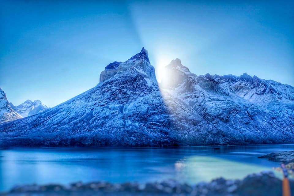
From Hotel Las Torres, the route climbs 5 km to Refugio Chileno, continues 3 km to Guardería Torres, then gains the last 1.4 km to the viewpoint. The full arm is 18.8 km return and about nine hours. The final stretch is the most demanding: it crosses glacial moraine, where the loose uneven ground can injure legs and joints. Stay on the marked path. At the viewpoint, the granite towers rise beyond a pale glacial lake; include the basin below them in a photo to give the peaks scale.
The main traverse from Hotel Las Torres to Los Cuernos is listed at 11.6 km and 4.5 hours. From Los Cuernos, it is 5 km and 2.5 hours to Italiano, then 7.5 km and 2.5 hours to Paine Grande. These are long sections between overnight stops, so keep the ranger station closing times in mind. Parts of the marked route cross Estancia Cerro Paine; follow the authorized trail rather than cutting across private land.
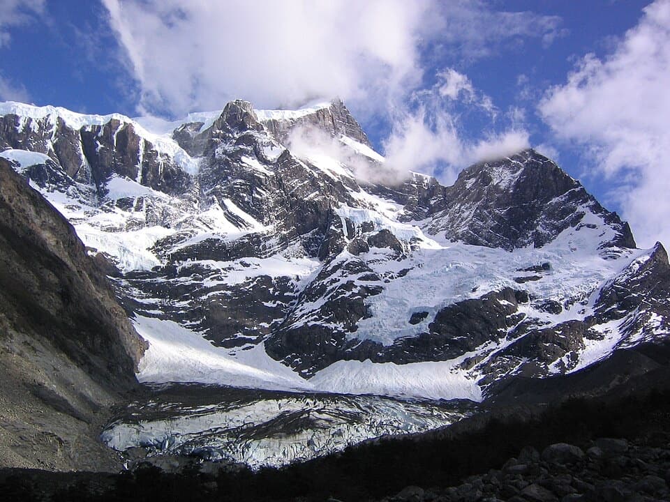
At Italiano, the French Valley branch climbs 5.4 km to Mirador Británico, about three hours each way. The full return detour adds 10.8 km and roughly six hours, and is rated demanding. From Británico, the Cuernos, Espada, Hoja and Máscara peaks sit to the west; Glaciar Francés cuts into Paine Grande to the east, with Fortaleza and Aleta de Tiburón to the north. The valley's Nothofagus woodland gives way to the open mountain view. For a photo, keep the forested valley in the foreground so the granite walls do not lose their scale.
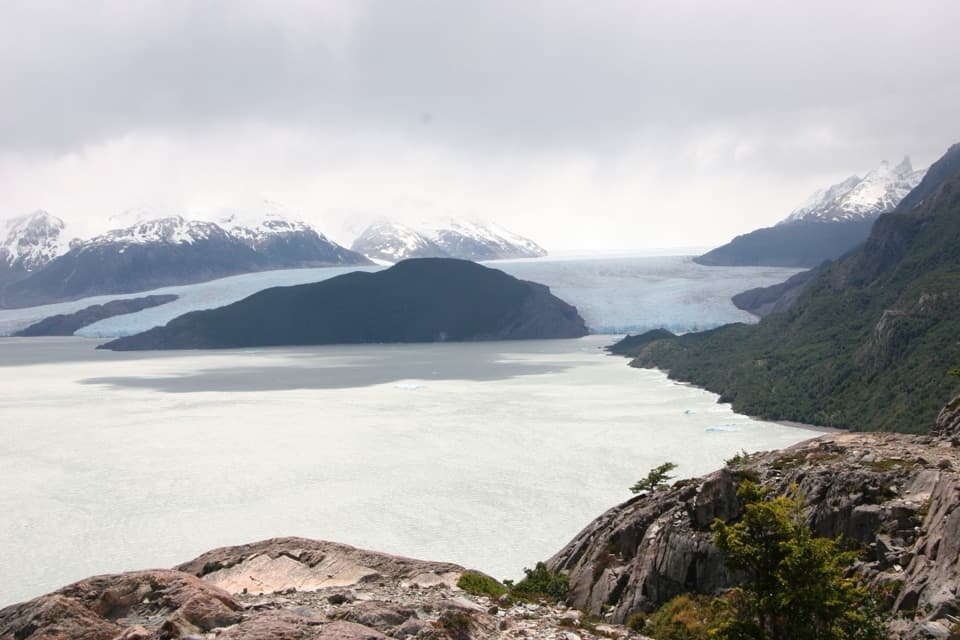
The marked route from Paine Grande to Guardería Grey is 11 km and about 3.5 hours one way; retracing it makes the full Grey arm 22 km and about seven hours. The final destination is the Grey sector and its glacier views, not a through-route to the O Circuit. The glacier flows from the Southern Patagonian Ice Field and sheds ice into Lago Grey. The boat crossing from Paine Grande to Pudeto is the west-end exit, so check the operator's sailing plan and leave enough time to reach the landing.
Overnight stays at the in-park refuges or campsites must be reserved for the W mountain zone; a park ticket is also required in advance. Day hikers, including people doing Base Torres only, are exempt from the overnight-reservation rule. Walk only marked trails, stay within daylight and sector closing times, and register at ranger stations. Dogs are prohibited. From May through September, snow is a risk and guides are required on some W sections, so verify the current winter protocol before choosing dates. Mountain areas have basic toilets but no treated water, and there is no cell signal in the park. Concessioned refuges and camps sell groceries, but what is available varies; do not plan around a particular item.
The Paine peaks have sedimentary rock above a granite base, shaped by glaciation over more than 12 million years. The French Valley passes through Nothofagus woodland, including lenga, within a park that records more than 274 plant species. Guanacos, foxes, ñandú and condors are among the park's wildlife, but sightings are never assured; watch from the trail and leave animals room.
Wildlife
 113 sightingsPumaMost seen around 7 PMSighting map
 146 sightingsAndean CondorMost seen around noonSighting map
 381 sightingsGuanacoMost seen around 7 AMSighting map
 53 sightingsHuemulMost seen around 7 AMSighting map
 36 sightingsLesser RheaMost seen around 6 PMSighting map
 11 sightingsWild HorseMost seen around 7 AMSighting map
Sighting maps show where each species has been reported across Torres del Paine. Wildlife moves, so no sighting is guaranteed.
Keep exploring
 ChallengingCerro Paine Trail13.1 km · 9 hr · At the trailheadA steep lenga climb to Cerro Paine’s 1,508 m summit
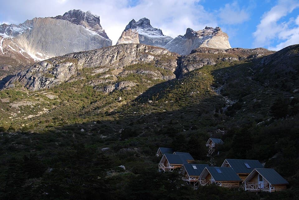 ChallengingSendero a Sector Cuernos23.2 km · 9 hr · At the trailheadA long lakeshore walk to the jagged Cuernos peaks.
 ChallengingO Circuit (Circuito Macizo Paine)93 km · 1.8 days · 0.6 km awayEight-day Paine massif loop over John Gardner Pass to Grey Glacier.
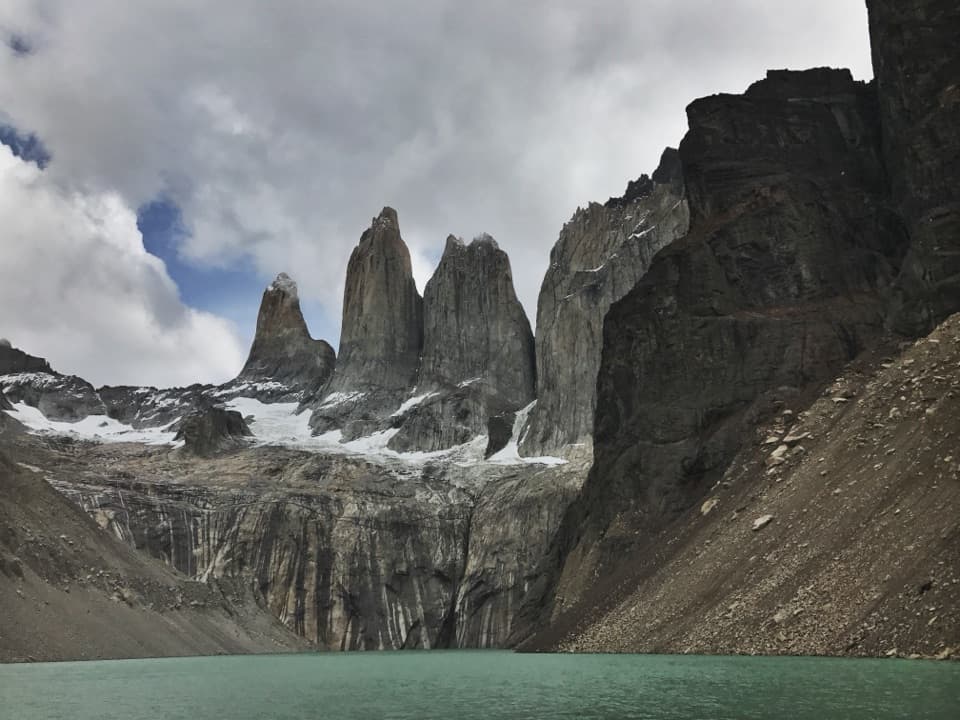 ChallengingBase Las Torres Trail20.1 km · 8 hr · 1.2 km awayA full-day climb to the lagoon beneath three granite towers.
 ModerateLaguna Inge Trail9.2 km · 2.3 hr · 1.4 km awayA short W route to a small lagoon and a Nordenskjöld view.
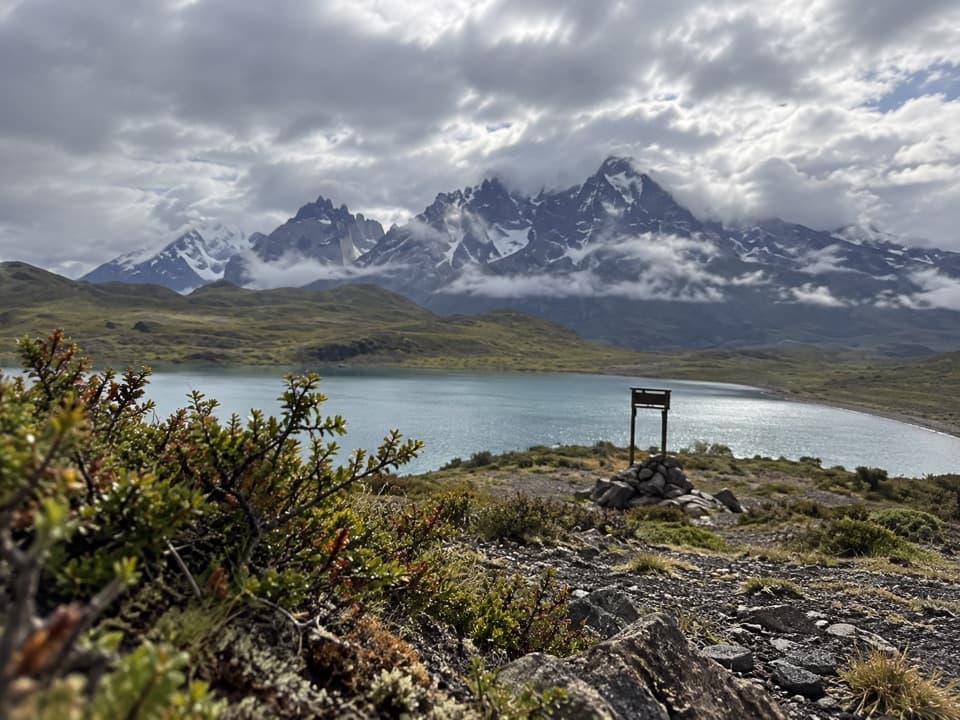 EasyLaguna Larga to Mirador Nordenskjöld3.5 km · 1.5 hr · 5.6 km awayA guided walk links Laguna Larga with broad Paine views.
 EasyLago Sarmiento – Sendero de los Trombolitos4.9 km · 2.5 hr · 8.8 km awayWhite thrombolites make this quiet Sarmiento shore unusual.
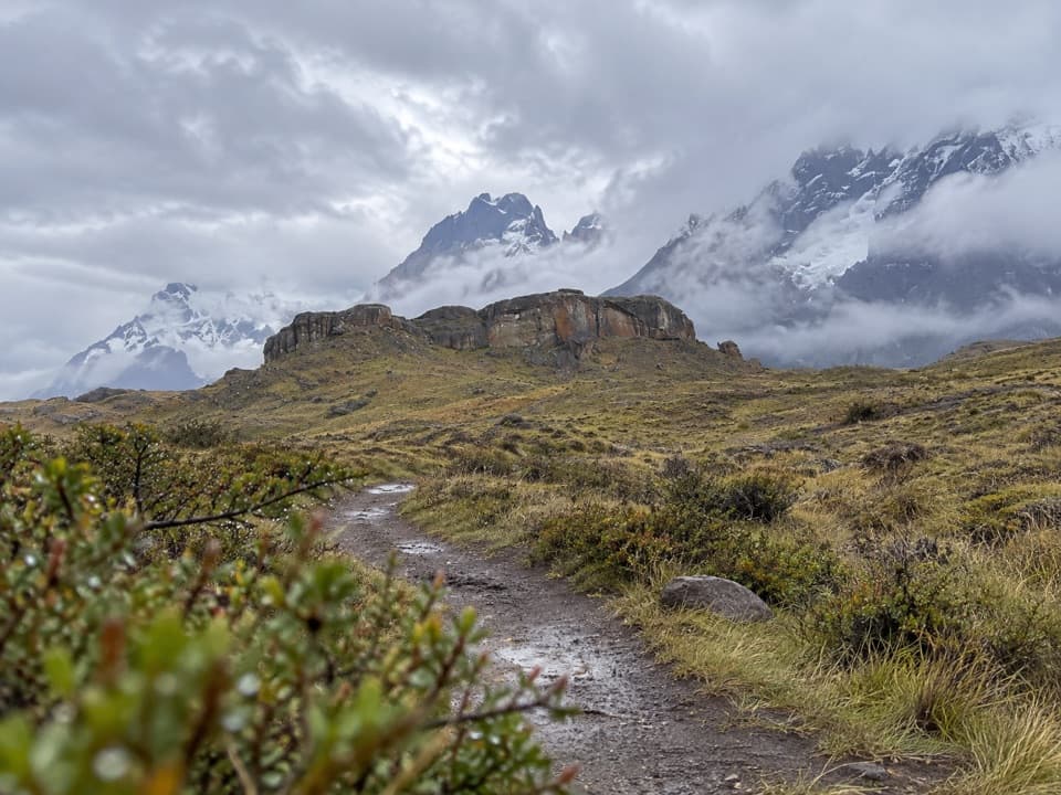 EasySendero Aonikenk6.6 km · 2.5 hr · 9.3 km awayA guided pampa traverse past rock art to Laguna Amarga.
 Lodging · At the trailheadHotel Las TorresWake up at the doorstep of the Base Torres trek.
 Campground · 1 km awayRefugio y Camping CentralA trek base with refuge beds and several ways to camp.
 Visitor center · 1.2 km awayCentro de Bienvenida - Reserva Las TorresTrail snacks, last-minute gear, and a check-in at the trailhead.
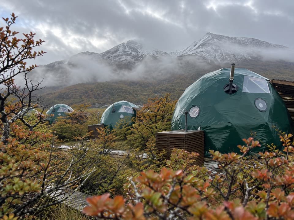 Lodging · 1.4 km awayEcoCamp PatagoniaA dome stay with views of the Paine Towers.
 Campground · 3.1 km awayRefugio y Camping ChilenoAn overnight stop for an early start to Base Torres.
 Entrance station · 5.3 km awayPortería Laguna AmargaThe practical eastern checkpoint before the park drive begins.
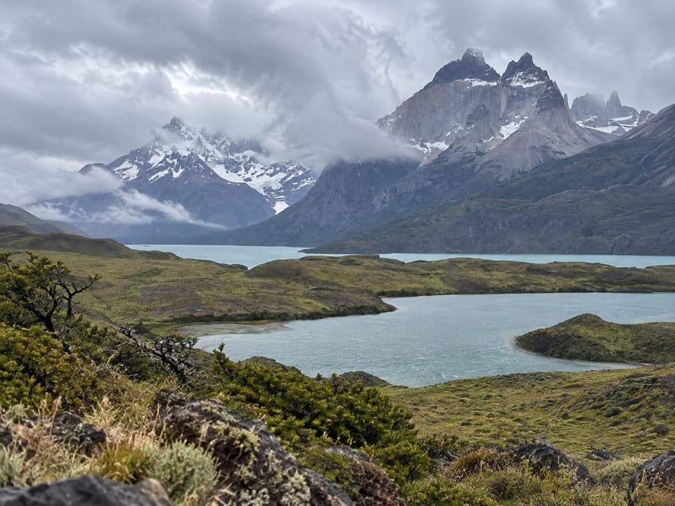 Sight · 5.6 km awayMirador Laguna LargaA short roadside view over a lagoon to the mountains.
 Sight · 6.2 km awayMirador Base TorresA full-day hike ends beneath Patagonia’s three granite spires.
Parkwolf’s Torres del Paine ranking

The audio tour guide for the drive, plus offline maps, trails, and wildlife heatmaps for when the signal drops.