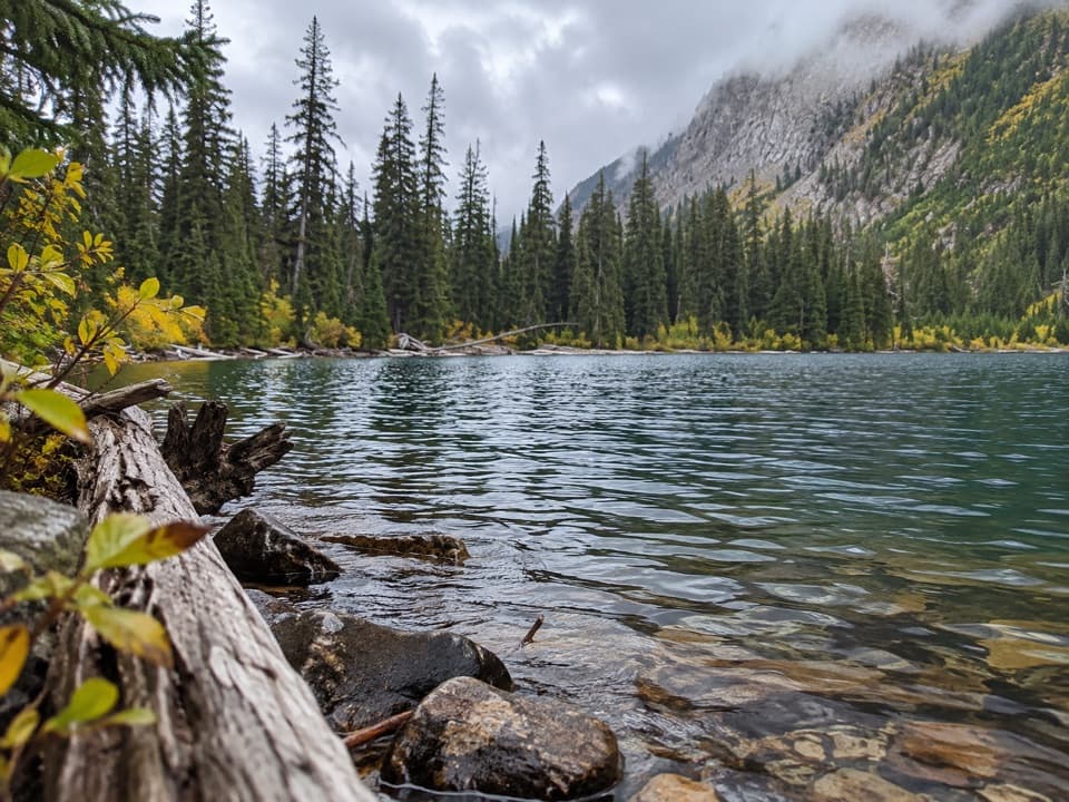
Lower Rowe Lake in Waterton Lakes National Park

Sight · Waterton Lakes National Park

Lower Rowe Lake

A small alpine lake beneath steep cliffs, reached by a moderate hike.

Type
Sight
Nearest trail
2.8 km
Audio stories
3 nearby
  • Trailhead
  • Parking

Hear the audio tour

Rowe Lakes Trailhead

Overview

About Lower Rowe Lake

Why stop

  • The creekside approach adds red rock and cascades.

Heads up

  • An 8 km, three-hour hike makes this more than a quick stop.

Map

Where it is

Loading the Waterton Lakes map
Full map
SightLower Rowe Lake49.05460, -114.05259
Keep this map with you offline in the Parkwolf app

Plan your stop

Before you go

7 active Waterton Lakes alerts

  • ClosureBelly River Campground closedBelly River Campground is closed to all traffic and travel because a carcass is in the area. - Violators may be charged under the Canada National Parks Act, with a maximum penalty of $25,000.Official details
  • ClosureBlakiston Fan closed to protect rutting elkThe Blakiston Fan area is closed to traffic and travel to prevent disturbance of elk rutting there.Official details

See all 7 alerts
A park ranger sits on a dash-mounted phone, talking, as Parkwolf’s Tour Guide plays “Army Cutworm Moths: A Grizzly Bear Buffet” on Grand Loop Road below Dunraven Pass in Yellowstone
Parkwolf Tour GuideThe highest, rockiest slopes around here are a summer buffet for grizzly bears.

Waterton Lakes Tour Guide

Your drive to Lower Rowe Lake, narrated.

Parkwolf is a GPS audio tour guide for Waterton Lakes National Park. As you drive, it chimes in with what’s ahead: hidden gems, upcoming stops, history, geology, and wildlife, right through your car’s speakers.

See the Waterton Lakes audio tour

Recorded for this place

Rowe Lakes Trailhead
0:00 / 0:27
“You’re approaching the Rowe Lakes trailhead, where I’d choose Lower Rowe Lake for a moderate hike.”

Plays as you drive up to Lower Rowe Lake in the Parkwolf Waterton Lakes Tour Guide.

More stories near here in the app

  • Little Prairie Day Use Area
  • Akamina Pass and Wall Lake
  • Cameron Lake
  • Lineham Falls Trailhead
  • 51 audio storiesacross Waterton Lakes’s roads, triggered by GPS as you drive
  • Wildlife heatmapsfor Bison, Black Bear, Elk, and 13 more
  • Works offlinemaps, 47 trails, 70 places, and audio download before you lose signal
  • CarPlay readysimple controls built for the drive
★★★★★
“Fantastic app with many points of information… It’s great to just turn on while you’re driving and it gives you an audio tour of the national Park. We love it!!!!”
JMJamesApp Store review
Download Parkwolf on the App StoreGet Parkwolf on Google Play

4.7 from 8,600+ ratings

Guide

More about Lower Rowe Lake

Give it half a dayLower Rowe Lake is a small alpine lake tucked below a steep cliff face in Waterton’s Rowe…

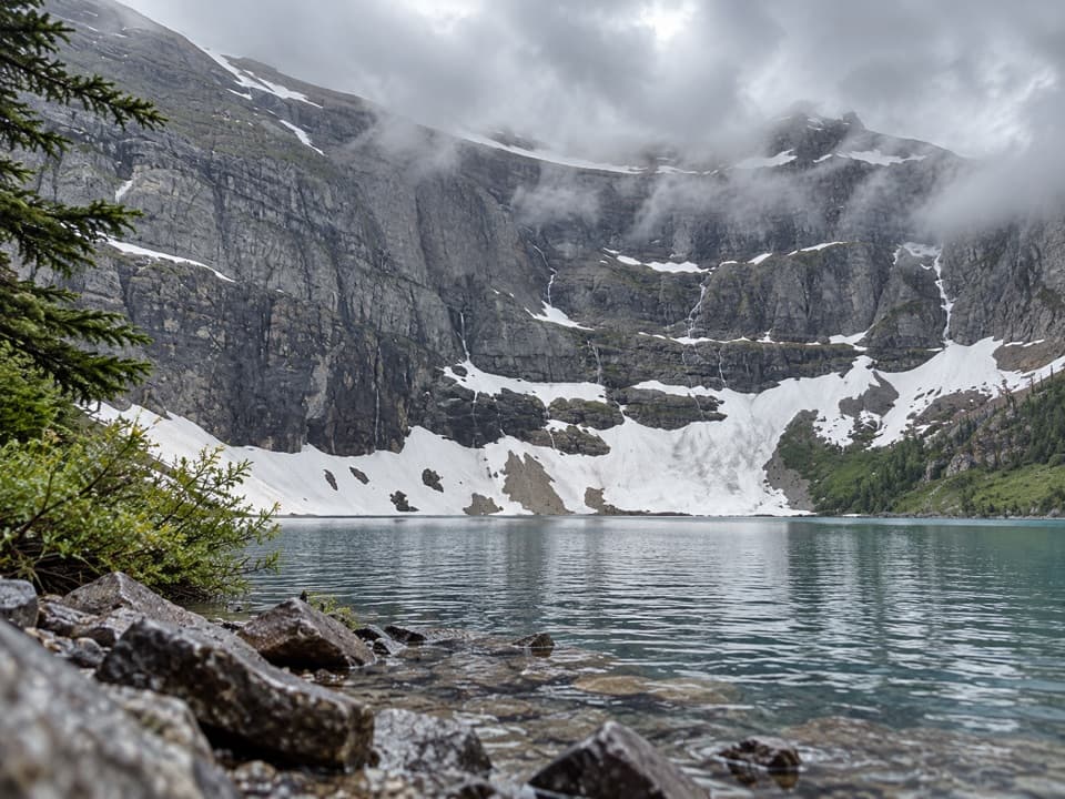
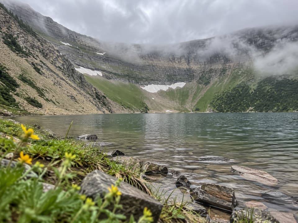
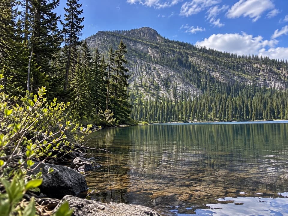
Lower Rowe Lake is a small alpine lake tucked below a steep cliff face in Waterton’s Rowe Valley. Reaching it takes about three hours on an 8 km return hike with 350 m of climbing, from the Rowe Lakes trailhead along Akamina Parkway, 10.5 km from town. It’s a good destination if you want a proper walk to a lakeshore; this isn’t a quick roadside stop.

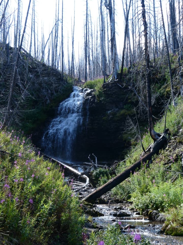
Follow Rowe CreekThe trail starts beside Rowe Creek, which tumbles over mossy ledges and bright red argillite.

The trail starts beside Rowe Creek, which tumbles over mossy ledges and bright red argillite. It then moves through forest and open slopes to a junction; take the short side path and bridge to Lower Rowe Lake. The main trail continues uphill toward the upper lakes.

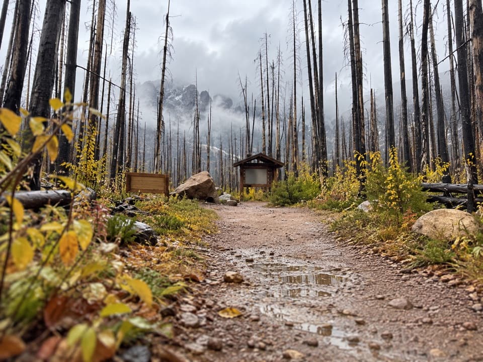
A valley still changingThe 2017 Kenow wildfire affected parts of the Rowe Lakes approach.

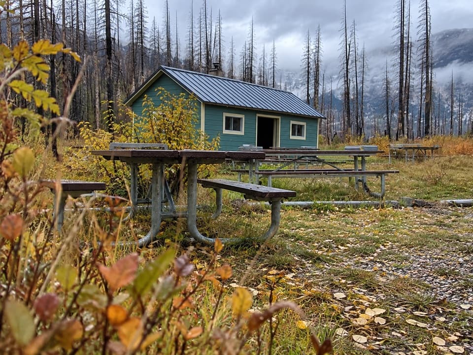
The 2017 Kenow wildfire affected parts of the Rowe Lakes approach. You’ll see a mix of fire-scarred forest and regrowth along the route, rather than one continuous burned stretch. The larch groves farther up toward Upper Rowe Lake were spared and turn gold in autumn, which is a good reason to continue if you’ve planned for the longer climb.

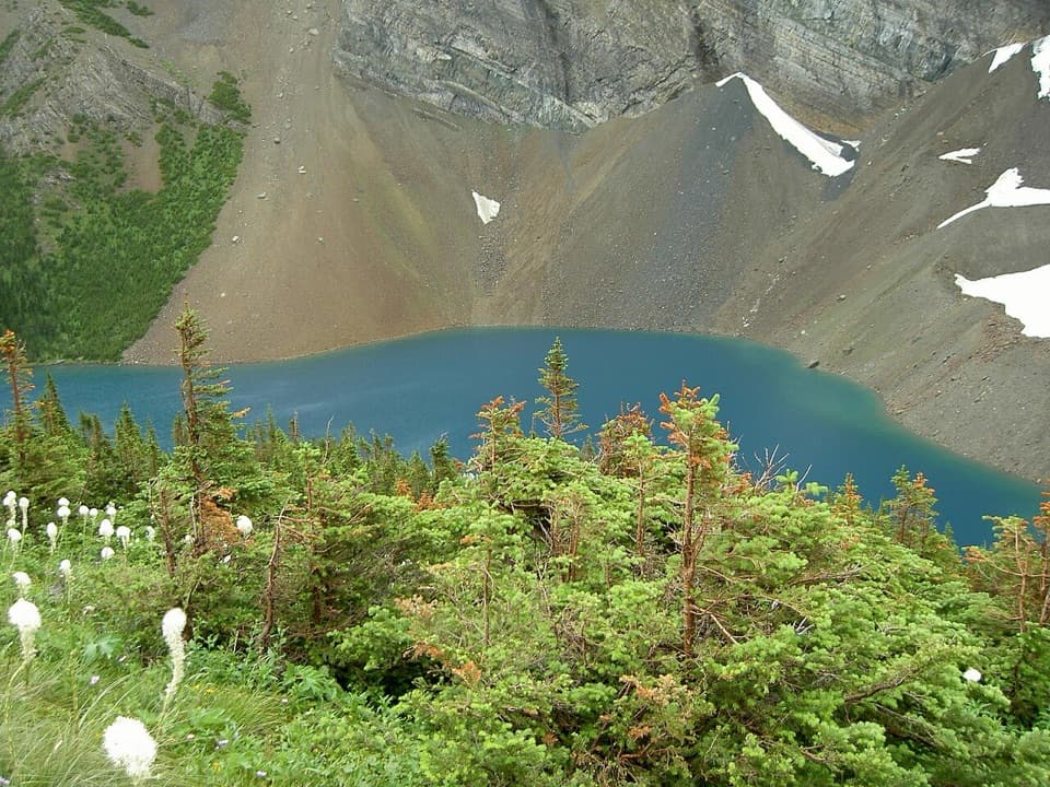
Frame the lakeThe water sits beneath a steep rock wall, with conifers lining the far shore.

The water sits beneath a steep rock wall, with conifers lining the far shore. For a photo, get close to the water and keep some of the rocky shore or driftwood in the foreground; it helps show the scale of the lake and cliffs.

Bring what you needThere are no services at the lakeshore, so carry food and water for the return walk.

There are no services at the lakeshore, so carry food and water for the return walk. Parking is at the Rowe Lakes trailhead on Akamina Parkway, where the lot has space for several cars.

Wildlife

Wildlife in Waterton Lakes

All Waterton Lakes wildlife maps

Sighting maps show where each species has been reported across Waterton Lakes. Wildlife moves, so no sighting is guaranteed.

Keep exploring

Near Lower Rowe Lake

See it all on the map

Trails nearby

More stops nearby

Parkwolf’s Waterton Lakes ranking

Top sights in Waterton Lakes

All 70 places
  1. 1Prince of Wales Hotel National Historic SiteSight
  2. 2Red Rock CanyonSight
  3. 3Cameron FallsSight
  4. 4Cameron LakeSight
  5. 5Bear’s HumpSight
  6. 6Bison PaddockSight

Take Parkwolf to Waterton Lakes.

The audio tour guide for the drive, plus offline maps, trails, and wildlife heatmaps for when the signal drops.

4.7 from 8,600+ ratings

Download Parkwolf on the App StoreGet Parkwolf on Google Play