Great Divide Trail (Waterton Section) in Waterton Lakes National Park

Waterton Lakes National Park, AB

Great Divide Trail (Waterton Section)

A 34-mile mountain crossing from Boundary Bay to Sage Pass.

Photo: Wikimedia Commons
Length
54.7km
Time
1.1days
Elev. change
1,213m
Difficulty
Challenging
  • Dogs allowed
  • High point 2,504 m
Parkwolf audio tour51 stories across Waterton Lakes’s roads

Overview

About Great Divide Trail (Waterton Section)

Why go

  • Carthew Summit links alpine lakes, ridge views and distant prairie.
  • One traverse samples the park’s lakes, high ridges and open burn country.

Heads up

  • Long, steep route requires campsite bookings and a separate end pickup.
  • Loose scree, exposed ridges and long sunny stretches raise the effort.

Map & elevation

The route

Loading the Waterton Lakes map
Full map
Elevation1,291–2,504 m
TrailheadBoundary Bay / Great Divide Trail southern terminus48.99883, -113.90618
Keep this map with you offline in the Parkwolf app

Plan your hike

Before you go

Parking

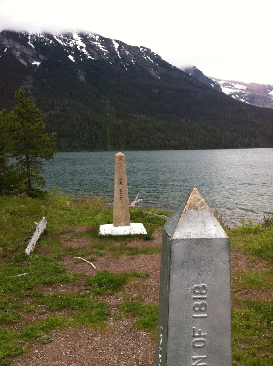
The southern start is the Boundary Bay monument near the international boundary; most hikers walk about 6 km from Waterton townsite to reach it. Sage Pass is a remote park exit, so arrange pickup via the Twin Lakes/Snowshoe Trail connection toward Red Rock Parkway rather than expecting a lot at the pass.

Safety

Steep loose scree and exposed high ridges require sure footing; burned sections have little shade. Reserve each backcountry campsite and obtain a Parks Canada Backcountry Permit before an overnight trip. The northern pickup relies on access toward Red Rock Parkway, which has seasonal vehicle closures.

7 active Waterton Lakes alerts

  • ClosureBelly River Campground closedBelly River Campground is closed to all traffic and travel because a carcass is in the area. - Violators may be charged under the Canada National Parks Act, with a maximum penalty of $25,000.Official details
  • ClosureBlakiston Fan closed to protect rutting elkThe Blakiston Fan area is closed to traffic and travel to prevent disturbance of elk rutting there.Official details
See all 7 alerts
A park ranger sits on a dash-mounted phone, talking, as Parkwolf’s Tour Guide plays “Army Cutworm Moths: A Grizzly Bear Buffet” on Grand Loop Road below Dunraven Pass in Yellowstone
Parkwolf Tour GuideThe highest, rockiest slopes around here are a summer buffet for grizzly bears.

Waterton Lakes Tour Guide

Your drive to Great Divide Trail (Waterton Section), narrated.

Parkwolf is a GPS audio tour guide for Waterton Lakes National Park. As you drive, it chimes in with what’s ahead: hidden gems, upcoming stops, history, geology, and wildlife, right through your car’s speakers.

See the Waterton Lakes audio tour

More stories near here in the app

  • Bertha Trailhead
  • Townsite Campground and Lakeshore
  • Waterton Lakes Visitor Centre
  • Paahtómahksikimi Cultural Centre
  • 51 audio storiesacross Waterton Lakes’s roads, triggered by GPS as you drive
  • Wildlife heatmapsfor Bison, Black Bear, Elk, and 13 more
  • Works offlinemaps, 47 trails, 70 places, and audio download before you lose signal
  • CarPlay readysimple controls built for the drive
★★★★★
“Fantastic app with many points of information… It’s great to just turn on while you’re driving and it gives you an audio tour of the national Park. We love it!!!!”
JMJamesApp Store review
Download Parkwolf on the App StoreGet Parkwolf on Google Play

4.7 from 8,600+ ratings

Trail guide

Hiking Great Divide Trail (Waterton Section)

A long point-to-point crossingThis 34-mile, one-way section of the Great Divide Trail runs from Boundary Bay through Waterton…

This 34-mile, one-way section of the Great Divide Trail runs from Boundary Bay through Waterton townsite and the Carthew–Alderson high country, then crosses the park to Sage Pass. The mapped distance includes the short Akamina Parkway road connector between Cameron Lake and the Rowe Lakes trailhead. It stops at Sage Pass; the longer route beyond the park is a separate section. The park-only mileage is measured from the mapped route because published totals cover a larger section or only the Carthew–Alderson day hike.

Plan several daysAllow roughly three to four days as a planning estimate, with about 27 hours of hiking spread…

Allow roughly three to four days as a planning estimate, with about 27 hours of hiking spread across steep climbs, rocky descents and a remote northern half. This is a hard backpacking traverse, not a long day hike. Reserve each backcountry campground you plan to use and obtain a Parks Canada backcountry permit before setting out. Waterton townsite is the main resupply and lodging stop; campsites along the route include Boundary Bay, Bertha Bay, Alderson Lake, Lone Lake and Twin Lakes.

Boundary Bay to Cameron LakeThe southern start is at the international-boundary monument at Boundary Bay.

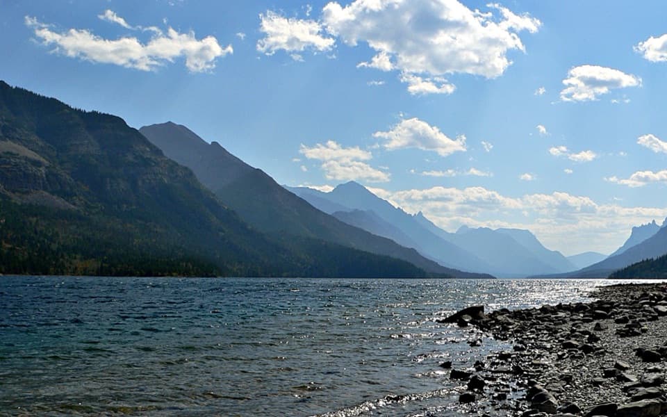
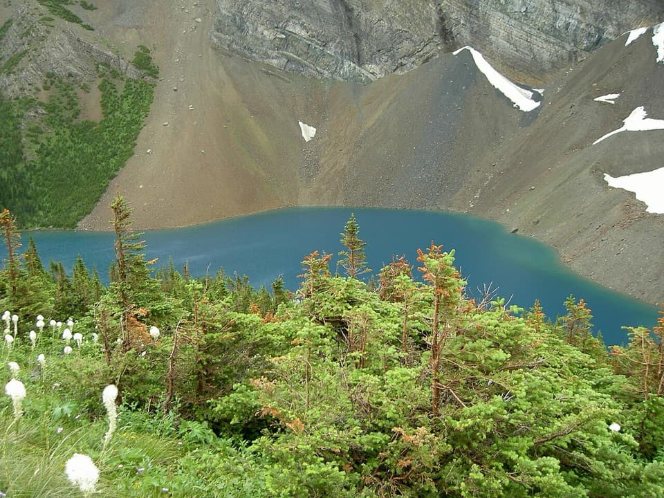
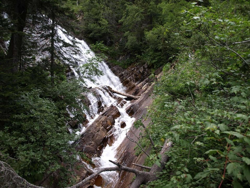
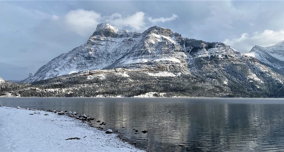
The southern start is at the international-boundary monument at Boundary Bay. Most hikers walk about 6 km from Waterton townsite to reach it. From there, the trail follows spurs near Upper Waterton Lake into town, then climbs from Cameron Falls toward Alderson Lake beneath Mount Alderson’s cliffs. Above the lake, steep switchbacks cross shale, loose scree and shrub bands to Carthew Lakes and Carthew Summit. The high point is exposed, with broad views back to the lakes and across Waterton Valley toward the prairie. Descend by more switchbacks to Cameron Lake.

The Rowe and Lineham high countryCameron Lake has a small refreshments shop, canoe rentals and a vault toilet.

Cameron Lake has a small refreshments shop, canoe rentals and a vault toilet. After the short road walk on Akamina Parkway to the Rowe Lakes trailhead, the route climbs through forest to Rowe Meadows, a recommended place to collect water. It continues up Lineham Ridge, then crosses a chain of saddles through the burned Blakiston Valley, passing Lone and Twin Lakes before the final climb to Sage Pass. Carry water treatment and enough capacity for the distance between reliable sources.

Fire, exposure and footingThe 2017 Kenow wildfire left long open stretches with little shade, especially around the…

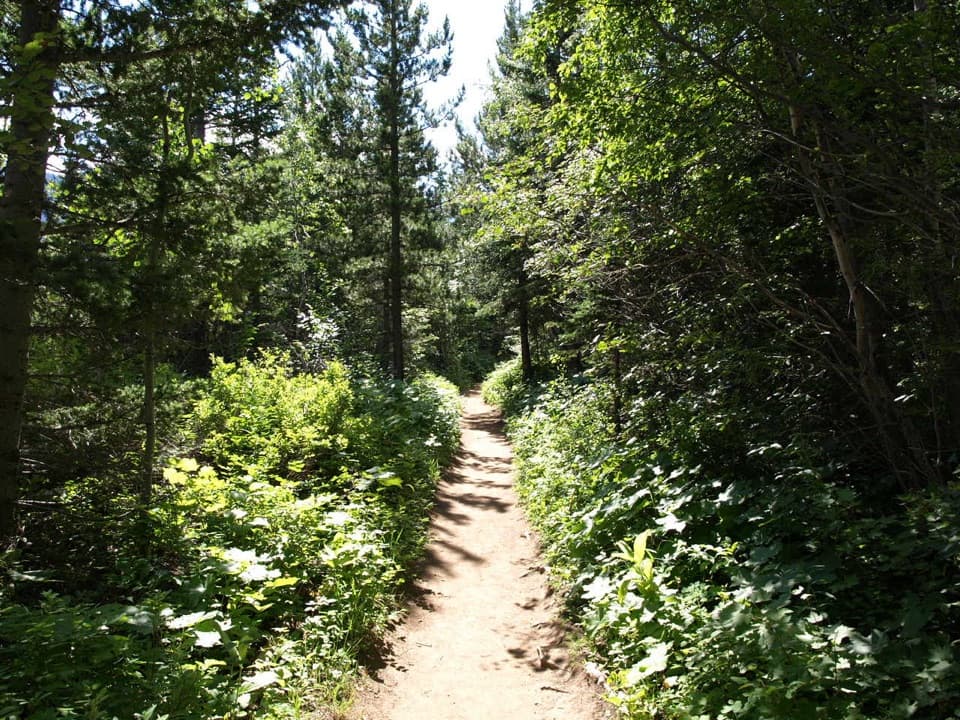
The 2017 Kenow wildfire left long open stretches with little shade, especially around the Blakiston Valley; hot, sunny days can make the northern traverse feel harder. The Carthew and Lineham sections combine steep grades, loose rock and exposed ridge terrain. The route is on established trails, but it is a remote multi-day walk with no difficult river crossings under ordinary conditions. Use bear-safe food practices around Cameron Lake and Akamina Creek.

The finish and accessSage Pass is a park exit, not a road-side pickup.

Sage Pass is a park exit, not a road-side pickup. Arrange transport from the north end using the Twin Lakes/Snowshoe Trail connection toward Red Rock Parkway, and check vehicle access before relying on that road. The separate walk from Waterton townsite south to the Boundary Bay monument is not included in the 34-mile mapped total. Dogs are allowed on park trails when leashed and under control; the same rule applies throughout this mapped section.

Wildlife

Wildlife in Waterton Lakes

All Waterton Lakes wildlife maps

Sighting maps show where each species has been reported across Waterton Lakes. Wildlife moves, so no sighting is guaranteed.

Keep exploring

Near Great Divide Trail (Waterton Section)

See it all on the map

Trails that start nearby

Places near the trailhead

Parkwolf’s Waterton Lakes ranking

Top-rated trails in Waterton Lakes

All 47 trails
  1. 1Crypt Lake TrailChallenging · 17.1 km
  2. 2Carthew-Alderson TrailChallenging · 20.1 km
  3. 3Bear’s Hump TrailModerate · 2.9 km
  4. 4Bertha Lake TrailModerate · 10.3 km
  5. 5Lineham RidgeChallenging · 17.2 km
  6. 6Upper Rowe Lake TrailModerate · 12.8 km

Take Parkwolf to Waterton Lakes.

The audio tour guide for the drive, plus offline maps, trails, and wildlife heatmaps for when the signal drops.

4.7 from 8,600+ ratings

Download Parkwolf on the App StoreGet Parkwolf on Google Play