1 active Westland Tai Poutini alert
- CautionActive landslide zones on Copland TrackDo not stop in either of Copland Track’s signposted active landslide zones; take extra care during and after heavy rain.Official details
Beach · Westland Tai Poutini National Park
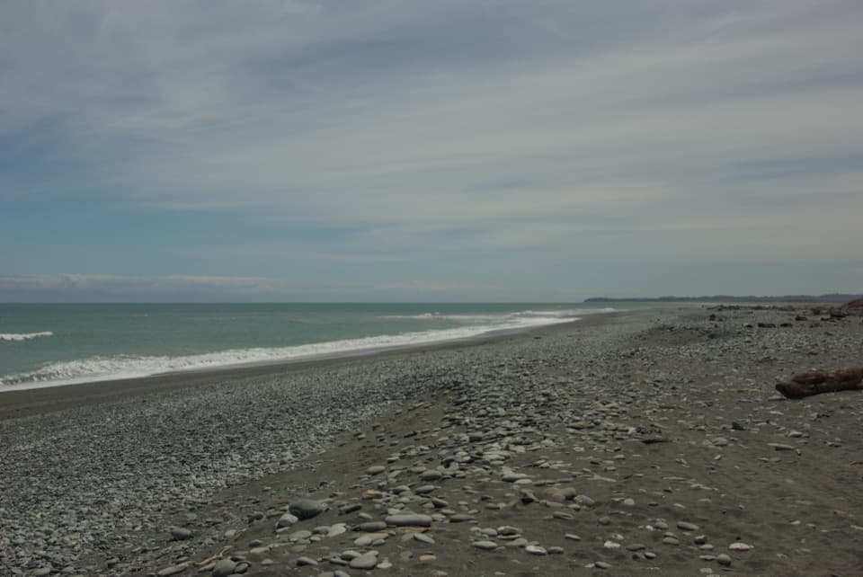
A wild, stony Tasman shore beside Ōkārito Lagoon.
Overview
Map
Plan your stop

The highest, rockiest slopes around here are a summer buffet for grizzly bears.
Westland Tai Poutini Tour Guide
Parkwolf is a GPS audio tour guide for Westland Tai Poutini National Park. As you drive, it chimes in with what’s ahead: hidden gems, upcoming stops, history, geology, and wildlife, right through your car’s speakers.
See the Westland Tai Poutini audio tourRecorded for this place
Ōkārito Walks: the Trig or the Wetland“Up ahead is the start of the Ōkārito walks, beside the old schoolhouse.”
Plays as you drive up to Ōkārito Beach in the Parkwolf Westland Tai Poutini Tour Guide.
More stories near here in the app
“Fantastic app with many points of information… It’s great to just turn on while you’re driving and it gives you an audio tour of the national Park. We love it!!!!”


Guide
Ōkārito Beach is an exposed stretch of Tasman Sea shoreline beside the small Ōkārito settlement, where ocean, lagoon and forest meet. The shore shifts between rounded stones, gravel and patches of dark sand, with driftwood above the surf. Come for a quiet coast walk and a look at the wild edge; don’t plan a swim.
Ōkārito is reached on the signposted 10 km Forks/Ōkārito Road from State Highway 6. Public parking and the exact beach entry for this pin aren’t clearly documented. For a longer outing, the 9.8 km Three Mile Pack Track–Ōkārito Coastal Walk runs through forest to Three Mile Lagoon. A beach return from the lagoon toward Ōkārito takes about 1 hour 20 minutes and is recommended only within an hour either side of low tide; storm surges can shift the timing.
This is a walk-and-look beach, not a swimming spot. Waves, rip currents and undertow can be dangerous, especially near the lagoon mouth.
Glacial debris left the area’s lumpy headlands. Over thousands of years, the Westland Current moved gravel and sand north, building a buffer between the rough sea and the wetlands and lagoons behind it. Glacier-fed rivers keep adding material to this changing coast.
For a strong shoreline photo, include rounded stones or driftwood in the foreground and let the surf lead your eye along the beach. Sunset over the Tasman is a draw; on a clear day, the wider coastal landscape can open toward the Southern Alps, though clouds decide whether they appear.
Wildlife
 89 sightingsKeaMost seen around 10 AMSighting map
 10 sightingsBlue DuckMost seen around 5 PMSighting map
 80 sightingsKererūMost seen around 7 AMSighting map
 38 sightingsTūīMost seen around 5 AMSighting map
 10 sightingsNew Zealand FalconMost seen around 10 AMSighting map
 28 sightingsYellow-crowned ParakeetMost seen around 8 AMSighting map
Sighting maps show where each species has been reported across Westland Tai Poutini. Wildlife moves, so no sighting is guaranteed.
Keep exploring
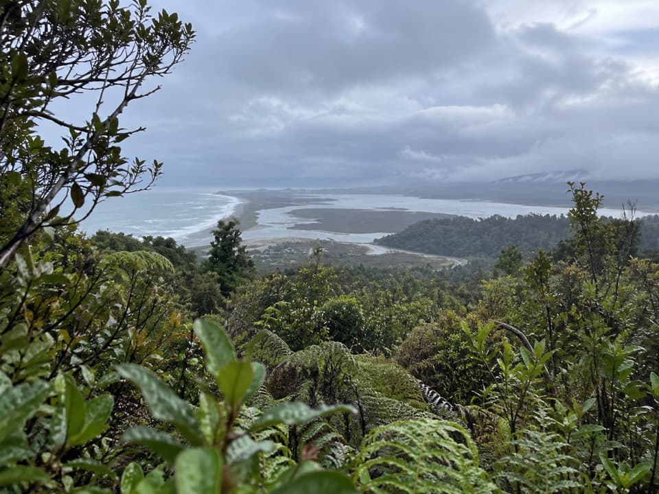 ModerateŌkārito Trig Walk4.2 km · 1.5 hr · 0.6 km awayShort climb, then lagoon, coast and Southern Alps in one view.
 ModerateThree Mile Pack Track - Ōkārito Coastal Walk9.8 km · 3.5 hr · 0.6 km awayWind-shaped forest leads over a bluff to a lagoon bridge.
 EasyŌkārito Wetland Walk1 km · 20 min · 0.6 km awayA curving boardwalk leads to a bench overlooking the lagoon.
 EasyPakihi Walk1 km · 30 min · 4.9 km awayA quick swamp and forest walk ends in a mountain view.
 Lodging · 0.6 km awayŌkārito School HouseSleep in a former village school, now a 12-person heritage lodge.
 Campground · 0.6 km awayŌkārito Community CampgroundA friendly coastal base for Ōkārito's beach, lagoon and walks.
 Sight · 0.8 km awayŌkārito TrigA bush climb opens onto lagoon, coast and alpine peaks.
 Sight · 0.8 km awayDonovan’s StoreAn 1865 gold-rush hotel still serves as a village gathering place.
 Sight · 1.1 km awayŌkārito WharfA historic lagoon wharf with gold-rush stories and mountain views.
 Sight · 2.9 km awayThree Mile LagoonA forest-fringed estuary at the end of an old gold-rush track.
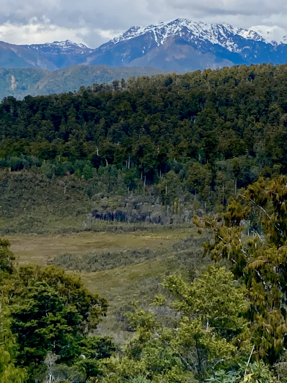 Sight · 4.7 km awayPakihi LookoutA short, steep climb opens onto wetland, forest and snowy peaks.
Parkwolf’s Westland Tai Poutini ranking

The audio tour guide for the drive, plus offline maps, trails, and wildlife heatmaps for when the signal drops.