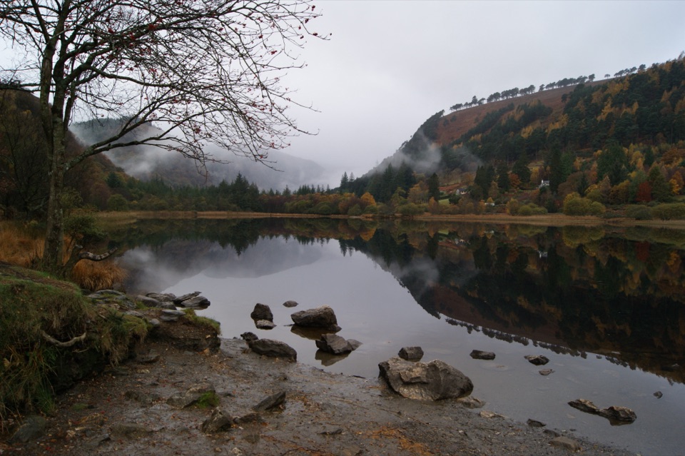
Lough Dan in Wicklow Mountains National Park

Sight · Wicklow Mountains National Park

Lough Dan

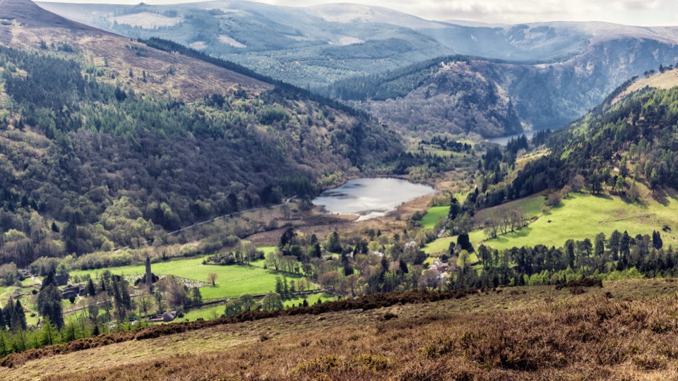
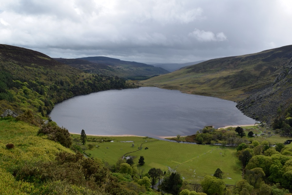
Boomerang-shaped ribbon lake, dark and quiet, best seen from above

Photo: Public Domain
Type
Sight
Nearest trail
1.1 km
Audio stories
1 nearby

Hear the audio tour

Scarr, Kanturk and Lough Dan

Overview

About Lough Dan

Why stop

  • Striking ribbon-lake views from public high ground

Heads up

  • Shore access is closed to general visitors
  • No public facilities at the lake

Map

Where it is

Loading the Wicklow Mountains map
Full map
SightLough Dan53.06949, -6.28361
Keep this map with you offline in the Parkwolf app

Plan your stop

Before you go

Best time to go

Low sun in early morning or late afternoon is when the ridges get their shape and the water goes darkest. Autumn brings colour on the slopes; winter gives you the emptiest hills. This corner of the mountains stays much quieter than the big-name valleys nearby, which is part of its appeal. Weather turns fast and visibility can drop to nothing, so check the forecast before committing to any hill walking.


The honest access limitation

The shoreline is not generally accessible. The land around the water belongs to a private estate and neighbouring farms, and there is no public right of way and no maintained public access to the lake itself. Routes you may see shared on hiking apps cross private ground. Treat this as a view, not a destination you walk down to. There are no facilities of any kind at the lake, and no visitor parking at the water.

3 active Wicklow Mountains alerts

  • CautionExtreme upland fire riskDo not use solid-fuel BBQs in Wicklow Mountains National Park, and take extreme care with cigarettes and other naked flames because the hills are dry and at extreme risk of fire.Official details
  • CautionGlendalough Spinc trail works and intermittent disruptionsExpect intermittent disruption on the Glendalough Spinc trails while NPWS upgrades the White Trail.Official details
See all 3 alerts
A park ranger sits on a dash-mounted phone, talking, as Parkwolf’s Tour Guide plays “Army Cutworm Moths: A Grizzly Bear Buffet” on Grand Loop Road below Dunraven Pass in Yellowstone
Parkwolf Tour GuideThe highest, rockiest slopes around here are a summer buffet for grizzly bears.

Wicklow Mountains Tour Guide

Your drive to Lough Dan, narrated.

Parkwolf is a GPS audio tour guide for Wicklow Mountains National Park. As you drive, it chimes in with what’s ahead: hidden gems, upcoming stops, history, geology, and wildlife, right through your car’s speakers.

Recorded for this place

Scarr, Kanturk and Lough Dan
0:00 / 0:20
“You’re nearing the walking access for Scarr and Kanturk near Oldbridge. The ridge gives you wide views over Lough Dan, with a quieter feel than the busiest Glendalough trails.”

Plays as you drive up to Lough Dan in the Parkwolf Wicklow Mountains Tour Guide.

More stories near here in the app

  • Why the River Looks Like Tea
  • Glenmacnass Waterfall
  • J.B. Malone Memorial and Djouce
  • Reading Glenmacnass Valley
  • 55 audio storiesacross Wicklow Mountains’s roads, triggered by GPS as you drive
  • Wildlife heatmapsfor Sika Deer, Red Deer, Grey Heron, and 3 more
  • Works offlinemaps, 34 trails, 31 places, and audio download before you lose signal
  • CarPlay readysimple controls built for the drive
★★★★★
“Fantastic app with many points of information… It’s great to just turn on while you’re driving and it gives you an audio tour of the national Park. We love it!!!!”
JMJamesApp Store review
Download Parkwolf on the App StoreGet Parkwolf on Google Play

4.7 from 8,600+ ratings

Guide

More about Lough Dan

What it isA long, curving ribbon lake sitting around 200 m above sea level, tucked into a glacially…

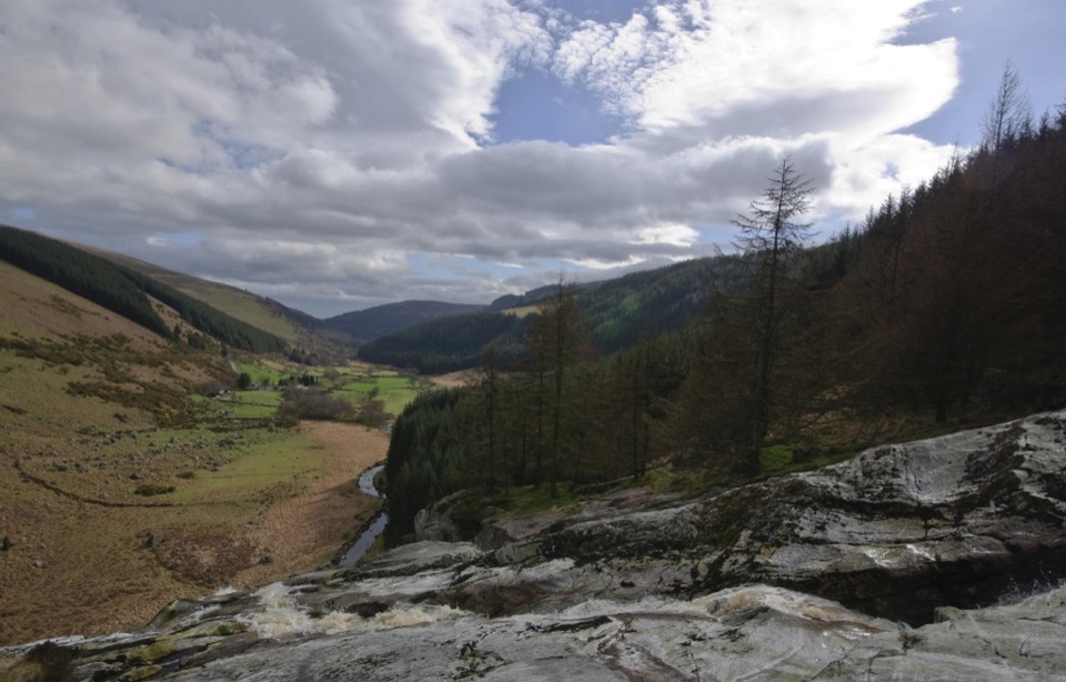
A long, curving ribbon lake sitting around 200 m above sea level, tucked into a glacially carved valley at the foot of Luggala and Knocknacloghoge. It covers about a square kilometre, fed by the Cloghoge River from the northeast and the Inchavore from the northwest, and drains south into the Avonmore. Dark, still water, conifer plantation, blanket bog and rough peaks all in one view.

How to see it properlyFrom the public road: the R759 runs through this landscape with open outlooks over the valley…
  • From the public road: the R759 runs through this landscape with open outlooks over the valley and surrounding mountains.
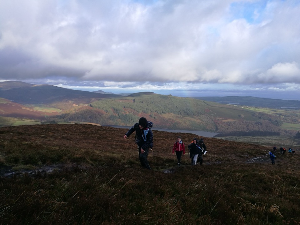
  • From the public uplands: the Wicklow Way crosses open hillside east of the lake and gives the classic look straight down its length, with the water narrowing between steep slopes. That high angle is genuinely the best version of this place.
  • Stick to waymarked trails and durable ground, and keep dogs on leads.
Landscape and natureThe valley is textbook glacial work, a deep trough with the lake pooled along its floor.

The valley is textbook glacial work, a deep trough with the lake pooled along its floor. Small pockets of native sessile oak woodland grow in this part of the mountains, some of it a century old, alongside heather, bilberry and sphagnum on the wetter ground. Deer roam the wider hills and are sometimes spotted at a distance, though nothing is guaranteed. Blanket bog and ground-nesting birds here are easily damaged by foot traffic, another good reason to stay on public paths.

What to bringWaterproofs, proper boots with grip for boggy and steep ground, water and food, and a…

Waterproofs, proper boots with grip for boggy and steep ground, water and food, and a downloaded map plus a way to navigate that does not rely on signal. Roadside stopping options are limited and informal, so drive slowly, park only where it is legal and safe, and never block gates or farm access.

The tradeoffYou trade the satisfaction of standing at the water for something quieter and, from the right…

You trade the satisfaction of standing at the water for something quieter and, from the right vantage, more dramatic. Come for the wide view over a wild valley rather than a lakeside afternoon, and it delivers.

Wildlife

Wildlife in Wicklow Mountains

All Wicklow Mountains wildlife maps

Sighting maps show where each species has been reported across Wicklow Mountains. Wildlife moves, so no sighting is guaranteed.

Keep exploring

Near Lough Dan

See it all on the map

Trails nearby

More stops nearby

Parkwolf’s Wicklow Mountains ranking

Top sights in Wicklow Mountains

All 31 places
  1. 1Glendalough Monastic Site and Visitor CentreSight
  2. 2Glendalough Upper LakeSight
  3. 3Sally GapSight
  4. 4Lough Tay Viewing PointSight
  5. 5Glenmacnass WaterfallSight
  6. 6Miners' VillageSight

Take Parkwolf to Wicklow Mountains.

The audio tour guide for the drive, plus offline maps, trails, and wildlife heatmaps for when the signal drops.

4.7 from 8,600+ ratings

Download Parkwolf on the App StoreGet Parkwolf on Google Play