
Place
Easy
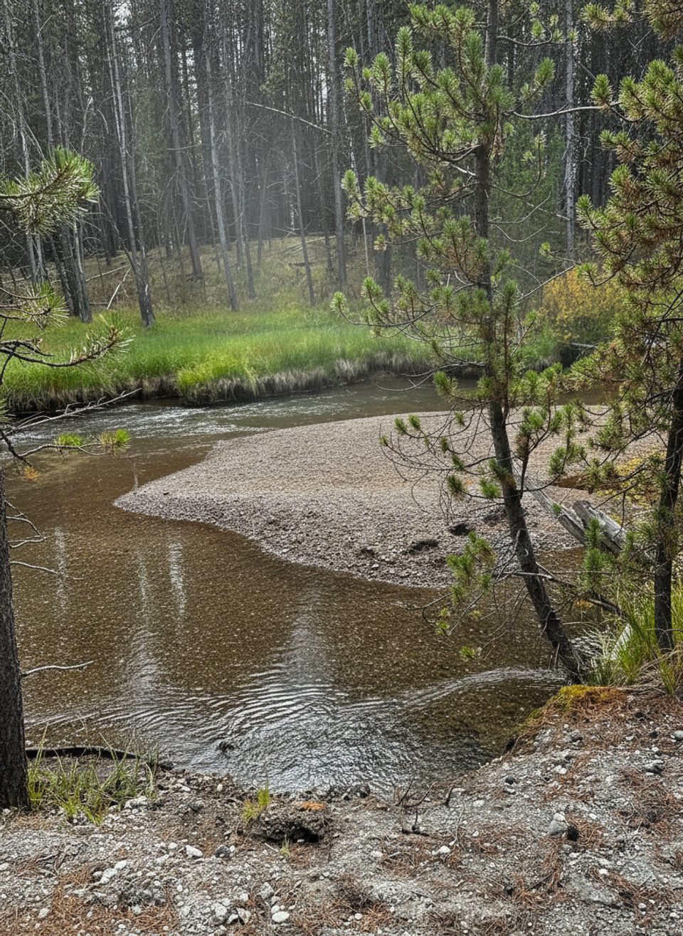
Sour Creek Trail is a mellow wander through meadows and creekside flats in the heart of Yellowstone’s caldera country. Expect an easy grade over roughly 5.2 miles total with about 350–380 feet of gain. Sources differ on route shape (out-and-back vs. loop), but the feel is the same: a low-key walk with room to breathe and look for wildlife.
The draw here is the setting more than a marquee viewpoint. Broad meadows open up to long sightlines—great for spotting bison, elk, and the occasional coyote—while Sour Creek adds that ever-present water soundtrack. Parts of the corridor can feel marshy, especially near the creek. In nearby lakes within the Yellowstone Caldera, you’ll even see lily pads, a reminder of the area’s swampy character.
Underfoot, the tread can be muddy—particularly in spring and early summer. Depending on recent weather, a crossing of Sour Creek may be required; water has been reported below knee height in April with a mild current, but don’t count on that. Water levels fluctuate, and it can be impassable. Sun exposure is real in the open meadows, so bring sunscreen. Crowds tend to be light compared to the park’s headliners; one recent report noted bathrooms near the trailhead, but don’t plan your day around it.
You’re walking atop the Sour Creek Dome, one of Yellowstone’s resurgent domes. It rose significantly from 1923 to 1985 and has since stabilized or subsided, a process strong enough to have subtly tilted Yellowstone Lake southward. It’s a calm hike layered over restless geology.
This is wildlife country—give large animals serious space and carry bear spray. Pets, bikes, motorized vehicles, and strollers aren’t allowed on this trail. Rivers here are fast and cold; do not swim and only consider creek crossings if conditions are clearly safe. Camping and fires are allowed only at designated backcountry sites with proper permits, and food storage rules apply. Off-trail travel in thermal areas is prohibited.
This area has seen closures in past years for wolf denning. Status changes—always check current park conditions before you go and be prepared to choose another hike if it’s closed or the creek is running high.
Late June through September typically offers drier tread and lower, clearer water. Spring brings the most mud and the trickiest creek conditions, though wildlife viewing can be excellent. Aim for early morning or late afternoon for cooler temps, softer light, and better wildlife activity.
Parking details aren’t specified; plan to use the signed trailhead area for Sour Creek and verify on arrival.
Seasonal creek crossing and muddy, marshy sections; active wildlife; past wolf-denning closures—always confirm current conditions and carry bear spray.
Place
Place
Place
Place
Easy
Easy
Moderate
Moderate

Parkwolf Tour Guide
