Hull Pot in Yorkshire Dales National Park

Sight · Yorkshire Dales National Park

Hull Pot

Walk in to a deep limestone chasm where a cavern collapsed

Photo: Wikimedia Commons
Type
Sight
Nearest trail
2.6 km
Audio stories
2 nearby

Hear the audio tour

When Hull Pot Becomes a Waterfall

Overview

About Hull Pot

Why stop

  • Dramatic limestone geology in open fell
  • Rain can turn the chasm into a waterfall

Heads up

  • The deep, unguarded rim demands constant care
  • Dry weather can leave the pot underwhelming
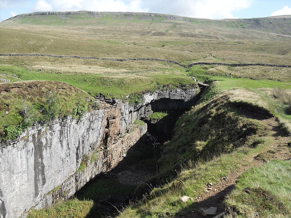
Hull Pot is an open limestone chasm that formed when a cavern collapsed, sitting on sheep-grazed fell on the western flank of Pen-y-ghent. Official dimensions are 91m long, 18m wide and 18m deep, so it reads as a single huge rectangular void in otherwise open moorland.
Parkwolf’s verdictWhy stop here

Map

Where it is

Loading the Yorkshire Dales map
Full map
SightHull Pot54.16656, -2.27066
Keep this map with you offline in the Parkwolf app

Plan your stop

Before you go

Best time to go

If the chance of a waterfall matters most, go after heavy or prolonged rain and accept muddy, slippery going and possibly poor visibility. For better footing and clearer light, choose a settled dry day; low morning or late afternoon light shows the depth of the chasm better than flat midday sun. Weekday mornings are usually quieter, since the route shares ground with Pen-y-ghent walkers.


Getting there

Hull Pot is reached on foot from Horton-in-Ribblesdale, following the walking route toward Pen-y-ghent, with a short detour off the main path to the rim. This is not a roadside stop. A common route (not the only one) is an out-and-back of roughly 4 miles, about 700 feet of ascent, 2 to 2.5 hours; longer loops taking in Pen-y-ghent are also popular. Expect gates, uneven fell paths and wet, slippery footing, and carry a map or GPS route, as the detour is easy to miss.

1 active Yorkshire Dales alert

  • ClosureTemporary closures on public rights of wayAvoid the listed sections of public rights of way while their temporary closures or pedestrian prohibition are in force. - Public Bridleway No. 52 (05.Official details
Yorkshire Dales alerts
A park ranger sits on a dash-mounted phone, talking, as Parkwolf’s Tour Guide plays “Army Cutworm Moths: A Grizzly Bear Buffet” on Grand Loop Road below Dunraven Pass in Yellowstone
Parkwolf Tour GuideThe highest, rockiest slopes around here are a summer buffet for grizzly bears.

Yorkshire Dales Tour Guide

Your drive to Hull Pot, narrated.

Parkwolf is a GPS audio tour guide for Yorkshire Dales National Park. As you drive, it chimes in with what’s ahead: hidden gems, upcoming stops, history, geology, and wildlife, right through your car’s speakers.

Recorded for this area

When Hull Pot Becomes a Waterfall
0:00 / 0:28
“Hull Pot, on the flank of Pen-y-ghent, is a huge open hole left by a collapsed cavern. In dry weather, Hull Pot Beck sinks into the limestone before it reaches the rim, then reappears as a smaller fall inside the pot.”

Plays on the road 2.3 km from Hull Pot in the Parkwolf Yorkshire Dales Tour Guide.

More stories near here in the app

  • Horton-in-Ribblesdale and Pen-y-ghent
  • Fountains Fell Trail
  • The Zigzags at St Oswald's
  • The Flash of a Wheatear
  • 298 audio storiesacross Yorkshire Dales’s roads, triggered by GPS as you drive
  • Wildlife heatmapsfor Eurasian Otter, Atlantic Salmon, Short-eared Owl, and 13 more
  • Works offlinemaps, 99 trails, 63 places, and audio download before you lose signal
  • CarPlay readysimple controls built for the drive
★★★★★
“Fantastic app with many points of information… It’s great to just turn on while you’re driving and it gives you an audio tour of the national Park. We love it!!!!”
JMJamesApp Store review
Download Parkwolf on the App StoreGet Parkwolf on Google Play

4.7 from 8,600+ ratings

Guide

More about Hull Pot

What you actually seeThe chasm itself, with bare limestone walls, ledges and scree at the bottom.
  • The chasm itself, with bare limestone walls, ledges and scree at the bottom.
  • Hull Pot Beck, which in dry weather can sink underground before it reaches the rim and may reappear inside the pot. Heavier rain can send water over the lip as a waterfall, and in exceptional flooding the pot can fill. A waterfall is not guaranteed.
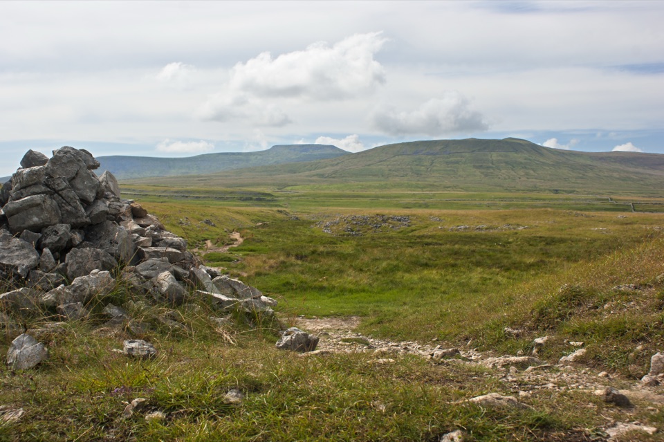
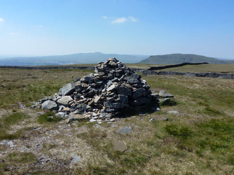
  • Clear views across limestone country, with dry-stone walls and the bulk of Pen-y-ghent nearby.
Safety at the edgeBe careful close to the edge.

Be careful close to the edge. The deep rim is unguarded, a plain limestone lip with no barrier or fence of any kind. Stay well back, keep children and dogs close, and do not lean out or scramble down. A walker has fallen here while taking a photograph, which is reason enough to view the pot from several metres back, especially on wet rock or in mist.

Facilities and kitThe exact feature has no positively verified visitor amenities.
  • The exact feature has no positively verified visitor amenities. Plan to be self-sufficient once you leave the village.
  • The normal facilities are the Horton-in-Ribblesdale car park and public toilets at the walk start.
  • Wear proper boots; trainers cope badly with wet limestone and peat.
  • Bring water, layers and a windproof. This is exposed fell, and the weather can change quickly.
Honest drawbacksIn dry spells the pot can look like a large empty hole with a dry streambed, which underwhelms…

In dry spells the pot can look like a large empty hole with a dry streambed, which underwhelms some visitors. There is nothing to do here beyond looking, so it works best combined with Pen-y-ghent or a longer fell walk. Low cloud removes the views, and in mist the unprotected edge needs extra care.

Wildlife

Wildlife in Yorkshire Dales

All Yorkshire Dales wildlife maps

Sighting maps show where each species has been reported across Yorkshire Dales. Wildlife moves, so no sighting is guaranteed.

Keep exploring

Near Hull Pot

See it all on the map

Trails nearby

More stops nearby

Parkwolf’s Yorkshire Dales ranking

Top sights in Yorkshire Dales

All 63 places
  1. 1Malham CoveSight
  2. 2Aysgarth FallsSight
  3. 3Ribblehead ViaductSight
  4. 4Gordale ScarSight
  5. 5Bolton CastleSight
  6. 6Janet's FossSight

Take Parkwolf to Yorkshire Dales.

The audio tour guide for the drive, plus offline maps, trails, and wildlife heatmaps for when the signal drops.

4.7 from 8,600+ ratings

Download Parkwolf on the App StoreGet Parkwolf on Google Play