Theodore Solomons Trail (Yosemite Section) in Yosemite National Park

Yosemite National Park, CA

Theodore Solomons Trail (Yosemite Section)

A remote 20-mile route from Glacier Point to Yosemite's southern boundary.

Photo: Wikimedia Commons
Length
20.1mi
Time
18hr
Elev. change
4,124ft
Difficulty
Challenging
  • No dogs
  • High point 10,266 ft

Hear the audio tour

Glacier Point

Overview

About Theodore Solomons Trail (Yosemite Section)

Why go

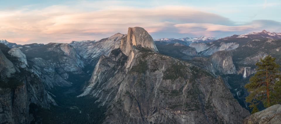
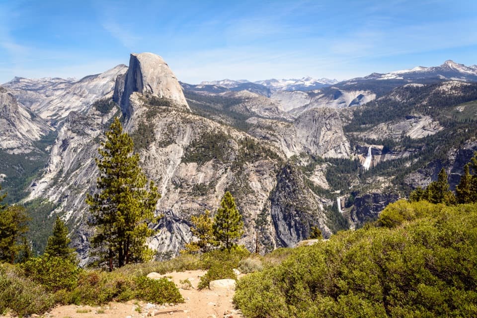
  • The Panorama Trail descent puts Half Dome and waterfalls in view.
  • A remote through-route connects Glacier Point with Yosemite’s southern high country.

Heads up

  • This 20-mile point-to-point section has no road pickup at its southern end.
  • The route joins existing trails and needs confident backcountry navigation.
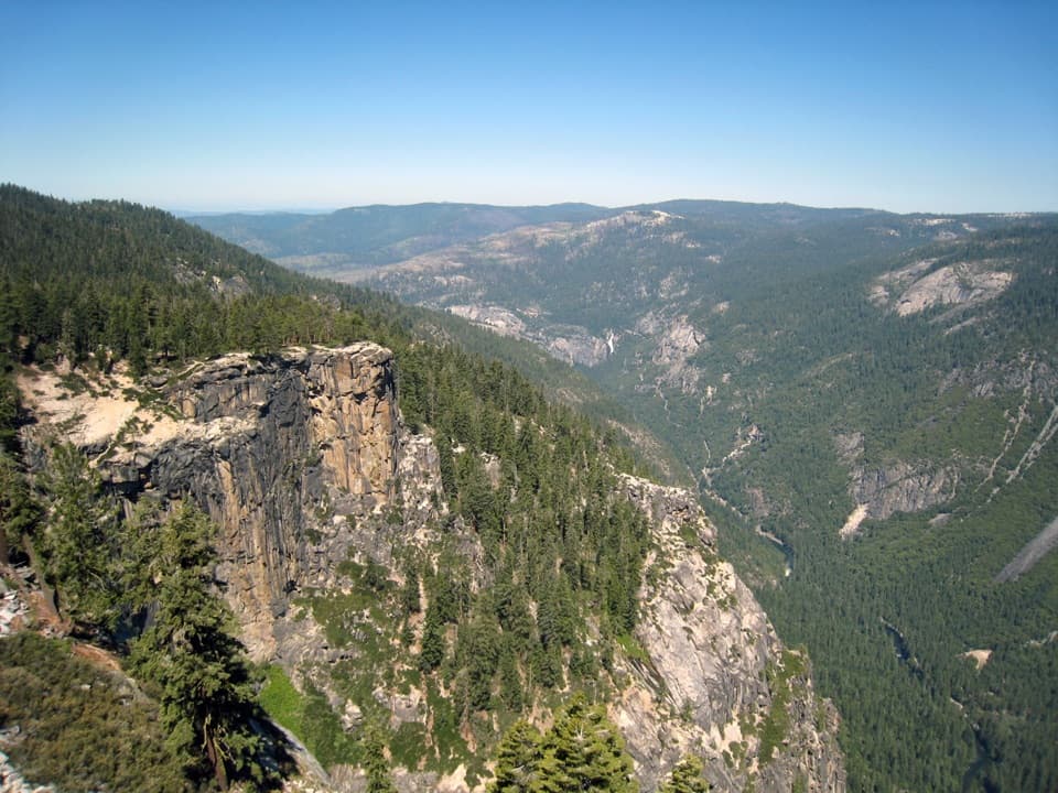
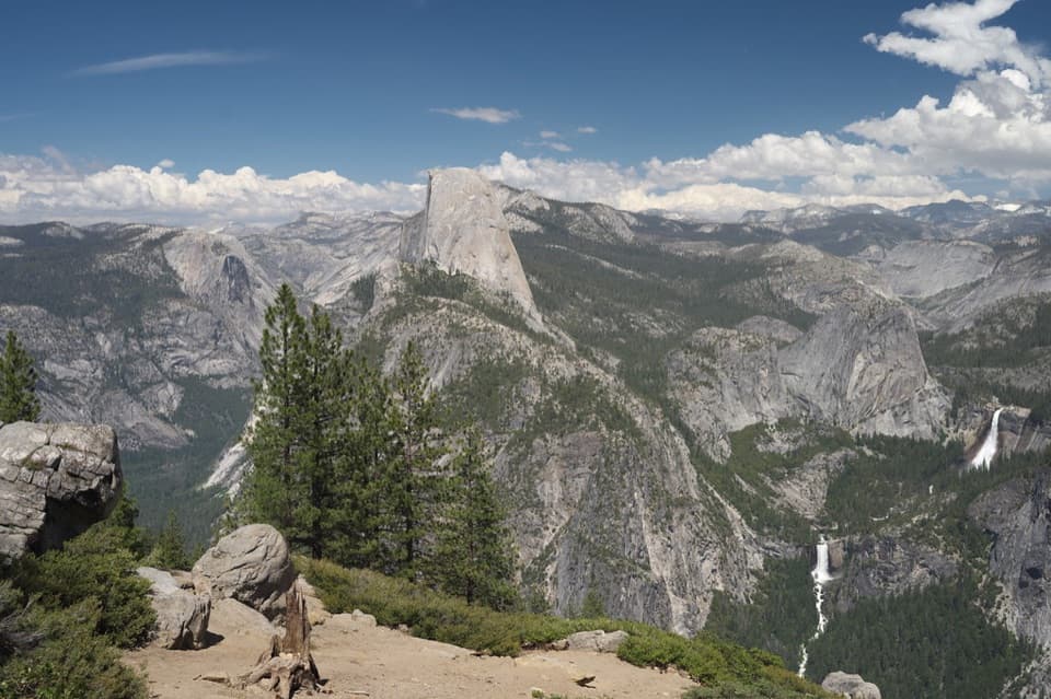
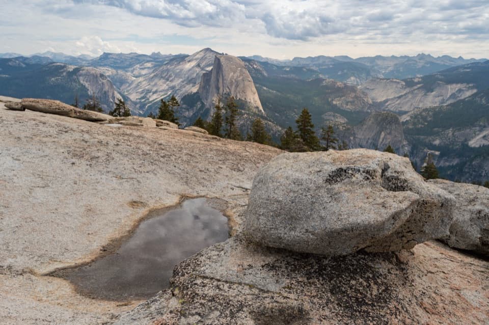
The signature view comes early, on the descent from Glacier Point: the Panorama Trail foreground leads toward Half Dome, Nevada Falls and Vernal Falls. For a photo, include some of the trail in the foreground with the granite valley and falls behind it; a plain overlook crop loses the sense of walking this route.
Parkwolf’s verdictA view worth framing

Map & elevation

The route

Loading the Yosemite map
Full map
Elevation6,142–10,266 ft
TrailheadGlacier Point Trailhead37.72768, -119.57429
Keep this map with you offline in the Parkwolf app

Plan your hike

Before you go

Parking

Start at Glacier Point Trailhead and park in the Glacier Point lot. From Yosemite Valley or Wawona, the drive is about 30 miles and roughly an hour; there is no regular shuttle. Glacier Point Road is seasonal, usually open from late spring through fall. There is no road pickup at the southern boundary, so arrange onward travel before setting out. Overnight parking on Glacier Point Road is prohibited from October 15 until seasonal reopening.

Safety

A wilderness permit and bear-resistant food canister are required for overnight travel; dogs are prohibited on trails and in wilderness. Expect a steep initial descent, a ford of Illilouette Creek, high-elevation exposure above 10,000 feet and a remote point-to-point finish. A coarse 25-point profile suggests about 4,650 feet of cumulative climbing. The TST follows a composite corridor rather than one continuously maintained trail.

4 active Yosemite alerts

  • ClosureDome Fire closes Glacier Point Road and trailsMentions Glacier Point Road, referenced in this guideGlacier Point Road is temporarily closed because Dome Fire smoke reduces visibility and to allow firefighting operations; some trails south of the road are also closed.Official details
  • CautionMist Trail access limited during October repairsThe Mist Trail between its John Muir Trail junction above the Vernal Fall footbridge and the top of Vernal Fall has limited access through October for repair work.Official details
See all 4 alerts
The Parkwolf Tour Guide on a dash-mounted phone, driving into Yosemite Valley

“You're coming up on Glacier Point, more than three thousand feet above Curry Village. Half Dome is the obvious landmark, but give yourself time to look down into the Valley and across to the high Sierra too.”

Yosemite Tour Guide

Yosemite, narrated.

Parkwolf is a GPS audio tour guide for Yosemite National Park. As you drive, it chimes in with what’s ahead: hidden gems, upcoming stops, history, geology, and wildlife, right through your car’s speakers.

See the Yosemite audio tour

Recorded for this trailhead

Glacier Point
0:00 / 0:31
“You're coming up on Glacier Point, more than three thousand feet above Curry Village. Half Dome is the obvious landmark, but give yourself time to look down into the Valley and across to the high Sierra too.”

Plays as you drive up to this trailhead in the Parkwolf Yosemite Tour Guide.

More stories near here in the app

  • Washburn Point
  • Happy Isles and Vernal Fall Footbridge
  • Curry Village and Stoneman Meadow
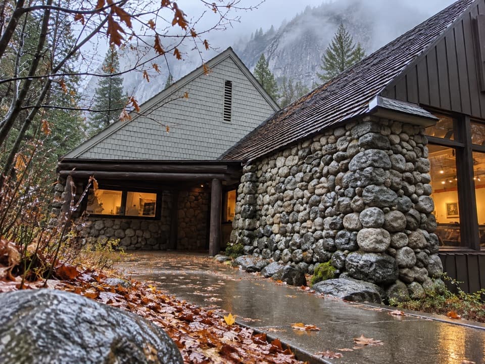
  • Yosemite Conservation Heritage Center
  • 125 audio storiesacross Yosemite’s roads, triggered by GPS as you drive
  • Wildlife heatmapsfor Black Bear, Peregrine Falcon, Mule Deer, and 13 more
  • Works offlinemaps, 141 trails, 99 places, and audio download before you lose signal
  • CarPlay readysimple controls built for the drive
★★★★★
“We just drove through Yosemite and it made our trip listening to this app as we drove through. Like having a tour guide in the car with you.”
Roddy 3210App Store review
Download Parkwolf on the App StoreGet Parkwolf on Google Play

4.7 from 8,600+ ratings

Trail guide

Hiking Theodore Solomons Trail (Yosemite Section)

A Yosemite through-routeThe Yosemite section of Theodore Solomons Trail is a 20.

The Yosemite section of Theodore Solomons Trail is a 20.1-mile, one-way backpacking route from Glacier Point to the park’s southern boundary near Fernandez Pass. It links existing Panorama, Buena Vista and Merced Pass trails rather than following one continuously built TST tread. This is a point-to-point route, not a loop or a stand-alone day hike; it continues beyond Yosemite, so plan the next leg and an exit before starting.

Plan for a long backcountry crossingAllow multiple days for the distance, remote terrain and roughly 4,650 feet of cumulative…

Allow multiple days for the distance, remote terrain and roughly 4,650 feet of cumulative climbing shown by a coarse elevation profile. The route drops sharply from Glacier Point, then climbs through the high country to a sampled high point near 10,270 feet. Overnight wilderness travel requires a permit and a bear-resistant food canister; dogs are not allowed on trails or in wilderness. There is no regular shuttle to Glacier Point and no road pickup where this section leaves the park.

Glacier Point to Illilouette CreekThe route starts on Panorama Trail, with a steep descent toward Illilouette Creek and wide…

The route starts on Panorama Trail, with a steep descent toward Illilouette Creek and wide views of Half Dome and the waterfalls. The first 2.5 miles lose nearly 1,000 feet. At the Illilouette Falls junction, the TST leaves the main Panorama descent and continues toward the creek; on this line, expect a creek ford. Park signs give about 3.5 miles to the creek while a recorded GPS track measures 4.5, so treat that first-stage turnaround as roughly four miles one way, not as the distance of this Yosemite section.

South through the high countryAfter Illilouette Creek, the mapped corridor follows existing routes toward Buena Vista and…

After Illilouette Creek, the mapped corridor follows existing routes toward Buena Vista and Merced Pass, then continues south to the boundary near Fernandez Pass. The grade rises again after the creek and the sampled profile reaches above 10,000 feet. The trail is a composite route, so carry reliable navigation and check the current route and water crossings before leaving the developed Glacier Point area.

The route’s historyTheodore Solomons proposed the route in 1974 as a lower-elevation alternative to the John Muir…

Theodore Solomons proposed the route in 1974 as a lower-elevation alternative to the John Muir Trail. It connects existing trails across the Sierra rather than forming one separately maintained tread. That distinction matters here: the Yosemite line is a defined section of a much longer through-route, and the boundary is only a map endpoint, not a trailhead or vehicle-access point.

Wildlife

Wildlife in Yosemite

All Yosemite wildlife maps

Sighting maps show where each species has been reported across Yosemite. Wildlife moves, so no sighting is guaranteed.

Keep exploring

Near Theodore Solomons Trail (Yosemite Section)

See it all on the map

Trails that start nearby

Places near the trailhead

Parkwolf’s Yosemite ranking

Top-rated trails in Yosemite

All 141 trails
  1. 1Half Dome TrailChallenging · 14.3 mi
  2. 2Clouds Rest TrailChallenging · 14 mi
  3. 3Nevada Fall Loop via Mist and John Muir TrailsChallenging · 6.4 mi
  4. 4Yosemite Falls TrailChallenging · 7.2 mi
  5. 5Panorama TrailChallenging · 8.2 mi
  6. 6Four Mile TrailChallenging · 4.8 mi

Take Parkwolf to Yosemite.

The audio tour guide for the drive, plus offline maps, trails, and wildlife heatmaps for when the signal drops.

4.7 from 8,600+ ratings

Download Parkwolf on the App StoreGet Parkwolf on Google Play