Sentinel Dome in Yosemite National Park

Sight · Yosemite National Park

Sentinel Dome

A short granite scramble, then the whole horizon opens up.

Photo: Wikimedia Commons
Type
Sight
Nearest trail
0.6 mi
Audio stories
13 nearby
  • Trailhead
  • Parking
  • Scenic viewpoint
  • #14 of 52 sights

Hear the audio tour

Sentinel Dome and Taft Point

Overview

About Sentinel Dome

Why stop

  • The summit panorama sweeps across Yosemite’s granite landmarks.

Heads up

  • The steep, exposed scramble makes the finish harder than the mileage suggests.

Map

Where it is

Loading the Yosemite map
Full map
SightSentinel Dome37.72298, -119.58433
Keep this map with you offline in the Parkwolf app

Plan your stop

Before you go

4 active Yosemite alerts

  • ClosureDome Fire closes Glacier Point Road and trailsMentions Glacier Point Road, referenced in this guideGlacier Point Road is temporarily closed because Dome Fire smoke reduces visibility and to allow firefighting operations; some trails south of the road are also closed.Official details
  • CautionMist Trail access limited during October repairsThe Mist Trail between its John Muir Trail junction above the Vernal Fall footbridge and the top of Vernal Fall has limited access through October for repair work.Official details

See all 4 alerts
The Parkwolf Tour Guide on a dash-mounted phone, driving into Yosemite Valley

“You're approaching the Sentinel Dome and Taft Point trailhead. My pick for a full-circle mountain view is Sentinel Dome: two miles round trip, with a steep final climb on bare granite.”

Yosemite Tour Guide

Yosemite, narrated.

Parkwolf is a GPS audio tour guide for Yosemite National Park. As you drive, it chimes in with what’s ahead: hidden gems, upcoming stops, history, geology, and wildlife, right through your car’s speakers.

See the Yosemite audio tour

Recorded for this place

Sentinel Dome and Taft Point
0:00 / 0:24
“You're approaching the Sentinel Dome and Taft Point trailhead. My pick for a full-circle mountain view is Sentinel Dome: two miles round trip, with a steep final climb on bare granite.”

Plays as you drive up to Sentinel Dome in the Parkwolf Yosemite Tour Guide.

More stories near here in the app

  • Glacier Point
  • Washburn Point
  • Swinging Bridge and Four Mile Trail
  • Yosemite Conservation Heritage Center
  • 125 audio storiesacross Yosemite’s roads, triggered by GPS as you drive
  • Wildlife heatmapsfor Black Bear, Peregrine Falcon, Mule Deer, and 13 more
  • Works offlinemaps, 141 trails, 99 places, and audio download before you lose signal
  • CarPlay readysimple controls built for the drive
★★★★★
“We just drove through Yosemite and it made our trip listening to this app as we drove through. Like having a tour guide in the car with you.”
Roddy 3210App Store review
Download Parkwolf on the App StoreGet Parkwolf on Google Play

4.7 from 8,600+ ratings

Guide

More about Sentinel Dome

A short climb to a huge panoramaSentinel Dome is a rounded granite summit above Yosemite Valley, reached by a 2-mile round trip…

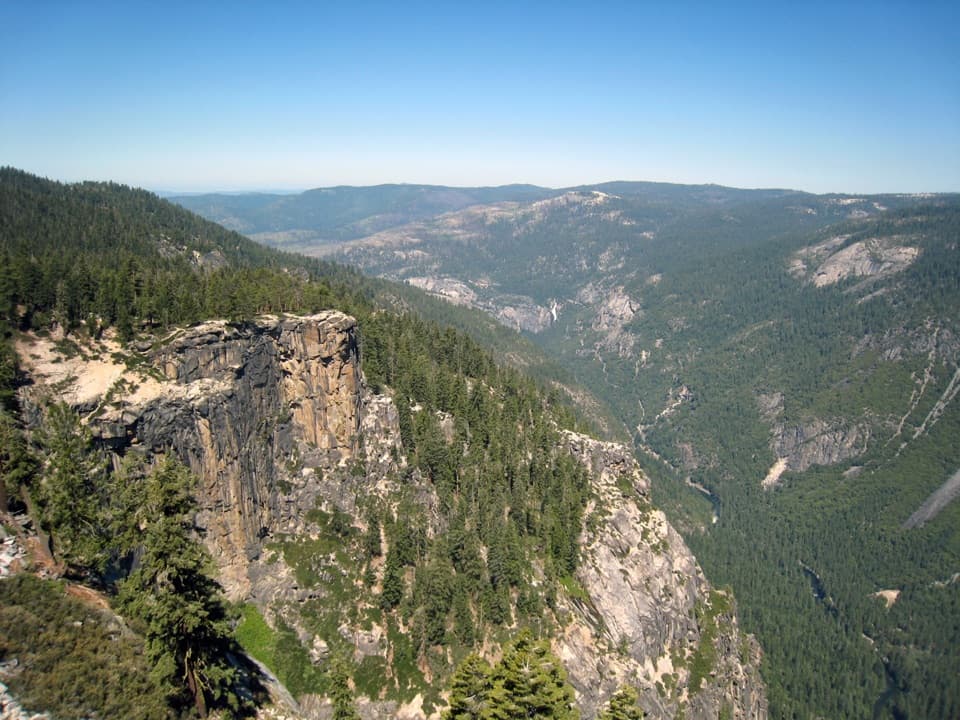
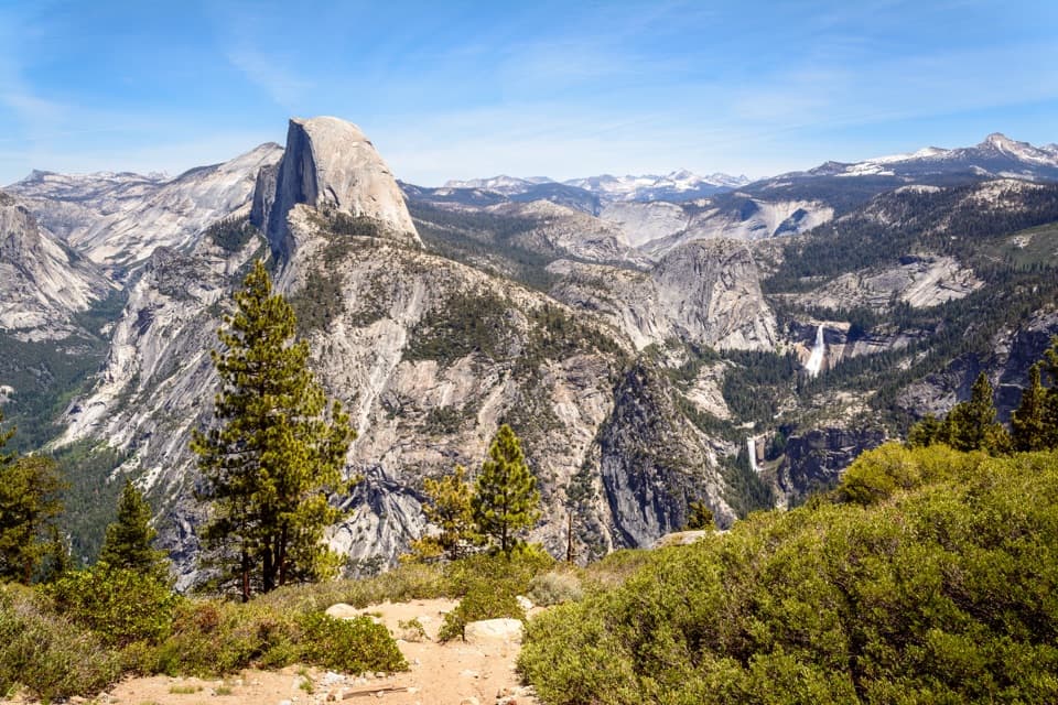
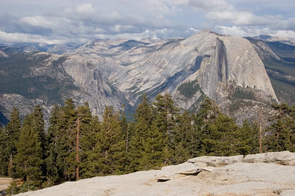
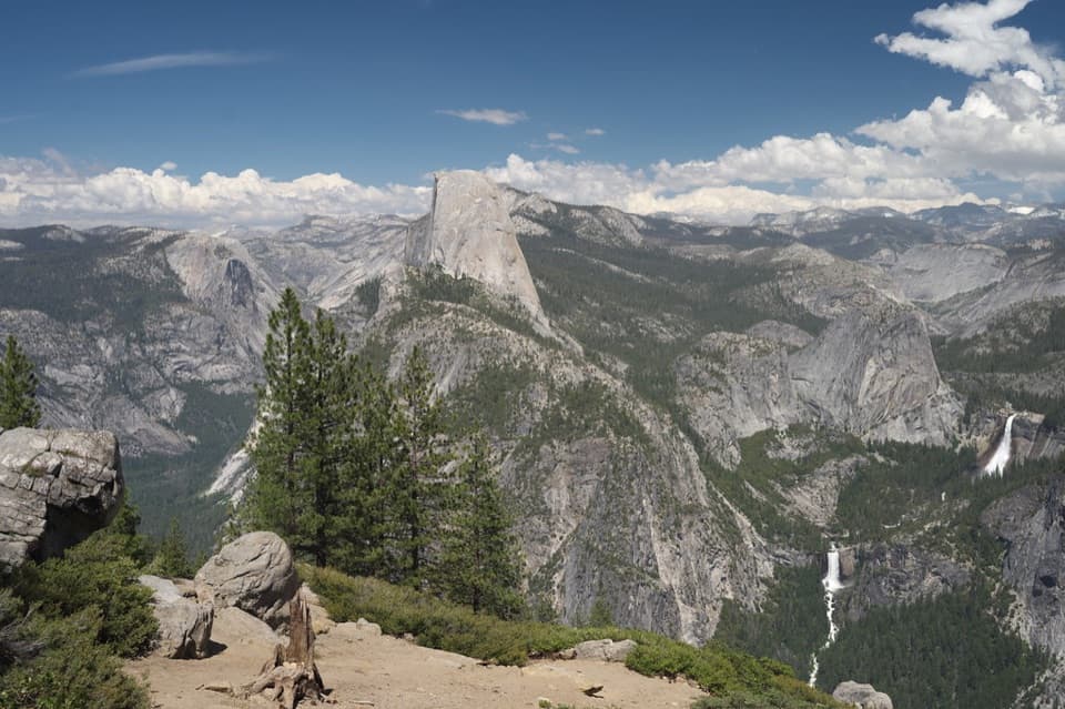
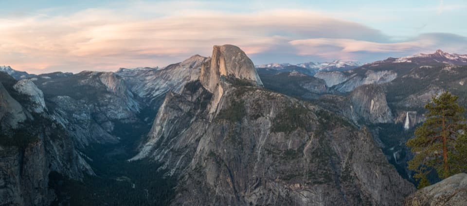
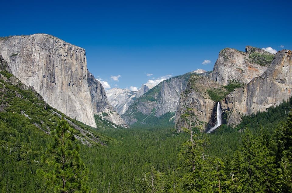
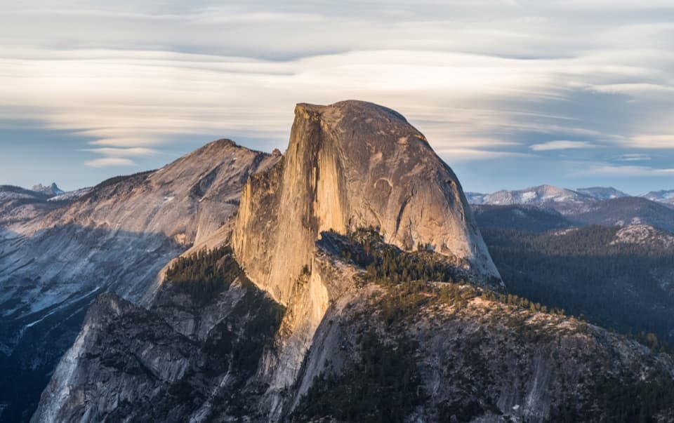
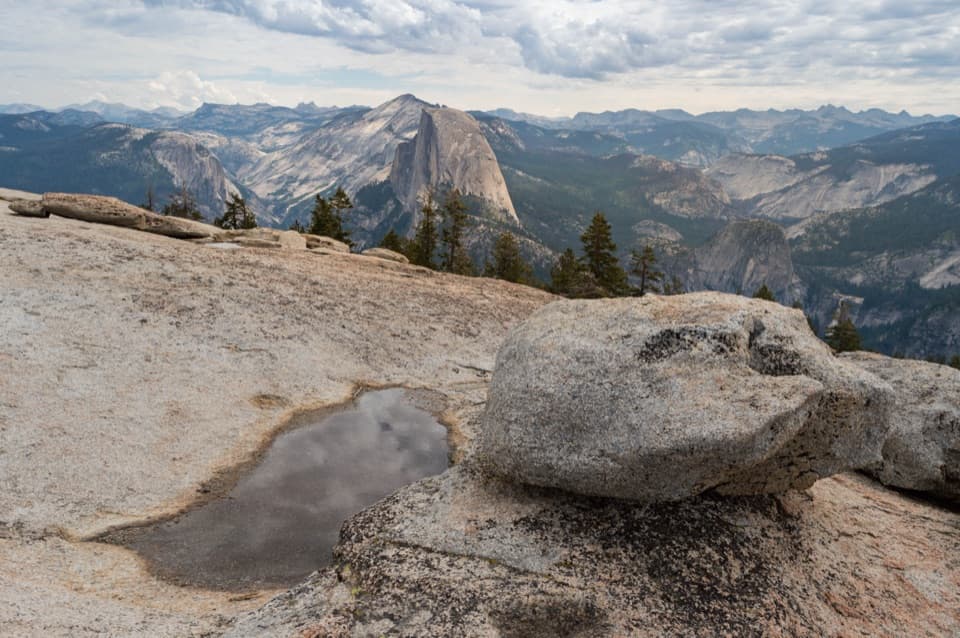
Sentinel Dome is a rounded granite summit above Yosemite Valley, reached by a 2-mile round trip from the shared Sentinel Dome/Taft Point trailhead on Glacier Point Road. Allow about 1–2 hours for the round trip, with 400 feet of elevation gain. The reward is a full-circle view across Yosemite’s high country and valley landmarks, including Half Dome, El Capitan, Yosemite Falls and Nevada Fall on a clear day.

Where the walk changes characterThe approach crosses forest before the trail reaches open granite.

The approach crosses forest before the trail reaches open granite. The last slope up the dome is a steep scramble, so the modest distance can feel tougher near the top than it looks on paper. Take your time on the bare rock, especially with children or anyone uneasy on steep ground. The trailhead is shared with Taft Point; the two-mile figure is for Sentinel Dome alone.

A granite shape made by iceThe summit’s smooth, rounded profile is part of Yosemite’s glacial landscape.

The summit’s smooth, rounded profile is part of Yosemite’s glacial landscape. Ice polished the park’s granite and helped shape its domes; the last major Tioga glacier began advancing about 26,000 years ago and reached its maximum roughly 18,000 years ago. From the top, the view makes that larger landscape easy to read: broad domes, deep valleys and sheer walls all sit within one sweep.

The pine in Ansel Adams’s photographA Jeffrey pine once grew on this summit, where Ansel Adams photographed it in 1940.

A Jeffrey pine once grew on this summit, where Ansel Adams photographed it in 1940. That image is part of Sentinel Dome’s story: the pine’s wind-shaped silhouette made the bare granite and open sky recognizable long before most people knew the summit by name.

Plan for the road and the weatherGlacier Point Road usually opens to cars from late May through October or November, depending…

Glacier Point Road usually opens to cars from late May through October or November, depending on conditions, so check its status before setting out. Services in the Glacier Point area are limited; carry enough water for the whole hike. The summit is exposed; stay off domes during thunderstorms.

Put the granite in the frameFor a photo, include a strip of the pale summit rock in the foreground with Half Dome or the…

For a photo, include a strip of the pale summit rock in the foreground with Half Dome or the valley beyond it. That close granite makes the distance and the open dome easier to see than a tight shot of the faraway cliffs.

Wildlife

Wildlife in Yosemite

All Yosemite wildlife maps

Sighting maps show where each species has been reported across Yosemite. Wildlife moves, so no sighting is guaranteed.

Keep exploring

Near Sentinel Dome

See it all on the map

Trails nearby

More stops nearby

Parkwolf’s Yosemite ranking

Top sights in Yosemite

All 99 places
  1. 1Tunnel ViewSight
  2. 2Glacier PointSight
  3. 3Yosemite FallsSight
  4. 4Half DomeSight
  5. 5Bridalveil FallSight
  6. 6El Capitan MeadowSight

Take Parkwolf to Yosemite.

The audio tour guide for the drive, plus offline maps, trails, and wildlife heatmaps for when the signal drops.

4.7 from 8,600+ ratings

Download Parkwolf on the App StoreGet Parkwolf on Google Play