Pohono Trail in Yosemite National Park

Yosemite National Park, CA

Pohono Trail

Five south-rim viewpoints make this long day earn its keep.

Photo: Wikimedia Commons
Length
12.5mi
Time
9hr
Elev. change
3,261ft
Difficulty
Challenging
  • No dogs
  • High point 7,664 ft
  • #30 of 141 in Yosemite

Hear the audio tour

Glacier Point

Overview

About Pohono Trail

Why go

  • Five named viewpoints spread the valley panorama along the route.
  • The Glacier Point-to-Tunnel View direction is net downhill.

Heads up

  • It is a long one-way hike with no return shuttle.
  • Four miles between Taft and Dewey leave the rim views behind.

Map & elevation

The route

Loading the Yosemite map
Full map
Elevation4,403–7,664 ft
TrailheadGlacier Point Parking and Tour Unloading Area37.72730, -119.57474
Keep this map with you offline in the Parkwolf app

Plan your hike

Before you go

Parking

Start at the Glacier Point Parking and Tour Unloading Area; finish at the Tunnel View parking area. Arrange a car shuttle or pickup between the ends before starting. There is no shuttle from Tunnel View or Yosemite Valley back to Glacier Point. Glacier Point Road closes seasonally, so check access before planning the hike.

Best time to go

Water and other services are limited along the route. Water is typically available at Glacier Point from late spring into early fall, but plan to carry enough for the whole walk. Glacier Point Road is the car access to the east end and usually closes seasonally; snow can linger on the trail after the road opens. Pets and bicycles are not allowed on Yosemite hiking trails.

Safety

Several stream crossings are unbridged and can run high in late spring and early summer. Water and other services are limited beyond Glacier Point; carry enough for the full day.

4 active Yosemite alerts

  • ClosureDome Fire closes Glacier Point Road and trailsMentions Glacier Point Road, referenced in this guideGlacier Point Road is temporarily closed because Dome Fire smoke reduces visibility and to allow firefighting operations; some trails south of the road are also closed.Official details
  • CautionMist Trail access limited during October repairsThe Mist Trail between its John Muir Trail junction above the Vernal Fall footbridge and the top of Vernal Fall has limited access through October for repair work.Official details
See all 4 alerts
The Parkwolf Tour Guide on a dash-mounted phone, driving into Yosemite Valley

“You're coming up on Glacier Point, more than three thousand feet above Curry Village. Half Dome is the obvious landmark, but give yourself time to look down into the Valley and across to the high Sierra too.”

Yosemite Tour Guide

Yosemite, narrated.

Parkwolf is a GPS audio tour guide for Yosemite National Park. As you drive, it chimes in with what’s ahead: hidden gems, upcoming stops, history, geology, and wildlife, right through your car’s speakers.

See the Yosemite audio tour

Recorded for this trailhead

Glacier Point
0:00 / 0:31
“You're coming up on Glacier Point, more than three thousand feet above Curry Village. Half Dome is the obvious landmark, but give yourself time to look down into the Valley and across to the high Sierra too.”

Plays as you drive up to this trailhead in the Parkwolf Yosemite Tour Guide.

More stories near here in the app

  • Washburn Point
  • Happy Isles and Vernal Fall Footbridge
  • Curry Village and Stoneman Meadow
  • Yosemite Conservation Heritage Center
  • 125 audio storiesacross Yosemite’s roads, triggered by GPS as you drive
  • Wildlife heatmapsfor Black Bear, Peregrine Falcon, Mule Deer, and 13 more
  • Works offlinemaps, 141 trails, 99 places, and audio download before you lose signal
  • CarPlay readysimple controls built for the drive
★★★★★
“We just drove through Yosemite and it made our trip listening to this app as we drove through. Like having a tour guide in the car with you.”
Roddy 3210App Store review
Download Parkwolf on the App StoreGet Parkwolf on Google Play

4.7 from 8,600+ ratings

Trail guide

Hiking Pohono Trail

The full south-rim dayThe Pohono Trail is a 12.

The Pohono Trail is a 12.5-mile, one-way point-to-point hike along the south rim of Yosemite Valley, from Glacier Point to Tunnel View. Plan on eight to ten hours. This direction loses elevation overall, but several moderate and steep climbs break up the descent, so treat it as a hard full-day hike. Arrange your ride before you start: there is no shuttle from Tunnel View or Yosemite Valley back to Glacier Point. Walking the route in reverse makes the climb much harder.

From Glacier Point to the rimThe start is at Glacier Point, about 3,200 feet above the valley.

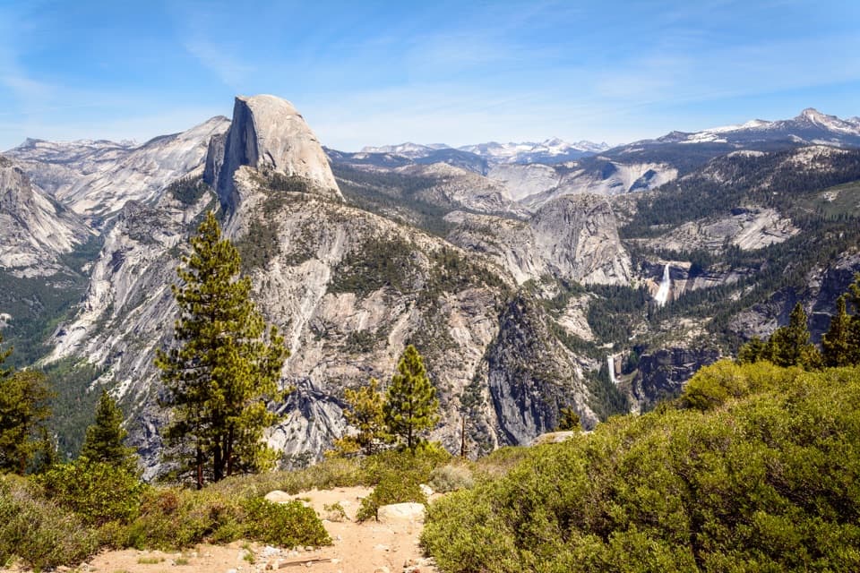
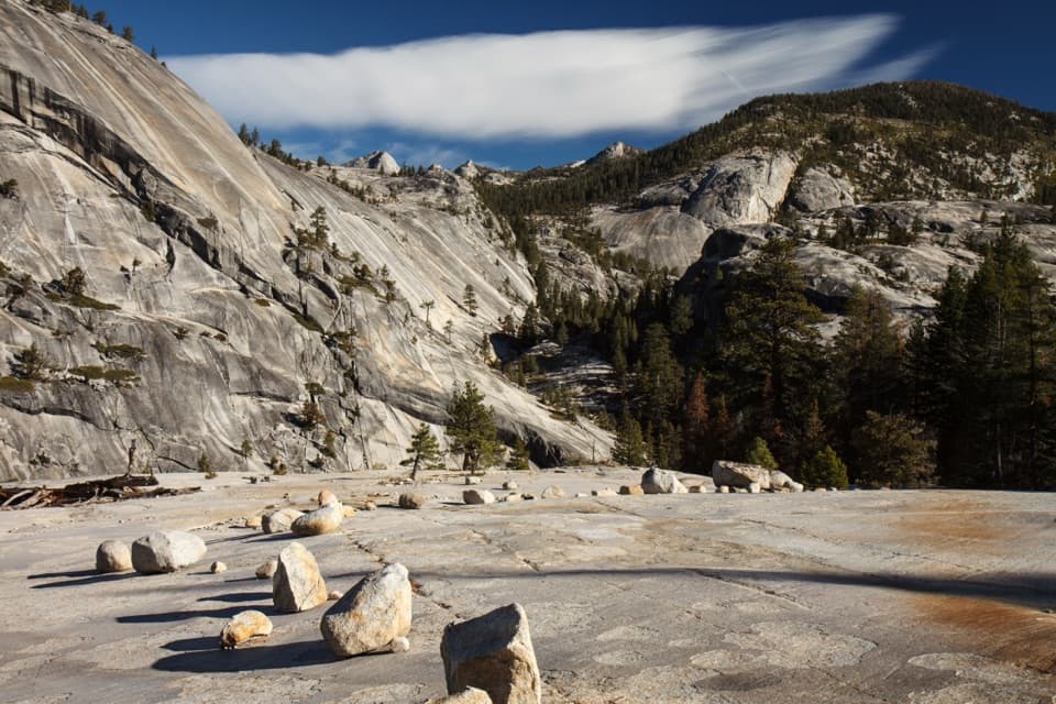
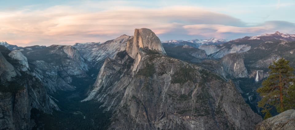
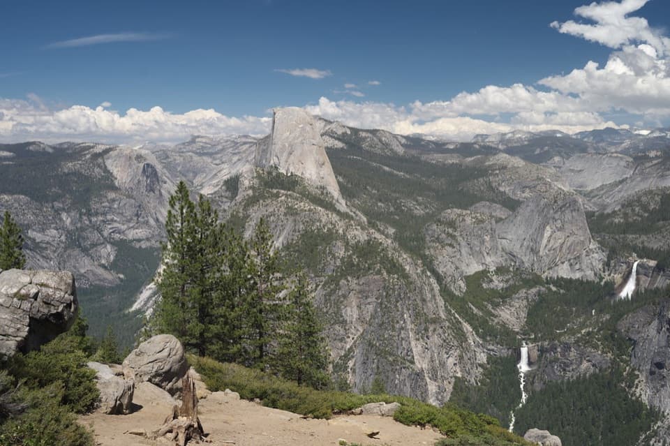
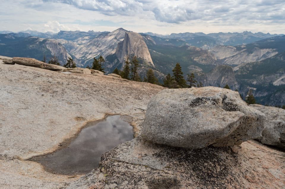
The start is at Glacier Point, about 3,200 feet above the valley. The overlook gives you a first look at Half Dome and the high Sierra before the trail heads west. The first mile climbs about 600 feet toward the base of Sentinel Dome, then the route winds through forest and open granite as it follows the south rim. Expect more ups and downs than the net descent suggests.

Five named viewpoints, and a long quiet stretchFrom east to west, the main south-rim viewpoints are Roosevelt, Taft, Dewey, Crocker and…

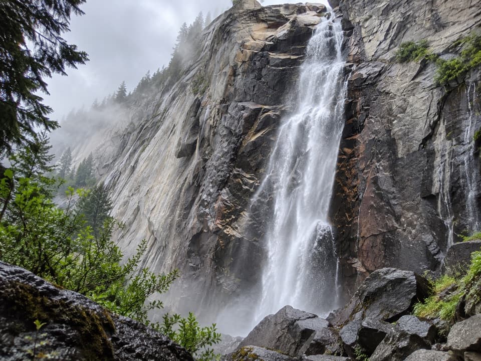
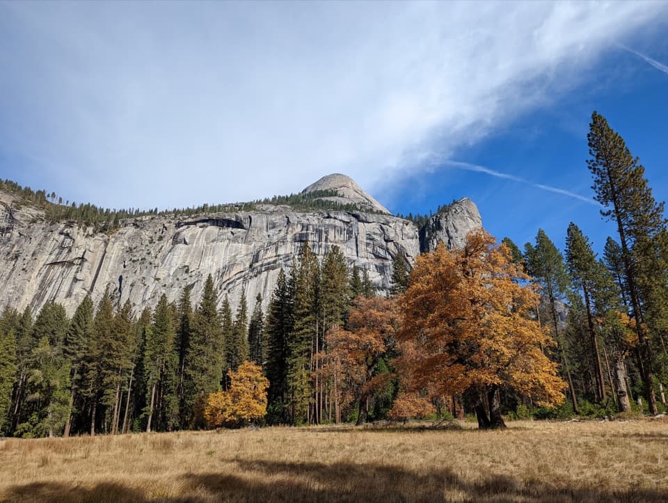
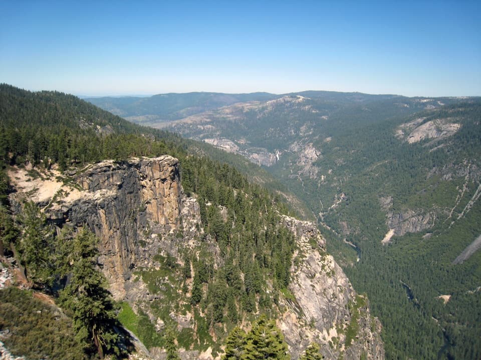
From east to west, the main south-rim viewpoints are Roosevelt, Taft, Dewey, Crocker and Stanford Points. Their angles shift across Half Dome, El Capitan, Cathedral Rocks and the valley waterfalls, so the payoff is a changing series of views rather than one summit. Between Taft and Dewey, though, the trail leaves the rim for about four miles and offers only occasional glimpses of the valley. Know that stretch is there; it is the route's longest quiet section. The views return at Dewey and continue west. At Crocker Point, include a little of the foreground granite in a photo to show the depth of the forested valley below.

The last miles to Tunnel ViewAfter Stanford Point, the trail continues toward Inspiration Point and finishes at Tunnel View.

After Stanford Point, the trail continues toward Inspiration Point and finishes at Tunnel View. The final mile and a half is rocky and uneven, a detail that matters when you reach it late in an already long hike. Several creek crossings break up the route; some have no bridge, and water can run high in late spring and early summer.

A shorter south-rim walkIf you want a viewpoint without committing to a one-way day, the separate Taft Point loop is 2.

If you want a viewpoint without committing to a one-way day, the separate Taft Point loop is 2.2 miles round trip and usually takes one to two hours from the Sentinel Dome/Taft Point trailhead. It still depends on seasonal access to Glacier Point Road, but it is a much smaller commitment than the full Pohono traverse.

Wildlife

Wildlife in Yosemite

All Yosemite wildlife maps

Sighting maps show where each species has been reported across Yosemite. Wildlife moves, so no sighting is guaranteed.

Keep exploring

Near Pohono Trail

See it all on the map

Trails that start nearby

Places near the trailhead

Parkwolf’s Yosemite ranking

Top-rated trails in Yosemite

All 141 trails
  1. 1Half Dome TrailChallenging · 14.3 mi
  2. 2Clouds Rest TrailChallenging · 14 mi
  3. 3Nevada Fall Loop via Mist and John Muir TrailsChallenging · 6.4 mi
  4. 4Yosemite Falls TrailChallenging · 7.2 mi
  5. 5Panorama TrailChallenging · 8.2 mi
  6. 6Four Mile TrailChallenging · 4.8 mi

Take Parkwolf to Yosemite.

The audio tour guide for the drive, plus offline maps, trails, and wildlife heatmaps for when the signal drops.

4.7 from 8,600+ ratings

Download Parkwolf on the App StoreGet Parkwolf on Google Play