Bubbles Nubble Loop in Acadia National Park

Acadia National Park, ME

Bubbles Nubble Loop

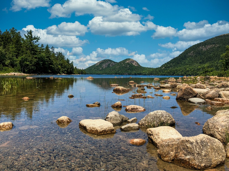
Three summits, two lakes, and one boulder left by the ice.

Photo: Wikimedia Commons
Length
3.5mi
Time
2.5hr
Elev. change
522ft
Difficulty
Moderate
  • Loop
  • Dogs allowed
  • High point 860 ft
  • #20 of 142 in Acadia

Hear the audio tour

Bubbles Divide and Bubble Rock

Overview

About Bubbles Nubble Loop

Why go

  • Three distinct summit viewpoints on one loop
  • Bubble Rock adds a memorable glacial feature

Heads up

  • Steep, exposed granite can be slick when wet
  • The complete three-summit route is longer than the published 2.6-mile total

Map & elevation

The route

Loading the Acadia map
Full map
Elevation338–860 ft
TrailheadBubbles Divide Trailhead / Bubbles parking lot44.34110, -68.25052
Keep this map with you offline in the Parkwolf app

Plan your hike

Before you go

Parking

Start at the Bubbles parking lot on Park Loop Road at Bubbles Divide Trailhead. The roadside lot is relatively small and can fill on busy days; Island Explorer serves the Bubbles seasonally from mid-June to October (check the current schedule).

Safety

Steep, exposed granite ledges and steps can be slick when wet. An Acadia entrance pass is required year-round; dogs must stay on a leash no longer than six feet. There is no accessible restroom at the trailhead.

4 active Acadia alerts

  • CautionAvoid water contact at Sand Beach LagoonDo not swim at Sand Beach Lagoon. - Bacterial levels have exceeded public-health standards, so the NPS has posted a Public Health Advisory.Official details
  • ClosureSchoodic Mountain Road closed for repairsSchoodic Mountain Road is closed from Schoodic Loop Road to the summit of Schoodic Head. - The closure began August 31 for resurfacing, regrading, and ditching.Official details
See all 4 alerts
A park ranger sits on a dash-mounted phone, talking, as Parkwolf’s Tour Guide plays “Army Cutworm Moths: A Grizzly Bear Buffet” on Grand Loop Road below Dunraven Pass in Yellowstone
Parkwolf Tour GuideThe highest, rockiest slopes around here are a summer buffet for grizzly bears.

Acadia Tour Guide

Your drive to Bubbles Nubble Loop, narrated.

Parkwolf is a GPS audio tour guide for Acadia National Park. As you drive, it chimes in with what’s ahead: hidden gems, upcoming stops, history, geology, and wildlife, right through your car’s speakers.

Recorded for this trailhead

Bubbles Divide and Bubble Rock
0:00 / 0:23
“You're nearing Bubbles Divide, the trailhead for Bubble Rock's perched boulder. For the shorter visit, walk to South Bubble and Bubble Rock and return the same way, about a mile with stairs and steep, uneven granite.”

Plays as you drive up to this trailhead in the Parkwolf Acadia Tour Guide.

More stories near here in the app

  • Bubble Pond and Its Rustic Bridge
  • Jordan Pond and Popovers
  • The Chickadee’s Hidden Pantry
  • Cadillac Mountain Summit
  • 116 audio storiesacross Acadia’s roads, triggered by GPS as you drive
  • Wildlife heatmapsfor Bald Eagle, Peregrine Falcon, White-tailed Deer, and 13 more
  • Works offlinemaps, 142 trails, 72 places, and audio download before you lose signal
  • CarPlay readysimple controls built for the drive
★★★★★
“…As we drove through Acadia it gave us a tour, which was really cool. Lots of great info about the parks and how to avoid the crowds. It’s a great travel companion!”
MyMysteryChicaApp Store review
Download Parkwolf on the App StoreGet Parkwolf on Google Play

4.7 from 8,600+ ratings

Trail guide

Hiking Bubbles Nubble Loop

The full three-summit loopBubbles Nubble Loop starts at Bubbles Divide, climbs South Bubble and North Bubble, reaches…

Bubbles Nubble Loop starts at Bubbles Divide, climbs South Bubble and North Bubble, reaches Conners Nubble, then returns by carriage road and Jordan Pond Carry. This record follows the complete three-summit directions, including the South Bubble and Bubble Rock out-and-back; the mapped line is 3.47 miles, or about 3.5. Plan around 2–3 hours for the steep climbs and viewpoint stops. The published 2.6-mile total appears to omit the South Bubble side trip even though the written directions include it. Leaving that spur out brings the mapped circuit to about 2.6 miles, so use the longer figure if you want all three summits. If Bubble Rock is your main goal, the shorter Bubbles hike is a better fit.

Route and footingFrom the Bubbles Divide parking area, steps climb quickly to a signposted junction.

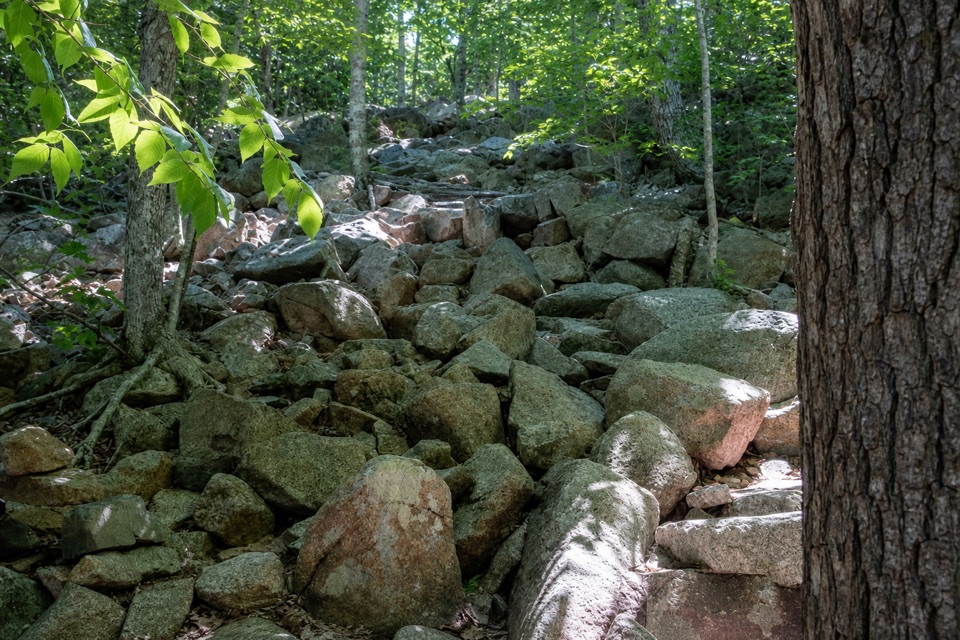
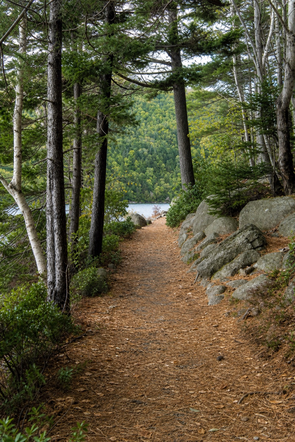
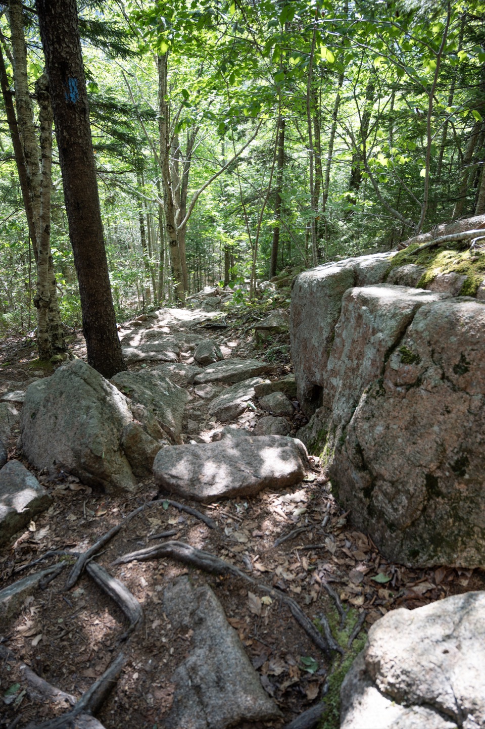
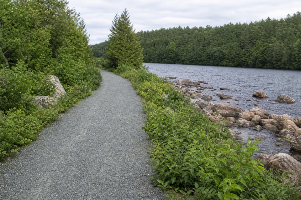
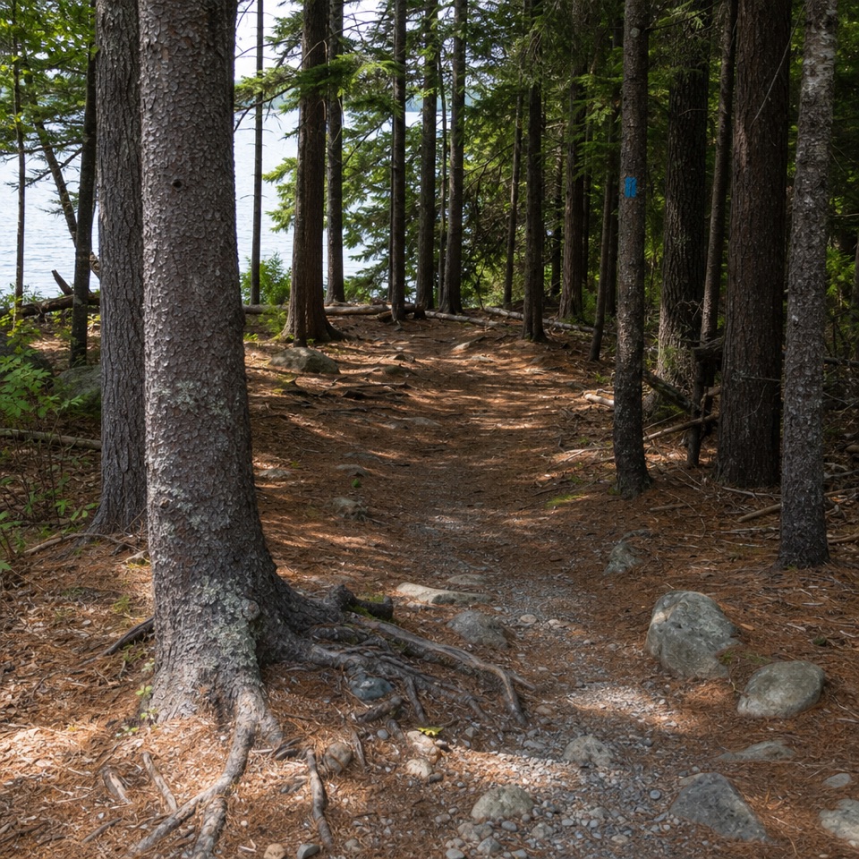
From the Bubbles Divide parking area, steps climb quickly to a signposted junction. Turn left for South Bubble and Bubble Rock, then retrace to the junction and continue toward North Bubble. The rocky ascent opens onto steep granite ledges; the footing is uneven and can be slick when wet. After North Bubble, the path descends through forest and crosses a carriage road. A short climb from the road reaches Conners Nubble; return the same way, then follow the carriage road for roughly 0.6 mile. A small wooden footbridge marks the Jordan Pond Carry turn. The Carry rises gently through forest, with planks over some wet stretches, to Bubbles Divide and the parking area. The two summit side trips are retraced, while the overall route closes as a loop.

Views from the ridgesThe three high points give the loop its variety.

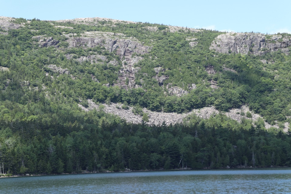
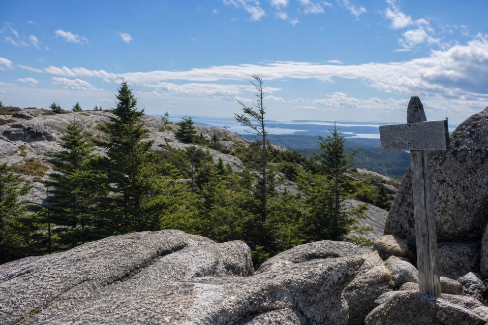
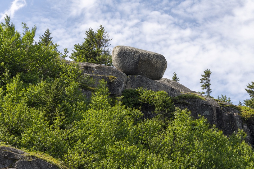
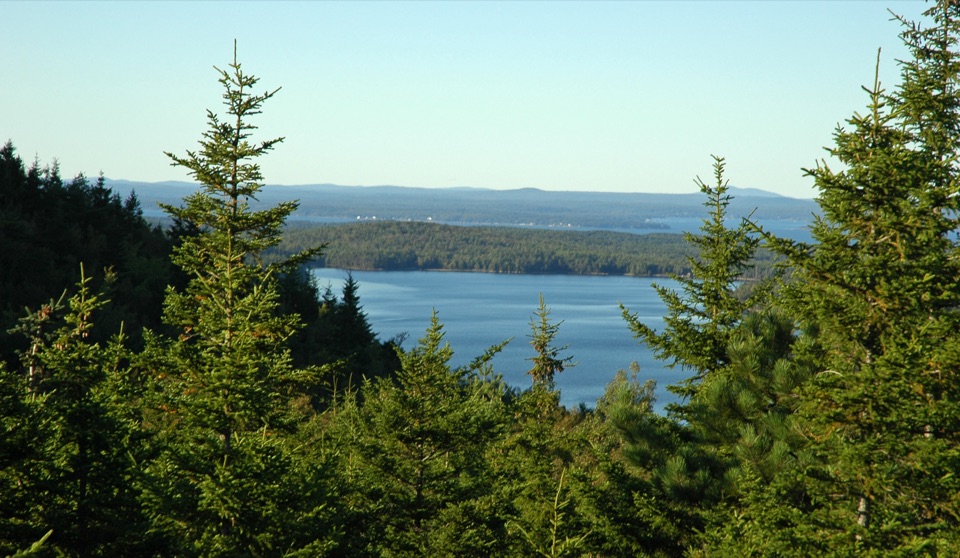
The three high points give the loop its variety. South Bubble looks across Jordan Pond valley; an open ledge beyond the summit marker is a good place to pause for that view. Bubble Rock, perched on the slope, is a large glacial erratic left behind as the ice retreated about 16,000 years ago. North Bubble opens toward Eagle Lake and the northern part of Mount Desert Island. Conners Nubble adds another angle over Eagle Lake, with nearby peaks beyond it. From the ridges, the wider panorama can include Jordan Pond, Pemetic and Sargent Mountains, and the Cranberry Isles.

Granite and glacial historyThe rounded, craggy shapes of the Bubbles are granite peaks sculpted by erosion and frost.

The rounded, craggy shapes of the Bubbles are granite peaks sculpted by erosion and frost. Their bedrock formed about 420 million years ago. Much later, retreating ice left scattered boulders such as Bubble Rock and helped shape the island's valleys and lakes. Seeing the erratic beside the steep rock face makes the glacial story unusually tangible on a short hike.

Plan for the climbThe route is moderate overall, but the short steep sections, steps, exposed ledges and uneven…

The route is moderate overall, but the short steep sections, steps, exposed ledges and uneven rock take more care than the distance alone suggests. Wear closed-toe shoes with good traction, carry water, and allow time for the viewpoints. There is no activity reservation, but an Acadia entrance pass is required year-round. Dogs are allowed on a leash no longer than six feet. The trailhead has no accessible restroom. Seasonal access is listed for spring through fall; the Island Explorer serves the Bubbles from mid-June to October, so check its current schedule before relying on it.

Parking and a nearby stopBegin at the Bubbles parking lot on Park Loop Road at Bubbles Divide Trailhead.

Begin at the Bubbles parking lot on Park Loop Road at Bubbles Divide Trailhead. The roadside lot is relatively small and can fill on busy days; use the seasonal bus or choose another hike if you cannot find a space. Jordan Pond House is a separate nearby stop, not part of the loop, and is known for popovers and meals.

Wildlife

Wildlife in Acadia

All Acadia wildlife maps

Sighting maps show where each species has been reported across Acadia. Wildlife moves, so no sighting is guaranteed.

Keep exploring

Near Bubbles Nubble Loop

See it all on the map

Trails that start nearby

Places near the trailhead

Parkwolf’s Acadia ranking

Top-rated trails in Acadia

All 142 trails
  1. 1Beehive Loop TrailChallenging · 1.4 mi
  2. 2Precipice TrailChallenging · 2.1 mi
  3. 3Jordan Pond PathModerate · 3.3 mi
  4. 4Bubbles TrailModerate · 1.5 mi
  5. 5Ocean PathEasy · 2.2 mi
  6. 6Cadillac Mountain South Ridge TrailChallenging · 7.8 mi

Take Parkwolf to Acadia.

The audio tour guide for the drive, plus offline maps, trails, and wildlife heatmaps for when the signal drops.

4.7 from 8,600+ ratings

Download Parkwolf on the App StoreGet Parkwolf on Google Play