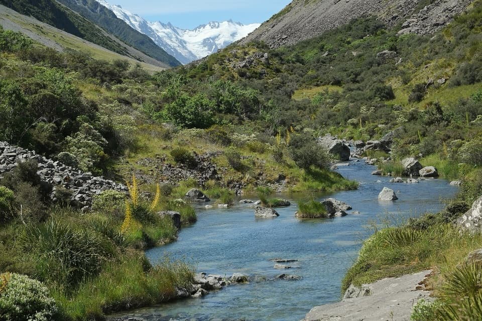
Ball Hut Track in Aoraki / Mount Cook National Park

#9 of 15 trails in Aoraki / Mount Cook

Aoraki / Mount Cook National Park, SI

Ball Hut Track

A rough moraine traverse to a tiny hut below Tasman Glacier.

Photo: Public Domain
Length
19.2km
Time
7hr
Elev. change
343m
Difficulty
Challenging
  • No dogs
  • High point 1,058 m

Hear the audio tour

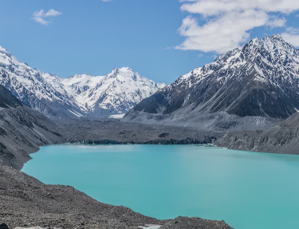
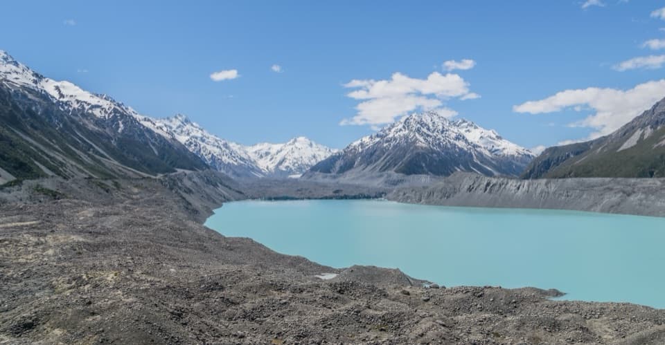
Tasman Glacier View and the Green Blue Lakes

Overview

About Ball Hut Track

Why go

  • Follows the historic Ball Hut Road to a remote glacier-side hut.
  • Glacier and peak views from the small hut flats.

Heads up

  • Unmarked, exposed route-finding beyond Husky Flat.
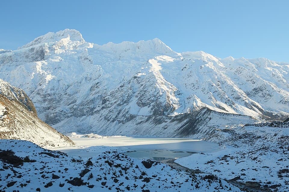
  • Large avalanches cross the road and track June–November.

Map & elevation

The route

Loading the Aoraki / Mount Cook map
Full map
Elevation715–1,058 m
TrailheadTasman Valley car park-43.69782, 170.16303
Keep this map with you offline in the Parkwolf app

Plan your hike

Before you go

Parking

Start at Tasman Valley car park at the end of Tasman Valley Road. Parking is free; the car park fills in summer, when overflow parking is along the road with care. Toilets may close in winter or during summer water shortages; drinking water is not available. Picnic tables and a day shelter are at the car park.

Best time to go

Large avalanches cross Ball Road and the track from June through November. Check with the visitor centre about conditions before entering this complex avalanche terrain. Dogs are not allowed on the track.

Safety

Beyond Husky Flat, expect unmarked high-country navigation around a large gorge on exposed, unstable moraine with collapsed sections; DOC advises high tramping and navigation skills. Complex avalanche terrain crosses the road and track from June through November. Dogs are prohibited.

A park ranger sits on a dash-mounted phone, talking, as Parkwolf’s Tour Guide plays “Army Cutworm Moths: A Grizzly Bear Buffet” on Grand Loop Road below Dunraven Pass in Yellowstone
Parkwolf Tour GuideThe highest, rockiest slopes around here are a summer buffet for grizzly bears.

Aoraki / Mount Cook Tour Guide

Your drive to Ball Hut Track, narrated.

Parkwolf is a GPS audio tour guide for Aoraki / Mount Cook National Park. As you drive, it chimes in with what’s ahead: hidden gems, upcoming stops, history, geology, and wildlife, right through your car’s speakers.

Recorded for this area

Tasman Glacier View and the Green Blue Lakes
0:00 / 0:23
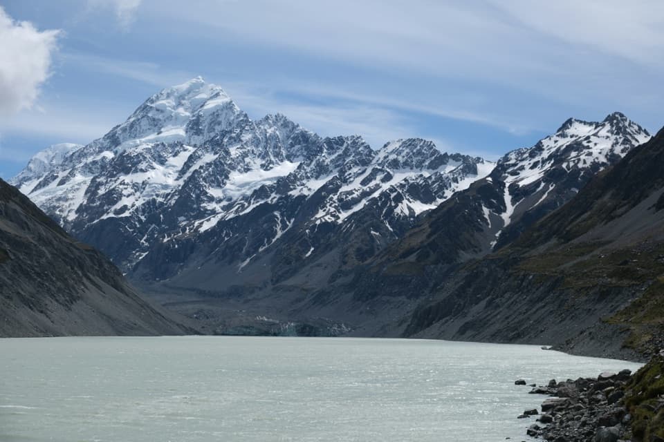
“Up ahead is the Tasman Valley car park, the start for a broad view across Tasman Lake to the glacier.”

Plays on the road 0.3 km from the trailhead in the Parkwolf Aoraki / Mount Cook Tour Guide.

More stories near here in the app

  • Perfume from Speargrass
  • Freda du Faur’s Six-Hour Ascent
  • The Night Aoraki Lost Its Summit
  • One River, Many Channels
  • 24 audio storiesacross Aoraki / Mount Cook’s roads, triggered by GPS as you drive
  • Wildlife heatmapsfor Kea, Rockwren, New Zealand Falcon, and 13 more
  • Works offlinemaps, 15 trails, 30 places, and audio download before you lose signal
  • CarPlay readysimple controls built for the drive
★★★★★
“Fantastic app with many points of information… It’s great to just turn on while you’re driving and it gives you an audio tour of the national Park. We love it!!!!”
JMJamesApp Store review
Download Parkwolf on the App StoreGet Parkwolf on Google Play

4.7 from 8,600+ ratings

Trail guide

Hiking Ball Hut Track

A long day to the glacierBall Hut Track is an advanced 19.

Ball Hut Track is an advanced 19.2 km out-and-back from Tasman Valley car park to a small hut on the west side of Tasman Glacier. The mapped corridor is about 9.6 km each way; allow roughly 6–8 hours. You follow the old Ball Hut Road for the first 5 km, then continue over exposed moraine to the hut and return the same way. A 9 km return figure does not fit that first 5 km section or the 3–4 hour one-way estimate, so plan for the longer walk. For a short glacier outing instead, the 1.5 km Tasman Glacier View Track starts at the same car park and climbs more than 300 steps to its viewpoint.

The old roadThe lower approach follows a historic 4WD road along the moraine beside the glacier.

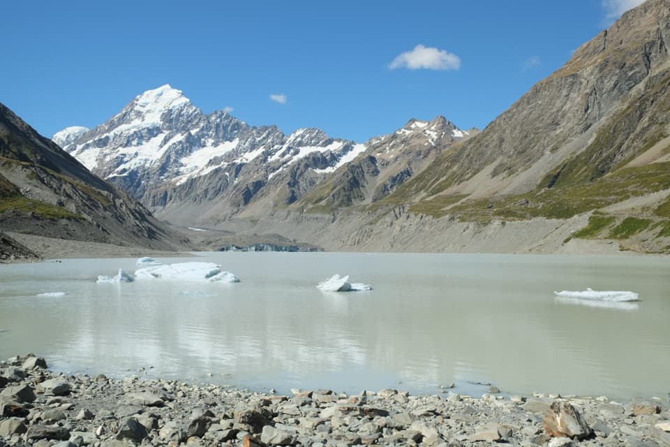
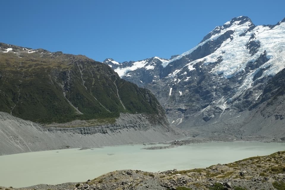
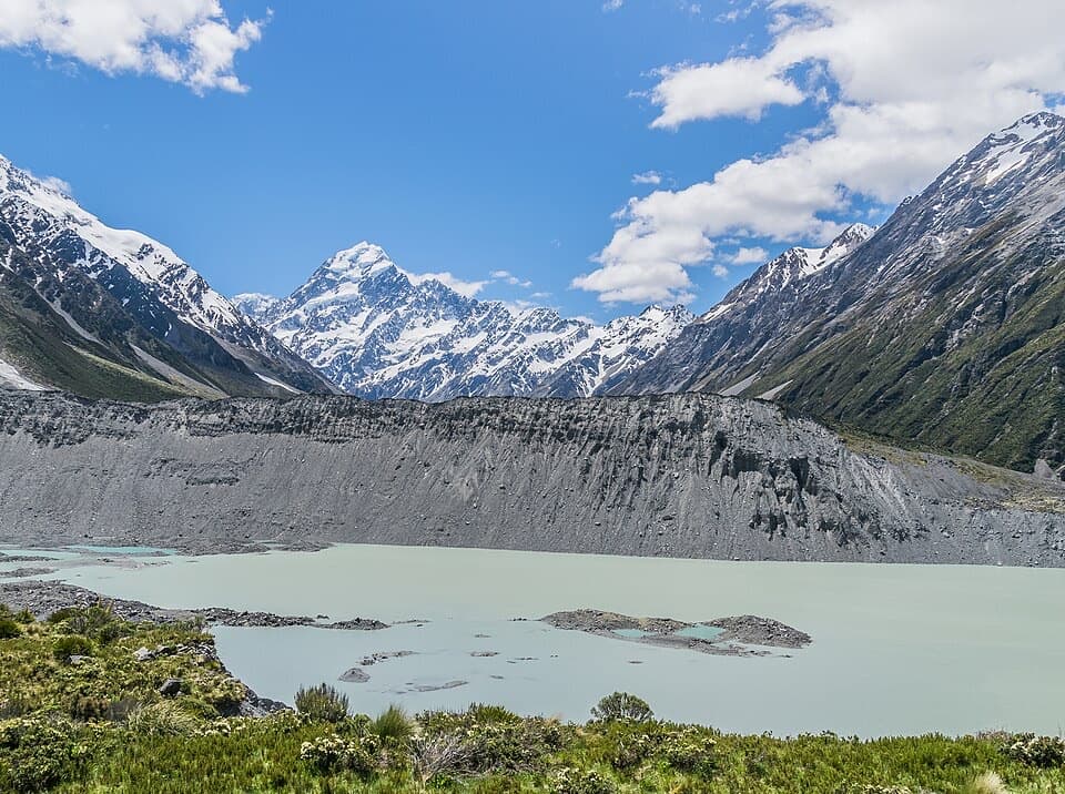
The lower approach follows a historic 4WD road along the moraine beside the glacier. Once the road ends, the route becomes harder and the views open onto the glacier and surrounding peaks. The moraine wall is unstable, with collapsed sections along the way, so the old road should not be mistaken for a maintained, easy walking track.

Past Husky FlatA severe-weather event in 2019 cut a large gorge at Husky Flat.

A severe-weather event in 2019 cut a large gorge at Husky Flat. Beyond it, there is no marked route; reaching Ball Hut means navigating exposed, unstable backcountry around the gorge and collapsed moraine. The mapped line follows the best available route corridor, but it is not on-the-ground wayfinding. Take high-country navigation and tramping skills, and check current access advice before setting out.

At Ball HutThe small standard hut has three bunks, mattresses, a non-flush toilet and untreated tap water…

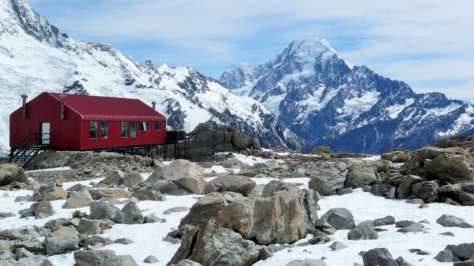
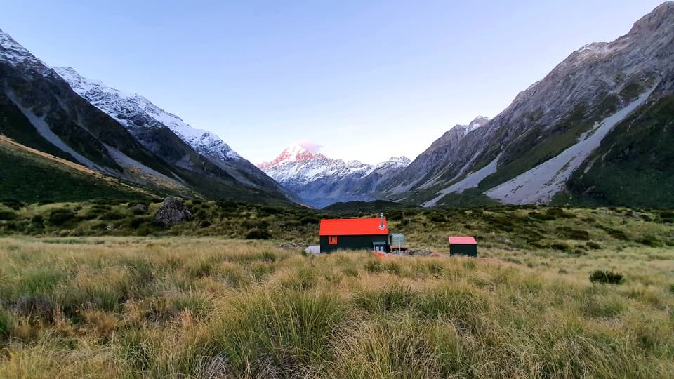
The small standard hut has three bunks, mattresses, a non-flush toilet and untreated tap water that must be boiled. It is first come, with no booking; DOC advises carrying a tent in summer in case the bunks are full. Overnight stays require an intentions form and hut fee through the visitor centre. From the grassy hut flats, look toward the Tasman Glacier and the surrounding peaks; the red hut makes a clear foreground for the alpine skyline.

Wildlife

Wildlife in Aoraki / Mount Cook

All Aoraki / Mount Cook wildlife maps

Sighting maps show where each species has been reported across Aoraki / Mount Cook. Wildlife moves, so no sighting is guaranteed.

Keep exploring

Near Ball Hut Track

See it all on the map

Trails that start nearby

Places near the trailhead

Parkwolf’s Aoraki / Mount Cook ranking

Top-rated trails in Aoraki / Mount Cook

All 15 trails
  1. 1Hooker Valley TrackModerate · 10 km
  2. 2Mueller Hut RouteChallenging · 10.4 km
  3. 3Sealy Tarns TrackChallenging · 5.3 km
  4. 4Kea Point TrackEasy · 3.1 km
  5. 5Tasman Glacier View TrackModerate · 1.5 km
  6. 6Red Tarns TrackModerate · 4 km

Take Parkwolf to Aoraki / Mount Cook.

The audio tour guide for the drive, plus offline maps, trails, and wildlife heatmaps for when the signal drops.

4.7 from 8,600+ ratings

Download Parkwolf on the App StoreGet Parkwolf on Google Play