Johnston Canyon Trail to Lower Falls in Banff National Park

#13 of 162 trails in Banff

Banff National Park, AB

Johnston Canyon Trail to Lower Falls

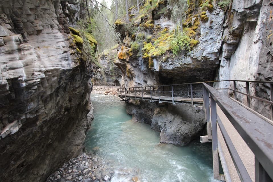
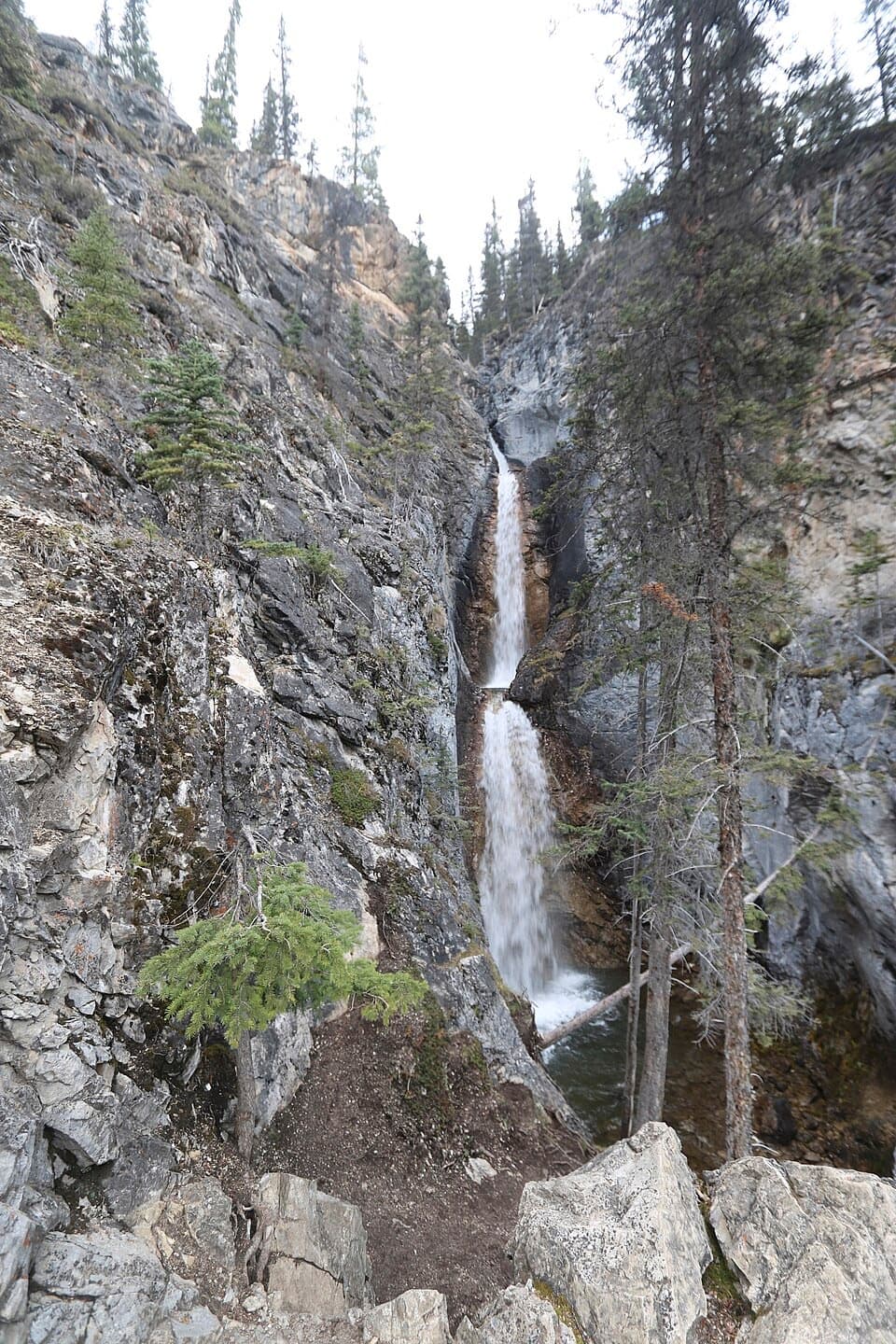
Paved canyon catwalks lead to a close view of Lower Falls.

Photo: Wikimedia Commons
Length
2.2km
Time
1hr
Elev. change
77m
Difficulty
Easy
  • Dogs allowed
  • High point 1,515 m

Hear the audio tour

Johnston Canyon and the Falls

Overview

About Johnston Canyon Trail to Lower Falls

Why go

  • Canyon catwalks keep the creek and rock walls close.
  • The short route ends at a close Lower Falls viewpoint.

Heads up

  • The narrow tunnel viewpoint can queue.
  • Busy catwalks leave little room to pass.

Map & elevation

The route

Loading the Banff map
Full map
Elevation1,438–1,515 m
TrailheadJohnston Canyon Day-use Area51.24652, -115.84108
Keep this map with you offline in the Parkwolf app

Plan your hike

Before you go

Parking

Start at Johnston Canyon Day-use Area on the Bow Valley Parkway, about 25 km northwest of Banff. The limited paved parking fills quickly. The area has eight accessible parking stalls, accessible flush toilets, a bike rack, picnic tables and benches.

Safety

Short sections reach a 26% grade and 28% cross-slope. The catwalks can ice over in winter, and the narrow Lower Falls tunnel bottlenecks.

8 active Banff alerts

  • ClosureJohnston Canyon Trail and Day Use Area closedMentions Johnston Canyon Trail, referenced in this guideJohnston Canyon Trail and Day Use Area are closed to all traffic and travel through December 11, 2026, because construction work requires protecting public and workers’ safety.Official details
  • ClosureBaker Lake and Hidden Lake campgrounds closed to campingCamping is prohibited at Baker Lake and Hidden Lake campgrounds through December 1, 2026, because a grizzly bear entered campsites and investigated tents and gear; the closures reduce risk to…Official details
See all 8 alerts
A park ranger sits on a dash-mounted phone, talking, as Parkwolf’s Tour Guide plays “Army Cutworm Moths: A Grizzly Bear Buffet” on Grand Loop Road below Dunraven Pass in Yellowstone
Parkwolf Tour GuideThe highest, rockiest slopes around here are a summer buffet for grizzly bears.

Banff Tour Guide

Your drive to Johnston Canyon Trail to Lower Falls, narrated.

Parkwolf is a GPS audio tour guide for Banff National Park. As you drive, it chimes in with what’s ahead: hidden gems, upcoming stops, history, geology, and wildlife, right through your car’s speakers.

See the Banff audio tour

Recorded for this trailhead

Johnston Canyon and the Falls
0:00 / 0:26
“Johnston Canyon is coming up, where railed catwalks carry you beside the creek through tight limestone walls. I'd choose Lower Falls for a shorter visit: allow about an hour round trip, with some uphill walking.”

Plays as you drive up to this trailhead in the Parkwolf Banff Tour Guide.

More stories near here in the app

  • Moose Meadows to the Ink Pots
  • A Fish Nest Under the Gravel
  • The Woodpecker's Sap Wells
  • A Nest Beside the Waterfall
  • 185 audio storiesacross Banff’s roads, triggered by GPS as you drive
  • Wildlife heatmapsfor Grizzly Bear, Brown Bear, Gray Wolf, and 13 more
  • Works offlinemaps, 162 trails, 90 places, and audio download before you lose signal
  • CarPlay readysimple controls built for the drive
★★★★★
“…Loved the commentary as you drove thru. I’m sure the app can do more than I know but the tips were very helpful. I’m gonna use it when we go to Banff next month.”
tesja22App Store review
Download Parkwolf on the App StoreGet Parkwolf on Google Play

4.7 from 8,600+ ratings

Trail guide

Hiking Johnston Canyon Trail to Lower Falls

Lower Falls and backJohnston Canyon Trail to Lower Falls is an easy, paved out-and-back through a tight limestone…

Johnston Canyon Trail to Lower Falls is an easy, paved out-and-back through a tight limestone gorge. The Lower Falls leg is 1.1 km each way, so plan on 2.2 km total (about 1.37 miles) and roughly an hour. This trail entry ends at Lower Falls; Upper Falls and the Ink Pots are longer continuation walks. It is a good short outing for a close canyon and waterfall view. Start early if you can: the narrow walkways and final tunnel pinch, and the close-view passage can queue.

Along Johnston CreekFrom Johnston Canyon Day-use Area, follow the paved route upstream.

From Johnston Canyon Day-use Area, follow the paved route upstream. The opening stretch passes through evergreen forest, then the walls close in and bridges and catwalks hug the rock beside Johnston Creek. The route gains about 85 m and drops about 55 m on the return; it is rated easy, but the short ramps are not flat. Narrow bridges can make passing awkward when the path is busy.

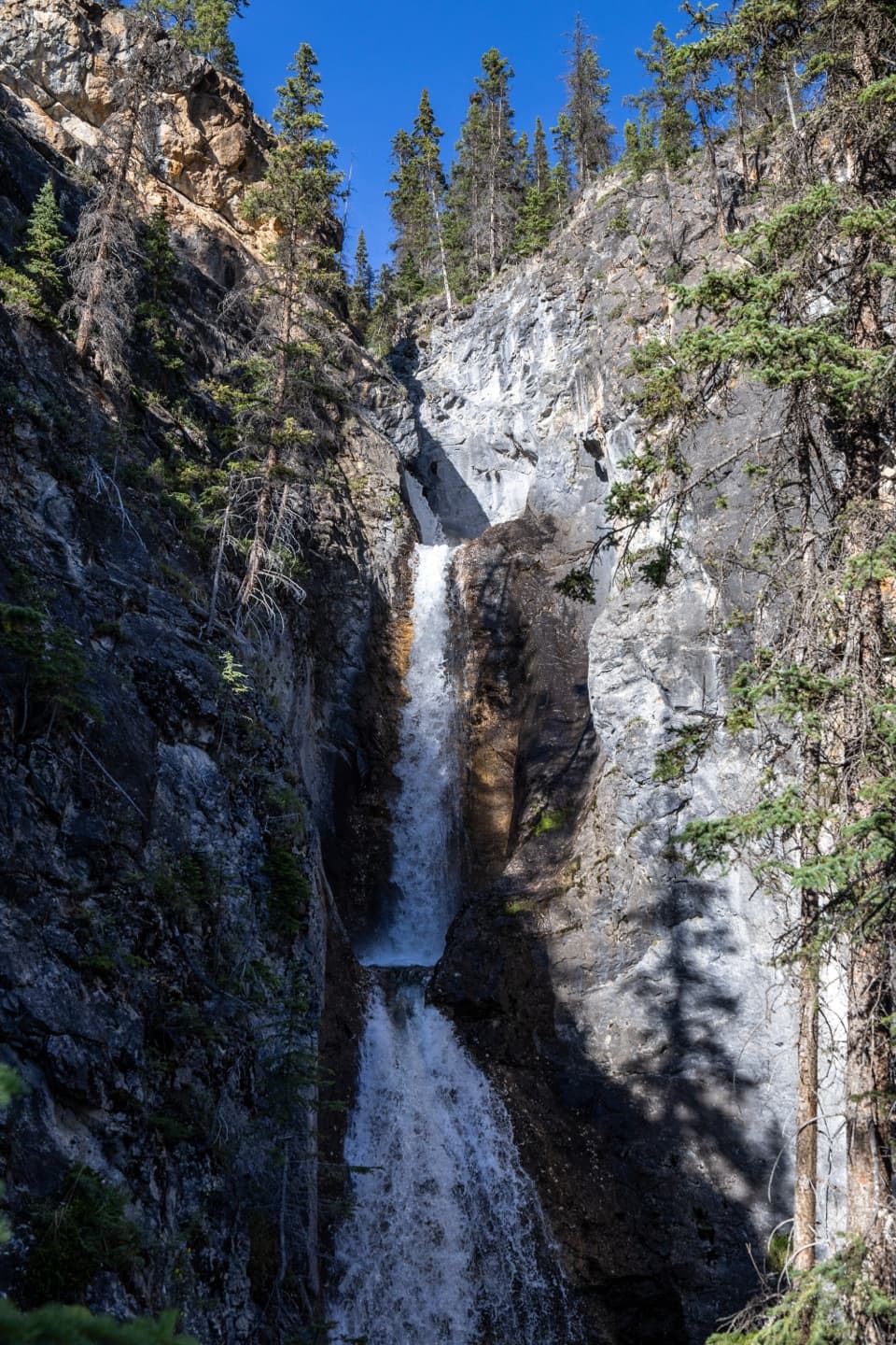
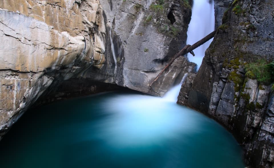
The Lower Falls stopThe waterfall drops through a cleft in the canyon into a plunge pool.

The waterfall drops through a cleft in the canyon into a plunge pool. A short tunnel-like passage leads to the closest viewing platform. That passage is the walk’s main bottleneck, and waits vary with the day and time. If the line has built up, you can still look toward Lower Falls from outside the passage and turn around without joining it. Keep the route simple: go to the falls, then retrace the same path. The trail continues farther up-canyon toward Upper Falls and the Ink Pots, but those longer walks are separate outings.

Footing, crowds and accessThis is a popular, compact walk, not a quiet canyon route.

This is a popular, compact walk, not a quiet canyon route. An early start is the most useful way to reduce crowding, and parking fills quickly. In winter the pavement and catwalks can be icy; traction devices help. The path is paved throughout and typically 1.82 m wide (minimum 1.5 m), but short sections reach a 26% grade and a 28% cross-slope. Strollers are not recommended. In summer, dogs may use the trail unless a posted restriction applies; keep them leashed and under physical control.

Limestone and the Johnston storyJohnston Creek cuts through layered limestone walls formed from marine sediments hundreds of…

Johnston Creek cuts through layered limestone walls formed from marine sediments hundreds of millions of years ago, leaving the narrow gorge, falls and overhangs beside the path. The strata are easiest to notice where the canyon walls squeeze close around the creek.

Local accounts connect the canyon’s name to William “Billy” Johnston, a trapper turned prospector associated with the Silver City gold rush of the 1880s. The story says he returned from the upper canyon claiming to have found gold nuggets; when other prospectors could not repeat the find, he headed west for British Columbia. Treat it as a local prospecting story, not a reason to expect gold in Johnston Creek.

Wildlife

Wildlife in Banff

All Banff wildlife maps

Sighting maps show where each species has been reported across Banff. Wildlife moves, so no sighting is guaranteed.

Keep exploring

Near Johnston Canyon Trail to Lower Falls

See it all on the map

Trails that start nearby

Places near the trailhead

Parkwolf’s Banff ranking

Top-rated trails in Banff

All 162 trails
  1. 1Sentinel Pass via Larch Valley TrailChallenging · 11.2 km
  2. 2Plain of Six Glaciers TrailModerate · 11.6 km
  3. 3Lake Agnes TrailModerate · 7.8 km
  4. 4Johnston Canyon Trail to Upper FallsEasy · 4.8 km
  5. 5Larch Valley / Minnestimma Lakes TrailModerate · 9 km
  6. 6Parker Ridge TrailModerate · 5.6 km

Take Parkwolf to Banff.

The audio tour guide for the drive, plus offline maps, trails, and wildlife heatmaps for when the signal drops.

4.7 from 8,600+ ratings

Download Parkwolf on the App StoreGet Parkwolf on Google Play