Ingar campground in Blue Mountains National Park

Campground · Blue Mountains National Park

Ingar campground

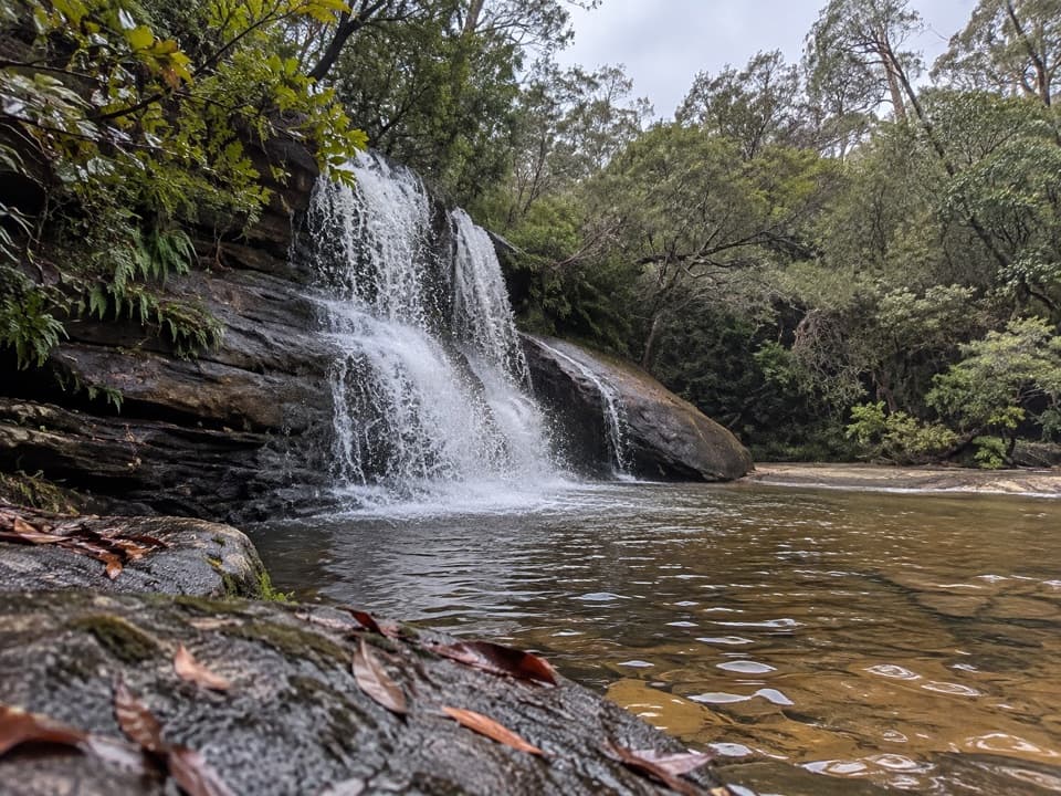
A remote walk-in camp beside Ingar Creek's rocky waterhole.

Type
Campground
Nearest trail
Right here
Audio stories
2 nearby
  • Restrooms
  • Picnic tables

Hear the audio tour

Murphys Glen Campground and Its Forest Wildlife

Overview

About Ingar campground

Why stop

  • A rocky creek waterhole for swimming

Heads up

  • The steep walk makes it a demanding stop

Map

Where it is

Loading the Blue Mountains map
Full map
CampgroundIngar campground-33.77107, 150.46280
Keep this map with you offline in the Parkwolf app

Plan your stop

Before you go

3 active Blue Mountains alerts

  • ClosureRoads and tracks closed across Blue Mountains National ParkMany roads, fire trails and walking tracks across Blue Mountains National Park are closed; do not enter closed areas.Official details
  • CautionPark-wide solid-fuel fire banA park fire ban is active across Blue Mountains National Park: campfires and solid-fuel barbecues and stoves are prohibited. - Gas and electric cookers are permitted, subject to safety rules.Official details

See all 3 alerts
A park ranger sits on a dash-mounted phone, talking, as Parkwolf’s Tour Guide plays “Army Cutworm Moths: A Grizzly Bear Buffet” on Grand Loop Road below Dunraven Pass in Yellowstone
Parkwolf Tour GuideThe highest, rockiest slopes around here are a summer buffet for grizzly bears.

Blue Mountains Tour Guide

Your drive to Ingar campground, narrated.

Parkwolf is a GPS audio tour guide for Blue Mountains National Park. As you drive, it chimes in with what’s ahead: hidden gems, upcoming stops, history, geology, and wildlife, right through your car’s speakers.

See the Blue Mountains audio tour

Recorded for this area

Murphys Glen Campground and Its Forest Wildlife
0:00 / 0:23
“You're coming up on Murphys Glen campground, a small bush camp beneath tall blue gums and turpentines. Choose it for a forest overnight with a chance of seeing sugar gliders in the trees at dusk.”

Plays on the road 2.1 km from Ingar campground in the Parkwolf Blue Mountains Tour Guide.

More stories near here in the app

  • The Millipede's Armoured Spiral
  • Bedford Creek from Bedford Road
  • A Telescope at Woodford House
  • The Hotel That Made Its Own Power
  • 188 audio storiesacross Blue Mountains’s roads, triggered by GPS as you drive
  • Wildlife heatmapsfor Grey Kangaroo, Wombat, Red-necked Wallaby, and 13 more
  • Works offlinemaps, 110 trails, 84 places, and audio download before you lose signal
  • CarPlay readysimple controls built for the drive
★★★★★
“Fantastic app with many points of information… It’s great to just turn on while you’re driving and it gives you an audio tour of the national Park. We love it!!!!”
JMJamesApp Store review
Download Parkwolf on the App StoreGet Parkwolf on Google Play

4.7 from 8,600+ ratings

Guide

More about Ingar campground

A walk-in creek campIngar campground is a small, remote tent camp on Kings Tableland near Wentworth Falls, set in…

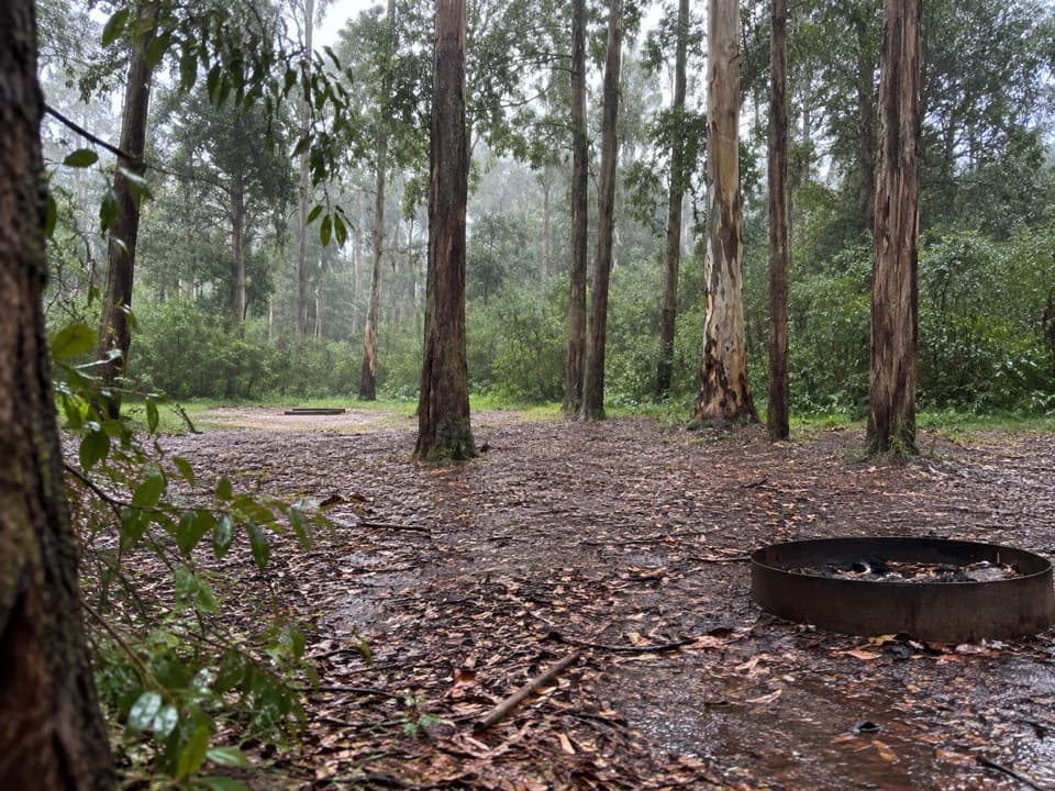
Ingar campground is a small, remote tent camp on Kings Tableland near Wentworth Falls, set in scribbly gum woodland beside the rocky waterhole on Ingar Creek. Its eight unpowered, unmarked sites make it an overnight stop on the walking and cycling route between Wentworth Falls and Woodford. Save it for a trip where the swim and bush setting are worth the approach; there’s no drive-up access.

The walk in is part of itThe campground directions give a 5 km walk via Bedford Creek Trail or a longer 13 km approach…

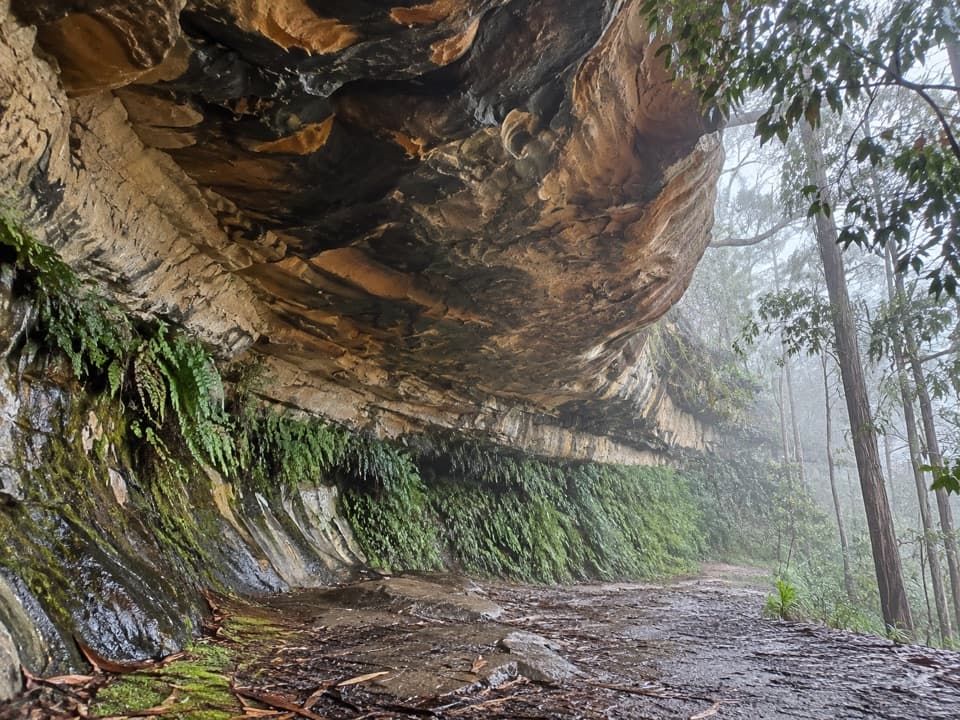
The campground directions give a 5 km walk via Bedford Creek Trail or a longer 13 km approach via Andersons Trail from Tableland Road. Both paths have steep sections, and wet weather can make them inaccessible. Other route information lists different totals for those access trails, so check which distance matches your starting point before setting out. If you continue toward Woodford along Bedford Creek Trail, the route drops to Bedford Creek’s rainforest before climbing hard back out to Murphys Trail.

Pack in what you needAll your gear comes in with you.

All your gear comes in with you. The sites are unpowered and unmarked; toilets, picnic tables and barbecue facilities are listed at camp. Bring drinking and cooking water and firewood, since no water supply is listed. The toilet type isn’t specified.

Spend time by the waterThe rocky pool is the main payoff for a swim or picnic.

The rocky pool is the main payoff for a swim or picnic. Eastern water dragons may bask on the bank, and sugar gliders, possums and bandicoots can be active around camp after dark. The creek and quiet bush setting are the draw; the steep ups and downs are the tradeoff, especially on the way back out.

Wildlife

Wildlife in Blue Mountains

All Blue Mountains wildlife maps

Sighting maps show where each species has been reported across Blue Mountains. Wildlife moves, so no sighting is guaranteed.

Parkwolf’s Blue Mountains ranking

Top sights in Blue Mountains

All 84 places
  1. 1Echo Point Lookout (Three Sisters)Sight
  2. 2Govetts Leap lookoutSight
  3. 3Wentworth FallsSight
  4. 4Scenic WorldSight
  5. 5Katoomba FallsSight
  6. 6Evans lookoutSight

Take Parkwolf to Blue Mountains.

The audio tour guide for the drive, plus offline maps, trails, and wildlife heatmaps for when the signal drops.

4.7 from 8,600+ ratings

Download Parkwolf on the App StoreGet Parkwolf on Google Play