Parking
Glen Doll car park beside the Angus Glens Ranger Base (DD8 4RD); follow the signed forest-walk route for Corrie Fee.
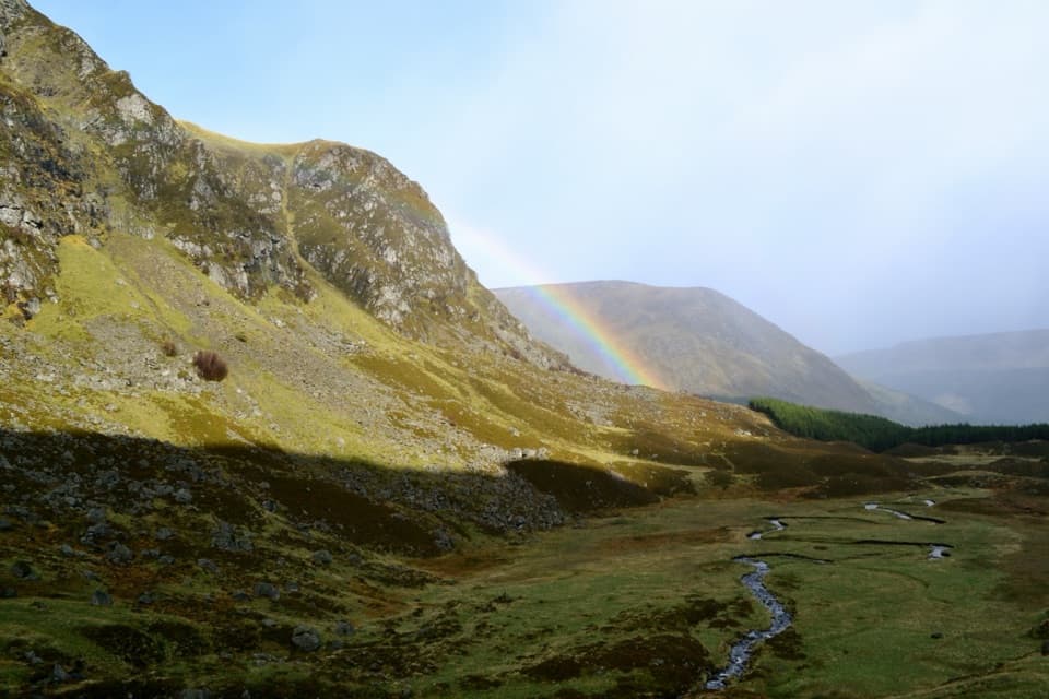
#9 of 260 trails in Cairngorms
Cairngorms National Park, SC
A steady climb opens onto a glacial bowl and waterfall.
Overview
Map & elevation
Plan your hike

The highest, rockiest slopes around here are a summer buffet for grizzly bears.
Cairngorms Tour Guide
Parkwolf is a GPS audio tour guide for Cairngorms National Park. As you drive, it chimes in with what’s ahead: hidden gems, upcoming stops, history, geology, and wildlife, right through your car’s speakers.
See the Cairngorms audio tourRecorded for this trailhead
Glen Doll and Corrie Fee“You're coming up on Glen Doll, the road end for the walk to Corrie Fee.”
Plays as you drive up to this trailhead in the Parkwolf Cairngorms Tour Guide.
More stories near here in the app
“Fantastic app with many points of information… It’s great to just turn on while you’re driving and it gives you an audio tour of the national Park. We love it!!!!”


Trail guide
Corrie Fee Trail is a 4.35-mile out-and-back from Glen Doll car park to the viewpoint at the entrance of Corrie Fee. The signed route follows a broad forest track before narrowing to a footpath that climbs beside the Fee Burn. Allow about 2½ hours for the return walk and a look around. The payoff is an open view into a steep glacial bowl, with a waterfall at its head and rocky crags above; it is a satisfying half-day walk without turning into a Munro outing.
Start at the Angus Glens Ranger Base and follow the forest-walk signs past Acharn, keeping left at the first fork and straight at the next junction for Corrie Fee. The wide track passes through mixed woodland and follows White Water before the final stretch becomes a narrower, steadily rising path. There is a small stream crossing near the end. At the forest edge, pause for the view into the corrie; the normal route turns around here and returns the same way.
The marked path is about 3.5 km one way to the reserve entrance, so this route counts the same distance back. A roughly 7.5 km circuit also returns beside the south side of White Water; that adds a different path, while this map retraces the signed route. Beyond the viewpoint, an optional 1.5 km unmarked climb continues through the corrie toward the plateau. It is steep and rough, with cross-drains and short unguarded boardwalks, and can be slippery or icy. Treat that as a serious hillwalk, not a little extra stroll; it is excluded from the route and distance here.
Corrie Fee and neighbouring Corrie Sharroch were excavated by glaciers. A small glacier occupied Corrie Fee around 12,000 years ago; as the ice retreated, it left the ridges, hummocks and scattered boulders across the corrie floor. From the viewpoint, look along the Fee Burn to the falls on the headwall and notice how sharply the rock walls curve around the bowl. Fee is linked to the Gaelic word for deer, while Sharroch is linked to a word for willow.
This reserve protects rare arctic-alpine plants and Scotland’s most extensive naturally established montane willow scrub. Globeflower, bog asphodel and alpine lady’s mantle grow close to the path; mid-May through mid-July is the best window for flowers. Dippers use the burn, while golden eagles, peregrines, ravens, ring ouzels, twite and mountain hares also live here. Keep an eye out, but treat these as possible sightings rather than a checklist.
The approach uses part of Jock’s Road. In the late nineteenth century, an estate owner tried to stop walkers crossing the route; a local walker, John Winter, challenged the closure in a dispute that reached the House of Lords and helped shape Scotland’s right-of-way law. It is a good reminder that this glen has a long history of people arguing for the right to walk through it.
Glen Doll car park is beside the Angus Glens Ranger Base. The base has an accessible toilet open 24 hours a day and picnic tables on the grass; there is no food service on the trail. Glen Clova Estate’s bar and restaurant are a separate stop down the glen. Dogs may use the public route when kept under proper control. In forest and moorland during ground-nesting bird season (usually April through July), keep them close at heel or on a short lead, and do the same around farm animals.
Wildlife
 159 sightingsRed DeerMost seen around 7 AMSighting map
 63 sightingsReindeerMost seen around 6 PMSighting map
 102 sightingsOspreyMost seen around 5 PMSighting map
 37 sightingsBlack GrouseMost seen around 4 AMSighting map
 72 sightingsRed GrouseMost seen around 6 PMSighting map
 82 sightingsPine MartenMost seen around 9 PMSighting map
Sighting maps show where each species has been reported across Cairngorms. Wildlife moves, so no sighting is guaranteed.
Keep exploring
 ModerateSouth Esk Trail3.4 km · 1 hr · At the trailheadA short loop beside the South Esk, with open Glen Clova views.
 ModerateDounalt Trail8.4 km · 3 hr · At the trailheadFollow White Water through larches, then return along Jock’s Road.ChallengingMayar and Driesh Circuit15.4 km · 6 hr · 0.2 km awayTwo Munros by a glacial corrie, waterfall, and open plateau
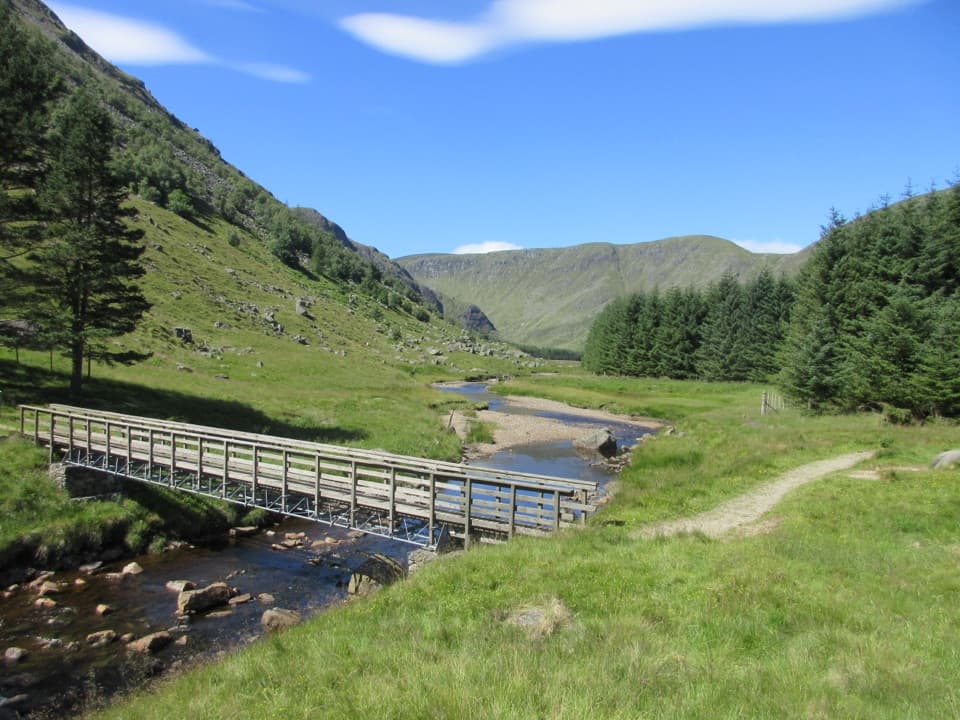
 ModerateWhite Water Trail4 km · 1.5 hr · 0.2 km awayA short riverside loop crossing a footbridge in Glen Doll.
 ModerateLoch Brandy Trail5.3 km · 3 hr · 5.3 km awayA steep climb to a dark loch beneath a rocky corrie.
 ModerateKilbo Path7.5 km · 4 hr · 6.5 km awayA high glen-to-glen pass with a faint line across the plateau.
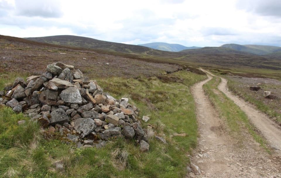 ModerateCapel Mounth10.5 km · 3.5 hr · 9.4 km awayA high old pass linking Loch Muick with Glen Clova.
 ModerateLoch Muick Circuit12.5 km · 4 hr · 9.4 km awayA long lochside loop past Queen Victoria's quiet retreat.
 Visitor center · At the trailheadGlen Doll Ranger BaseGlen Doll’s ranger base for forest walks and the Corrie Fee route.
 Sight · 3.1 km awayCorrie FeeA long forest walk opens onto an ice-carved mountain bowl.
 Sight · 5.7 km awayLoch BrandyA high corrie loch worth the steep climb from Glen Clova.Sight · 7 km awayLoch MuickA mountain loch with a full shore circuit and a royal retreat.
 Visitor center · 9.2 km awaySpittal of Glen Muick Visitor CentreA handy information stop before walking up Glen Muick.
 Sight · 14.4 km awayConnecting ContoursA contour-lined path turns a Glenshee layby into a scenic pause.
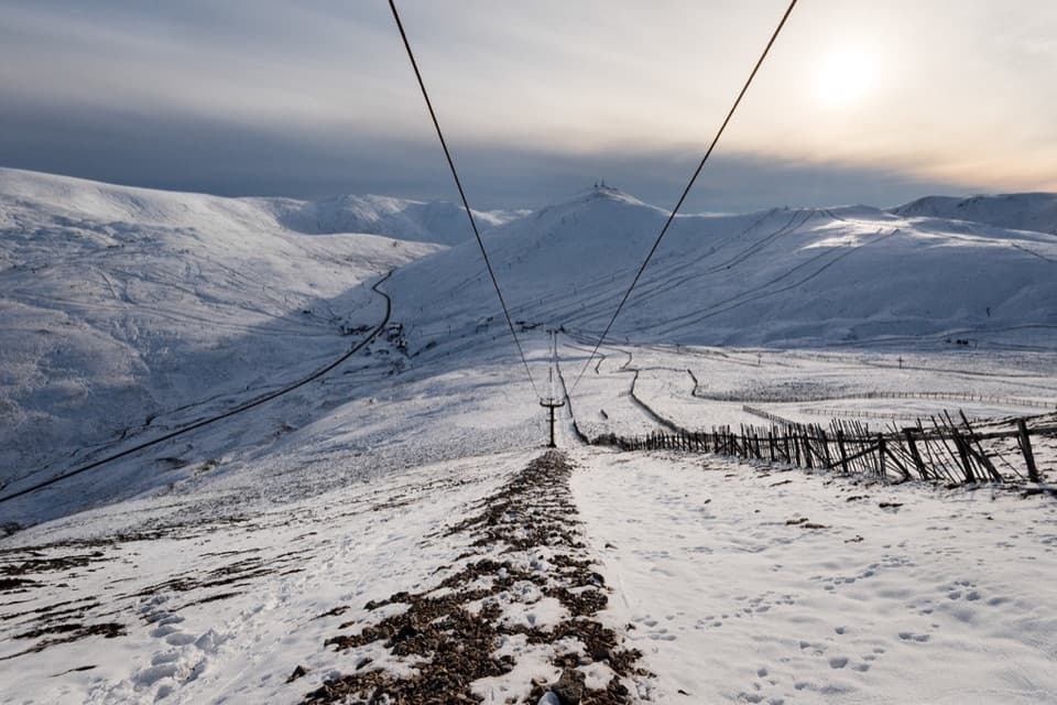 Sight · 14.5 km awayGlenshee Ski CentreSki on good snow, or ride the Cairnwell Chair for summer views.
 Sight · 15.2 km awayQueen’s WellWalk 8 km to a stone crown built for Queen Victoria.
Parkwolf’s Cairngorms ranking

The audio tour guide for the drive, plus offline maps, trails, and wildlife heatmaps for when the signal drops.




