Mayar and Driesh Circuit in Cairngorms National Park

Cairngorms National Park, SC

Mayar and Driesh Circuit

Two Munros by a glacial corrie, waterfall, and open plateau

Photo: Wikimedia Commons
Length
15.4km
Time
6hr
Elev. change
666m
Difficulty
Challenging
  • Loop
  • Dogs allowed
  • High point 922 m
  • #29 of 260 in Cairngorms

Hear the audio tour

Glen Doll and Corrie Fee

Overview

About Mayar and Driesh Circuit

Why go

  • Corrie Fee’s waterfall and glacial amphitheatre
  • Two Munro summits linked in one loop

Heads up

  • Long, steep day with rough, boggy upland sections
  • Open plateau needs confident navigation in poor visibility

Map & elevation

The route

Loading the Cairngorms map
Full map
Elevation256–922 m
TrailheadGlen Doll car park56.87040, -3.17584
Keep this map with you offline in the Parkwolf app

Plan your hike

Before you go

Parking

Start at Glen Doll car park at the head of Glen Clova. Follow the signed Corrie Fee/Forest Walks approach past Acharn; the earlier Jock’s Road branch is not part of this circuit. Parking is charged. Toilets and a ranger information post are at the car park.

Safety

The climb beside Corrie Fee’s waterfall is steep, and the open plateau is rough and can be boggy with less obvious wayfinding. The Burn of Kilbo return uses stepping stones. For the usual circuit descent from Driesh, retrace to the bealach and use the Kilbo path; the NNE Scorrie ridge line is steep and poorly defined.

3 active Cairngorms alerts

  • CautionStorm Boelo high windsStorm Boelo will bring extremely windy weather to the Cairngorms; take extra care and limit time outdoors. - The Park Authority expects the very windy weather to last until Monday 26 October.Official details
  • ClosureGlenmore wildfire closures and dangerous treesWildfire damage has closed Allt Mor car park and the path to Sugarbowl/Utsi’s Bridge; keep out of the closed area.Official details
See all 3 alerts
A park ranger sits on a dash-mounted phone, talking, as Parkwolf’s Tour Guide plays “Army Cutworm Moths: A Grizzly Bear Buffet” on Grand Loop Road below Dunraven Pass in Yellowstone
Parkwolf Tour GuideThe highest, rockiest slopes around here are a summer buffet for grizzly bears.

Cairngorms Tour Guide

Your drive to Mayar and Driesh Circuit, narrated.

Parkwolf is a GPS audio tour guide for Cairngorms National Park. As you drive, it chimes in with what’s ahead: hidden gems, upcoming stops, history, geology, and wildlife, right through your car’s speakers.

See the Cairngorms audio tour

Recorded for this trailhead

Glen Doll and Corrie Fee
0:00 / 0:28
“You're coming up on Glen Doll, the road end for the walk to Corrie Fee.”

Plays as you drive up to this trailhead in the Parkwolf Cairngorms Tour Guide.

More stories near here in the app

  • The Fight for Jock’s Road
  • Loch Brandy from Milltown of Clova
  • The Curlew’s Curved Bill
  • Loch Muick from Spittal
  • 298 audio storiesacross Cairngorms’s roads, triggered by GPS as you drive
  • Wildlife heatmapsfor Red Deer, Reindeer, Osprey, and 13 more
  • Works offlinemaps, 260 trails, 90 places, and audio download before you lose signal
  • CarPlay readysimple controls built for the drive
★★★★★
“Fantastic app with many points of information… It’s great to just turn on while you’re driving and it gives you an audio tour of the national Park. We love it!!!!”
JMJamesApp Store review
Download Parkwolf on the App StoreGet Parkwolf on Google Play

4.7 from 8,600+ ratings

Trail guide

Hiking Mayar and Driesh Circuit

The full circuitMayar and Driesh Circuit is a 9.

Mayar and Driesh Circuit is a 9.6-mile loop from Glen Doll car park over two Munros, climbing through Corrie Fee and returning by Kilbo. The stored line follows the complete loop, including the short return from Driesh to the descent junction. Published route figures range from about 9 to 9.5 miles; this mapped line measures about 9.6. Allow around six hours and roughly 835 metres of ascent. The payoff is a striking glacial bowl, a waterfall and two broad, open summits.

This is a long mountain day rather than a stroll to the waterfall. The lower approach follows tracks and woodland paths; the upper half crosses rough, sometimes boggy open ground where the line becomes less obvious. If you only want Corrie Fee, its shorter reserve path makes a separate outing without either summit.

Into Corrie FeeFrom the car park, follow the Corrie Fee signs past Acharn, cross the White Water and climb…

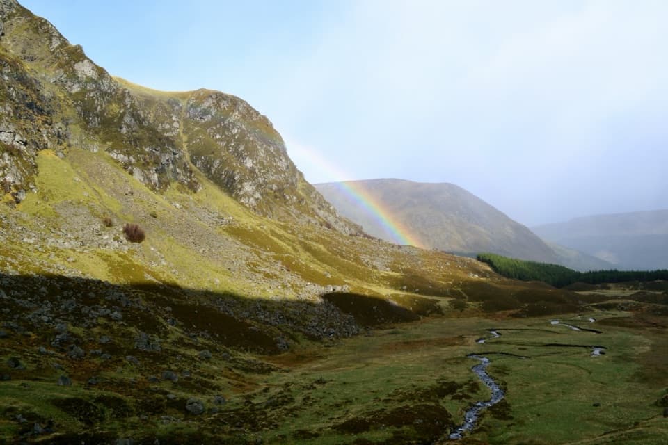
From the car park, follow the Corrie Fee signs past Acharn, cross the White Water and climb through the forest. A viewpoint beyond the deer fence opens onto Corrie Fee’s steep headwall and stream. The corrie is a glacial amphitheatre, with uneven mounds left by retreating ice. Its path climbs steeply beside the waterfall, staying to its left, then reaches open ground above the bowl. This is the circuit’s signature view; the viewpoint and the higher path both give a strong angle back into the corrie.

Mayar and the plateauAbove the headwall, follow the hill path across open moorland to Mayar’s small summit cairn at…

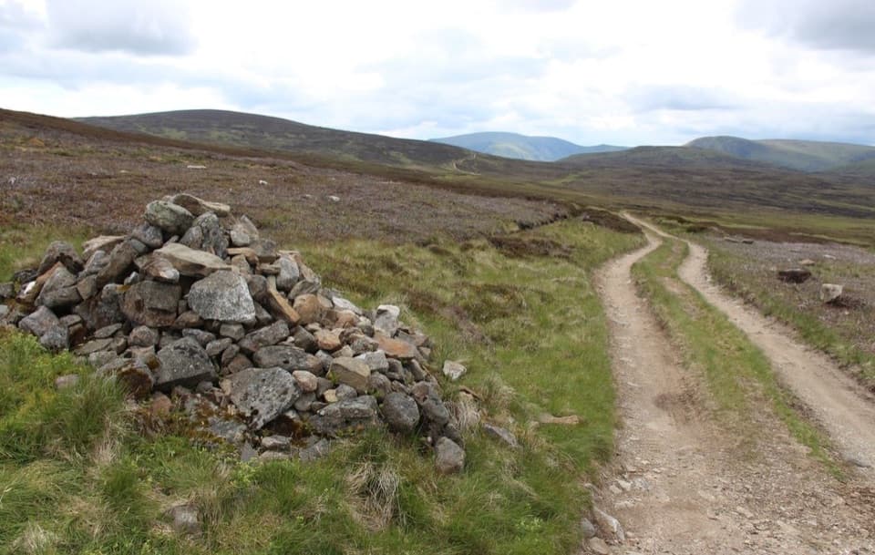
Above the headwall, follow the hill path across open moorland to Mayar’s small summit cairn at 928 metres. Continue east across the plateau toward Driesh; fenceposts help indicate the line but do not turn this into a continuously waymarked trail. Expect rough ground and patches of bog. Mayar’s summit looks over the rolling Mounth uplands, with a wide, quiet horizon rather than a single dramatic drop.

DrieshThe traverse descends to the bealach between Corrie Kilbo and Black Skellies, then climbs…

The traverse descends to the bealach between Corrie Kilbo and Black Skellies, then climbs Driesh’s steeper initial slope to its domed top at 946 metres. A trig point and large shelter cairn mark the summit. Views extend toward the Firth of Tay on a clear day, though the broad plateau keeps the outlook open in every direction. To make the circuit’s usual descent, retrace to the bealach instead of taking the steep, poorly defined line down the NNE Scorrie ridge shown on some maps.

The Kilbo returnFrom the bealach, the route follows the path along the Shank of Drumfollow, crosses the slope…

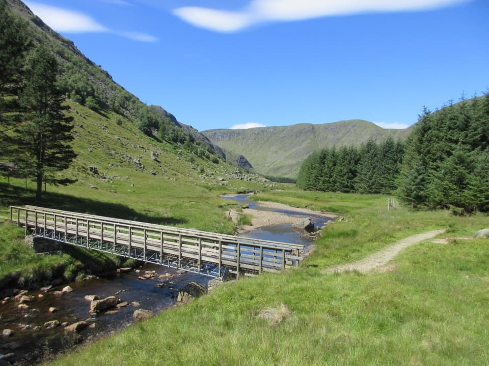
From the bealach, the route follows the path along the Shank of Drumfollow, crosses the slope to a deer-fence gate and descends through forest. Burn of Kilbo is crossed on stepping stones; forest tracks and a bridge then lead back to the approach track and car park. This return closes the loop and includes several different surfaces after the exposed plateau.

Corrie Fee’s wildlifeThe reserve protects alpine plants adapted to cliffs and gullies, including alpine…

The reserve protects alpine plants adapted to cliffs and gullies, including alpine blue-sow-thistle and mountain saxifrages, as well as globeflower, wild angelica and melancholy thistle. A natural stand of montane willow scrub grows here, and golden eagles or peregrines may be seen overhead. Keep dogs under proper control and stay on the path around fragile plants. Under Scotland’s responsible-access rules, dogs are allowed when controlled appropriately.

Start and suppliesGlen Doll car park at the head of Glen Clova is the start; follow the signed Corrie Fee…

Glen Doll car park at the head of Glen Clova is the start; follow the signed Corrie Fee approach rather than the earlier branch for Jock’s Road toward Braemar. Parking is charged, and toilets and a ranger information post are at the car park. No food outlet or drinking-water point is verified along the route, so bring what you need for the full day.

Wildlife

Wildlife in Cairngorms

All Cairngorms wildlife maps

Sighting maps show where each species has been reported across Cairngorms. Wildlife moves, so no sighting is guaranteed.

Keep exploring

Near Mayar and Driesh Circuit

See it all on the map

Trails that start nearby

Places near the trailhead

Parkwolf’s Cairngorms ranking

Top-rated trails in Cairngorms

All 260 trails
  1. 1Loch an Eilein CircuitEasy · 5 km
  2. 2Lairig GhruChallenging · 30.6 km
  3. 3Ben Macdui and Cairn Gorm CircuitChallenging · 19.8 km
  4. 4Loch Morlich TrailModerate · 5.6 km
  5. 5Meall a’ Bhuachaille CircuitChallenging · 8 km
  6. 6Loch Muick CircuitModerate · 12.5 km

Take Parkwolf to Cairngorms.

The audio tour guide for the drive, plus offline maps, trails, and wildlife heatmaps for when the signal drops.

4.7 from 8,600+ ratings

Download Parkwolf on the App StoreGet Parkwolf on Google Play