Glen Tilt to Glen Fernate Drove Road in Cairngorms National Park

Cairngorms National Park, SC

Glen Tilt to Glen Fernate Drove Road

A long old drovers' road across the hills to Glen Tilt.

Photo: Wikimedia Commons
Length
24km
Time
8.5hr
Elev. change
382m
Difficulty
Challenging
  • High point 641 m
Parkwolf audio tour298 stories across Cairngorms’s roads

Overview

About Glen Tilt to Glen Fernate Drove Road

Why go

  • A rare through-walk on a historic cattle-droving road
  • A clear route across two remote Highland glens

Heads up

  • Long point-to-point logistics need arranging in advance
  • The Allt Garbh Buidhe crossing can be dangerous in spate

Map & elevation

The route

Loading the Cairngorms map
Full map
Elevation259–641 m
TrailheadA924 at Glenfernate Estate access, east of Straloch56.75686, -3.55288
Keep this map with you offline in the Parkwolf app

Plan your hike

Before you go

Parking

The start is at the Glenfernate Estate access on the A924, about 0.5 km east of Straloch. No public parking is documented at the access. This is a 24 km point-to-point route ending near the Falls of Tarf, so arrange transport for both ends and do not assume roadside parking is permitted.

Safety

The Allt Garbh Buidhe crossing can be dangerous in spate. Do not cross when the burn is high.

3 active Cairngorms alerts

  • CautionStorm Boelo high windsStorm Boelo will bring extremely windy weather to the Cairngorms; take extra care and limit time outdoors. - The Park Authority expects the very windy weather to last until Monday 26 October.Official details
  • ClosureGlenmore wildfire closures and dangerous treesWildfire damage has closed Allt Mor car park and the path to Sugarbowl/Utsi’s Bridge; keep out of the closed area.Official details
See all 3 alerts
A park ranger sits on a dash-mounted phone, talking, as Parkwolf’s Tour Guide plays “Army Cutworm Moths: A Grizzly Bear Buffet” on Grand Loop Road below Dunraven Pass in Yellowstone
Parkwolf Tour GuideThe highest, rockiest slopes around here are a summer buffet for grizzly bears.

Cairngorms Tour Guide

Your drive to Glen Tilt to Glen Fernate Drove Road, narrated.

Parkwolf is a GPS audio tour guide for Cairngorms National Park. As you drive, it chimes in with what’s ahead: hidden gems, upcoming stops, history, geology, and wildlife, right through your car’s speakers.

See the Cairngorms audio tour

More stories near here in the app

  • Spittal of Glenshee and the Dalmunzie Hills
  • The Bog’s Sticky Trap
  • A Grouse in the Heather
  • The Man Behind the Munros
  • 298 audio storiesacross Cairngorms’s roads, triggered by GPS as you drive
  • Wildlife heatmapsfor Red Deer, Reindeer, Osprey, and 13 more
  • Works offlinemaps, 260 trails, 90 places, and audio download before you lose signal
  • CarPlay readysimple controls built for the drive
★★★★★
“Fantastic app with many points of information… It’s great to just turn on while you’re driving and it gives you an audio tour of the national Park. We love it!!!!”
JMJamesApp Store review
Download Parkwolf on the App StoreGet Parkwolf on Google Play

4.7 from 8,600+ ratings

Trail guide

Hiking Glen Tilt to Glen Fernate Drove Road

A long crossing, not a loopThis is a 24 km (14.

This is a 24 km (14.9 mi) point-to-point walk from the A924 east of Straloch to the main Glen Tilt track, about 300 m northeast of the Falls of Tarf. The falls are nearby, not the route endpoint. It crosses open, remote ground, with a long climb toward Fealar before descending west to Glen Tilt. Allow 8–10 hours with stops; that is a planning estimate because no published walking time was found. The ends are far apart, so sort out transport before setting off.

Through Gleann FearnachStart at the Glenfernate Estate access on the A924, about 0.5 km east of Straloch.

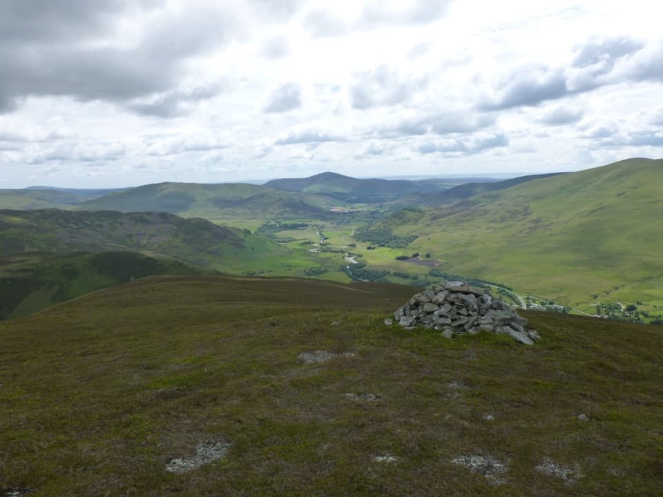
Start at the Glenfernate Estate access on the A924, about 0.5 km east of Straloch. The route passes Glenfernate Lodge and heads north up Gleann Fearnach for 7 km to Daldhu. From there, continue generally north for another 12 km on the track to Fealar Lodge. The long climb opens onto higher, treeless hills; the walk is mainly about covering ground through the glen and over the high country.

West to Glen TiltAt Fealar Lodge, leave the track for a path west toward Glen Tilt.

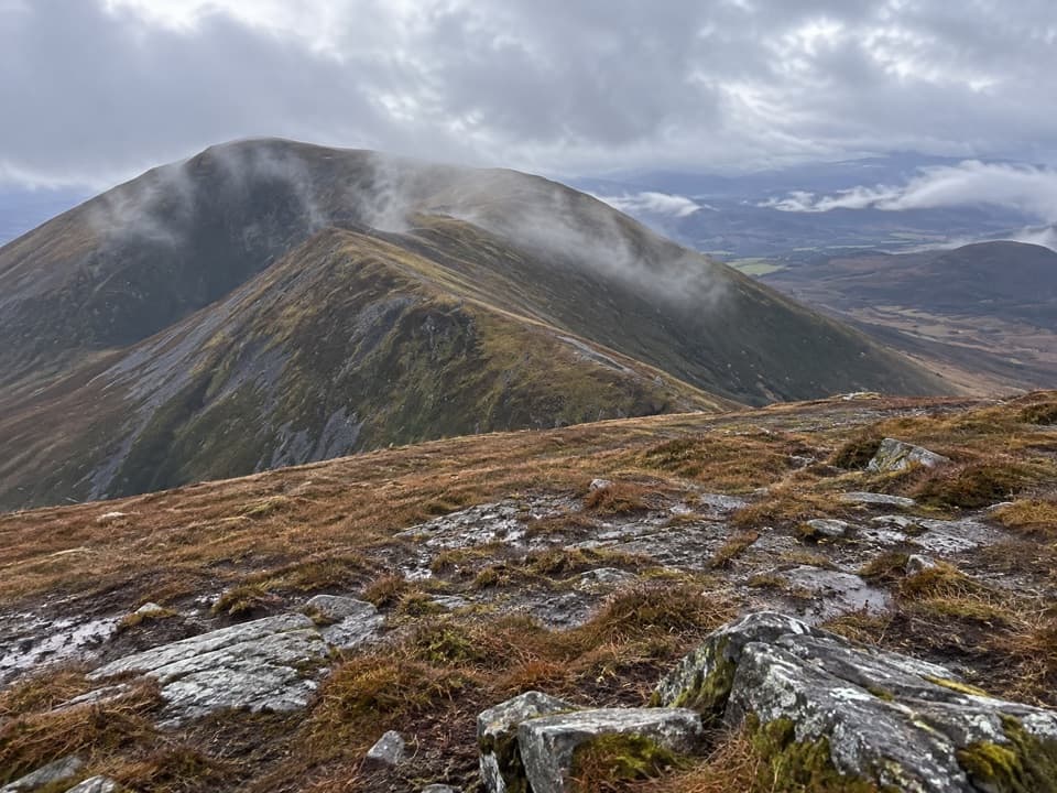
At Fealar Lodge, leave the track for a path west toward Glen Tilt. You must cross the Allt Garbh Buidhe to reach the main Glen Tilt track. The burn is usually manageable, but can be dangerous in spate; do not try to cross high water. The route ends about 300 m northeast of the Falls of Tarf, rather than at the waterfall itself.

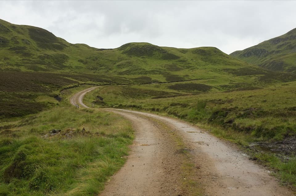
An old cattle roadThis drove road carried cattle to the Tryst at Kirkmichael.

This drove road carried cattle to the Tryst at Kirkmichael. In the mid-1700s, Kirkmichael’s annual fair was among Scotland’s principal cattle markets and could last several days. The route already appeared on Roy’s Military Survey of 1747–55, a reminder that this high crossing was an established line long before modern estate tracks.

Plan the two endsThe named start is an estate access on the A924, but no public car park is documented.

The named start is an estate access on the A924, but no public car park is documented. This is a through-walk, not a circuit; arrange a pickup or another return plan, and do not assume roadside parking is permitted. The route is listed for pedestrians, but current estate access arrangements are not confirmed. Check access notices before going. Dog rules and on-route water or facilities were not established, so verify those and bring what you need for a full day.

Wildlife

Wildlife in Cairngorms

All Cairngorms wildlife maps

Sighting maps show where each species has been reported across Cairngorms. Wildlife moves, so no sighting is guaranteed.

Parkwolf’s Cairngorms ranking

Top-rated trails in Cairngorms

All 260 trails
  1. 1Loch an Eilein CircuitEasy · 5 km
  2. 2Lairig GhruChallenging · 30.6 km
  3. 3Ben Macdui and Cairn Gorm CircuitChallenging · 19.8 km
  4. 4Loch Morlich TrailModerate · 5.6 km
  5. 5Meall a’ Bhuachaille CircuitChallenging · 8 km
  6. 6Loch Muick CircuitModerate · 12.5 km

Take Parkwolf to Cairngorms.

The audio tour guide for the drive, plus offline maps, trails, and wildlife heatmaps for when the signal drops.

4.7 from 8,600+ ratings

Download Parkwolf on the App StoreGet Parkwolf on Google Play