Monega Pass in Cairngorms National Park

Cairngorms National Park, SC

Monega Pass

An old high road over a bare, exposed plateau.

Length
14.5km
Time
5hr
Elev. change
652m
Difficulty
Challenging
  • Dogs allowed
  • High point 1,015 m
  • #116 of 260 in Cairngorms

Hear the audio tour

Auchavan and the Monega Circuit

Overview

About Monega Pass

Why go

  • A rare high-level pass crossing with wide views into Caenlochan Glen
  • An old boundary marker and a route with a long history

Heads up

  • One-way logistics need a pickup or two cars
  • The faint line across exposed ground demands confident navigation

Map & elevation

The route

Loading the Cairngorms map
Full map
Elevation363–1,015 m
TrailheadAuchavan, end of the public road56.81077, -3.32590
Keep this map with you offline in the Parkwolf app

Plan your hike

Before you go

Parking

At the south end, start at the public road end at Auchavan; parking nearby is limited, and the turning area must remain clear. At the north end, use the car park by the Cairnwell Burn footbridge on the A93. This is a point-to-point walk, so arrange a pickup or leave a vehicle at each end.

Safety

Long, exposed high ground with stretches where no reliable path is visible; compass navigation is needed in mist. The ascent from Glen Isla and descent near Sron na Gaoithe are steep and rough. Snow can hide the route for months in winter.

3 active Cairngorms alerts

  • CautionStorm Boelo high windsStorm Boelo will bring extremely windy weather to the Cairngorms; take extra care and limit time outdoors. - The Park Authority expects the very windy weather to last until Monday 26 October.Official details
  • ClosureGlenmore wildfire closures and dangerous treesWildfire damage has closed Allt Mor car park and the path to Sugarbowl/Utsi’s Bridge; keep out of the closed area.Official details
See all 3 alerts
A park ranger sits on a dash-mounted phone, talking, as Parkwolf’s Tour Guide plays “Army Cutworm Moths: A Grizzly Bear Buffet” on Grand Loop Road below Dunraven Pass in Yellowstone
Parkwolf Tour GuideThe highest, rockiest slopes around here are a summer buffet for grizzly bears.

Cairngorms Tour Guide

Your drive to Monega Pass, narrated.

Parkwolf is a GPS audio tour guide for Cairngorms National Park. As you drive, it chimes in with what’s ahead: hidden gems, upcoming stops, history, geology, and wildlife, right through your car’s speakers.

See the Cairngorms audio tour

Recorded for this trailhead

Auchavan and the Monega Circuit
0:00 / 0:26
“Auchavan is coming up, the Glen Isla road end for the Monega Hill and Glas Maol circuit. That's a hard thirteen-mile day of seven to seven and a half hours, with exposed ground, unreliable paths and a boggy return.”

Plays as you drive up to this trailhead in the Parkwolf Cairngorms Tour Guide.

More stories near here in the app

  • A Grouse in the Heather
  • A Water Vole’s Grassy Clue
  • The Bog’s Sticky Trap
  • The Man Behind the Munros
  • 298 audio storiesacross Cairngorms’s roads, triggered by GPS as you drive
  • Wildlife heatmapsfor Red Deer, Reindeer, Osprey, and 13 more
  • Works offlinemaps, 260 trails, 90 places, and audio download before you lose signal
  • CarPlay readysimple controls built for the drive
★★★★★
“Fantastic app with many points of information… It’s great to just turn on while you’re driving and it gives you an audio tour of the national Park. We love it!!!!”
JMJamesApp Store review
Download Parkwolf on the App StoreGet Parkwolf on Google Play

4.7 from 8,600+ ratings

Trail guide

Hiking Monega Pass

A one-way crossing, not a circuitMonega Pass is a 14 km (9 mi) point-to-point walk from the end of the public road at Auchavan…

Monega Pass is a 14 km (9 mi) point-to-point walk from the end of the public road at Auchavan in Glen Isla to the Cairnwell Burn footbridge beside the A93. It climbs about 650 m and takes around five hours. This is a demanding high route, not the longer Monega Hill and Glas Maol summit circuit. Plan your pickup or second car before setting off; there is no loop back to Auchavan.

Climb out of Glen IslaFollow the track up the glen past Tulchan Lodge and along the river.

Follow the track up the glen past Tulchan Lodge and along the river. The public right of way continues beyond the lodge gate. The route then leaves the valley floor and climbs steeply up Monega Hill's nose. The angle eases near Little Glas Maol before the crossing runs along Glas Maol's eastern flank, below its summit.

The exposed plateauThe high ground is open and exposed.

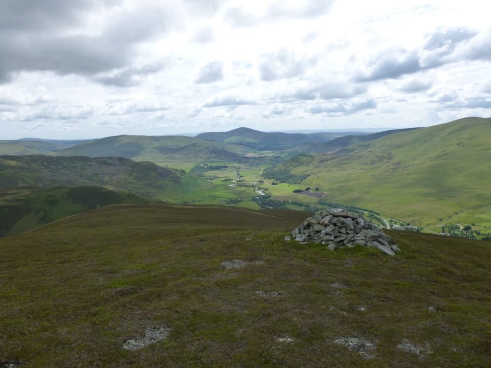
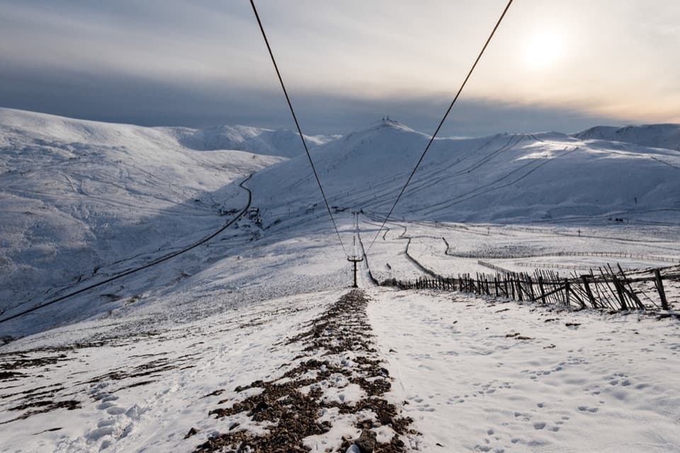
The high ground is open and exposed. Beyond the old county boundary, the visible path becomes unreliable, and mist can make the line hard to pick out; you need to be confident with a compass and mountain navigation. The route reaches just over 1,000 m, and snow can cover the track for months in winter. An old stone boundary marker stands near the meeting point of Angus, Perth and Kinross, and Aberdeenshire. From the pass top, look into Caenlochan Glen; including the ridge in the foreground shows how high the route crosses.

Down to the Cairnwell BurnThe route angles toward Sron na Gaoithe and descends over steep, rough ground, with a rocky…

The route angles toward Sron na Gaoithe and descends over steep, rough ground, with a rocky nose and faint tread in places. Cross the burns near the bottom and use the footbridge to reach the finish by the A93. Allow time for the descent and keep your bearings as you leave the plateau.

Sort the logistics firstParking near the Auchavan road end is limited; keep the turning area clear for local vehicles.

Parking near the Auchavan road end is limited; keep the turning area clear for local vehicles. There is a car park by the Cairnwell Burn footbridge at the north end. Arrange a lift or leave a vehicle at each end. No food, toilets or water stop was verified along the route, so carry what you need. Dogs are allowed under Scotland's responsible access rules; keep them under proper control near livestock and wildlife.

Wildlife

Wildlife in Cairngorms

All Cairngorms wildlife maps

Sighting maps show where each species has been reported across Cairngorms. Wildlife moves, so no sighting is guaranteed.

Keep exploring

Near Monega Pass

See it all on the map

Trails that start nearby

Places near the trailhead

Parkwolf’s Cairngorms ranking

Top-rated trails in Cairngorms

All 260 trails
  1. 1Loch an Eilein CircuitEasy · 5 km
  2. 2Lairig GhruChallenging · 30.6 km
  3. 3Ben Macdui and Cairn Gorm CircuitChallenging · 19.8 km
  4. 4Loch Morlich TrailModerate · 5.6 km
  5. 5Meall a’ Bhuachaille CircuitChallenging · 8 km
  6. 6Loch Muick CircuitModerate · 12.5 km

Take Parkwolf to Cairngorms.

The audio tour guide for the drive, plus offline maps, trails, and wildlife heatmaps for when the signal drops.

4.7 from 8,600+ ratings

Download Parkwolf on the App StoreGet Parkwolf on Google Play