Parking
Limited parking at the end of the public road in Auchavan. Keep the turning area clear for the gritter and school minibus; no public transport serves the start.

Cairngorms National Park, SC
A long Glen Isla horseshoe with two Munros and a boggy finish.
Overview
Map & elevation
Plan your hike

The highest, rockiest slopes around here are a summer buffet for grizzly bears.
Cairngorms Tour Guide
Parkwolf is a GPS audio tour guide for Cairngorms National Park. As you drive, it chimes in with what’s ahead: hidden gems, upcoming stops, history, geology, and wildlife, right through your car’s speakers.
See the Cairngorms audio tourRecorded for this trailhead
Auchavan and the Monega Circuit“Auchavan is coming up, the Glen Isla road end for the Monega Hill and Glas Maol circuit. That's a hard thirteen-mile day of seven to seven and a half hours, with exposed ground, unreliable paths and a boggy return.”
Plays as you drive up to this trailhead in the Parkwolf Cairngorms Tour Guide.
More stories near here in the app
“Fantastic app with many points of information… It’s great to just turn on while you’re driving and it gives you an audio tour of the national Park. We love it!!!!”


Trail guide
This is a 13.1-mile (21.1 km) loop from Auchavan over Monega Hill, Glas Maol and Creag Leacach, then back across rough moor by Black Hill and Monamenach. The full mapped circuit measures about 13 miles; a shorter estimate sometimes given for this walk does not identify a different endpoint. Expect about 1,135 m of ascent and 7 to 7½ hours. It is a hard, exposed day, with the clearest paths on the long climb and the roughest footing on the later peat ground.
Begin at the end of the public road and take the track signed for Tulchan. Cross the cattle grid, keep to the west bank of the River Isla, cross at Tulchan Lodge and continue up the glen. After the forestry the route opens toward the hills. At the Monega Path sign, the tempting shortcut crosses a ditch and burn; it is easier to stay on the track briefly and take the rough grassy track beyond the burn. Parking is limited. Leave the turning area clear for the gritter and school minibus, and follow the estate’s access signs by Tulchan Lodge.
No public transport serves the start, and no food, toilet or drinking-water stop is identified on the route. Treat it as a self-supported full day. Dogs are allowed under Scotland’s normal access rights, but keep them under close control around livestock and wildlife.
The broad climb up Monega Hill eases near the top; leave the track for the summit beside the cliff edge. From here, follow the ridge west, rejoin the track near Little Glas Maol, then turn northwest for Glas Maol’s trig point and large shelter cairn at 1,068 m. In clear weather, the Cairngorms and nearby Cairnwell hills fill the view. The eastern edge of Monega Hill gives the route’s defining outlook into Caenlochan Glen: include the dark crags with the valley below to show the scale.
From Glas Maol, head southwest along the county-boundary wall. Near the bealach of Bathach Beag, a small stone shelter has a turf roof and a bench inside. Continue over Cul Riabhach, then follow the stony ridge to Creag Leacach’s 987 m summit and its 943 m southwest top. This is open high ground with rough, rocky patches; the wall and ridge help keep the line clear when visibility is good.
After the southwest top, descend through heather on the east side of the wall and rise toward Càrn Ait. A fence line leads toward Mallrenheskein and the low point at Easter Glacanbuidhe. The climb across Black Hill is the boggiest stretch: peat hags break up the ground, and the old fence is a useful guide. Pass the old gateway, descend east-southeast and then southeast to Glack of Glengairney, and climb Monamenach. The direct final ascent can feel punishing after the miles behind you, but the 807 m summit opens broad views. Drop southeast to the track and follow Glack Burn back to Auchavan.
The route uses part of the Monega Pass, one of the old Mounth Roads across the high plateau. Drovers likely used this high crossing, and old accounts say smugglers did too. Queen Victoria crossed it in 1861, when it was known as the Month Eigie Road. The ridge also crosses the old county-boundary country where Angus, Perth and Kinross, and Aberdeenshire meet.
Wildlife
 159 sightingsRed DeerMost seen around 7 AMSighting map
 63 sightingsReindeerMost seen around 6 PMSighting map
 102 sightingsOspreyMost seen around 5 PMSighting map
 37 sightingsBlack GrouseMost seen around 4 AMSighting map
 72 sightingsRed GrouseMost seen around 6 PMSighting map
 82 sightingsPine MartenMost seen around 9 PMSighting map
Sighting maps show where each species has been reported across Cairngorms. Wildlife moves, so no sighting is guaranteed.
Keep exploring
 ModerateMonamenach from Auchavan5.2 km · 2.5 hr · 0.1 km awayA short, steep Corbett climb with wide Glen Isla views.
 ChallengingMonega Pass14.5 km · 5 hr · 0.3 km awayAn old high road over a bare, exposed plateau.
 ModerateKilbo Path7.5 km · 4 hr · 5.5 km awayA high glen-to-glen pass with a faint line across the plateau.
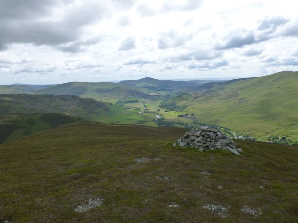 ModerateBen Gulabin Trail5.6 km · 3 hr · 8 km awayA steep, direct climb to open views over Glen Shee.
 ChallengingGlen Ey–Glenshee Track24.5 km · 8 hr · 8.2 km awayA remote crossing over Loch nan Eun into Glen Ey.
 ChallengingGlas Tulaichean and Càrn an Rìgh30.1 km · 9 hr · 8.7 km awayTwo Munros, a remote ridge, and a full day on rough ground.ChallengingThe Cairnwell Munros Circuit12.9 km · 5.5 hr · 9.9 km awayThree Munros above a high start at Glenshee Ski Centre
 ModerateDounalt Trail8.4 km · 3 hr · 11 km awayFollow White Water through larches, then return along Jock’s Road.
 Sight · 7.9 km awayConnecting ContoursA contour-lined path turns a Glenshee layby into a scenic pause.
 Sight · 8.2 km awayCorrie FeeA long forest walk opens onto an ice-carved mountain bowl.
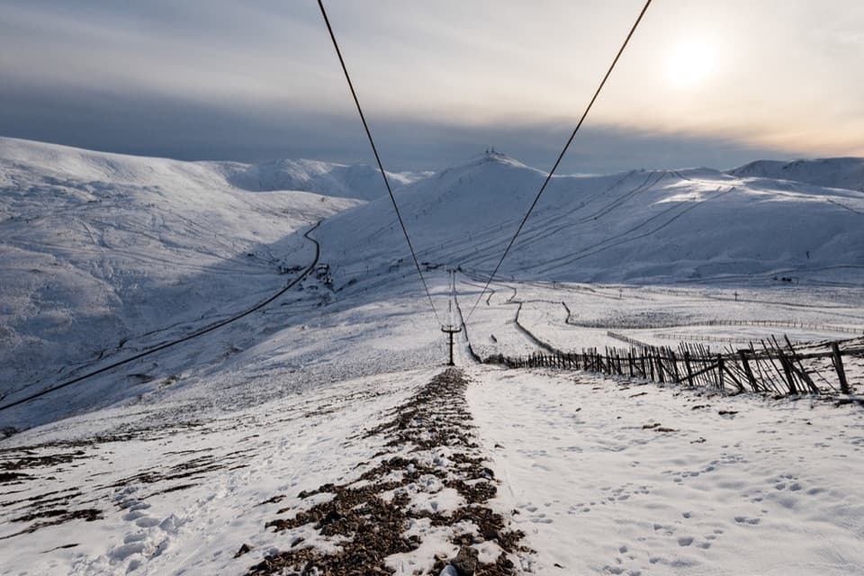 Sight · 9.9 km awayGlenshee Ski CentreSki on good snow, or ride the Cairnwell Chair for summer views.
 Visitor center · 11 km awayGlen Doll Ranger BaseGlen Doll’s ranger base for forest walks and the Corrie Fee route.
 Sight · 15.6 km awayLoch BrandyA high corrie loch worth the steep climb from Glen Clova.
Parkwolf’s Cairngorms ranking

The audio tour guide for the drive, plus offline maps, trails, and wildlife heatmaps for when the signal drops.





