The Tolmounth (Jock’s Road) in Cairngorms National Park

Cairngorms National Park, SC

The Tolmounth (Jock’s Road)

A high, exposed pass with a drove-road story.

Photo: Wikimedia Commons
Length
20.4km
Time
8hr
Elev. change
622m
Difficulty
Challenging
  • Dogs allowed
  • High point 895 m
  • #54 of 260 in Cairngorms

Hear the audio tour

Loch Callater from Auchallater

Overview

About The Tolmounth (Jock’s Road)

Why go

  • A full crossing with the loch, a high pass and a long glen descent.
  • A historic right of way with Davy’s Bourach as a memorable landmark.

Heads up

  • The exposed, indistinct plateau makes weather and navigation consequential.
  • It is a long one-way walk with transport to arrange between the ends.

Map & elevation

The route

Loading the Cairngorms map
Full map
Elevation273–895 m
TrailheadAuchallater A93 access56.97743, -3.39014
Keep this map with you offline in the Parkwolf app

Plan your hike

Before you go

Parking

Start at the A93 access at Auchallater (OS grid reference NO 156 882) and finish at Glen Doll Ranger Base car park near Braedownie. Arrange transport between the ends; this is a through-route. No designated parking at Auchallater was confirmed.

Safety

The high, exposed plateau is broad and featureless; the tread becomes less distinct and may disappear beneath winter snow for months. Poor visibility demands confident navigation. The headwall climb and Glen Doll descent are steep.

3 active Cairngorms alerts

  • CautionStorm Boelo high windsStorm Boelo will bring extremely windy weather to the Cairngorms; take extra care and limit time outdoors. - The Park Authority expects the very windy weather to last until Monday 26 October.Official details
  • ClosureGlenmore wildfire closures and dangerous treesWildfire damage has closed Allt Mor car park and the path to Sugarbowl/Utsi’s Bridge; keep out of the closed area.Official details
See all 3 alerts
A park ranger sits on a dash-mounted phone, talking, as Parkwolf’s Tour Guide plays “Army Cutworm Moths: A Grizzly Bear Buffet” on Grand Loop Road below Dunraven Pass in Yellowstone
Parkwolf Tour GuideThe highest, rockiest slopes around here are a summer buffet for grizzly bears.

Cairngorms Tour Guide

Your drive to The Tolmounth (Jock’s Road), narrated.

Parkwolf is a GPS audio tour guide for Cairngorms National Park. As you drive, it chimes in with what’s ahead: hidden gems, upcoming stops, history, geology, and wildlife, right through your car’s speakers.

See the Cairngorms audio tour

Recorded for this trailhead

Loch Callater from Auchallater
0:00 / 0:21
“You’re approaching Auchallater, the start of the walk to Loch Callater. For a mountain-ringed loch without a summit climb, allow three to three and a half hours for the seven-and-a-quarter-mile return walk.”

Plays as you drive up to this trailhead in the Parkwolf Cairngorms Tour Guide.

More stories near here in the app

  • A Boulder Far from Home
  • A Ptarmigan’s Snowshoes
  • Braemar, the Flying Stag and Kindrochit
  • Braemar Highland Games Pavilion
  • 298 audio storiesacross Cairngorms’s roads, triggered by GPS as you drive
  • Wildlife heatmapsfor Red Deer, Reindeer, Osprey, and 13 more
  • Works offlinemaps, 260 trails, 90 places, and audio download before you lose signal
  • CarPlay readysimple controls built for the drive
★★★★★
“Fantastic app with many points of information… It’s great to just turn on while you’re driving and it gives you an audio tour of the national Park. We love it!!!!”
JMJamesApp Store review
Download Parkwolf on the App StoreGet Parkwolf on Google Play

4.7 from 8,600+ ratings

Trail guide

Hiking The Tolmounth (Jock’s Road)

One long day across the MounthThe Tolmounth (Jock’s Road) is a 12.7-mile (20.

The Tolmounth (Jock’s Road) is a 12.7-mile (20.4-kilometre) point-to-point crossing from the A93 at Auchallater to Glen Doll Ranger Base near Braedownie. It follows the old pass beside Loch Callater, climbs to an 880-metre col, crosses open ground near 900 metres, then drops into Glen Doll. Allow about eight hours of walking, with extra time for stops or slow navigation. Arrange transport between the ends before setting out; this is not a loop, and turning back means retracing a long way. It suits experienced hillwalkers ready for a full day on remote mountain ground.

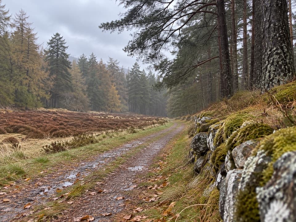
From Auchallater to the high colA good track leads southeast up Glen Callater and past Callater Stable bothy to Loch Callater.

A good track leads southeast up Glen Callater and past Callater Stable bothy to Loch Callater. The route follows the loch’s northeast shore, then keeps beside Allt an Loch as the valley narrows. The headwall is a steep climb to the col between Tolmount and the Knaps of Fafernie. Take a breather there: the route changes character once you leave the clearer glen paths for the open plateau.

The exposed crossingThe broad high ground is open and featureless, with a slight rise to about 900 metres below…

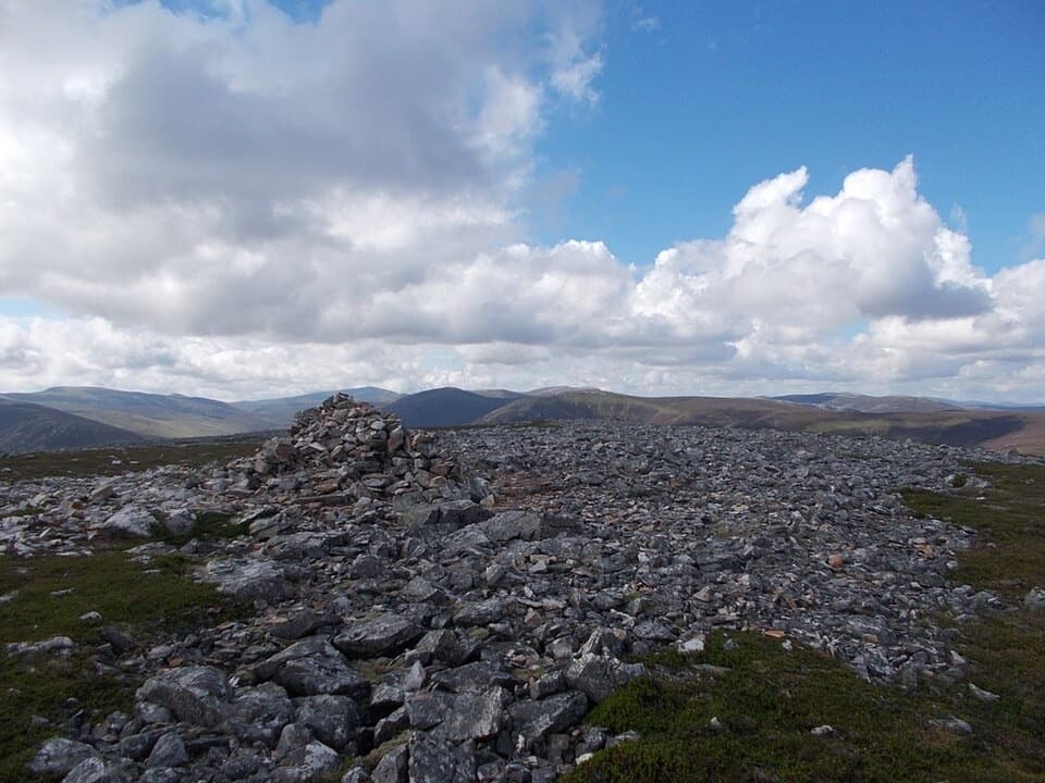
The broad high ground is open and featureless, with a slight rise to about 900 metres below Crow Craigies before the route undulates along the ridge toward Craig Lunkard. The line becomes hard to pick out in places. Winter snow can cover it for months, and bad weather turns route-finding into the main challenge. This is a serious mountain crossing, not a waymarked forest stroll; go only when you can navigate confidently in the conditions.

Down into Glen DollFrom the ridge, the path drops steeply south into the head of Glen Doll.

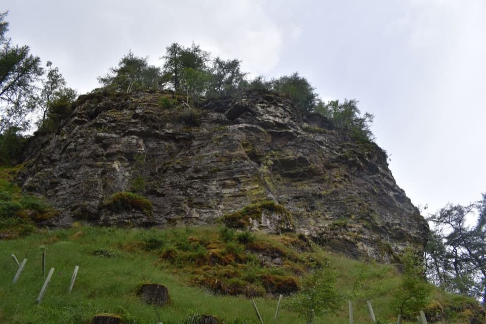
From the ridge, the path drops steeply south into the head of Glen Doll. Keep to the route above White Water rather than descending straight to the river. Davy’s Bourach, a small stone shelter, is a useful landmark. From there the way continues southeast for almost two kilometres before descending to the glen floor and entering forest for the final stretch to the Ranger Base. Heather and blaeberry cover the slopes; golden eagles are sometimes seen over the Glen Doll climb, though a sighting is never assured.

A drove road with a contested historyThe Tolmounth was a drovers’ route, carrying sheep from Braemar over the pass to Cullow market…

The Tolmounth was a drovers’ route, carrying sheep from Braemar over the pass to Cullow market near Glen Clova. Its public right of way was tested in court after a landowner tried to close it: the case ran through Scotland’s Court of Session in 1886–87 and the House of Lords in 1888. The name’s origin is less certain. A popular story links “Jock” to drover John Winter, but the name was already in use and his identity was later described as a mystery.

Davy’s BourachFive experienced walkers died in a storm on New Year’s Day 1959.

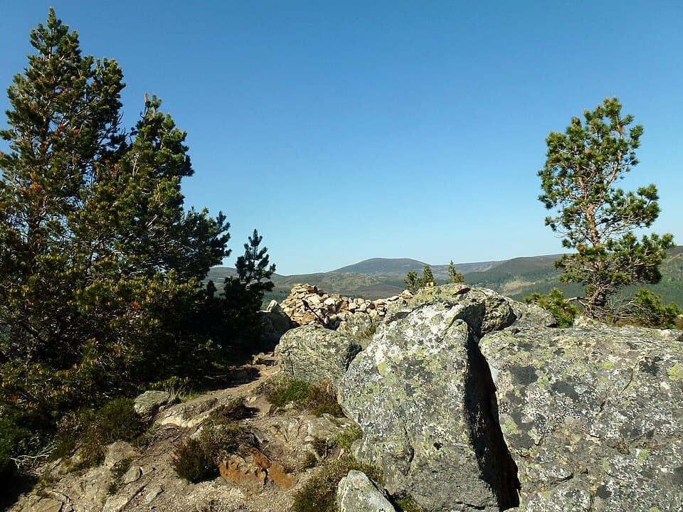
Five experienced walkers died in a storm on New Year’s Day 1959. Davie Glen built the stone shelter in 1966 in their memory, and it remains a distinctive landmark on the descent. Pause respectfully, then keep moving: it is a remote shelter on a long route, not a staffed stop or a source of supplies.

Make the logistics workThere is no food stop on the pass.

There is no food stop on the pass. Glen Doll car park has toilets, and Clova village is the nearest place for food; bring what you need for the crossing. Dogs may come under Scotland’s access rules if kept under proper control, especially around livestock and ground-nesting birds. At Loch Callater, a photo looking southeast toward Tolmount can show both the lochside path and the mountain above it.

Wildlife

Wildlife in Cairngorms

All Cairngorms wildlife maps

Sighting maps show where each species has been reported across Cairngorms. Wildlife moves, so no sighting is guaranteed.

Keep exploring

Near The Tolmounth (Jock’s Road)

See it all on the map

Trails that start nearby

Places near the trailhead

Parkwolf’s Cairngorms ranking

Top-rated trails in Cairngorms

All 260 trails
  1. 1Loch an Eilein CircuitEasy · 5 km
  2. 2Lairig GhruChallenging · 30.6 km
  3. 3Ben Macdui and Cairn Gorm CircuitChallenging · 19.8 km
  4. 4Loch Morlich TrailModerate · 5.6 km
  5. 5Meall a’ Bhuachaille CircuitChallenging · 8 km
  6. 6Loch Muick CircuitModerate · 12.5 km

Take Parkwolf to Cairngorms.

The audio tour guide for the drive, plus offline maps, trails, and wildlife heatmaps for when the signal drops.

4.7 from 8,600+ ratings

Download Parkwolf on the App StoreGet Parkwolf on Google Play